|
MV Enköping
The ''Enköping'' is a Swedish motor vessel, and former steam ship, that was built in 1868 at Oskarshamn. Over the years, she has operated under the names ''Östhammar'', ''Skokloster'', ''Arholma'', ''Väddö'', ''Glafsfjorden'', ''Södra Skärgården'' and ''Soten''. In 1948 she was converted to diesel power. In 1990 Strömma Kanalbolaget bought her, and she is now used for tourist services on Lake Malaren and in the Stockholm archipelago. According to her owners, she is the oldest passenger ship still in service in the Lloyd's Register of Shipping, and she is a listed historic ship of Sweden. History ''Enköping'' was built as a steam ship by the Oskarshamn Shipyard in Oskarshamn and launched on the 20 June 1868. She was delivered to the Bockholmssunds Ångfartygsbolag of Stockholm for service on the route from Stockholm to Enköping via Lake Malaren. Despite several changes of ownership, she continued to operate on this route until 1885. ''Enköping'' was sold to Ångfar ... [...More Info...] [...Related Items...] OR: [Wikipedia] [Google] [Baidu] |
Strömma Kanalbolaget
Ångfartygs AB Strömma Kanal, better known as the Strömma Kanalbolaget, is an operator of tourist shipping services in and around Stockholm, Sweden, as well as a number of ferry routes under the name Cinderellabåtarna in the same area. It is part of the group, which operates tourist services in a number of cities around Europe, including the City Sightseeing tourist bus franchise for Stockholm. History Ångfartygs AB Strömma Kanal was started in 1968 with the aim of saving historic ships from being scrapped. It took its name from a 19th-century shipping company that operated services from Stockholm to Sandhamn, via the Strömma Canal The Strömma Canal () is a short canal located near Strömma, on Värmdö (island), Värmdö island, Stockholm County, part of Värmdö Municipality in Sweden. Situation This short canal runs parallel to the Svanvägen Road and forms a relati .... In 1992, the company was taken over by August Lindholm Eftr. AB, a company that operated sights ... [...More Info...] [...Related Items...] OR: [Wikipedia] [Google] [Baidu] |
Sigtuna
Sigtuna is a Urban areas in Sweden, locality situated in the eponymous Sigtuna Municipality, in Stockholm County, Sweden with 9,689 inhabitants in 2020. It is the namesake even though the seat of the municipality is in another locality, Märsta. Sigtuna is for historical reasons still often referred to as a . Sigtuna is situated at the bay Skarven, stretching around Upplands-Bro and a part of Mälaren, Lake Mälaren. Present-day Sigtuna, a harbour town that was established around 980, developed about east of Old Sigtuna, which, according to Old Norse religion, was previously the home of the widely revered god Odin. Etymology The name of Sigtuna was moved from what is presently called Fornsigtuna, Signhildsberg. The meaning of ''Sigtuna'' is contested. According to one theory, it is a compound (linguistics), compound name where the second element is -''wikt:tún#Old_Norse, tuna'' and the first one is either of two closely related dialectal words, viz. ''sig'' meaning "seeping wate ... [...More Info...] [...Related Items...] OR: [Wikipedia] [Google] [Baidu] |
1868 Ships
Events January * January 2 – British Expedition to Abyssinia: Robert Napier leads an expedition to free captive British officials and missionaries. * January 3 – The 15-year-old Mutsuhito, Emperor Meiji of Japan, declares the ''Meiji Restoration'', his own restoration to full power, under the influence of supporters from the Chōshū and Satsuma Domains, and against the supporters of the Tokugawa shogunate, triggering the Boshin War. * January 5 – Paraguayan War: Brazilian Army commander Luís Alves de Lima e Silva, Duke of Caxias, enters Asunción, Paraguay's capital. Some days later he declares the war is over. Nevertheless, Francisco Solano López, Paraguay's president, prepares guerrillas to fight in the countryside. * January 7 – The Arkansas constitutional convention meets in Little Rock. * January 9 – Penal transportation from Britain to Australia ends, with arrival of the convict ship ''Hougoumont'' in Western Australia, after an 89-d ... [...More Info...] [...Related Items...] OR: [Wikipedia] [Google] [Baidu] |
Lysekil
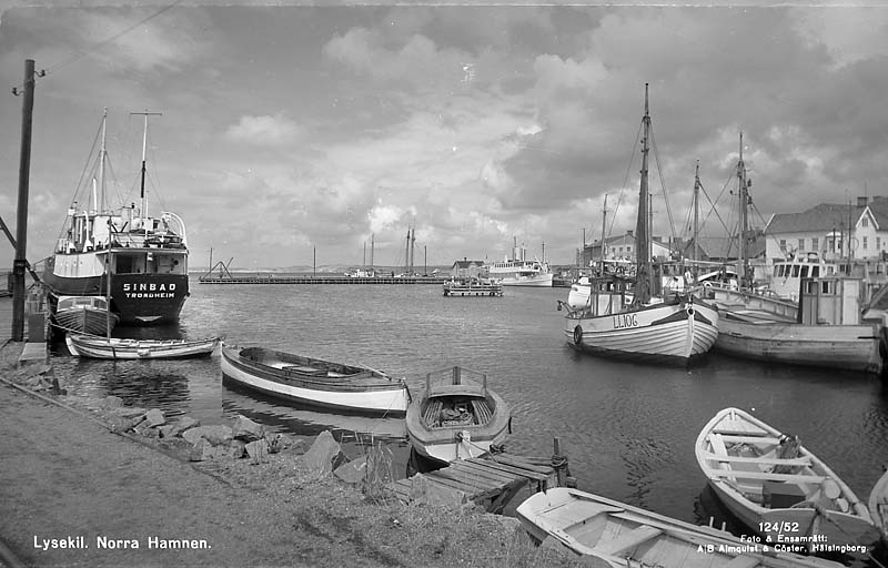
Lysekil () is a Urban areas in Sweden, locality and the seat of Lysekil Municipality in Västra Götaland County, Sweden. It had about 7,600 inhabitants in 2018. Situated on the south tip of Stångenäs peninsula at the mouth of Gullmarn fjord, it has two nature reserves. Originally a small fishing village, it developed into a town for Fishing industry, fishing industries, Maritime transport, commercial shipping and trade during the 18th and 19th centuries. Stone industry based on the red Bohus granite from quarries in the town, was also vital to Lysekil up until the 1950s. One of Sweden's largest oil refineries, Preemraff Lysekil is situated outside the town. During the 19th century, Lysekil was established as a prominent seaside resort, spa and bathing resort and tourism still makes up a large part of the town's economy. History Lysekil is first mentioned in 1570. It was originally an estate belonging to Lyse farm further inland. The population lived mostly on fishing and Mari ... [...More Info...] [...Related Items...] OR: [Wikipedia] [Google] [Baidu] |
Kungshamn
Kungshamn (''King's Landing'') is a locality and the seat of Sotenäs Municipality in Västra Götaland County, Sweden with 3071 citizens (in 2011).''Sotenäs Kommun: Historia'' During summers, population is doubled multiple times, as Kungshamn is a popular tourist visit. The town consists of the former towns of "Gravarne", "Bäckevik" and "Fisketången". Kungshamn is situated on a just north of |
Gothenburg
Gothenburg ( ; ) is the List of urban areas in Sweden by population, second-largest city in Sweden, after the capital Stockholm, and the fifth-largest in the Nordic countries. Situated by the Kattegat on the west coast of Sweden, it is the gubernatorial seat of Västra Götaland County, with a population of approximately 600,000 in the city proper and about 1.1 million inhabitants in Metropolitan Gothenburg, the metropolitan area. Gustavus Adolphus, King Gustavus Adolphus founded Gothenburg by royal charter in 1621 as a heavily fortified, primarily Dutch, trading colony. In addition to the generous privileges given to his Dutch allies during the ongoing Thirty Years' War, e.g. tax relaxation, he also attracted significant numbers of his German and Scottish allies to populate his only town on the western coast; this trading status was furthered by the founding of the Swedish East India Company. At a key strategic location at the mouth of the , where Scandinavia's largest dr ... [...More Info...] [...Related Items...] OR: [Wikipedia] [Google] [Baidu] |
Styrsö
Styrsö () is a small island and a Urban areas in Sweden, locality situated in Göteborg Municipality, Gothenburg Municipality, Västra Götaland County, Sweden. It had 1,304 inhabitants in 2010. It lies in the Southern Göteborg Archipelago, Southern Gothenburg Archipelago of Sweden with about 1,400 inhabitants. Regulaferriesconnect the island to Gothenburg and a bridge links Styrsö with Donsö. The main type of land transport on the island is a three-wheeled moped, called a ''flakmoped'' in Swedish language, Swedish. (The locals call it ''lastmoppe''). Regular cars are not allowed on the Island. On Styrsö there are four small communities with different characters. The oldest is the Village, called "Byn" with the church from 1752, farms and old cultivated land. "Styrsö Tången" (Seaweed) is the traditional fishing village with dense buildings and winding narrow roads. In "Halsvik", the well-ordered seacaptains made their mark on the buildings and "Bratten" got the nice summer g ... [...More Info...] [...Related Items...] OR: [Wikipedia] [Google] [Baidu] |
Göta Canal
The Göta Canal () is a Swedish canal constructed in the early 19th century. The canal is long, of which were dug or blasted, with a width varying between and a maximum depth of about .Uno Svedin, Britt Hägerhäll Aniansson, ''Sustainability, Local Democracy and the Future: The Swedish Model'', pp. 93–94. Springer, 2002. The speed is limited to 5 knots in the canal. The Göta Canal is a part of a waterway long, linking a number of lakes and rivers to provide a route from Gothenburg (Göteborg) on the west coast to Söderköping on the Baltic Sea via the Trollhätte kanal and Göta älv river, through the large lakes Vänern and Vättern. This waterway was dubbed as Sweden's Blue Ribbon (). Contrary to the popular belief it is not correct to consider this waterway as a sort of ''greater'' Göta Canal: the Trollhätte Canal and the Göta Canal are completely separate entities. History The idea of a canal across southern Sweden was first put forward as early as 151 ... [...More Info...] [...Related Items...] OR: [Wikipedia] [Google] [Baidu] |
Lake Vänern
A lake is often a naturally occurring, relatively large and fixed body of water on or near the Earth's surface. It is localized in a basin or interconnected basins surrounded by dry land. Lakes lie completely on land and are separate from the ocean, although they may be connected with the ocean by rivers. Lakes, as with other bodies of water, are part of the water cycle, the processes by which water moves around the Earth. Most lakes are fresh water and account for almost all the world's surface freshwater, but some are salt lakes with salinities even higher than that of seawater. Lakes vary significantly in surface area and volume of water. Lakes are typically larger and deeper than ponds, which are also water-filled basins on land, although there are no official definitions or scientific criteria distinguishing the two. Lakes are also distinct from lagoons, which are generally shallow tidal pools dammed by sandbars or other material at coastal regions of oceans or large la ... [...More Info...] [...Related Items...] OR: [Wikipedia] [Google] [Baidu] |
Värmland
Värmland () is a ''Provinces of Sweden, landskap'' (historical province) in west-central Sweden. It borders Västergötland, Dalsland, Dalarna, Västmanland, and Närke, and is bounded by Norway in the west. Name Several Latinized versions of the name exist, including ''Varmelandia'', ''Vermelandia'', ''Wermelandia'', ''Værmalandia'', ''Værmolandia'', ''Virmolandia'' and ''Vermillandia''. Some of the Latinised forms show the origin of the name to come from the large local lake by the name of (from older ''*Virmil''); others from the river name ''*Værma'', the main outlet of that lake. The province was originally part of Götaland, and became part of Svealand in 1815. ''Wermland'' is an obsolete Swedish spelling of the name, which may still be seen in proper names such as ''Nya Wermlands-Tidningen'', a newspaper. Administration Sub-divisions Sweden's provinces were sub-divided into Hundred (division), hundreds or districts. Värmland was historically divided into Citi ... [...More Info...] [...Related Items...] OR: [Wikipedia] [Google] [Baidu] |
Arvika
Arvika is a locality and the seat of Arvika Municipality, Värmland County, Sweden with 14,244 inhabitants in 2010. Geography The town of Arvika is situated at Kyrkviken, a bay of Glafsfjorden, Sweden's only inland fjord, a remnant of the time following the last ice age (once a fjord of the Ancylus Lake). The town is located approximately 380 km west of Stockholm, 250 km north of Gothenburg, 150 km east of Oslo, and 50 km from the Norwegian border. The area is hilly with the tallest hill ''Storkasberget'' close to the town centre. Arvika and its surroundings have excellent water infrastructure. In fact, Arvika has the innermost harbour in the whole of Sweden. Through a system of canals, lake Vänern can be reached, and from there the Göta Canal allows further passage to Gothenburg and Sweden's west coast. History Ten kilometers west of the city, in ''Bergs Klätt'', there are remnants of a younger Stone Age and Nordic Bronze Age settlements in the form of graves. The ... [...More Info...] [...Related Items...] OR: [Wikipedia] [Google] [Baidu] |
Väddö
Väddö is an island in the Baltic Sea in Roslagen district, Sweden. It is situated in Norrtälje Municipality. Together with the adjoined Björkö it is considered the seventh largest island of Sweden. Väddö is separated from the mainland by the artificial Väddö Canal, first dug in the 16th century. References See also * Geography of Sweden * Islands of Sweden Islands of Norrtälje Municipality Islands of the Stockholm archipelago {{Stockholm-geo-stub ... [...More Info...] [...Related Items...] OR: [Wikipedia] [Google] [Baidu] |


