|
Lynn And Hunstanton Railway
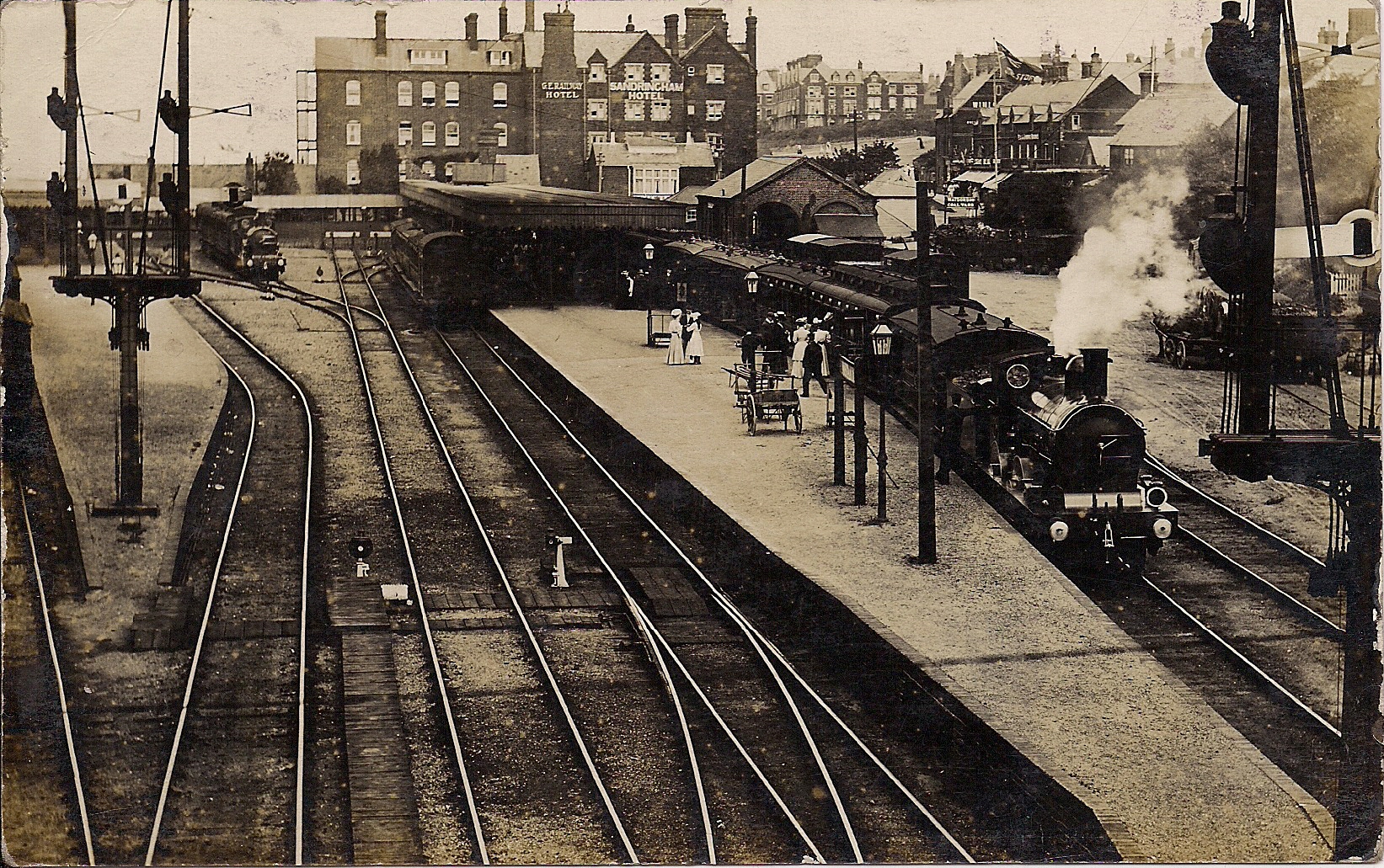
The Lynn and Hunstanton Railway was a line in Norfolk, England that opened in 1862. The railway was a major factor in developing Hunstanton as a seaside resort and residential community. The company was allied to the West Norfolk Junction Railway which built a line connecting Heacham, south of Hunstanton, to Wells-next-the-Sea that was not a financial success. The companies amalgamated in 1874 to form the Hunstanton and West Norfolk Railway, and in 1890 the company was sold to the Great Eastern Railway. The Prince of Wales, later King Edward VII, acquired an estate at Sandringham, Norfolk, and Wolferton station was used by the Royal Family and visiting heads of state. Hunstanton developed a thriving holiday trade, and day trip excursions became popular. After 1950 decline set in, and the Wells line closed to passengers in 1952; Hunstanton through trains to and from London ended in 1960 and further decline resulted in closure in 1969. Promotion and construction In 1846 efforts w ... [...More Info...] [...Related Items...] OR: [Wikipedia] [Google] [Baidu] |
Norfolk
Norfolk () is a ceremonial and non-metropolitan county in East Anglia in England. It borders Lincolnshire to the north-west, Cambridgeshire to the west and south-west, and Suffolk to the south. Its northern and eastern boundaries are the North Sea, with The Wash to the north-west. The county town is the city of Norwich. With an area of and a population of 859,400, Norfolk is a largely rural county with a population density of 401 per square mile (155 per km2). Of the county's population, 40% live in four major built up areas: Norwich (213,000), Great Yarmouth (63,000), King's Lynn (46,000) and Thetford (25,000). The Broads is a network of rivers and lakes in the east of the county, extending south into Suffolk. The area is protected by the Broads Authority and has similar status to a national park. History The area that was to become Norfolk was settled in pre-Roman times, (there were Palaeolithic settlers as early as 950,000 years ago) with camps along the highe ... [...More Info...] [...Related Items...] OR: [Wikipedia] [Google] [Baidu] |
Panic Of 1866
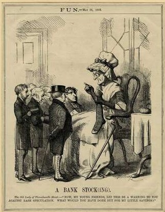
The Panic of 1866 was an international financial downturn that accompanied the failure of Overend, Gurney and Company in London, and the ''corso forzoso'' abandonment of the silver standard in Italy. In Britain, the economic impacts are held partially responsible for public agitation for political reform in the months leading up to the 1867 Reform Act. The crisis led to a sharp rise in unemployment to 8% and a subsequent fall in wages across the country. Similar to the "knife and fork" motives of Chartism in the late 1830s and 1840s, the financial pressure on the British working class led to rising support for greater representation of the people. Groups such as the Reform League saw rapid increases in membership and the organisation spearheaded multiple demonstrations against the political establishment such as the Hyde Park riot of 1866. Ultimately the popular pressure that arose from the banking crisis and the recession that followed can be held partly responsible for the en ... [...More Info...] [...Related Items...] OR: [Wikipedia] [Google] [Baidu] |
Bill Pertwee
William Desmond Anthony Pertwee, (21 July 1926 – 27 May 2013) was a British comedy actor. He played the role of Chief ARP Warden Hodges in the sitcom ''Dad's Army''. Early life Pertwee was born in Amersham, Buckinghamshire, on 21 July 1926."Dad's Army star Bill Pertwee dies aged 86" BBC News, 27 May 2013 Born the youngest of three boys of a Brazilian mother and an English father, James Francis Carter Pertwee, who travelled the country as a salesman until he became ill and died in 1938, when Bill Pertwee was 12. The family moved home many times during Pertwee's childhood and he lived in , |
Burnham Railway Station
Burnham railway station is a railway station serving Burnham, Buckinghamshire, England, from and situated between to the east and to the west. The station is in Haymill, a ward of western Slough, about half a mile to the south of Burnham proper. Originally in Buckinghamshire, the station transferred into the county of Berkshire when county boundaries were realigned in 1974. The station is served by local services operated by the Elizabeth line. The station is on the Great Western Main Line, the original line of the Great Western Railway. History On opening on 1 July 1899, the station was named '' Burnham Beeches'', becoming ''Burnham (Bucks)'' from 1 September 1930 to 5 May 1975, and then purely ''Burnham'', although National Rail variously refers to the station as ''Burnham (Bucks)'' and ''Burnham (Berks)''. The station was closed as a First World War economy measure from 2 April 1917 to 3 March 1919. In preparation for the introduction of Elizabeth line services ... [...More Info...] [...Related Items...] OR: [Wikipedia] [Google] [Baidu] |
Holkham
Holkham is a small village and civil parish in north Norfolk, England, which includes a stately home and estate, Holkham Hall, and a beach, Holkham Gap, at the centre of Holkham National Nature Reserve. Geography The parish has an area of and in the 2001 census had a population of 236 in 104 households. For the purposes of local government, the parish falls within the district of North Norfolk. The village of Holkham is located on the coast road (the A149) between Wells-next-the-Sea and Burnham Overy Staithe. At one time the village was a landing with access to the sea via a tidal creek to the harbour at Wells. The creek succumbed to land reclamation, much of which created the grounds of the estate, starting in 1639 and ending in 1859 when the harbour at Wells was edged with a sea wall. The land west of the wall was subsequently turned to agricultural uses. Aerial photographs show traces of the creek in the topsoil, and the lake to the west of the hall appears to be based on ... [...More Info...] [...Related Items...] OR: [Wikipedia] [Google] [Baidu] |
Walsingham
Walsingham () is a civil parish in North Norfolk, England, famous for its religious shrines in honour of Mary, mother of Jesus. It also contains the ruins of two medieval Christian monasticism, monastic houses.Ordnance Survey (2002). ''OS Explorer Map 251 – Norfolk Coast Central''. . Walsingham is northwest of Norwich. The civil parish includes Little Walsingham and Great Walsingham, together with Egmere medieval settlement, Egmere (a depopulated medieval village at ), and has an area of 1 E7 m², 18.98 km². At the United Kingdom Census 2011, 2011 census, it had a population of 819.Office for National Statistics & Norfolk County Council (2001). Census population and household counts for unparished urban areas and all parishes''. Retrieved 2 December 2005. The village's name means 'Homestead/village of Waels' people'. Walsingham is a major centre of Christian pilgrimage, pilgrimage. In 1061, according to the Walsingham legend, an Anglo-Saxon noblewoman, Richeldis de ... [...More Info...] [...Related Items...] OR: [Wikipedia] [Google] [Baidu] |
Kettering
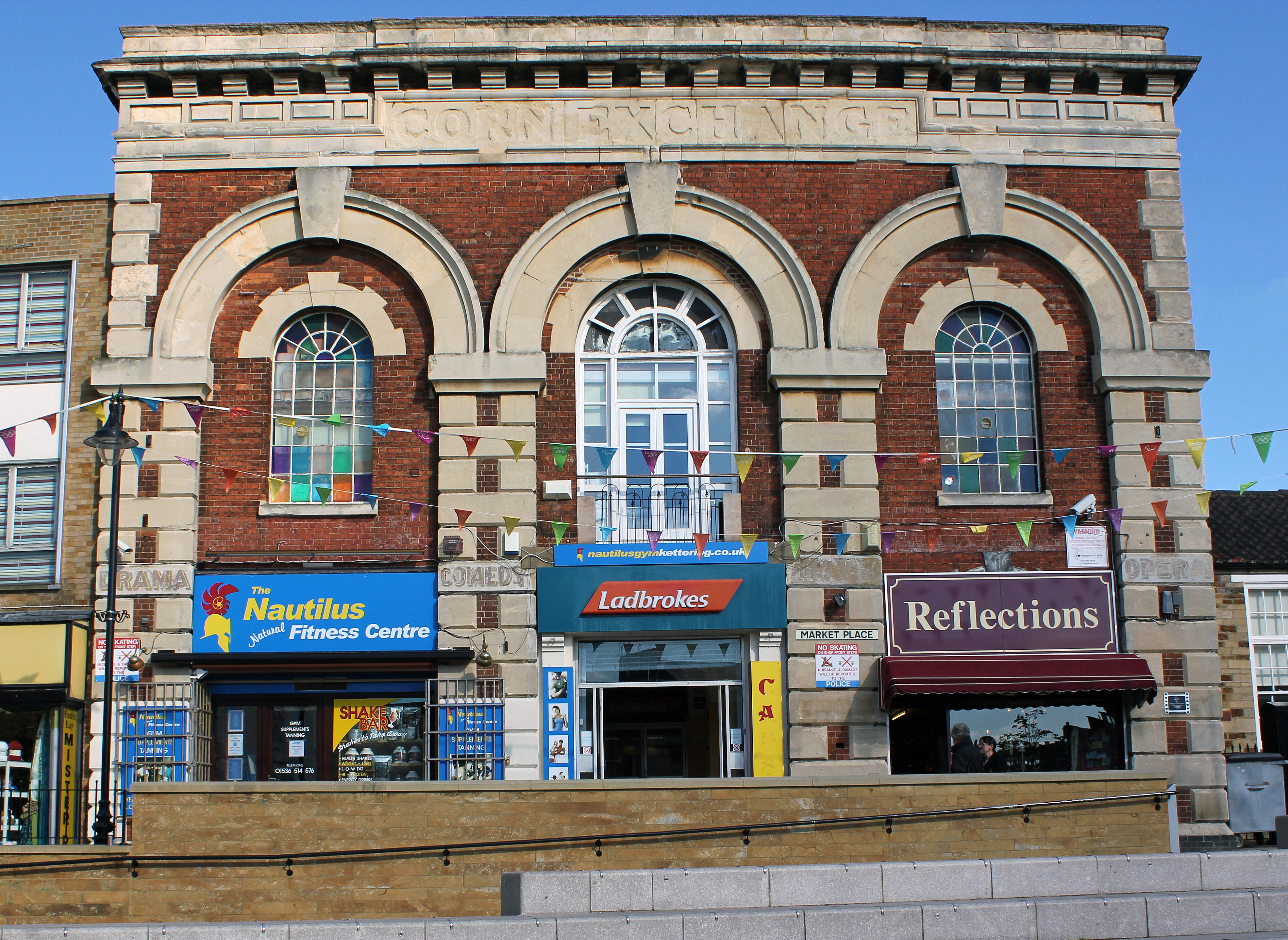
Kettering is a market and industrial town in North Northamptonshire, England. It is located north of London and north-east of Northampton, west of the River Ise, a tributary of the River Nene. The name means "the place (or territory) of Ketter's people (or kinsfolk)".R.L. Greenall: A History of Kettering, Phillimore & Co. Ltd, 2003, . p.7. In the 2011 census Kettering's built-up area had a population of 63,675. It is part of the East Midlands, along with other towns in Northamptonshire. There is a growing commuter population as it is on the Midland Main Line railway, with East Midlands Railway services direct to London St Pancras International taking about an hour. Early history Kettering means "the place (or territory) of Ketter's people (or kinsfolk)". Spelt variously Cytringan, Kyteringas and Keteiringan in the 10th century, although the origin of the name appears to have baffled place-name scholars in the 1930s, words and place-names ending with "-ing" usually derive f ... [...More Info...] [...Related Items...] OR: [Wikipedia] [Google] [Baidu] |
World War II
World War II or the Second World War, often abbreviated as WWII or WW2, was a world war that lasted from 1939 to 1945. It involved the vast majority of the world's countries—including all of the great powers—forming two opposing military alliances: the Allies and the Axis powers. World War II was a total war that directly involved more than 100 million personnel from more than 30 countries. The major participants in the war threw their entire economic, industrial, and scientific capabilities behind the war effort, blurring the distinction between civilian and military resources. Aircraft played a major role in the conflict, enabling the strategic bombing of population centres and deploying the only two nuclear weapons ever used in war. World War II was by far the deadliest conflict in human history; it resulted in 70 to 85 million fatalities, mostly among civilians. Tens of millions died due to genocides (including the Holocaust), starvation, ma ... [...More Info...] [...Related Items...] OR: [Wikipedia] [Google] [Baidu] |
City Of London
The City of London is a city, ceremonial county and local government district that contains the historic centre and constitutes, alongside Canary Wharf, the primary central business district (CBD) of London. It constituted most of London from its settlement by the Romans in the 1st century AD to the Middle Ages, but the modern area named London has since grown far beyond the City of London boundary. The City is now only a small part of the metropolis of Greater London, though it remains a notable part of central London. Administratively, the City of London is not one of the London boroughs, a status reserved for the other 32 districts (including Greater London's only other city, the City of Westminster). It is also a separate ceremonial county, being an enclave surrounded by Greater London, and is the smallest ceremonial county in the United Kingdom. The City of London is widely referred to simply as the City (differentiated from the phrase "the city of London" by ca ... [...More Info...] [...Related Items...] OR: [Wikipedia] [Google] [Baidu] |
Liverpool Street Station
Liverpool Street station, also known as London Liverpool Street, is a central London railway terminus and connected London Underground station in the north-eastern corner of the City of London, in the ward of Bishopsgate Without. It is the terminus of the West Anglia Main Line to Cambridge, the Great Eastern Main Line to Norwich, commuter trains serving east London and destinations in the East of England, and the Stansted Express service to Stansted Airport. The station opened in 1874, as a replacement for Bishopsgate station as the Great Eastern Railway's main London terminus. By 1895, it had the most platforms of any London terminal station. During the First World War, an air raid on the station killed 16 on site, and 146 others in nearby areas. In the build-up to the Second World War, the station served as the entry point for thousands of child refugees arriving in London as part of the ''Kindertransport'' rescue mission. The station was damaged by the 1993 Bishopsgate ... [...More Info...] [...Related Items...] OR: [Wikipedia] [Google] [Baidu] |
Tottenham And Hampstead Junction Railway
The Tottenham & Hampstead Junction Railway was a railway line in north London, formed by an Act of Parliament of 28 July 1862, which today is mostly part of the Gospel Oak to Barking line. It was effectively part of an attempt by the Great Eastern Railway to obtain a west end terminus to complement Bishopsgate railway station in east London. The line opened on 21 July 1868 between Tottenham North Junction (on the Great Eastern Railway) and Highgate Road. An extension to Kentish Town opened in 1870. An extension to Gospel Oak opened on 4 June 1888.Gospel Oak to Barking Line User GroupHistory of the Barking to Gospel Oak line/ref> History Even before it opened, the line had problems. Plans to extend the western end of this line via a proposed 'London Main Trunk Railway', underneath Hampstead Road, the Metropolitan Railway (modern Circle line) and Tottenham Court Road, to Charing Cross were rejected by Parliament in 1864. Instead it was decided to terminate the line at ... [...More Info...] [...Related Items...] OR: [Wikipedia] [Google] [Baidu] |
St Pancras Railway Station
St Pancras railway station (), also known as London St Pancras or St Pancras International and officially since 2007 as London St Pancras International, is a central London railway terminus on Euston Road in the London Borough of Camden. It is the terminus for Eurostar services from Belgium, France and the Netherlands to London. It provides East Midlands Railway services to , , , and on the Midland Main Line, Southeastern high-speed trains to Kent via and , and Thameslink cross-London services to Bedford, Cambridge, Peterborough, Brighton, Horsham and Gatwick Airport. It stands between the British Library, the Regent's Canal and London King's Cross railway station, with which it shares a London Underground station, . The station was constructed by the Midland Railway (MR), which had an extensive rail network across the Midlands and the North of England, but no dedicated line into London. After rail traffic problems following the 1862 International Exhibition, the MR decid ... [...More Info...] [...Related Items...] OR: [Wikipedia] [Google] [Baidu] |


_railway_station1940102_555a2ca7.jpg)


_p139_-_Liverpool_Street_and_Broad_Street_stations_(plan).jpg)