|
List Of International River Borders
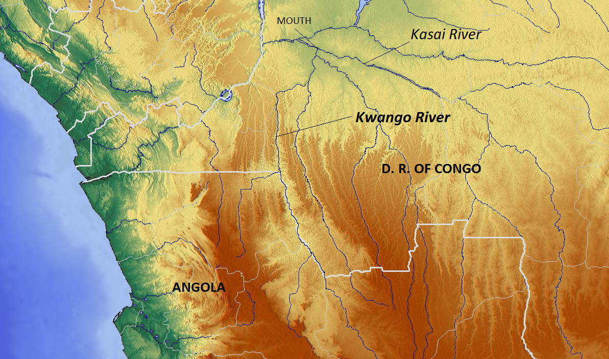
This is a List of international river borders. Rivers that form any portion of the border between two countries minimum: By region Africa 300px, Countries in Africa The following rivers form borders of countries in Africa: * Akanyaru River: Rwanda and Burundi * Akagera River: Rwanda and Tanzania * Bahr al-Arab: Sudan and South Sudan * Caledon River: Lesotho and South Africa * Chobe River: Namibia and Botswana * Congo River: Democratic Republic of Congo and Republic of Congo * Donga River: Nigeria and Cameroon * Kagitumba river: Rwanda, Uganda and Tanzania * Kasai River and Kwango River: Democratic Republic of Congo and Angola * Kunene River: Namibia and Angola * Limpopo River: South Africa and Botswana * Limpopo River: South Africa and Zimbabwe * Luapula River: Democratic Republic of Congo and Zambia * Niger River: Benin and Niger * Okavango River: Namibia and Angola * Orange River: Namibia and South Africa * Rusizi River: Burundi and Democratic Republic of the C ... [...More Info...] [...Related Items...] OR: [Wikipedia] [Google] [Baidu] |
African Continent-en
African or Africans may refer to: * Anything from or pertaining to the continent of Africa: ** People who are native to Africa, descendants of natives of Africa, or individuals who trace their ancestry to indigenous inhabitants of Africa *** Ethnic groups of Africa *** Demographics of Africa *** African diaspora ** African, an adjective referring to something of, from, or related to the African Union ** Citizenship of the African Union ** Demographics of the African Union ** Africanfuturism ** African art ** *** African jazz (other) ** African cuisine ** African culture ** African languages ** African music ** African Union ** African lion, a lion population in Africa Books and radio * ''The African'' (essay), a story by French author J. M. G. Le Clézio * ''The African'' (Conton novel), a novel by William Farquhar Conton * ''The African'' (Courlander novel), a novel by Harold Courlander * ''The Africans'' (radio program) Music * "African", a song by Peter ... [...More Info...] [...Related Items...] OR: [Wikipedia] [Google] [Baidu] |
Democratic Republic Of Congo
The Democratic Republic of the Congo (french: République démocratique du Congo (RDC), colloquially "La RDC" ), informally Congo-Kinshasa, DR Congo, the DRC, the DROC, or the Congo, and formerly and also colloquially Zaire, is a country in Central Africa. It is bordered to the northwest by the Republic of the Congo, to the north by the Central African Republic, to the northeast by South Sudan, to the east by Uganda, Rwanda, and Burundi, and by Tanzania (across Lake Tanganyika), to the south and southeast by Zambia, to the southwest by Angola, and to the west by the South Atlantic Ocean and the Cabinda exclave of Angola. By area, it is the second-largest country in Africa and the 11th-largest in the world. With a population of around 108 million, the Democratic Republic of the Congo is the most populous officially Francophone country in the world. The national capital and largest city is Kinshasa, which is also the nation's economic center. Centered on the Congo Ba ... [...More Info...] [...Related Items...] OR: [Wikipedia] [Google] [Baidu] |
Luapula River
The Luapula River is a section of Africa's second-longest river, the Congo. It is a transnational river forming for nearly all its length part of the border between Zambia and the DR Congo. It joins Lake Bangweulu (wholly in Zambia) to Lake Mweru (shared between the two countries) and gives its name to the Luapula Province of Zambia.Terracarta/International Travel Maps, Vancouver Canada: "Zambia, 2nd edition", 2000 Source and upper Luapula The Luapula drains Lake Bangweulu and its swamps into which flows the Chambeshi River, the source of the Congo. There is no single clear channel connecting the two rivers and the lake, but a mass of shifting channels, lagoons and swamps, as the explorer David Livingstone found to his cost. (He died exploring the area, and one of his last acts was to question Chief Chitambo about the course of the Luapula.)Blaikie, William Garden (1880): ''The Personal Life Of David Livingstone''Project Gutenberg Ebook #13262 release date: August 23, 2004.D ... [...More Info...] [...Related Items...] OR: [Wikipedia] [Google] [Baidu] |
Zimbabwe
Zimbabwe (), officially the Republic of Zimbabwe, is a landlocked country located in Southeast Africa, between the Zambezi and Limpopo Rivers, bordered by South Africa to the south, Botswana to the south-west, Zambia to the north, and Mozambique to the east. The capital and largest city is Harare. The second largest city is Bulawayo. A country of roughly 15 million people, Zimbabwe has 16 official languages, with English, Shona language, Shona, and Northern Ndebele language, Ndebele the most common. Beginning in the 9th century, during its late Iron Age, the Bantu peoples, Bantu people (who would become the ethnic Shona people, Shona) built the city-state of Great Zimbabwe which became one of the major African trade centres by the 11th century, controlling the gold, ivory and copper trades with the Swahili coast, which were connected to Arab and Indian states. By the mid 15th century, the city-state had been abandoned. From there, the Kingdom of Zimbabwe was established, fol ... [...More Info...] [...Related Items...] OR: [Wikipedia] [Google] [Baidu] |
Limpopo River
The Limpopo River rises in South Africa and flows generally eastward through Mozambique to the Indian Ocean. The term Limpopo is derived from Rivombo (Livombo/Lebombo), a group of Tsonga settlers led by Hosi Rivombo who settled in the mountainous vicinity and named the area after their leader. The river is approximately long, with a drainage basin in size. The mean discharge measured over a year is per second at its mouth. The Limpopo is the second largest river in Africa that drains to the Indian Ocean, after the Zambezi River. The first European to sight the river was Vasco da Gama, who anchored off its mouth in 1498 and named it Espirito Santo River. Its lower course was explored by St Vincent Whitshed Erskine in 1868–69, and Captain J F Elton travelled down its middle course in 1870. The drainage area of Limpopo River has decreased over geological time. Up to Late Pliocene or Pleistocene times, the upper course of the Zambezi River drained into the Limpopo River. Th ... [...More Info...] [...Related Items...] OR: [Wikipedia] [Google] [Baidu] |
Kunene River
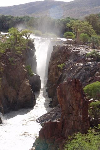
The Cunene (Portuguese spelling) or Kunene (common Namibian spelling) is a river in Southern Africa. It flows from the Angola highlands south to the border with Namibia. It then flows west along the border until it reaches the Atlantic Ocean. It is one of the few perennial rivers in the region. It is about long, with a drainage basin in area. Its mean annual discharge is 174 m3/s (6,145 cfs) at its mouth. The Epupa Falls lie on the river. Olushandja Dam dams a tributary of the river, the Etaka, and helps provide the Ruacana Power Station with water. Dam controversies The Namibian government proposed in the late 1990s to build the Epupa Dam, a controversial hydroelectric dam on the Cunene. In 2012 the Governments of Namibia and Angola announced plans to jointly build the Orokawe dam in the Baynes Mountains. According to the indigenous Himba who would have been most affected by the construction of the dam, the dam threatens the local ecosystem and therefore the economic bas ... [...More Info...] [...Related Items...] OR: [Wikipedia] [Google] [Baidu] |
Angola
, national_anthem = " Angola Avante"() , image_map = , map_caption = , capital = Luanda , religion = , religion_year = 2020 , religion_ref = , coordinates = , largest_city = capital , official_languages = Portuguese , languages2_type = National languages , languages2 = , ethnic_groups = , ethnic_groups_ref = , ethnic_groups_year = 2000 , demonym = , government_type = Unitary dominant-party presidential republic , leader_title1 = President , leader_name1 = João Lourenço , leader_title2 = Vice President , leader_name2 = Esperança da CostaInvestidura do Pr ... [...More Info...] [...Related Items...] OR: [Wikipedia] [Google] [Baidu] |
Kwango River
The Cuango or Kwango ( pt, Rio Cuango) is a transboundary river of Angola and Democratic Republic of Congo. It is the largest left bank tributary of the Kasai River in the Congo River basin. It flows through Malanje in Angola. The Kwango River basin has large resources of diamonds in the Chitamba-Lulo Kimberlite Cluster in Lunda Norte Province, discovered in the main river channel and on flats and terraces in its flood plains. History The Rund Kingdom, which expanded to become the Lunda Empire, encompassed territory stretching from Kwango River to the Luapula River. Its rulers partook in the slave trade. Lunda's expansion in the valley promoted a common political and cultural heritage while also promoting slave trading, accounting for the low population densities between the Kwango and Kwilu rivers.Ogot, p.607 The Portuguese colonized the Kwango River valley and usurped the Kingdom of Kasanje. The Kwango River was subject to a Portuguese treaty signing in Lisbon on May 25, 1 ... [...More Info...] [...Related Items...] OR: [Wikipedia] [Google] [Baidu] |
Kasai River
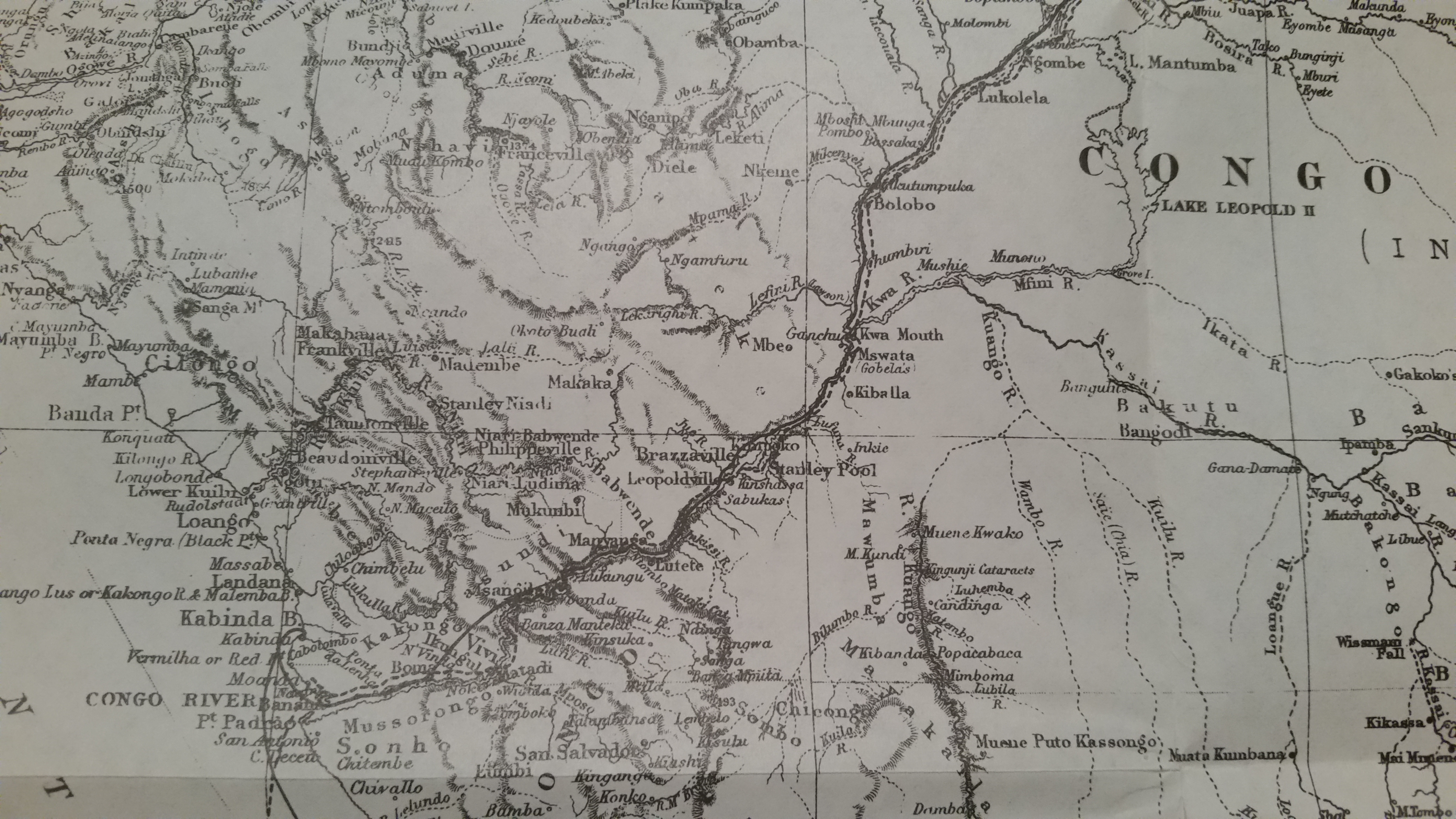
The Kasai River ( ; called Cassai in Angola) is a tributary (left side) of the Congo River, located in Central Africa. The river begins in central Angola and flows to the east until it reaches the border between Angola and the Democratic Republic of the Congo, where it turns north and serves as the border until it flows into the DRC. From Ilebo, between the confluences with Lulua river and Sankuru river, the Kasai river turns to a westerly direction. The lower stretch of the river from the confluence with Fimi river, is known as the Kwa(h) River, before it joins the Congo at Kwamouth northeast of Kinshasa. The Kasai basin consists mainly of equatorial rainforest areas, which provide an agricultural land in a region noted for its infertile, sandy soil. It is a tributary of Congo river and diamonds are found in it. Around 60% of diamonds in Belgium go from Kasai river for cutting and shaping. Exploration Henry Morton Stanley reached the confluence on 9 March 1877, calling the rive ... [...More Info...] [...Related Items...] OR: [Wikipedia] [Google] [Baidu] |
Uganda
}), is a landlocked country in East Africa East Africa, Eastern Africa, or East of Africa, is the eastern subregion of the African continent. In the United Nations Statistics Division scheme of geographic regions, 10-11-(16*) territories make up Eastern Africa: Due to the historical .... The country is bordered to the east by Kenya, to the north by South Sudan, to the west by the Democratic Republic of the Congo, to the south-west by Rwanda, and to the south by Tanzania. The southern part of the country includes a substantial portion of Lake Victoria, shared with Kenya and Tanzania. Uganda is in the African Great Lakes region. Uganda also lies within the Nile, Nile basin and has a varied but generally a modified equatorial climate. It has a population of around 49 million, of which 8.5 million live in the Capital city, capital and largest city of Kampala. Uganda is named after the Buganda kingdom, which encompasses a large portion of the south of the country, includi ... [...More Info...] [...Related Items...] OR: [Wikipedia] [Google] [Baidu] |
Kagitumba River
The Kagitumba is a river on the border of Rwanda and Uganda part of the upper headwaters of the Nile. Kagitumba is the name taken by the Muvumba river for its last stretch before it empties in the Akagera River. The river is only 39 km (24 miles) and is located on the North Eastern extremity of Rwanda. For its entire length, it forms the border of Rwanda and Uganda. Despite its short length, this is one of the major rivers of Rwanda. Its drainage basin covers 3500 km2 and spans parts of Gicumbi, Gatsibo and Nyagatare District Districts in Rwanda, and Kabale and Ntungamo Districts in Uganda. Course Kagitumba is the name taken by the Muvumba River at is confluence with Cyinzinga. Some sources as well as locals still consider this river to still be the Muvumba. The Kagitumba initially flows northward for 14 km before making 90 degrees turn east for the remaining 25 km. Kagitumba river form the last stretch of the border between Rwanda and Uganda. The river em ... [...More Info...] [...Related Items...] OR: [Wikipedia] [Google] [Baidu] |
Cameroon
Cameroon (; french: Cameroun, ff, Kamerun), officially the Republic of Cameroon (french: République du Cameroun, links=no), is a country in west-central Africa. It is bordered by Nigeria to the west and north; Chad to the northeast; the Central African Republic to the east; and Equatorial Guinea, Gabon and the Republic of the Congo to the south. Its coastline lies on the Bight of Biafra, part of the Gulf of Guinea and the Atlantic Ocean. Due to its strategic position at the crossroads between West Africa and Central Africa, it has been categorized as being in both camps. Its nearly 27 million people speak 250 native languages. Early inhabitants of the territory included the Sao civilisation around Lake Chad, and the Baka hunter-gatherers in the southeastern rainforest. Portuguese explorers reached the coast in the 15th century and named the area ''Rio dos Camarões'' (''Shrimp River''), which became ''Cameroon'' in English. Fulani soldiers founded the Adamawa Emirate ... [...More Info...] [...Related Items...] OR: [Wikipedia] [Google] [Baidu] |


