|
Líneas Aéreas Nacionales S.A.
Lineas Aéreas Nacionales S.A. (commonly known as ''LANSA'') was a Transport in Peru, Peruvian commercial airline headquartered in Lima, Peru, which was established in 1963. After its last Lockheed L-188 Electra, Lockheed Electra LANSA Flight 508, crashed on Christmas Eve 1971, LANSA ceased operation, and lost its operating authority on January 4, 1972, when its working capital was exhausted. History LANSA was founded in 1963, and began flight operations in January 1964 with internal connections. In 1965 33.3% was bought by Eastern Air Lines. From May to September 1966 the company suspended its flight activities while undergoing far-reaching reorganization and passed completely under Peruvian control. With the arrival of the NAMC YS-11 in 1967, LANSA increased the number of flights to 9 national airports, including Cuzco and Iquitos. By January 4, 1972, the Peruvian government revoked LANSA's operating certificate. The airline had already ceased all operations, following the cra ... [...More Info...] [...Related Items...] OR: [Wikipedia] [Google] [Baidu] |
Lima
Lima ( ; ), founded in 1535 as the Ciudad de los Reyes (, Spanish for "City of Biblical Magi, Kings"), is the capital and largest city of Peru. It is located in the valleys of the Chillón River, Chillón, Rímac River, Rímac and Lurín Rivers, in the desert zone of the central coastal part of the country, overlooking the Pacific Ocean. The city is considered the political, cultural, financial and commercial center of Peru. Due to its geostrategic importance, the Globalization and World Cities Research Network has categorized it as a "beta" tier city. Jurisdictionally, the metropolis extends mainly within the province of Lima and in a smaller portion, to the west, within the Constitutional Province of Callao, where the seaport and the Jorge Chávez Airport are located. Both provinces have regional autonomy since 2002. The 2023 census projection indicates that the city of Lima has an estimated population of 10,092,000 inhabitants, making it the List of cities in the Americas b ... [...More Info...] [...Related Items...] OR: [Wikipedia] [Google] [Baidu] |
Rodríguez Ballón International Airport
Rodríguez Ballón International Airport (, ) is an airport serving Arequipa, the capital of Arequipa Region and Peru's second largest city. This airport and Cusco's Alejandro Velasco Astete International Airport are the main air hubs in southern Peru. It is named for early Peruvian aviator Alfredo Rodríguez Ballón. It is the third busiest airport in Peru. It is the main air gateway for tourists visiting the city of Arequipa, nearby ruins, and the Colca Canyon, the world's second deepest canyon (only behind Cotahuasi Canyon, also in Arequipa). The airport's passenger traffic has grown very rapidly since the airport was granted in concession as part of 6 airports in the southern part of Peru to Aeropuertos Andinos del Perú. As of the end of 2017 passenger traffic was 1,689,921 as reported by CORPAC, Peru's national airport corporation. The current terminal has already excedeed its planned capacity (around 1.5 million passengers) and it is expected that the airport will re ... [...More Info...] [...Related Items...] OR: [Wikipedia] [Google] [Baidu] |
Golosón International Airport
Golosón International Airport () is an airport located on the western side of the city of La Ceiba, in the Atlántida Department on the north coast of Honduras. It is also known as La Ceiba Airport (''Aeropuerto de La Ceiba'') and Hector C. Moncada Air Base (''Base Aérea Hector C. Moncada''). Facilities The airport is at an elevation of above mean sea level. It has one runway with an Asphalt concrete, asphalt surface measuring . Airlines and destinations Historical airline service SAHSA (Servicio Aereo de Honduras S.A., the former national flag carrier airline of Honduras) was serving La Ceiba in 1950 with Douglas DC-3 domestic flights in Honduras with its schedules appearing in a Pan American World Airways (Pan Am) system timetable at the time. In early 1980, Belize Airways Ltd. was operating British Aircraft Corporation BAC One-Eleven series 500 jet service nonstop between the airport and Belize City with this flight offering direct, one stop connecting service to ... [...More Info...] [...Related Items...] OR: [Wikipedia] [Google] [Baidu] |
La Ceiba
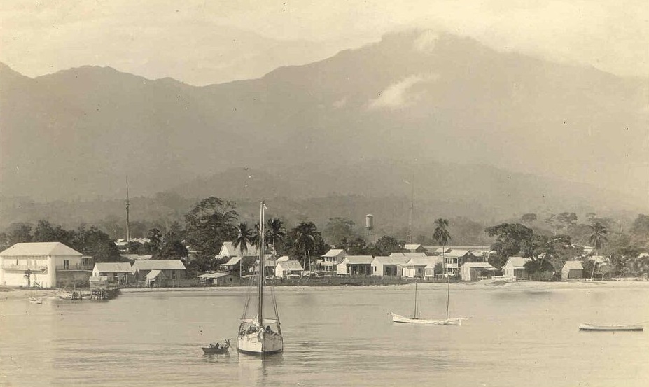
La Ceiba () is a municipality, the capital of the Honduran department of Atlántida (department), Atlántida, and a port city on the northern Caribbean coast in Honduras. It forms part of the southeastern boundary of the Gulf of Honduras. With an estimated population of 232,696 living in approximately 170 residential areas (called ''colonias'' or ''barrios''), it is the fourth most populous municipality in the country. It was also one of several important ports during colonial times for exporting goods like sugar and gold to Spain and importing enslaved Africans to Honduras. La Ceiba was officially founded on 23 August 1877. The city was named after a giant ceiba tree that grew near the old dock. The city has been officially proclaimed the "Eco-Tourism Capital of Honduras," as well as the "Entertainment Capital of Honduras". Every year, on the third or fourth Saturday of May, the city holds its La Ceiba Carnival, famous carnival to commemorate Isidore the Laborer (Spanish ''San ... [...More Info...] [...Related Items...] OR: [Wikipedia] [Google] [Baidu] |
FAP Captain Carlos Martínez De Pinillos International Airport
FAP may refer to: Technology and industry * FORTRAN Assembly Program, the macro assembler for some IBM mainframe computers * Fair Access Policy, a term for a bandwidth cap, limiting Internet usage * Femtocell (Femto Access Point), a small cellular telephone base station * Fabrika automobila Priboj, a motor vehicle manufacturer based in Priboj, Serbia * Film Academy of the Philippines, the Philippines' official counterpart of the United States' Academy of Motion Picture Arts and Sciences * Face Animation Parameter, part of the MPEG-4 face animation standard developed by the Moving Picture Experts Group Science and medicine * Functional analytic psychotherapy, clinical psychotherapy that uses a "radical behaviorist" position * Familial adenomatous polyposis, a condition where polyps form in the large intestine * Familial amyloid polyneuropathy, a neurodegenerative, genetically transmitted disease * Fixed action pattern, an instinctive animal behavioral sequence * Filamentou ... [...More Info...] [...Related Items...] OR: [Wikipedia] [Google] [Baidu] |
Trujillo, Peru
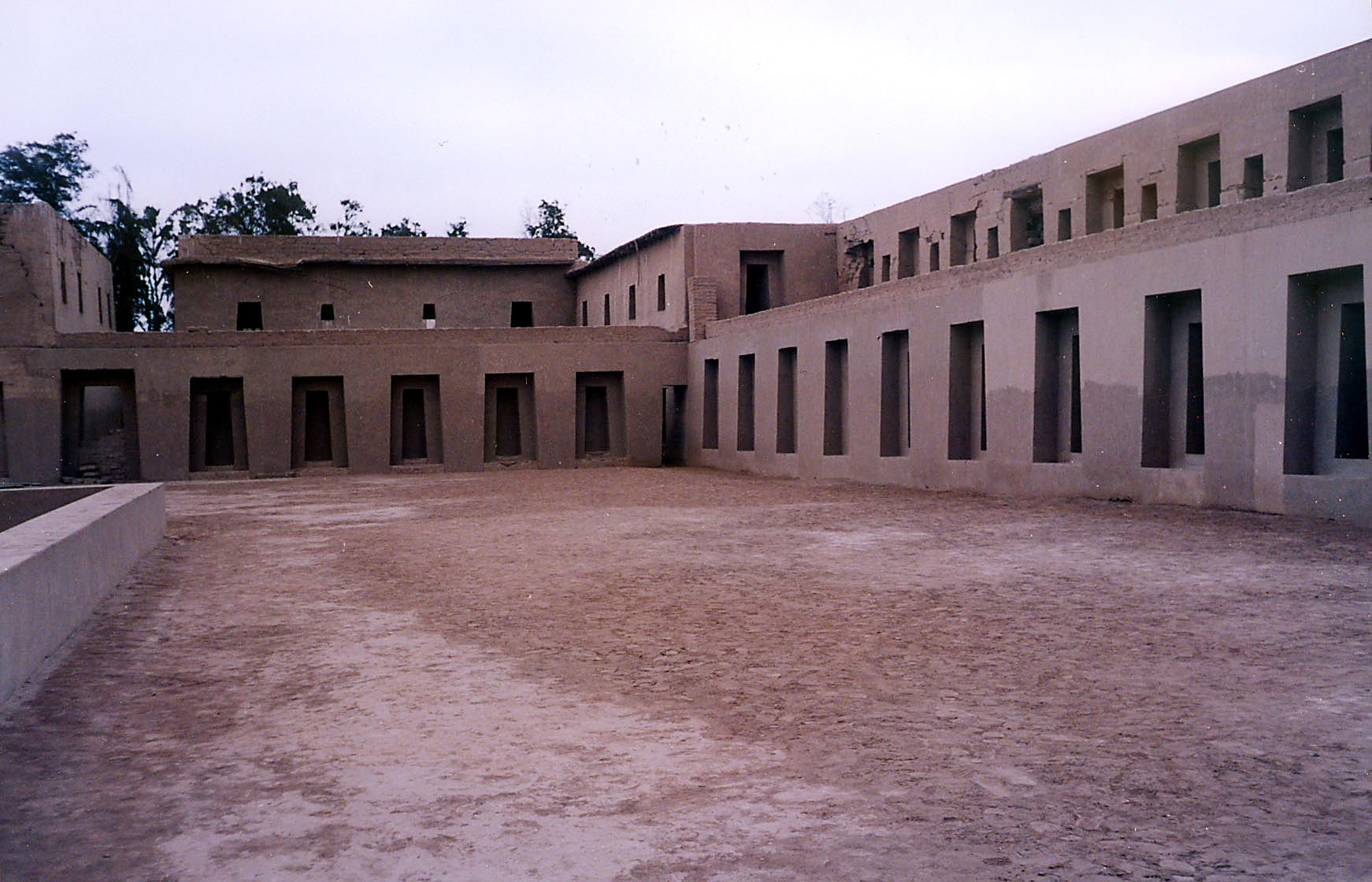
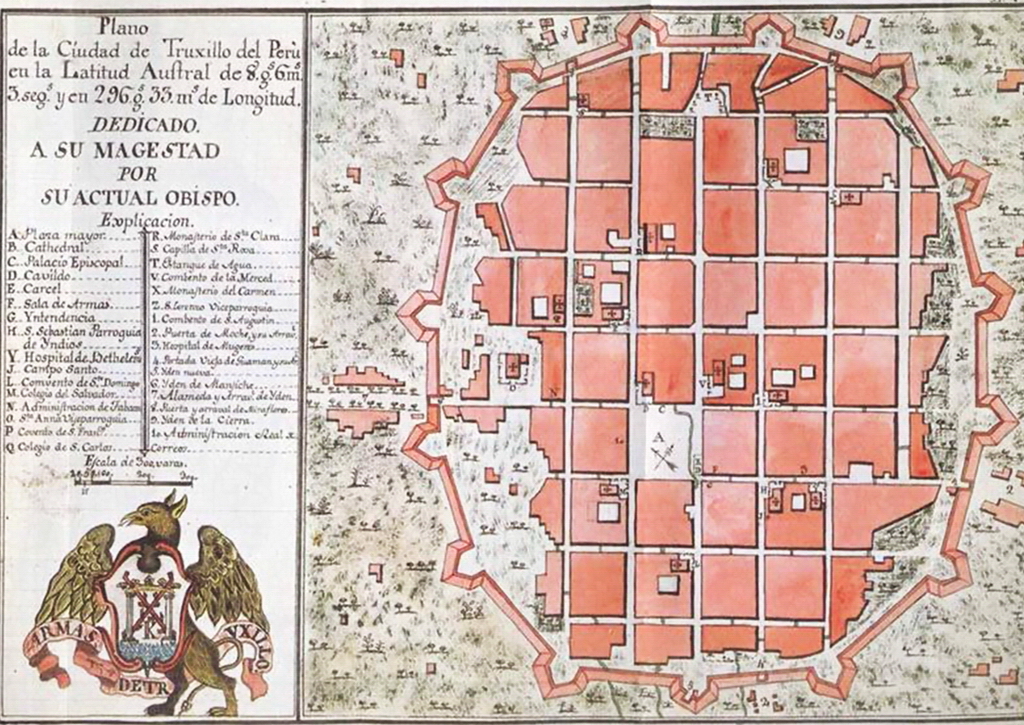
Trujillo (; ; Mochica language, Mochica: ''Cɥimor'') is a city in coastal northwestern Peru and the capital of the Department of La Libertad. It is the third most populous city and center of the List of metropolitan areas of Peru, third most populous metropolitan area of Peru. It is located on the banks of the Moche River, near its mouth at the Pacific Ocean, in the Moche Valley. This was a site of the great prehistoric Moche (culture), Moche and Chimu cultures before the Inca conquest and subsequent expansion. The Independence of Trujillo from Spain was proclaimed in the Historic Centre of Trujillo on December 29, 1820, and the city was honored in 1822 by the Congress of the Republic of Peru with the title "Meritorious City and Faithful to the Fatherland", for its role in the fight for Peruvian independence. Trujillo is the birthplace of Peru's judiciary. In 1823, Riva Agüero settled in Trujillo after being deposed, but his government lacked legal recognition, while the Cong ... [...More Info...] [...Related Items...] OR: [Wikipedia] [Google] [Baidu] |
Coronel FAP Carlos Ciriani Santa Rosa International Airport
Coronel FAP Carlos Ciriani Santa Rosa International Airport is an airport serving Tacna, Peru. It is run by CORPAC S.A. (Corporación Peruana de Aeropuertos y Aviación Comercial S.A.), a government organization that oversees airport management. This is the main airport of the Tacna Region, and is north of Peru's border with Chile. Airlines and destinations See also *Transport in Peru *List of airports in Peru This is a list of airports in Peru, sorted by location. Peru, officially the Republic of Peru, is a country located in western South America. It is bordered in the north by Ecuador and Colombia, in the east by Brazil, in the southeast by Bolivia ... References External links SkyVector Aeronautical Charts * Airports in Peru [...More Info...] [...Related Items...] OR: [Wikipedia] [Google] [Baidu] |
Tacna
Tacna, officially known as San Pedro de Tacna, is a city in southern Peru and the regional capital of the Tacna Region. A very commercially active city, it is located only north of the border with Arica y Parinacota Region from Chile, inland from the Pacific Ocean and in the valley of the Caplina River. It is Peru's tenth most populous city. The city has gained a reputation for its patriotism, with many monuments and streets named after heroes of Peru's struggle for independence (1821–1824) and the War of the Pacific (1879–1883). Residents of Tacna are known in Spanish as '. History Pre-Columbian era At the time of the Spanish conquest, the region around Tacna was already multiethnic, displaying a mix of local sedentary populations and mitma settlers from the Altiplano. The proportions of these are that the first made up about 66% of the population and the latter 25%. Fishing-oreinted people known as Camanchacos made up about the remaining 9% of the population. Muc ... [...More Info...] [...Related Items...] OR: [Wikipedia] [Google] [Baidu] |
Pucallpa
Pucallpa (, ; Shipibo language, Shipibo: ''May Ushin'') is a city in eastern Peru located on the banks of the Ucayali River, a major tributary of the Amazon River. It is the capital of the Ucayali region, the Coronel Portillo Province and the Calleria District. This city is categorized as the only metropolis in Ucayali, being the largest populated center of the region. According to the ''Instituto Nacional de Estadística e Informática'', it is the tenth most populated city in Peru and second largest in the Peruvian Amazon after Iquitos. In 2017 it housed a population of 211,611 inhabitants. Although originally located in the Callería District, district of Callería, in the 1980s it formed a conurbation with the towns of Coronel Portillo Province, Puerto Callao (Yarinacocha District, district of Yarinacocha) and San Fernando (Manantay District, district of Manantay, created in 2000). Most of the transport to Pucallpa is done through the Ucayali River, located in the central e ... [...More Info...] [...Related Items...] OR: [Wikipedia] [Google] [Baidu] |
FAP Captain Guillermo Concha Iberico International Airport
PAF Captain Guillermo Concha Iberico International Airport is an airport serving Piura, Peru. It is from Piura's main square and from the resort of Máncora. It is the main airport of the department of Piura, the second most populous of Peru's regions. The airport is run by Aeropuertos del Perú (AdP), a private operator that manages various airports in northern Peru. It is served by JetSmart, LATAM Perú and Sky Airline. Airlines and destinations Incidents and accidents *On March 28, 1998 a Peruvian Air Force Antonov 32 carrying the dual civil/military registration OB-1389/FAP-388 and inbound from Tumbes evacuating 50 people stranded by El Niño-driven floods had an engine failure while approaching Piura. As the aircraft was overloaded, the pilot could not maintain altitude, and the plane struck three houses of a nearby shantytown and crashed into a canal. While the crew of five survived, 21 passengers and one person on the ground died. *On 20 September 2005, an Air ... [...More Info...] [...Related Items...] OR: [Wikipedia] [Google] [Baidu] |
Piura
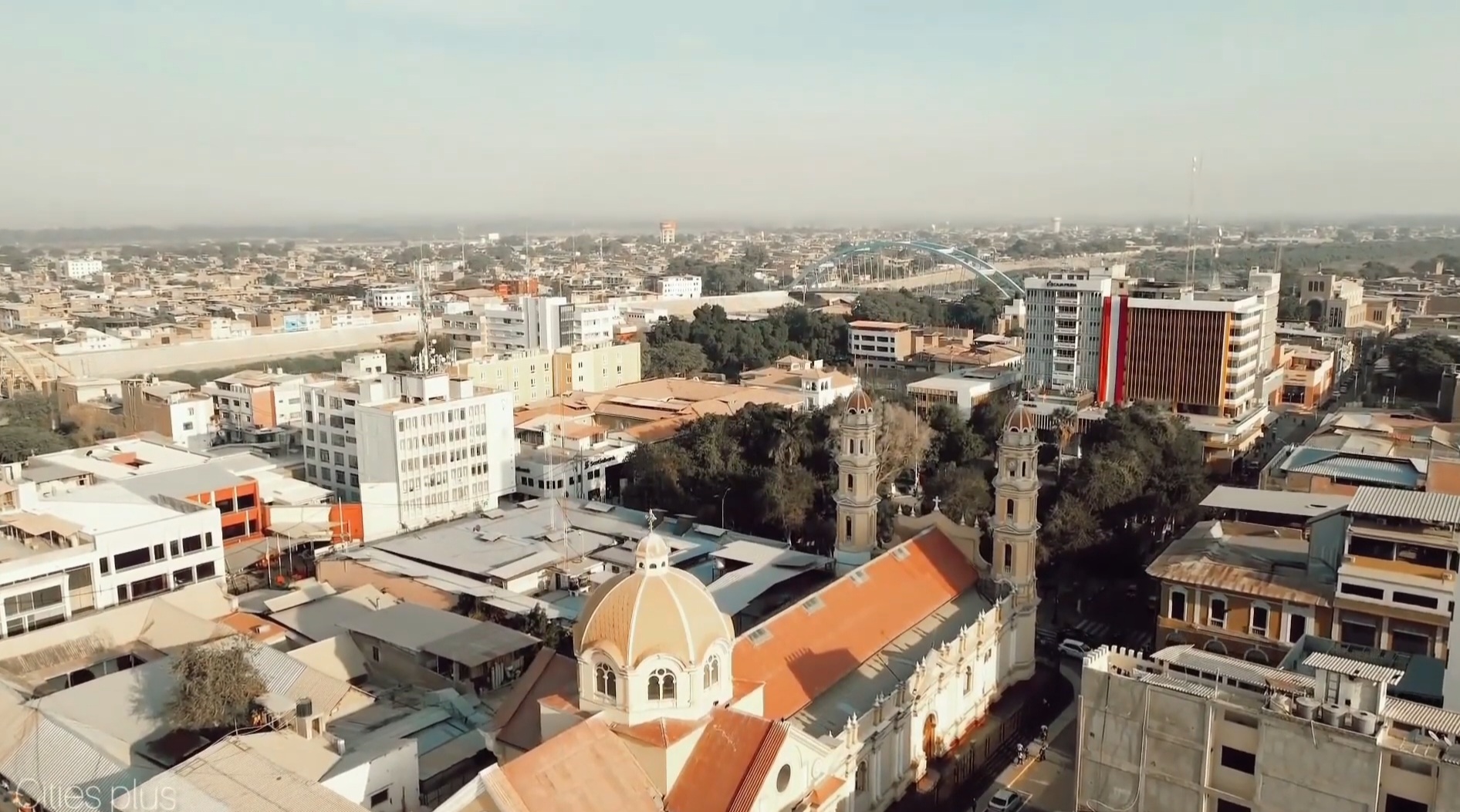
Piura is a city in northwestern Peru, located north of the Sechura Desert along the Piura River. It is the capital of the Piura Region and the Piura Province. Its population was 484,475 as of 2017 and it is the 7th most populous city in Peru. The city is located in the central eastern part of the Piura Region, 981 kilometers from the country's capital, Lima and is near to the border with Ecuador. It was here that Spanish Conqueror Francisco Pizarro founded the third Spanish city in South America and first in Peru, under the name of ''San Miguel de Piura'', in JulyHemming, J., 1970, The Conquest of the Incas, New York: Harcourt Brace Jovanovich, Inc., or August of 1532. Piura declared its independence from Spain on 4 January 1821, a few months before Peru gained its independence on 28 July 1821. It is the commercial and administrative center of the Department of Piura. Symbols Coat of arms The coat of arms of Piura was created by the Spanish Crown on December 7, 1537, thr ... [...More Info...] [...Related Items...] OR: [Wikipedia] [Google] [Baidu] |
Coronel FAP Francisco Secada Vignetta International Airport
Coronel (Crnl.) FAP Francisco Secada Vignetta International Airport is an airport serving Iquitos, capital of Loreto Region and Peru's fifth largest city. It is also known as Iquitos International Airport, and is one of the main airports in Peru. It is located 7 km (4 miles) to the southeast of the center of Iquitos. It has a single runway 2,500 m (8,202 ft) in length. It is the only airport in Amazonia with the ISO9001 stamp. The airport plays a particularly important logistical and economic role because the city of Iquitos is only accessible by air or by river. Iquitos and FAP Captain David Abensur Rengifo International Airport, Pucallpa are the main air hubs in the Peruvian Amazon. History In 1973, Iquitos Airport changed its name in commemoration of a pilot of the Peruvian Air Force, Francisco Secada Vignetta, who was born in Iquitos and made his name in the Leticia Incident, war with Colombia that took place between 1932 and 1933. It currently administered by Aeropuerto ... [...More Info...] [...Related Items...] OR: [Wikipedia] [Google] [Baidu] |


