|
Losone San Rocco 060415
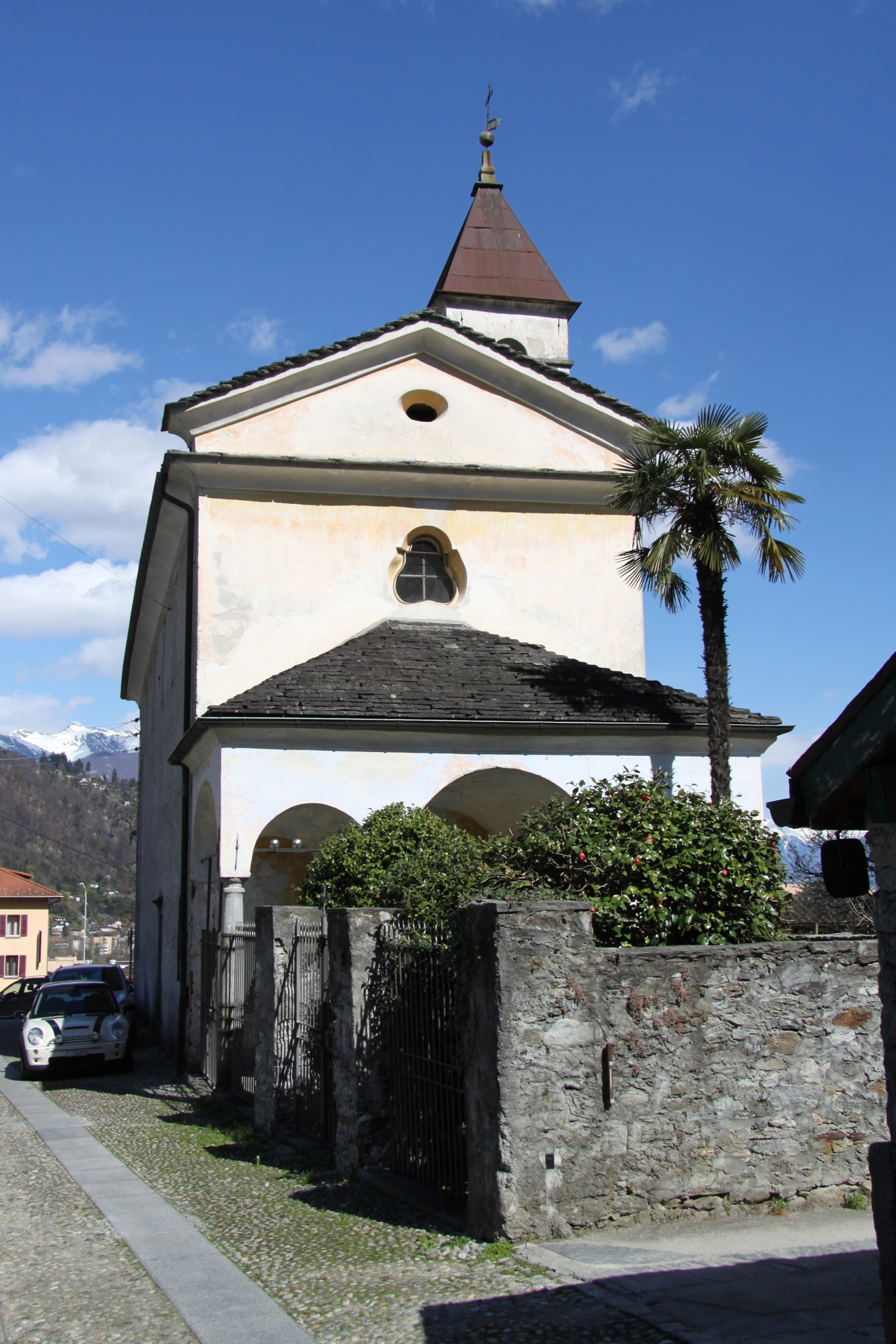
Losone is a municipality in the district of Locarno in the canton of Ticino in Switzerland. History The peat bogs of Arcegno, the rock shelters of Quarigo and the rock carvings in soapstone and gneiss appear to confirm that Losone has been inhabited since the Neolithic period. In 1934 and again in 1970-73 grave goods from the 1st to 4th Centuries were found. There are also traces of a further use of the grave yard in the 6th Century as well. The modern municipality of Losone is first mentioned in 1061 as ''Loxono'' though this is from a 1402 copy of the original. In 1200 it was mentioned as ''de losono''. During the Middle Ages the settlement or ''borgo'' included; the so-called Bassa Losone, Arcegno and until 1807, Vosa im Onsernonetal. It formed a '' Vicinanza'' in the parish of Locarno and had its own statutes and laws. The status of an independent ''Vicinanza'' was confirmed in 1734. Losone owned rights to alpine pastures in the valleys of Bosco/Gurin, Onsernone and V ... [...More Info...] [...Related Items...] OR: [Wikipedia] [Google] [Baidu] |
Locarno (district)
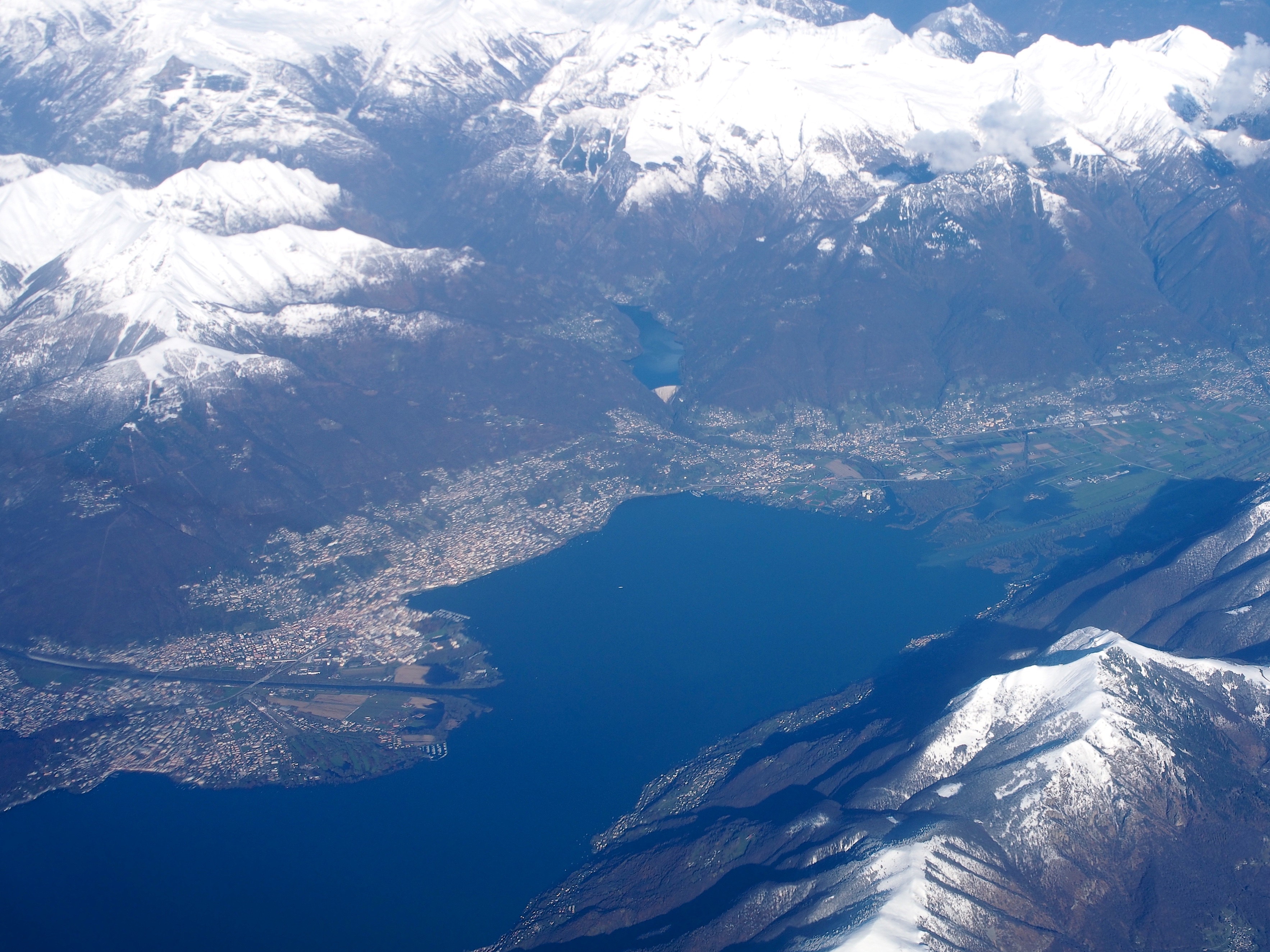
The Locarno District (also called Locarnese) is a district of Canton Ticino, Switzerland. It has a population of (as of ). Geography The Locarno District has an area, , of . Of this area, or 6.4% is used for agricultural purposes, while or 58.1% is forested. Of the rest of the land, or 4.9% is settled (buildings or roads), or 2.3% is either rivers or lakes and or 24.3% is unproductive land. Of the built up area, housing and buildings made up 2.8% and transportation infrastructure made up 1.2%. Out of the forested land, 47.1% of the total land area is heavily forested and 3.6% is covered with orchards or small clusters of trees. Of the agricultural land, 3.0% is used for growing crops and 2.8% is used for alpine pastures. Of the water in the district, 0.5% is in lakes and 1.9% is in rivers and streams. Of the unproductive areas, 14.7% is unproductive vegetation and 9.6% is too rocky for vegetation. Demographics The Locarno District has a population () of . Of the Swi ... [...More Info...] [...Related Items...] OR: [Wikipedia] [Google] [Baidu] |
Vineyard
A vineyard (; also ) is a plantation of grape-bearing vines, grown mainly for winemaking, but also raisins, table grapes and non-alcoholic grape juice. The science, practice and study of vineyard production is known as viticulture. Vineyards are often characterised by their ''terroir'', a French term loosely translating as "a sense of place" that refers to the specific geographical and geological characteristics of grapevine plantations, which may be imparted to the wine itself. History The earliest evidence of wine production dates from between 6000 and 5000 BC. Wine making technology improved considerably with the ancient Greeks but it wasn't until the end of the Roman Empire that cultivation techniques as we know them were common throughout Europe. In medieval Europe the Church was a staunch supporter of wine, which was necessary for the celebration of the Mass. During the lengthy instability of the Middle Ages, the monasteries maintained and developed viticultura ... [...More Info...] [...Related Items...] OR: [Wikipedia] [Google] [Baidu] |
Confluence
In geography, a confluence (also: ''conflux'') occurs where two or more flowing bodies of water join to form a single channel. A confluence can occur in several configurations: at the point where a tributary joins a larger river (main stem); or where two streams meet to become the source of a river of a new name (such as the confluence of the Monongahela and Allegheny rivers at Pittsburgh, forming the Ohio); or where two separated channels of a river (forming a river island) rejoin at the downstream end. Scientific study of confluences Confluences are studied in a variety of sciences. Hydrology studies the characteristic flow patterns of confluences and how they give rise to patterns of erosion, bars, and scour pools. The water flows and their consequences are often studied with mathematical models. Confluences are relevant to the distribution of living organisms (i.e., ecology) as well; "the general pattern ownstream of confluencesof increasing stream flow and decreasing ... [...More Info...] [...Related Items...] OR: [Wikipedia] [Google] [Baidu] |
Maggia (river)
The Maggia is a river in the Swiss canton of Ticino. The springs are near the Cristallina mountain at 8136 ft (2480 m). The river runs through the Val Sambuco, the Val Lavizzara, and the Valle Maggia, and enters Lago Maggiore between Ascona and Locarno. The village Maggia is situated on the river. The river is used for hydroelectric power production, e.g. with the dams of Lago del Narèt and Lago del Sambuco near the sources. The Maggia river is a popular scuba diving Scuba diving is a mode of underwater diving whereby divers use breathing equipment that is completely independent of a surface air supply. The name "scuba", an acronym for " Self-Contained Underwater Breathing Apparatus", was coined by Chr ... spot due to its crystal clear waters. The name of the river derives from the name of the village Maggia. In the 1990s the river had a European record: the river that grew fastest during rains. This characteristic led to many tragedies in the past. One inv ... [...More Info...] [...Related Items...] OR: [Wikipedia] [Google] [Baidu] |
Sopraceneri
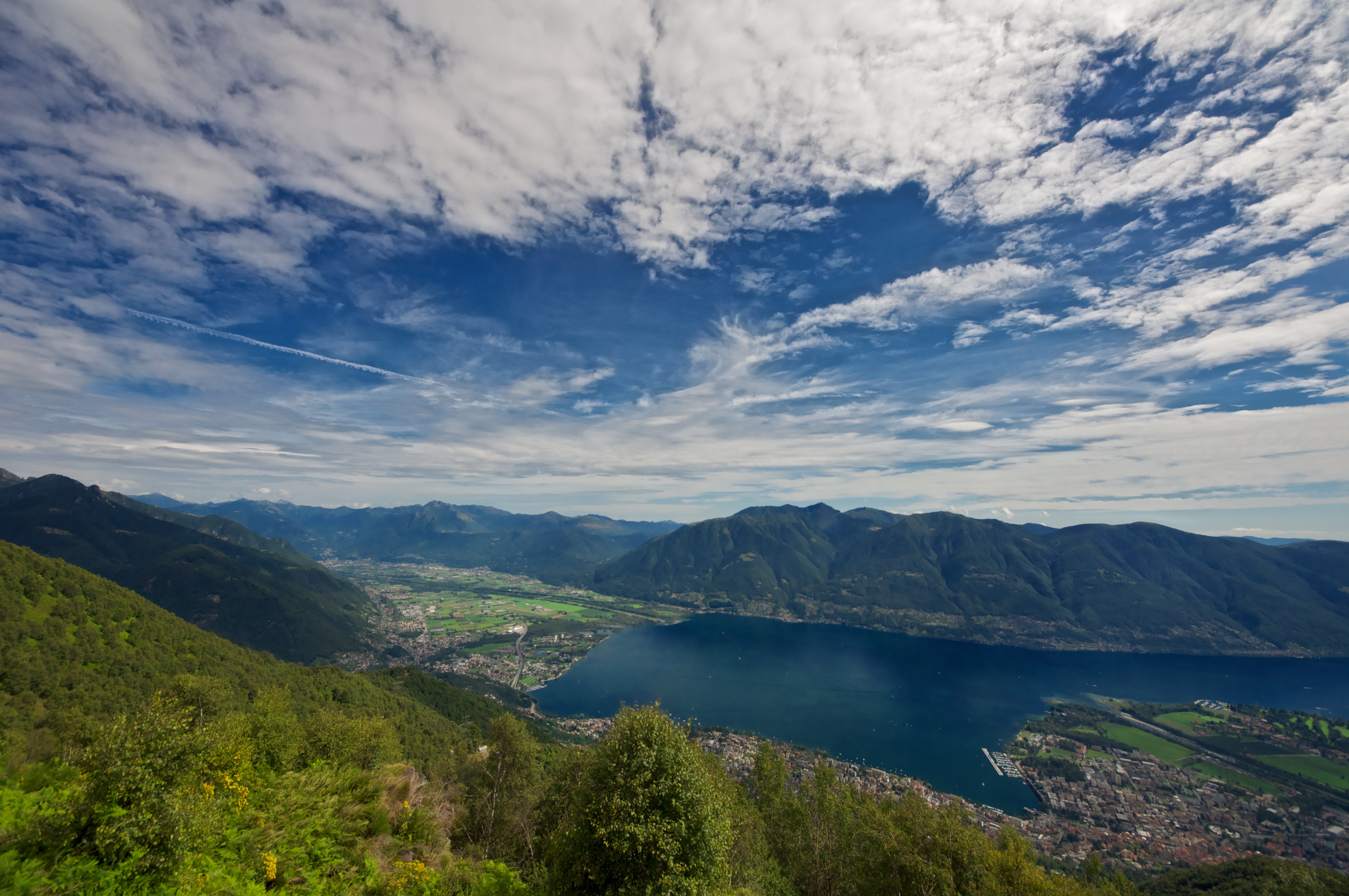
The Sopraceneri (''above the Ceneri'', lombard: ''Surascender'') is the part of the Swiss canton of Ticino that lies to the north of the Monte Ceneri Pass through the Lugano Prealps. It includes the whole of the valley of the Ticino river and its side valleys, the Swiss shore of Lake Maggiore, the cities of Bellinzona and Locarno, as well as towns including Biasca and Riviera. The Sopraceneri is not a half-canton with formally defined boundaries, but roughly maps to the districts of Bellinzona, Blenio, Leventina, Locarno, Riviera and Vallemaggia. The remainder of the canton is described as the Sottoceneri (''under the Ceneri''), and includes the towns of Lugano, Mendrisio and Chiasso Chiasso (; lmo, Ciass ) is a municipality in the district of Mendrisio in the canton of Ticino in Switzerland. As the southernmost of Switzerland's municipalities, Chiasso is on the border with Italy, in front of Ponte Chiasso (a frazione of Co .... Whilst the Sopraceneri comprises , or ab ... [...More Info...] [...Related Items...] OR: [Wikipedia] [Google] [Baidu] |
Golino (Switzerland) , Ticino, Switzerland
{{disambiguation ...
Golino may refer to: People * Carlo Golino (1913-1991), Italian academic and educator * Enzo Golino (1932−2020), Italian journalist and literary critic *Valeria Golino (born 1965), Italian actress and director Other uses *Golino, a settlement in Centovalli Centovalli (literally: hundred valleys) is a valley and a municipality in the district of Locarno in the canton of Ticino in Switzerland. It is composed of 19 villages or hamlets "frazioni". The municipality was formed on 25 October 2009 throu ... [...More Info...] [...Related Items...] OR: [Wikipedia] [Google] [Baidu] |
Pewter
Pewter () is a malleable metal alloy consisting of tin (85–99%), antimony (approximately 5–10%), copper (2%), bismuth, and sometimes silver. Copper and antimony (and in antiquity lead) act as hardeners, but lead may be used in lower grades of pewter, imparting a bluish tint. Pewter has a low melting point, around , depending on the exact mixture of metals. The word ''pewter'' is probably a variation of the word '' spelter'', a term for zinc alloys (originally a colloquial name for zinc). History Pewter was first used around the beginning of the Bronze Age in the Near East. The earliest known piece of pewter was found in an Egyptian tomb, c. 1450 BC, but it is unlikely that this was the first use of the material. Pewter was used for decorative metal items and tableware in ancient times by the Egyptians and later the Romans, and came into extensive use in Europe from the Middle Ages until the various developments in pottery and glass-making during the 18th and 19th centur ... [...More Info...] [...Related Items...] OR: [Wikipedia] [Google] [Baidu] |
Grinding (abrasive Cutting)
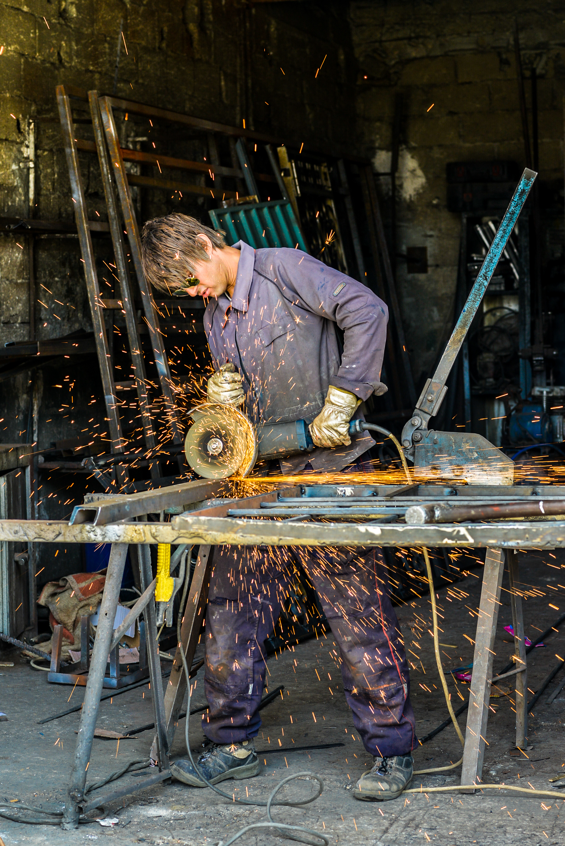
Grinding is a type of abrasive machining process which uses a grinding wheel as cutting tool. A wide variety of machines are used for grinding, best classified as portable or stationary: * Portable power tools such as angle grinders, die grinders and cut-off saws * Stationary power tools such as bench grinders and cut-off saws * Stationary hydro- or hand-powered sharpening stones Milling practice is a large and diverse area of manufacturing and toolmaking. It can produce very fine finishes and very accurate dimensions; yet in mass production contexts, it can also rough out large volumes of metal quite rapidly. It is usually better suited to the machining of very hard materials than is "regular" machining (that is, cutting larger chips with cutting tools such as tool bits or milling cutters), and until recent decades it was the only practical way to machine such materials as hardened steels. Compared to "regular" machining, it is usually better suited to taking very ... [...More Info...] [...Related Items...] OR: [Wikipedia] [Google] [Baidu] |
Early Modern Switzerland
The early modern history of the Old Swiss Confederacy ('' Eidgenossenschaft'', also known as the "Swiss Republic" or ''Republica Helvetiorum'') and its constituent Thirteen Cantons encompasses the time of the Thirty Years' War (1618–1648) until the French invasion of 1798. The early modern period was characterized by an increasingly aristocratic and oligarchic ruling class as well as frequent economic or religious revolts. This period came to be referred to as the ''Ancien Régime'' retrospectively, in post-Napoleonic Switzerland. The loosely organized Confederation remained generally disorganized and crippled by the religious divisions created by the Swiss Reformation. During this period the Confederation gained formal independence from the Holy Roman Empire with support from France, and had very close relations with France. The early modern period also saw the growth of French-Swiss literature, and notable authors of the Age of Enlightenment such as the mathemat ... [...More Info...] [...Related Items...] OR: [Wikipedia] [Google] [Baidu] |
Rector (ecclesiastical)
A rector is, in an ecclesiastical sense, a cleric who functions as an administrative leader in some Christian denominations. In contrast, a vicar is also a cleric but functions as an assistant and representative of an administrative leader. Ancient usage In ancient times bishops, as rulers of cities and provinces, especially in the Papal States, were called rectors, as were administrators of the patrimony of the Church (e.g. '). The Latin term ' was used by Pope Gregory I in '' Regula Pastoralis'' as equivalent to the Latin term ' (shepherd). Roman Catholic Church In the Roman Catholic Church, a rector is a person who holds the ''office'' of presiding over an ecclesiastical institution. The institution may be a particular building—such as a church (called his rectory church) or shrine—or it may be an organization, such as a parish, a mission or quasi-parish, a seminary or house of studies, a university, a hospital, or a community of clerics or religious. If a ... [...More Info...] [...Related Items...] OR: [Wikipedia] [Google] [Baidu] |
Muralto
Muralto is a municipality in the district of Locarno, in the canton of Ticino in Switzerland. Geography Muralto has an area, , of . Of this area, or 71.7% is used for agricultural purposes, while or 3.3% is forested. Of the rest of the land, or 93.3% is settled (buildings or roads) and or 1.7% is unproductive land. Of the built up area, housing and buildings made up 68.3% and transportation infrastructure made up 18.3%. while parks, green belts and sports fields made up 6.7%. Out of the forested land, 1.7% of the total land area is heavily forested and 1.7% is covered with orchards or small clusters of trees. Of the agricultural land, 1.7% is used for growing crops, while 1.7% is used for orchards or vine crops and 68.3% is used for alpine pastures. The municipality is located in the Locarno district, in the agglomeration of Locarno. It lies along Lake Maggiore and is bordered by the Ramogna and Rabissale streams. It was created in 1881, when it separated from Orseli ... [...More Info...] [...Related Items...] OR: [Wikipedia] [Google] [Baidu] |


