|
Lizumer Hütte
The Lizumer Hütte is an Alpine club hut of the Hall in Tirol section of the Austrian Alpine Club in the Tux Alps in the Austrian state of Tyrol. The hut is located in the rear Wattental in the middle of the extensive ski touring and hiking area of the Wattentaler Lizum. Due to its location and size, the hut is also used for a wide variety of alpine courses and seminars. History Lizumer Hütte was built in 1912 by members of the Haller Alpenverein as a base for ski tours and was expanded in 1932. In the years 1938/39 the hut was expropriated by the German Reich. After the war, it became the property of the French occupation before being transferred to the Austrian government in 1955, which owns it to this day. In 2006, the hut was completely renovated by the Hall section of the Alpine Club, equipped with climbing walls inside and out, and in 2007 it was awarded the hut quality seal of the Austrian Alpine Club. Ascents Lizumer Hütte can be reached in two hours from the parki ... [...More Info...] [...Related Items...] OR: [Wikipedia] [Google] [Baidu] |
Wattentaler Lizum
{{Coord, 47, 10, 21, N, 11, 38, 16, E, region:AT-7_type:landmark, display=title The Wattentaler Lizum (locally also Wattener Lizum) is the name of the head of the Wattental valley which branches off the lower Inn valley near Wattens. ''Lizum'' means "alpine pasture at the head of the valley" in Tyrolese. The Wattentaler Lizum lies at the eastern end of the valley in the municipality of Wattenberg. Lizum-Walchen Training Area The military training area of Lizum-Walchen has an area of over 50 km² and is the second largest in Austria after the Allentsteig Training Area. It covers the area of the Wattentaler Lizum and the ''Mölstal'' valley to the west. It belongs to the Austrian Armed Forces and puts up to 40,000 soldiers each year through military Alpine training. There are two military camps in the training area: ''Lager Walchen'' (1,410 m) and, four kilometres further south, ''Lager Lizum'' (1,995 m). File:Wattentaler_Lizum_AT6112_Picture1.jpg, Lizum Camp ( ... [...More Info...] [...Related Items...] OR: [Wikipedia] [Google] [Baidu] |
Venice
Venice ( ; it, Venezia ; vec, Venesia or ) is a city in northeastern Italy and the capital of the Veneto Regions of Italy, region. It is built on a group of 118 small islands that are separated by canals and linked by over 400 bridges. The islands are in the shallow Venetian Lagoon, an enclosed bay lying between the mouths of the Po River, Po and the Piave River, Piave rivers (more exactly between the Brenta (river), Brenta and the Sile (river), Sile). In 2020, around 258,685 people resided in greater Venice or the ''Comune di Venezia'', of whom around 55,000 live in the historical island city of Venice (''centro storico'') and the rest on the mainland (''terraferma''). Together with the cities of Padua, Italy, Padua and Treviso, Italy, Treviso, Venice is included in the Padua-Treviso-Venice Metropolitan Area (PATREVE), which is considered a statistical metropolitan area, with a total population of 2.6 million. The name is derived from the ancient Adri ... [...More Info...] [...Related Items...] OR: [Wikipedia] [Google] [Baidu] |
Munich
Munich ( ; german: München ; bar, Minga ) is the capital and most populous city of the States of Germany, German state of Bavaria. With a population of 1,558,395 inhabitants as of 31 July 2020, it is the List of cities in Germany by population, third-largest city in Germany, after Berlin and Hamburg, and thus the largest which does not constitute its own state, as well as the List of cities in the European Union by population within city limits, 11th-largest city in the European Union. The Munich Metropolitan Region, city's metropolitan region is home to 6 million people. Straddling the banks of the River Isar (a tributary of the Danube) north of the Northern Limestone Alps, Bavarian Alps, Munich is the seat of the Bavarian Regierungsbezirk, administrative region of Upper Bavaria, while being the population density, most densely populated municipality in Germany (4,500 people per km2). Munich is the second-largest city in the Bavarian dialects, Bavarian dialect area, ... [...More Info...] [...Related Items...] OR: [Wikipedia] [Google] [Baidu] |
Via Alpina
The Via Alpina is a network of five long-distance hiking trails across the alpine regions of Slovenia, Austria, Germany, Liechtenstein, Switzerland, Italy, France, and Monaco. The longest of trails is the red trail, whose termini are in Trieste and Monaco. The Via Alpina was created by a group of public and private organisations from the 8 Alpine countries in 2000, receiving EU funding from 2001 until 2008. It was initiated by the Association Grande Traversée des Alpes in Grenoble, which hosted the Via Alpina international secretariat until January 2014, when it was transferred to the International Commission for the Protection of the Alps CIPRA (Liechtenstein). There are national secretariats (hosted by public administrations or hiking associations) in each country. Its aim is to support sustainable development in remote mountain areas and promote the Alpine cultures and cultural exchanges. Purple trail * A1: From Tržaška koča na Doliču to Aljažev dom v Vratih. * A2: ... [...More Info...] [...Related Items...] OR: [Wikipedia] [Google] [Baidu] |
Rosenjoch
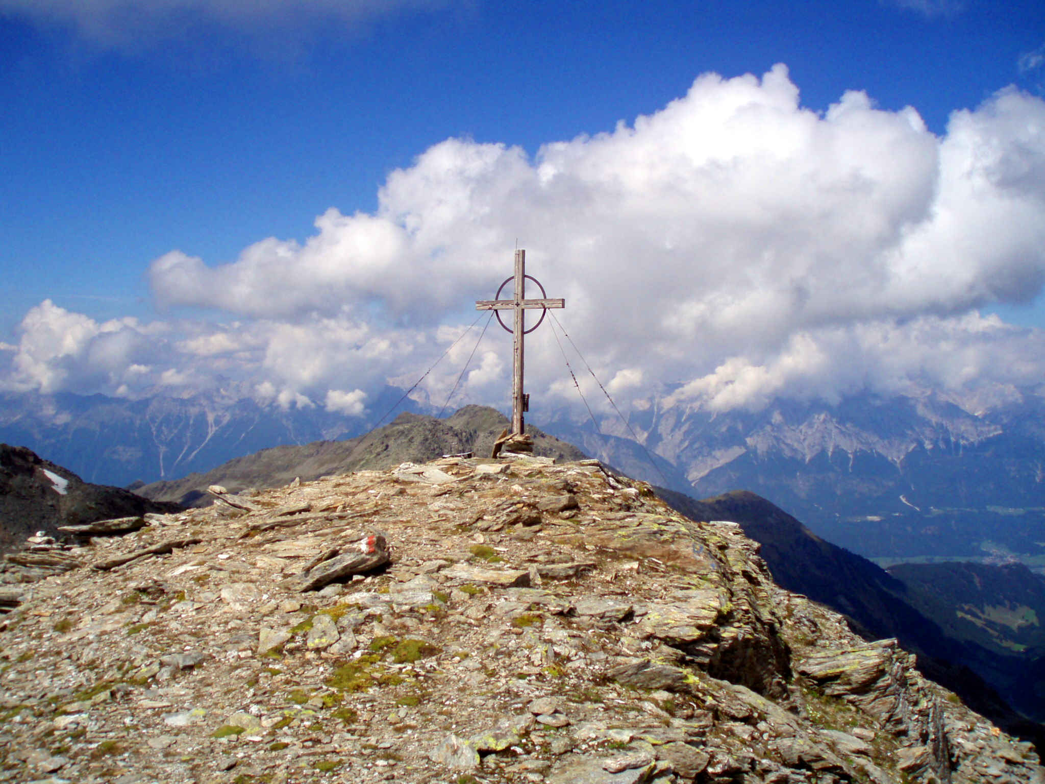
The Rosenjoch is a mountain, , and the highest point of the Voldertal and ''Arztal'' in the western Tux Alps. The top which bears a summit cross lies on the Inn Valley Mountain Trail (''Inntaler Höhenweg'') between the Glungezer Hut and Lizumer Hut in the Wattentaler Lizum {{Coord, 47, 10, 21, N, 11, 38, 16, E, region:AT-7_type:landmark, display=title The Wattentaler Lizum (locally also Wattener Lizum) is the name of the head of the Wattental valley which branches off the lower Inn valley near Wattens. ''Lizum'' mean ... and is thus frequently climbed in summer. The Rosenjoch may also be reached from the Voldertal Hut. In late winter and early spring the Rosenjoch is popular with skiers. Nevertheless, its ascent requires safe conditions. External links {{commons category Mountains of the Alps Two-thousanders of Austria Mountains of Tyrol (state) Tux Alps ... [...More Info...] [...Related Items...] OR: [Wikipedia] [Google] [Baidu] |
Weerberg
Weerberg is a municipality in the Schwaz district in the Austrian state of Tyrol. Geography Important peaks in the parish territory are the 2,762 m high Rastkogel and the 2,506 m high Gilfert The Gilfert is a peak in the Tux Alps. It is the most northerly extent of the Rastkogel Massif and can therefore be seen from almost anywhere in the Lower Inn Valley. Location and countryside The summit bears a large cross, as do the two nor ..., both in the Tux Alps. References Cities and towns in Schwaz District {{Tyrol-geo-stub ... [...More Info...] [...Related Items...] OR: [Wikipedia] [Google] [Baidu] |
Tuxer Tal
The Tuxertal is a valley located in Tyrol, Austria. A side valley of the Zillertal, from which it branches at Mayrhofen, the Tuxertal is about 13 km long and accessible on the Tuxer Straße (Tux Road). From Mayrhofen () to Hintertux (1500 m) in the municipality of Tux, the village that gives the valley its name, there is a height difference of about 850 m. The valley ends at Hintertux and the Hintertux Glacier. The Tuxbach, which rises near Hintertux, flows as far as Mayrhofen where it empties into the River Ziller. The five main settlements in the Tuxertal are (from the head of the valley): Hintertux (1,500 m), Madseit (1,385 m), Juns (1360 m), Tux (former Lanersbach) (1,300 m), Vorderlanersbach (1,300 m) and the parish of Finkenberg (840 m). The Tuxertal is the only way of reaching the Hintertux Glacier by means of road and cable lift. Gallery Image:TuxerKalb.JPG, Tux cattle The Tux-Zillertal, german: Tux-Zillertaler, itali ... [...More Info...] [...Related Items...] OR: [Wikipedia] [Google] [Baidu] |
World War II
World War II or the Second World War, often abbreviated as WWII or WW2, was a world war that lasted from 1939 to 1945. It involved the vast majority of the world's countries—including all of the great powers—forming two opposing military alliances: the Allies and the Axis powers. World War II was a total war that directly involved more than 100 million personnel from more than 30 countries. The major participants in the war threw their entire economic, industrial, and scientific capabilities behind the war effort, blurring the distinction between civilian and military resources. Aircraft played a major role in the conflict, enabling the strategic bombing of population centres and deploying the only two nuclear weapons ever used in war. World War II was by far the deadliest conflict in human history; it resulted in 70 to 85 million fatalities, mostly among civilians. Tens of millions died due to genocides (including the Holocaust), starvation, ma ... [...More Info...] [...Related Items...] OR: [Wikipedia] [Google] [Baidu] |
Wattenberg, Tyrol
Wattenberg is a municipality in the district of Innsbruck-Land in the Austrian state of Tyrol located 15 km east of Innsbruck and 2.50 km above the Swarovski crystal town Wattens Wattens is a market town of the Innsbruck-Land District in the Austrian state of Tyrol. It is chiefly known as home of the Swarovski crystal glass company. Geography Wattens is located in the Lower Inn Valley of North Tyrol, about east of Innsbr .... Population Gallery Image:Schmiederer Kapelle AT6112.JPG, Wattenberg. Image:Wattentaler Lizum AT6112 Picture2.jpg Image:Wattenberg_AT6112.JPG, Wattenberg Tyrol. References External links * Municipality Wattenberg: Official website of the municipality in thHall-Wattens region Cities and towns in Innsbruck-Land District {{Tyrol-geo-stub ... [...More Info...] [...Related Items...] OR: [Wikipedia] [Google] [Baidu] |
Nazi Germany
Nazi Germany (lit. "National Socialist State"), ' (lit. "Nazi State") for short; also ' (lit. "National Socialist Germany") (officially known as the German Reich from 1933 until 1943, and the Greater German Reich from 1943 to 1945) was the German state between 1933 and 1945, when Adolf Hitler and the Nazi Party controlled the country, transforming it into a dictatorship. Under Hitler's rule, Germany quickly became a totalitarian state where nearly all aspects of life were controlled by the government. The Third Reich, meaning "Third Realm" or "Third Empire", alluded to the Nazi claim that Nazi Germany was the successor to the earlier Holy Roman Empire (800–1806) and German Empire (1871–1918). The Third Reich, which Hitler and the Nazis referred to as the Thousand-Year Reich, ended in May 1945 after just 12 years when the Allies defeated Germany, ending World War II in Europe. On 30 January 1933, Hitler was appointed chancellor of Germany, the head of gove ... [...More Info...] [...Related Items...] OR: [Wikipedia] [Google] [Baidu] |

.jpg)


