|
Little Main Restigouche River
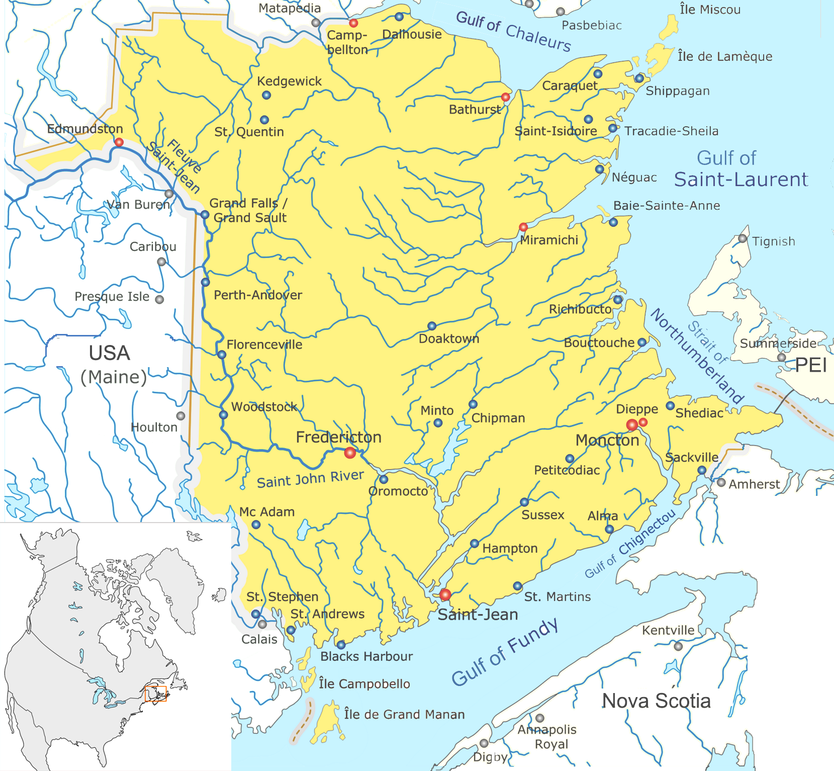
The Little Main Restigouche River is a tributary of the head of the Restigouche River, flowing in Madawaska County, Victoria County and Restigouche County, in Northwest of New Brunswick, in Canada. The course of the river passes successively in: * Madawaska County: Rivière-Verte Parish, Notre-Dame-de-Lourdes and Sainte-Anne Parish; * Victoria County, New Brunswick: Drummond Parish; * Restigouche County: Saint-Quentin Parish and Grimmer Parish. Geography The "Little Main Restigouche River" originates from a mountain stream of Madawaska County, located at the South of a watershed line to which the Caribou Creek (tributary of the Gounamitz West Branch River) drains the North side and the Main Branch (a tributary of the Little Forks Branch Green river) drains the West side. This source is located at: * East of the confluence of Lake First; * Northeast of the city center of Edmundston; * Northeast of the confluence of the "Little Main Restigouche River"; * East of the ... [...More Info...] [...Related Items...] OR: [Wikipedia] [Google] [Baidu] |
Canada
Canada is a country in North America. Its ten provinces and three territories extend from the Atlantic Ocean to the Pacific Ocean and northward into the Arctic Ocean, covering over , making it the world's second-largest country by total area. Its southern and western border with the United States, stretching , is the world's longest binational land border. Canada's capital is Ottawa, and its three largest metropolitan areas are Toronto, Montreal, and Vancouver. Indigenous peoples have continuously inhabited what is now Canada for thousands of years. Beginning in the 16th century, British and French expeditions explored and later settled along the Atlantic coast. As a consequence of various armed conflicts, France ceded nearly all of its colonies in North America in 1763. In 1867, with the union of three British North American colonies through Confederation, Canada was formed as a federal dominion of four provinces. This began an accretion of provinces an ... [...More Info...] [...Related Items...] OR: [Wikipedia] [Google] [Baidu] |
Gulf Of Saint Lawrence
, image = Baie de la Tour.jpg , alt = , caption = Gulf of St. Lawrence from Anticosti National Park, Quebec , image_bathymetry = Golfe Saint-Laurent Depths fr.svg , alt_bathymetry = Bathymetry of the Gulf of St. Lawrence , caption_bathymetry = Bathymetry of the Gulf of St. Lawrence , location = , group = , coordinates = , type = Gulf , etymology = , part_of = , inflow = , rivers = , outflow = , oceans = , catchment = , basin_countries = CanadaSaint Pierre and Miquelon (France) , agency = , designation = , date-built = , engineer = , date-flooded = , length = , width = , area = , depth = , max-depth = , volume = , residence_time = , salinity ... [...More Info...] [...Related Items...] OR: [Wikipedia] [Google] [Baidu] |
List Of Rivers Of New Brunswick
This is a List of bodies of water in the Canadian province of New Brunswick, including waterfalls. New Brunswick receives precipitation year-round, which feeds numerous streams and rivers. There are two main discharge basins: the Gulf of Saint Lawrence to the east and north and the Bay of Fundy to the south. The major rivers are the Saint John River (Wolastoq) and the Miramichi River. Bodies of water See also *List of bays in New Brunswick *List of lakes in New Brunswick *List of mountains in New Brunswick *List of islands of New Brunswick *List of waterfalls in Canada References External links * *Map of New Brunswick Watershed Groups and Provisional Water Classification* * Map of the main rivers of New Brunswick in French * {{Rivers of New Brunswick New Brunswick * Bodies of water New Brunswick New Brunswick (french: Nouveau-Brunswick, , locally ) is one of the thirteen provinces and territories of Canada. It is one of the three Maritime provinces and one of ... [...More Info...] [...Related Items...] OR: [Wikipedia] [Google] [Baidu] |
Campbellton, New Brunswick
Campbellton is a city in Restigouche County, New Brunswick, Canada. Situated on the south bank of the Restigouche River opposite Pointe-à-la-Croix, Quebec, Campbellton was officially incorporated in 1889 and achieved city status in 1958. Forestry and tourism are major industries in the regional economy, while a pulp mill in the Campbellton community of Atholville is the largest single employer in the area. As part of the tourism "industry", wealthy sportfishermen seeking Atlantic salmon flock to the scenic Restigouche Valley every summer. The region sees extensive annual snowfall. Alpine and Nordic ski facilities at Sugarloaf Provincial Park provide winter recreation opportunities for both visitors and local residents. Campbellton is also a local retail and service centre. On 1 January 2023, Campbellton amalgamated with the villages of Atholville and Tide Head, the local service district (LSD) of Glencoe and parts of four other LSDs. The names of the annexed communities ... [...More Info...] [...Related Items...] OR: [Wikipedia] [Google] [Baidu] |
Quebec
Quebec ( ; )According to the Canadian government, ''Québec'' (with the acute accent) is the official name in Canadian French and ''Quebec'' (without the accent) is the province's official name in Canadian English is one of the thirteen provinces and territories of Canada. It is the largest province by area and the second-largest by population. Much of the population lives in urban areas along the St. Lawrence River, between the most populous city, Montreal, and the provincial capital, Quebec City. Quebec is the home of the Québécois nation. Located in Central Canada, the province shares land borders with Ontario to the west, Newfoundland and Labrador to the northeast, New Brunswick to the southeast, and a coastal border with Nunavut; in the south it borders Maine, New Hampshire, Vermont, and New York in the United States. Between 1534 and 1763, Quebec was called ''Canada'' and was the most developed colony in New France. Following the Seven Years' War, Quebec b ... [...More Info...] [...Related Items...] OR: [Wikipedia] [Google] [Baidu] |
Patapédia River
The Patapédia River (French: ''Rivière Patapédia'') is a tributary of the Restigouche River in Northwest New Brunswick and Southeast Quebec, in Canada. The course of river in Quebec (upper segment) has its beginnings the Matapédia Valley in the regional county municipality of La Mitis of the Gaspé Peninsula, in the administrative region of Gaspésie-Îles-de-la-Madeleine, while its end forms the natural provincial border between Quebec and New Brunswick before flowing into the Restigouche River at the "Million Dollar Pool". Also known as the Patapédia Pool, the deep, cold reservoir gets its name from the abundance of salmon that gather there every season. The upper part of the river is served by forest roads in Zec du Bas-Saint-Laurent. The lower part of Quebec Bank of the river is served by forest roads from the Matapedia Valley such Thomas road, coming from the village of L'Ascension-de-Patapédia, Quebec. The New Brunswick bank of the river has no carrosables access roa ... [...More Info...] [...Related Items...] OR: [Wikipedia] [Google] [Baidu] |
Kedgwick, New Brunswick
Kedgwick is a Canadian incorporated rural community in northern New Brunswick, Canada. On 1 January 2023, Kedgwick annexed a large area including the local service districts of St. Jean Baptiste – Menneval and White's Brook, with parts of two others. A variation of the original Micmac Madawamkedjwik, the name was "shortened by the river men to Tom Kedgwick or Kedgwick" (Ganong). Of uncertain meaning. Appears as Grande Fourche, " Big Fork", on some maps; however, the older variant prevailed. Forestry is the major industry in the area. History Originally a local improvement district, then an incorporated village, Kedgwick became a rural community in 2012 when it amalgamated with the surrounding local service district of the parish of Grimmer. Geography Located in the Appalachian Mountains in the western part of the county, Kedgwick is approximately 75 kilometres southwest of Campbellton and 15 kilometres east of the Restigouche River along Route 17. Being surrounded by wo ... [...More Info...] [...Related Items...] OR: [Wikipedia] [Google] [Baidu] |
Kedgwick River
The Kedgwick River is a tributary of the head of the Restigouche River, in New Brunswick, in Canada. It flows southeast in: * Quebec: in the unorganized territory of Lac-Huron, Quebec, in regional county municipality (MRC) Rimouski-Neigette, in the administrative region of Bas-Saint-Laurent; * New Brunswick: Saint-Quentin and Grimmer Parish, in Restigouche County. Geography Kedgwick River rises at the mouth of the Little Lake Kedgwick (length: ; height: ), located in the Northeastern part of the Réserve faunique de Rimouski (Rimouski Wildlife Reserve), in Notre Dame Mountains, in province of Quebec. The Little Lake Kedgwick is powered by the creek of "Lac à Poil" (coming from the North). The mouth of the Little Lake Kedgwick is located at: * Southeast and Southwest of the border between Quebec and New Brunswick; * Southwest of the summit of the "mountain à Dubé" top; * Southwest of the summit of the "mountain du Lac Perdu" (mountain of Lost Lake); * Southeast of Ri ... [...More Info...] [...Related Items...] OR: [Wikipedia] [Google] [Baidu] |
Saint-Quentin, New Brunswick
Saint-Quentin is a town in northern New Brunswick, Canada. Saint-Quentin is in the Restigouche region of the Appalachian Mountains, 50 kilometres west of Mount Carleton, the province's highest elevation. The majority of individuals in the area speak French. On 1 January 2023, Saint-Quentin annexed the local service district (LSD) of St. Martin de Restigouche and part of the LSD of the parish of Saint-Quentin Revised census figures have not been released. History In 1897, the Restigouche and Western Railway Company embarked on a project to build a railway linking Campbellton and St-Léonard, two towns in northwestern New Brunswick. The progress of its construction sent workers deep into the forest. In 1909, Simon Gallant, an Acadian working as a blacksmith, decided to settle his family by a stream near Five Fingers where he found a stray cow. At the same time, authorities began to worry about the emigration of Québec families to the United States and to Western Canada ... [...More Info...] [...Related Items...] OR: [Wikipedia] [Google] [Baidu] |
Province Of Quebec
Quebec ( ; )According to the Canadian government, ''Québec'' (with the acute accent) is the official name in Canadian French and ''Quebec'' (without the accent) is the province's official name in Canadian English is one of the thirteen provinces and territories of Canada. It is the largest province by area and the second-largest by population. Much of the population lives in urban areas along the St. Lawrence River, between the most populous city, Montreal, and the provincial capital, Quebec City. Quebec is the home of the Québécois nation. Located in Central Canada, the province shares land borders with Ontario to the west, Newfoundland and Labrador to the northeast, New Brunswick to the southeast, and a coastal border with Nunavut; in the south it borders Maine, New Hampshire, Vermont, and New York in the United States. Between 1534 and 1763, Quebec was called ''Canada'' and was the most developed colony in New France. Following the Seven Years' War, Quebec becam ... [...More Info...] [...Related Items...] OR: [Wikipedia] [Google] [Baidu] |
Edmundston
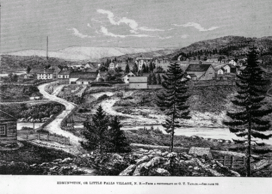
Edmundston is a city in Madawaska County, New Brunswick, Canada. On 1 January 2023, Edmundston will expanded, annexing the village of Rivière-Verte and parts of the local service districts of the parish of Saint-Jacques and the parish of Saint-Joseph. History During the early colonial period, the area was a camping and meeting place of the Maliseet (Wolastoqiyik) Nation during seasonal migrations. From the mid to late eighteenth century, one of the largest Maliseet villages had been established at Madawaska and had become a refuge site for other Wabanaki peoples. The Maliseet village was originally located near the falls at the confluence of the Madawaska and Saint John Rivers. Currently, the City of Edmundston surrounds a federal Indian Reserve (St. Basile 10/Madawaska Maliseet First Nation). Originally named ''Petit-Sault'' (Little Falls) in reference to the waterfalls located where the Madawaska River merges into the Saint John River, the settlement was renamed ''Edmun ... [...More Info...] [...Related Items...] OR: [Wikipedia] [Google] [Baidu] |
.jpg)


