|
Lichtenberg (locality)
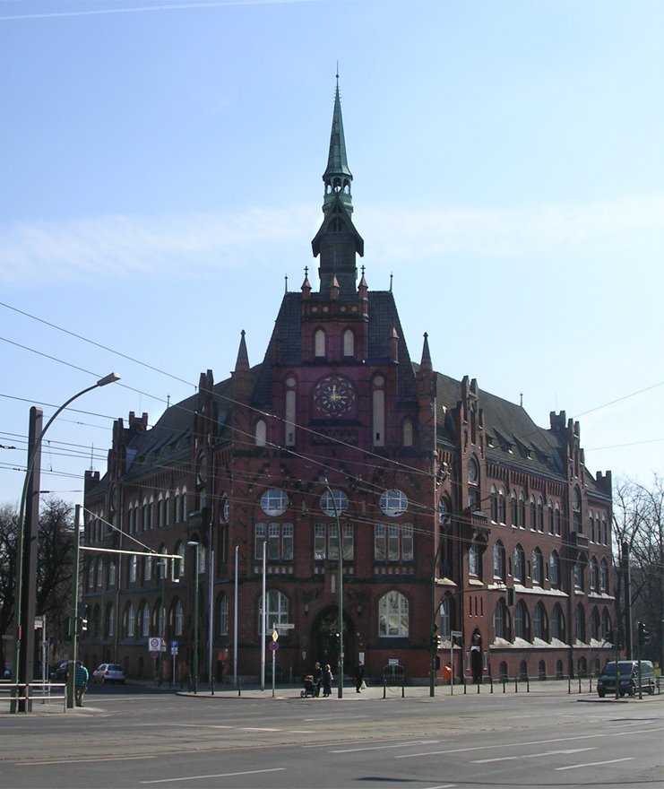
Lichtenberg () is a quarter (''Ortsteil'') of Berlin in the homonymous borough (''Bezirk'') of Lichtenberg. Until 2001 it was an autonomous district with the localities of Fennpfuhl, Rummelsburg, Friedrichsfelde and Karlshorst. History The historic village of Lichtenberg, today also called ''Alt-Lichtenberg'', was founded about 1230, due to the German colonization of the territory of Barnim. The settlement around the fieldstone church was first mentioned in a 1288 deed, its estates were acquired by the neighbouring City of Berlin in 1391. ''Alt-Lichtenberg'' suffered severely during the Thirty Years' War and remained a small village at the Berlin gates until in the late 18th century Prussian noblemen like general Wichard Joachim Heinrich von Möllendorf built their residences here. In 1815 the Lichtenberg estate became a property of the Prussian chancellor Karl August von Hardenberg. The village came to be a residential area and a suburb of Berlin from the mid 19th century on ... [...More Info...] [...Related Items...] OR: [Wikipedia] [Google] [Baidu] |
Friedrichshain
Friedrichshain () is a quarter (''Ortsteil'') of the borough of Friedrichshain-Kreuzberg in Berlin, Germany. From its creation in 1920 until 2001, it was a freestanding city borough. Formerly part of East Berlin, it is adjacent to Mitte, Prenzlauer Berg, Kreuzberg and Lichtenberg. Friedrichshain is named after the ''Volkspark Friedrichshain'', a vast green park at the northern border with Prenzlauer Berg. In the Nazi era, the borough was called '' Horst-Wessel-Stadt''. Friedrichshain is one of the trendy districts of Berlin and has experienced gentrification. Geography Friedrichshain is defined by the following roads and places, starting clock-wise in the west: Lichtenberger Straße, Mollstraße, Otto-Braun-Straße, Am Friedrichshain, Virchowstraße, Margarete-Sommer-Straße, Danziger Straße, Landsberger Allee, Hausburgstraße, Thaerstraße, Eldenaer Straße, S-Bahn-Trasse, Kynaststraße, Stralauer Halbinsel, Spree. History The largely working-class district was created in ... [...More Info...] [...Related Items...] OR: [Wikipedia] [Google] [Baidu] |
Europe
Europe is a large peninsula conventionally considered a continent in its own right because of its great physical size and the weight of its history and traditions. Europe is also considered a Continent#Subcontinents, subcontinent of Eurasia and it is located entirely in the Northern Hemisphere and mostly in the Eastern Hemisphere. Comprising the westernmost peninsulas of Eurasia, it shares the continental landmass of Afro-Eurasia with both Africa and Asia. It is bordered by the Arctic Ocean to the north, the Atlantic Ocean to the west, the Mediterranean Sea to the south and Asia to the east. Europe is commonly considered to be Boundaries between the continents of Earth#Asia and Europe, separated from Asia by the drainage divide, watershed of the Ural Mountains, the Ural (river), Ural River, the Caspian Sea, the Greater Caucasus, the Black Sea and the waterways of the Turkish Straits. "Europe" (pp. 68–69); "Asia" (pp. 90–91): "A commonly accepted division between Asia and E ... [...More Info...] [...Related Items...] OR: [Wikipedia] [Google] [Baidu] |
Berlin-Lichtenberg Station
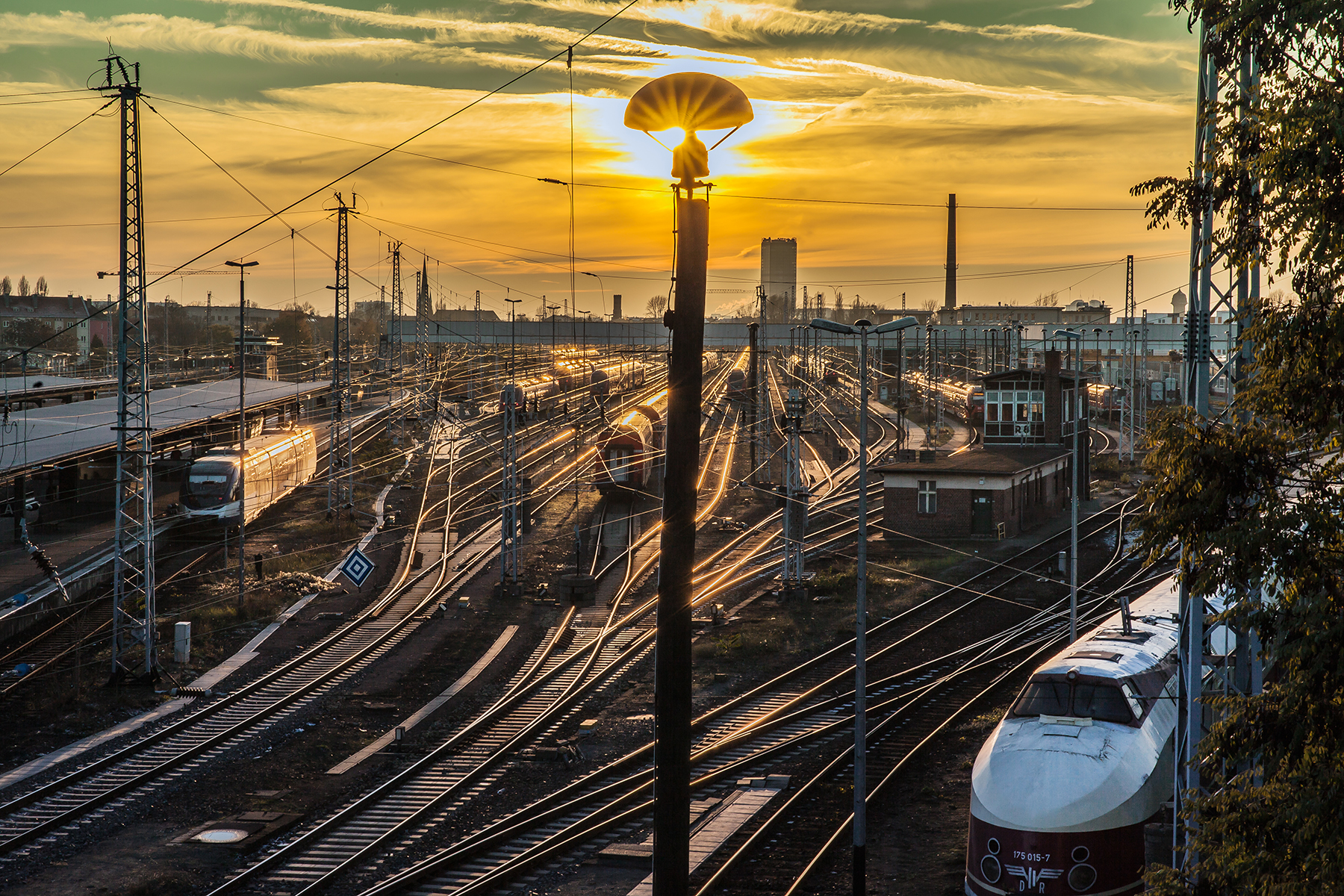
Berlin-Lichtenberg is a railway station in Berlin, Germany. It is located on the Eastern Railway, Wriezen Railway and Berlin Frankfurter Allee–Berlin-Rummelsburg railway lines in the Lichtenberg district. The station is also part of the Berlin S-Bahn and U-Bahn ( line) network. During the division of the city, Lichtenberg with its extended railyards became the central transport facility of East Berlin, together with Berlin Ostbahnhof. Today, the station mainly provides regional rail service to the eastern and northern environs. Overview The station building marks the southeastern border of the Lichtenberg quarter and is primarily accessible from the ''Weitlingstraße'' neighbourhood in the adjacent Rummelsburg locality. North of it, the Frankfurter Allee, part of the Bundesstraße 1/ 5 highway, crosses the tracks on the eight-lane ''Lichtenberger Brücke'' (Lichtenberg Bridge). Until 2006, international trains to Kaliningrad, Warsaw, Kyiv, Minsk, Moscow and Siberia (among oth ... [...More Info...] [...Related Items...] OR: [Wikipedia] [Google] [Baidu] |
S75 (Berlin)
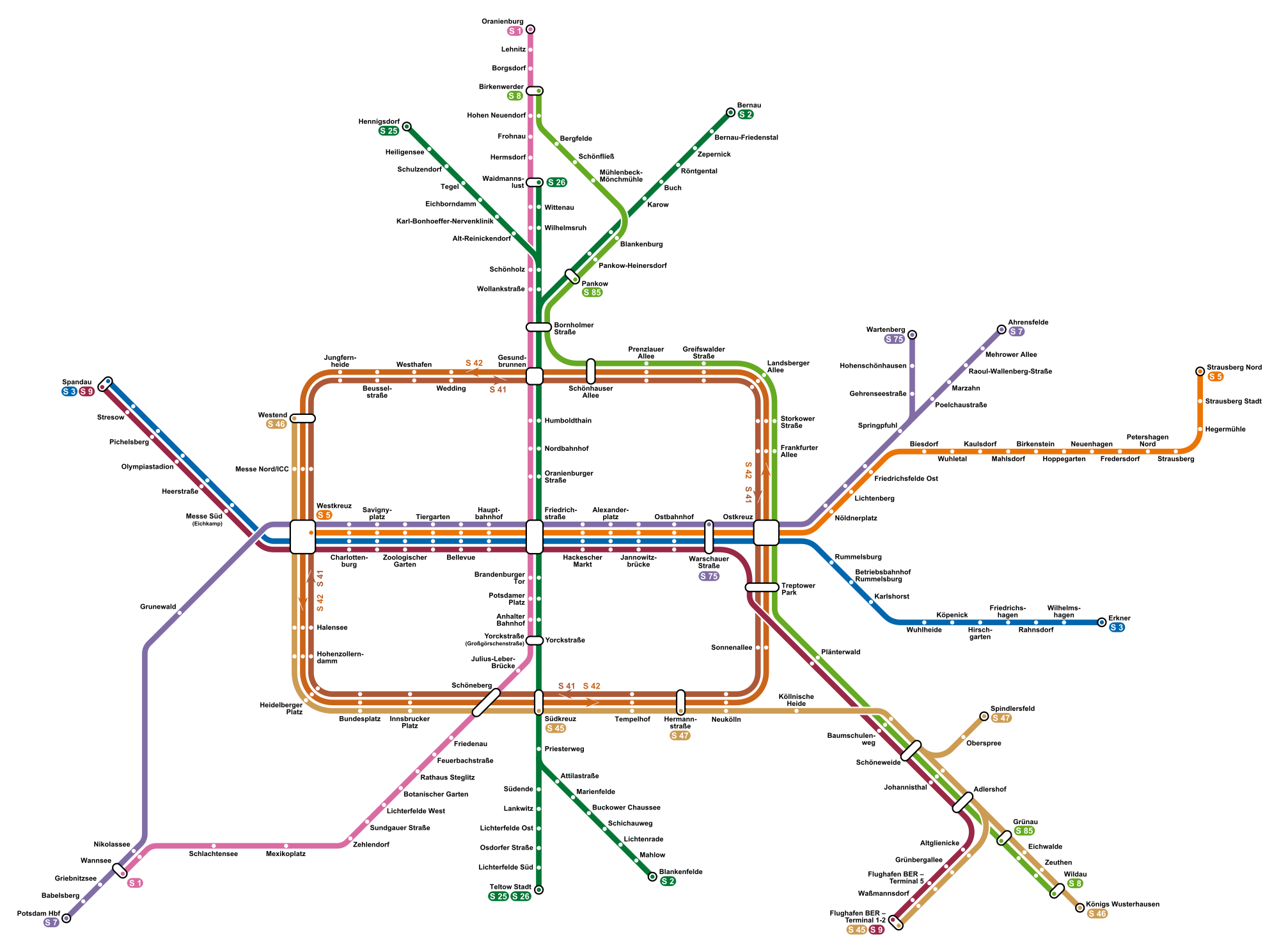
S75 is a line on the Berlin S-Bahn. It operates from Wartenberg to Warschauer Straße over: *a section of the Outer ring, completed in the early 1940s as part of the Outer freight ring The Berlin Outer Freight Ring (German: ''Güteraußenring'', GAR) was a planned ring railway around the city of Berlin, Germany. The first sections of a line to the west of the city were built in the early 20th century as part of the Brandenburg B ..., *the Prussian Eastern line, opened on 1 October 1866 and electrified on 6 November 1928, References {{Public transport in Berlin Berlin S-Bahn lines fi:S75 (Berliinin S-Bahn) ... [...More Info...] [...Related Items...] OR: [Wikipedia] [Google] [Baidu] |
S7 (Berlin)
S7 is a line on the Berlin S-Bahn. It operates from Ahrensfelde to Potsdam over: *the Wriezen Railway, completed on 1 May 1898 and electrified to Marzahn in 1976, to Mehrower Allee in 1980 and to Ahrensfelde in 1982, *a section of the Outer ring, completed in the early 1940s as part of the Outer freight ring and electrified in 1976, *a section of the Prussian Eastern line, opened on 1 October 1866 and electrified on 6 November 1928, *the Stadtbahn, opened on 7 February 1882 and electrified on 11 June 1928, *a section of the Berlin-Blankenheim line, opened west of Grunewald Grunewald is the name of both a locality and a forest in Germany: * Grunewald (forest) * Grunewald (locality) Grünewald may refer to: * Grünewald (surname) * Grünewald, Germany, a municipality in Brandenburg, Germany * Grünewald (Luxembourg), ... in 1879 and further east in 1882 and electrified in 1928 and *a section of the Berlin-Potsdam-Magdeburg line, opened in 1838 and electrified in 1928. Galler ... [...More Info...] [...Related Items...] OR: [Wikipedia] [Google] [Baidu] |
S5 (Berlin)
S5 is a line on the Berlin S-Bahn. It operates from Strausberg Nord to Westkreuz over: *the Strausberg–Strausberg Nord line, completed in 1955 and electrified in 1956, *a section of the Prussian Eastern line, opened on 1 October 1866 and electrified on 6 November 1928, *the Stadtbahn ' (; German for "city railway"; plural ') is a German word referring to various types of urban rail transport. One type of transport originated in the 19th century, firstly in Berlin and followed by Vienna, where rail routes were created that co ..., opened on 7 February 1882 and electrified on 11 June 1928. References {{Public transport in Berlin Berlin S-Bahn lines Transport in Strausberg ... [...More Info...] [...Related Items...] OR: [Wikipedia] [Google] [Baidu] |
Berlin S-Bahn
The Berlin S-Bahn () is a rapid transit railway system in and around Berlin, the capital city of Germany. It has been in operation under this name since December 1930, having been previously called the special tariff area ''Berliner Stadt-, Ring- und Vorortbahnen'' (Berlin city, orbital, and suburban railways). It complements the Berlin U-Bahn and is the link to many outer-Berlin areas, such as Berlin Brandenburg Airport. As such, the Berlin S-Bahn blends elements of a commuter rail service and a rapid transit system. In its first decades of operation, the trains were steam-drawn; even after the electrification of large parts of the network, a number of lines remained under steam. Today, the term ''S-Bahn'' is used in Berlin only for those lines and trains with third-rail electrical power transmission and the special Berlin S-Bahn loading gauge. The third unique technical feature of the Berlin S-Bahn, the , is being phased out and replaced by a communications-based train control ... [...More Info...] [...Related Items...] OR: [Wikipedia] [Google] [Baidu] |
Marzahn-Hellersdorf
Marzahn-Hellersdorf () is the tenth borough of Berlin, formed in 2001 by merging the former boroughs of Marzahn and Hellersdorf. Geography It is situated in the northeast of Berlin. Marzahn-Hellersdorf borders to the Berlin boroughs of Lichtenberg in the west and Treptow-Köpenick in the south as well as to the Brandenburg municipalities of Ahrensfelde in the north and Hoppegarten and Neuenhagen in the east. Demographics As of 2010, the borough had a total population 248,264, of whom about 30,000 (12%) were of non-German origin. Therefore, it is considered to be the least ethnically diverse borough of Berlin with the highest percentage of (Ethnic) Germans. Although the immigrant minority is relatively small, the borough has a higher concentration of Russia-born, Kazakhstan-born (e.g. Volga Germans) and Vietnamese people as compared to other parts of the city. Recently, there has been a significant influx of people with Middle Eastern and Muslim background. Subdivision The bo ... [...More Info...] [...Related Items...] OR: [Wikipedia] [Google] [Baidu] |
Marzahn
Marzahn () is a locality within the borough of Marzahn-Hellersdorf in Berlin. Berlin's 2001 administrative reform led to the former boroughs of Marzahn and Hellersdorf fusing into a single new borough. In the north the Marzahn locality includes the neighbourhoods of ''Bürknersfelde'' and ''Ahrensfelde'', an overbuilt strip of land which once had belonged to the Brandenburg municipality of Ahrensfelde and was incorporated into Berlin in 1990. Geography Subdivision Marzahn is divided into three zones (''Ortslagen''): *Marzahn-Nord (''Berlin-Ahrensfelde'') *Marzahn-Mitte *Marzahn-Süd History The historic village of Marzahn was first mentioned as ''Morczane'' in a 1300 deed by Margrave Albert III of Brandenburg-Salzwedel, when he granted the estates to the Friedland Cistercian abbey (in today's Neuhardenberg). After the Thirty Years' War it fell to Elector Frederick William of Brandenburg. The new village church was finished in 1871 according to plans by Friedrich August St� ... [...More Info...] [...Related Items...] OR: [Wikipedia] [Google] [Baidu] |
Rummelsburg
Rummelsburg () is a subdivision or neighborhood (''Ortsteil'') of the borough (''Bezirk'') of Lichtenberg of the German capital, Berlin. History Rummelsburg was founded in 1669. On 30 January 1889 it became a rural municipality, with the name of Boxhagen-Rummelsburg. Merged in 1912 in the town of Lichtenberg, in 1920 it was incorporated in Berlin with the '' Greater Berlin Act''. Geography Overview Located in the eastern side of the city and crossed by Spree river in the western corner, Rummelsburg borders with Lichtenberg, Friedrichsfelde, Karlshorst, Friedrichshain (in Friedrichshain-Kreuzberg district), Plänterwald and Oberschöneweide (both in Treptow-Köpenick district). The lake Rummelsburger See belongs to the locality and separates it from Stralau, a zone of Friedrichshain. Subdivision Rummelsburg counts 1 zone (''Ortslage''): * Victoriastadt Transport The locality is served by several urban rail lines of ''S-Bahn'' and '' U-Bahn''. The stations serving the loc ... [...More Info...] [...Related Items...] OR: [Wikipedia] [Google] [Baidu] |
Alt-Hohenschönhausen
Alt-Hohenschönhausen (, literally ''Old Hohenschönhausen'') is a quarter (''Ortsteil'') in the borough (''Bezirk'') of Lichtenberg, Berlin. Known also as Hohenschönhausen it was, until 2001, the main and the eponymous locality of the former Hohenschönhausen borough. In 2008 the population was in excess of 41,000. History Early history The earliest evidence of settlement in Alt-Hohenschönhausen are from the Bronze Age, and when the settlement history of the wider Berlin area is taken into consideration, there could have been settlements there since 10,000BC. Alt-Hohenschönhausen was first mentioned in 1230. In the initial centuries of the Common Era the area was mainly inhabited by the Sprevane and Hevelli tribes. By the 13th century the area had been colonised by Germans, particularly from the settlement of Schönhausen, during the eastward migration and settlement of Germans in the medieval period. By the 14th century, the prefix ''Hoh'' (high) was added to the name of the ... [...More Info...] [...Related Items...] OR: [Wikipedia] [Google] [Baidu] |


