|
Kirkhamgate
Kirkhamgate is a village, north-west of Wakefield, West Yorkshire, England. It originated as a hamlet in the Alverthorpe township in the parish of Wakefield in the West Riding of Yorkshire. Geography Kirkhamgate is situated on rising ground at a junction on the Wakefield to Batley road to the east of the M1 motorway. It is primarily a residential village surrounded by farmland that is part of the Rhubarb Triangle The Rhubarb Triangle is a area of West Yorkshire, England between Wakefield, Morley and Rothwell famous for producing early forced rhubarb. It includes Kirkhamgate, East Ardsley, Stanley, Lofthouse and Carlton. The Rhubarb Triangle was .... Events Kirkhamgate holds an annual scarecrow festival in September. References External links ...[...More Info...] [...Related Items...] OR: [Wikipedia] [Google] [Baidu] |
City Of Wakefield
The City of Wakefield is a local government district with the status of a city and metropolitan borough in West Yorkshire, England. Wakefield, the largest settlement, is the administrative centre of the district. The population of the City of Wakefield at the 2011 Census was 325,837. The district includes the ''Five Towns'' of Normanton, Pontefract, Featherstone, Castleford and Knottingley. Other towns include Ossett, Horbury, Hemsworth, South Kirkby and Moorthorpe and South Elmsall. The city and district are governed by Wakefield Metropolitan District Council from headquarters in County Hall. In 2010, Wakefield was named as the UK's third most musical city by PRS for Music. Economy The economic and physical condition of several of the former mining towns and villages in Wakefield District have started to improve due to the booming economy of Leeds – and an increase in numbers of commuters to the city from the sub-region – and a recognition of undeveloped assets. For i ... [...More Info...] [...Related Items...] OR: [Wikipedia] [Google] [Baidu] |
Wakefield
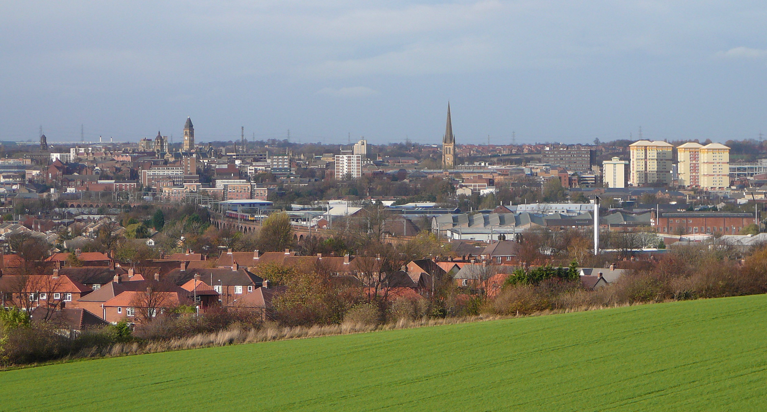
Wakefield is a cathedral city in West Yorkshire, England located on the River Calder. The city had a population of 99,251 in the 2011 census.https://www.nomisweb.co.uk/census/2011/ks101ew Census 2011 table KS101EW Usual resident population, West Yorkshire – Wakefield BUASD, code E35000474 The city is the administrative centre of the wider City of Wakefield metropolitan district, which had a population of , the most populous district in England. It is part of the West Yorkshire Built-up Area and the Yorkshire and The Humber region. In 1888, it was one of the last group of towns to gain city status due to having a cathedral. The city has a town hall and county hall, as the former administrative centre of the city's county borough and metropolitan borough as well as county town to both the West Riding of Yorkshire and West Yorkshire, respectively. The Battle of Wakefield took place in the Wars of the Roses, and the city was a Royalist stronghold in the Civil War. Wake ... [...More Info...] [...Related Items...] OR: [Wikipedia] [Google] [Baidu] |
Alverthorpe
Alverthorpe is a suburb of, and former village in Wakefield, West Yorkshire, England. History After the start of the Industrial Revolution woollen and worsted yarns were spun and woollen and worsted cloth woven in the mills and factories that were built in the valley. Rope and twine were also manufactured. In 1830 the township's population was 4,590 and in 1870 it had 1,423 houses and the population had risen to 6,645. A. Talbot & Sons manufactured sweets for many years in a factory with a landmark chimney which was originally a rag mill. The company originated in 1890, selling wholesale groceries from a horse-drawn vehicle, but moved into boiled sweet manufacture when its sweet supplier, John Kay of Flushdyke, retired and gave it his recipes. The company's humbugs, mint imperials, toffees and Yorkshire mixtures became popular throughout Yorkshire and further afield. The Talbots ran the business until the mid-1960s, when it was sold to Victory V lozenges. In the early 20t ... [...More Info...] [...Related Items...] OR: [Wikipedia] [Google] [Baidu] |
Rhubarb Triangle
The Rhubarb Triangle is a area of West Yorkshire, England between Wakefield, Morley and Rothwell famous for producing early forced rhubarb. It includes Kirkhamgate, East Ardsley, Stanley, Lofthouse and Carlton. The Rhubarb Triangle was originally much bigger, covering an area between Leeds, Bradford and Wakefield. From the 1900s to 1930s, the rhubarb industry expanded and at its peak covered an area of about . Rhubarb is native to Siberia and thrives in the wet cold winters in Yorkshire. West Yorkshire once produced 90% of the world's winter forced rhubarb from the forcing sheds that were common across the fields there. In 2010, Yorkshire Forced Rhubarb was awarded Protected Designation of Origin (PDO) status by the European Commission’s Protected Food Name scheme after being recommended by Department for Environment, Food and Rural Affairs (Defra). Cultivation The cultivation method for forced rhubarb was developed in the early 1800s. The fields were fertilised with l ... [...More Info...] [...Related Items...] OR: [Wikipedia] [Google] [Baidu] |
Ossett
Ossett is a market town in the City of Wakefield metropolitan borough in West Yorkshire, England. Historically part of the West Riding of Yorkshire, it is situated between Dewsbury, Horbury and Wakefield. At the 2011 Census, the population was 21,231.https://www.nomisweb.co.uk/census/2011/ks101ew Census 2011 table KS101EW Usual resident population, West Yorkshire – Ossett BUASD, code E35000387 Ossett forms part of the Heavy Woollen District. History Toponymy The name ''Ossett'' derives from the Old English and is either "the fold of a man named Osla" or " a fold frequented by blackbirds". Ossett is sometimes misspelled as "Osset". In Ellis' ''On Early English Pronunciation'', one of the founding works of British linguistics, the incorrect spelling is used. The British Library has an online dialect study that uses the spelling. One new alternative theory is that it is the place where King Osbehrt died after receiving fatal wounds when fighting the Great Heathen Army of the Vi ... [...More Info...] [...Related Items...] OR: [Wikipedia] [Google] [Baidu] |
West Yorkshire
West Yorkshire is a metropolitan and ceremonial county in the Yorkshire and Humber Region of England. It is an inland and upland county having eastward-draining valleys while taking in the moors of the Pennines. West Yorkshire came into existence as a metropolitan county in 1974 after the reorganisation of the Local Government Act 1972 which saw it formed from a large part of the West Riding of Yorkshire. The county had a recorded population of 2.3 million in the 2011 Census making it the fourth-largest by population in England. The largest towns are Huddersfield, Castleford, Batley, Bingley, Pontefract, Halifax, Brighouse, Keighley, Pudsey, Morley and Dewsbury. The three cities of West Yorkshire are Bradford, Leeds and Wakefield. West Yorkshire consists of five metropolitan boroughs (City of Bradford, Calderdale, Kirklees, City of Leeds and City of Wakefield); it is bordered by the counties of Derbyshire to the south, Greater Manchester to the south-west, Lancash ... [...More Info...] [...Related Items...] OR: [Wikipedia] [Google] [Baidu] |
Morley And Outwood (UK Parliament Constituency)
Morley and Outwood is a constituency represented in the House of Commons of the UK Parliament since 2015 by Andrea Jenkyns of the Conservative Party. History Forerunners and boundaries The Morley and Outwood constituency was first contested in 2010. It consists of the town of Morley, in the City of Leeds metropolitan district, and around Outwood in the City of Wakefield district. It is largely a successor to the previous Morley and Rothwell seat, which existed from 1997 until 2010; Rothwell was transferred to a new Elmet and Rothwell seat, while Outwood was previously part of the abolished Normanton constituency. At the same time, the Leeds suburb of Middleton was transferred to Leeds Central. The remainder of the former Normanton constituency was divided between the Normanton, Pontefract and Castleford constituency and the Wakefield constituency. Political history At the 2010 general election, Morley and Outwood was won by Ed Balls of the Labour Party, who had be ... [...More Info...] [...Related Items...] OR: [Wikipedia] [Google] [Baidu] |
West Riding Of Yorkshire
The West Riding of Yorkshire is one of three historic subdivisions of Yorkshire, England. From 1889 to 1974 the administrative county County of York, West Riding (the area under the control of West Riding County Council), abbreviated County of York (WR), was based closely on the historic boundaries. The lieutenancy at that time included the City of York and as such was named West Riding of the County of York and the County of the City of York. Its boundaries roughly correspond to the present ceremonial counties of West Yorkshire, South Yorkshire and the Craven, Harrogate and Selby districts of North Yorkshire, along with smaller parts in Lancashire (for example, the parishes of Barnoldswick, Bracewell, Brogden and Salterforth became part of the Pendle district of Lancashire and the parishes of Great Mitton, Newsholme and Bowland Forest Low became part of the Ribble Valley district also in Lancashire), Cumbria, Greater Manchester and, since 1996, the unitary East Riding of ... [...More Info...] [...Related Items...] OR: [Wikipedia] [Google] [Baidu] |
Houses And Farm Building, Batley Road, Kirkhamgate - Geograph
A house is a single-unit residential building. It may range in complexity from a rudimentary hut to a complex structure of wood, masonry, concrete or other material, outfitted with plumbing, electrical, and heating, ventilation, and air conditioning systems.Schoenauer, Norbert (2000). ''6,000 Years of Housing'' (rev. ed.) (New York: W.W. Norton & Company). Houses use a range of different roofing systems to keep precipitation such as rain from getting into the dwelling space. Houses may have doors or lock (security device), locks to secure the dwelling space and protect its inhabitants and contents from burglars or other trespassers. Most conventional modern houses in Western cultures will contain one or more bedrooms and bathrooms, a kitchen or cooking area, and a living room. A house may have a separate dining room, or the eating area may be integrated into another room. Some large houses in North America have a recreation room. In traditional agriculture-oriented societies, Li ... [...More Info...] [...Related Items...] OR: [Wikipedia] [Google] [Baidu] |
East Ardsley
East Ardsley is a village in the City of Leeds metropolitan borough, in West Yorkshire, England. East Ardsley forms part of the Heavy Woollen District. Etymology The name ''Ardsley'' is first attested in the Domesday Book as ''Erdeslau'' and ''Eadeslauue'', apparently primarily with reference to what is now East Ardsley as opposed to West Ardsley. The first element of the name comes from the Old English personal name ''Eard'', a nickname form of longer names like ''Eardwulf'', in the genitive form ''Eardes'' ('Eard's'). The second element comes from Old English ''hlǣw'' ('hill, mound'). Thus the name once meant 'Eard's hill' or 'Eard's mound'. The name first appears with the element ''east'' in 1459, in the forms ''Est Ardeslaw'' and ''East Ardeslawe''.Harry Parkin, ''Your City's Place-Names: Leeds'', English Place-Name Society City-Names Series, 3 (Nottingham: English Place-Names Society, 2017), pp. 16-17. Location Historically part of the West Riding of Yorkshire, it ... [...More Info...] [...Related Items...] OR: [Wikipedia] [Google] [Baidu] |
Leeds
Leeds () is a city and the administrative centre of the City of Leeds district in West Yorkshire, England. It is built around the River Aire and is in the eastern foothills of the Pennines. It is also the third-largest settlement (by population) in England, after London and Birmingham. The city was a small manorial borough in the 13th century and a market town in the 16th century. It expanded by becoming a major production centre, including of carbonated water where it was invented in the 1760s, and trading centre (mainly with wool) for the 17th and 18th centuries. It was a major mill town during the Industrial Revolution. It was also known for its flax industry, iron foundries, engineering and printing, as well as shopping, with several surviving Victorian era arcades, such as Kirkgate Market. City status was awarded in 1893, a populous urban centre formed in the following century which absorbed surrounding villages and overtook the nearby York population. It is locate ... [...More Info...] [...Related Items...] OR: [Wikipedia] [Google] [Baidu] |
Wrenthorpe
Wrenthorpe is a village north-west of Wakefield, in West Yorkshire, England. It is located in the Rhubarb Triangle. History Although earlier remains, such as Roman coins and pottery, have been found in the area, the current settlement dates from after the ''Domesday Books compilation in 1086. Pottery has played an important role in Wrenthorpe's history, building from the presence of a few potters in the 15th century, to a thriving cottage industry that peaked in the 17th century, before declining over the course of the 18th. Such was the scale of pottery production, the village became known as "Potovens," attributed to the kilns used to fire finished pottery. Reminders of this heritage can be found in local names, such as "Potovens Lane" and the remains of pottery and clay tobacco pipes that can be found in the soil. As the potteries declined, coal mining, already present on a smaller scale providing fuel for the potters' kilns, expanded to meet the needs of the Industrial R ... [...More Info...] [...Related Items...] OR: [Wikipedia] [Google] [Baidu] |


.jpg)