|
Koksha River
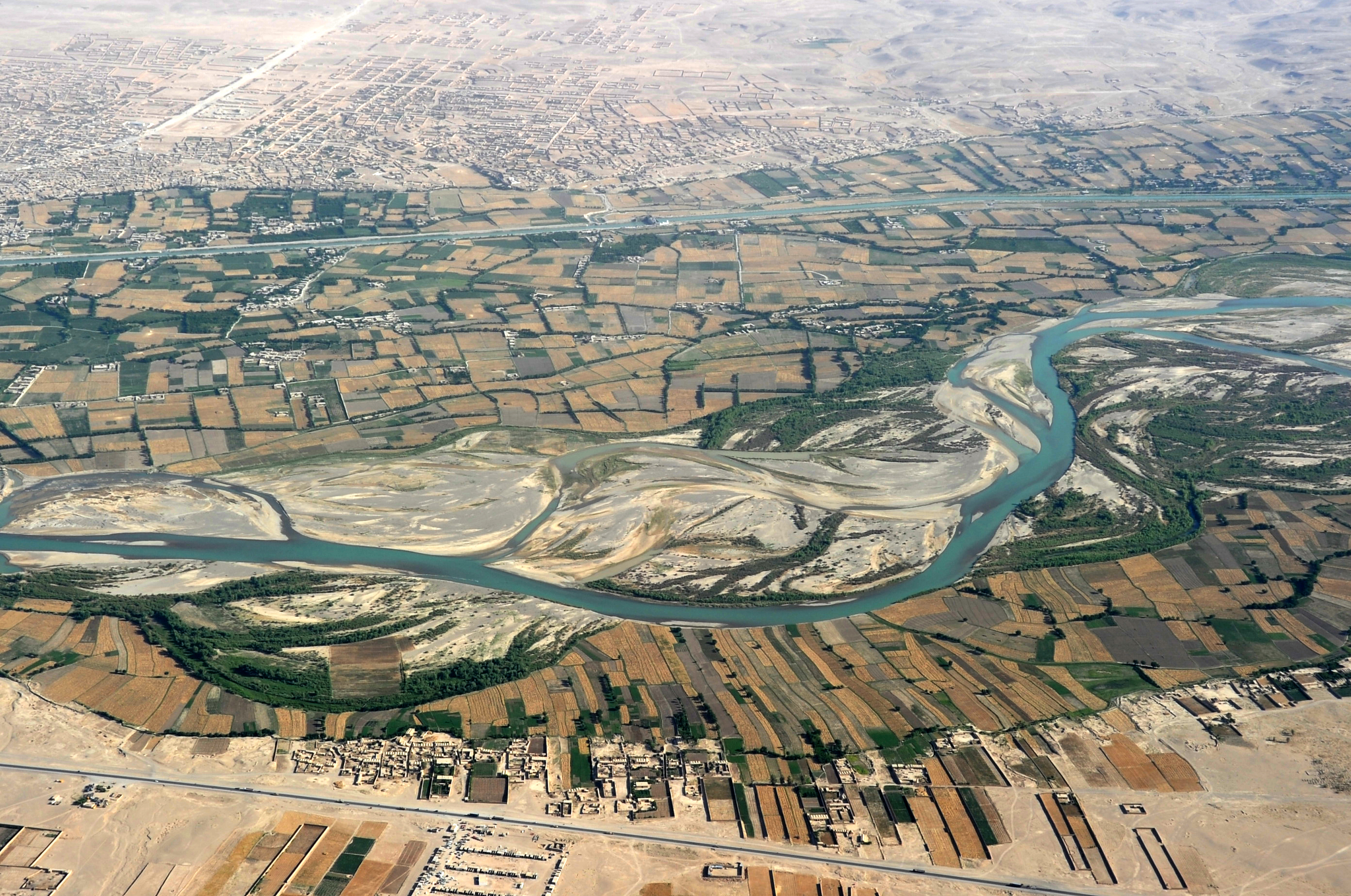
The Kokcha River ( fa, رودخانه کوکچه) is located in northeastern Afghanistan. A tributary of the Panj river, it flows through Badakhshan Province in the Hindu Kush. It is named after the Koksha Valley. The city of Feyzabad lies along the Kokcha. Near the village of Artin Jelow there is a bridge over the river. Course The Kokcha begins in Kuran wa Munjan District near the district center of Kuran wa Munjan and flows north, passing through Yamgan District and Jurm District. Near the village of Baharak, the Warduj river meets the Kokcha. The river then flows east, going around the northern border of Argo District and passing Feyzabad. Finally, the Kokcha enters Takhar Province, flows around the southern border of Rustaq District, and ends at the Amu Darya by Ai-Khanoum. See also * List of rivers of Afghanistan * Teshkan Bridge The Teshkan Bridge in Badashkhan is a bridge across the Kokcha River. Highway 302, which crosses the bridge, is the only road conn ... [...More Info...] [...Related Items...] OR: [Wikipedia] [Google] [Baidu] |
Afghanistan
Afghanistan, officially the Islamic Emirate of Afghanistan,; prs, امارت اسلامی افغانستان is a landlocked country located at the crossroads of Central Asia and South Asia. Referred to as the Heart of Asia, it is bordered by Pakistan to the Durand Line, east and south, Iran to the Afghanistan–Iran border, west, Turkmenistan to the Afghanistan–Turkmenistan border, northwest, Uzbekistan to the Afghanistan–Uzbekistan border, north, Tajikistan to the Afghanistan–Tajikistan border, northeast, and China to the Afghanistan–China border, northeast and east. Occupying of land, the country is predominantly mountainous with plains Afghan Turkestan, in the north and Sistan Basin, the southwest, which are separated by the Hindu Kush mountain range. , Demographics of Afghanistan, its population is 40.2 million (officially estimated to be 32.9 million), composed mostly of ethnic Pashtuns, Tajiks, Hazaras, and Uzbeks. Kabul is the country's largest city and ser ... [...More Info...] [...Related Items...] OR: [Wikipedia] [Google] [Baidu] |
Kuran Wa Munjan
Kurān wa Munjān, also spelled Kiran wa Munjan (‘Alāqahdārī Kirān wa Munjān) or Koran va Monjan, ( fa, کران و منجان) is a village in Badakhshan Province in north-eastern Afghanistan. It is the capital of Kuran wa Munjan District. Climate Owing to its altitude, Kuran wa Munjan features a subarctic climate (''Dsc'') bordering on a tundra climate (''ET'') under the Köppen climate classification. It has brief, pleasant summers and very cold, snowy winters. Winters are extremely long with below-freezing months from October until May. Summers are very short and the seasonal lag Seasonal lag is the phenomenon whereby the date of maximum average air temperature at a geographical location on a planet is delayed until some time after the date of maximum insolation (i.e. the summer solstice). This also applies to the minimum ... prevailed as August is the warmest month of the year with an average temperature of . The coldest month January has an average temperature o ... [...More Info...] [...Related Items...] OR: [Wikipedia] [Google] [Baidu] |
Rivers Of Afghanistan
A river is a natural flowing watercourse, usually freshwater, flowing towards an ocean, sea, lake or another river. In some cases, a river flows into the ground and becomes dry at the end of its course without reaching another body of water. Small rivers can be referred to using names such as creek, brook, rivulet, and rill. There are no official definitions for the generic term river as applied to geographic features, although in some countries or communities a stream is defined by its size. Many names for small rivers are specific to geographic location; examples are "run" in some parts of the United States, "burn" in Scotland and northeast England, and "beck" in northern England. Sometimes a river is defined as being larger than a creek, but not always: the language is vague. Rivers are part of the water cycle. Water generally collects in a river from precipitation through a drainage basin from surface runoff and other sources such as groundwater recharge, springs, a ... [...More Info...] [...Related Items...] OR: [Wikipedia] [Google] [Baidu] |
Teshkan Bridge
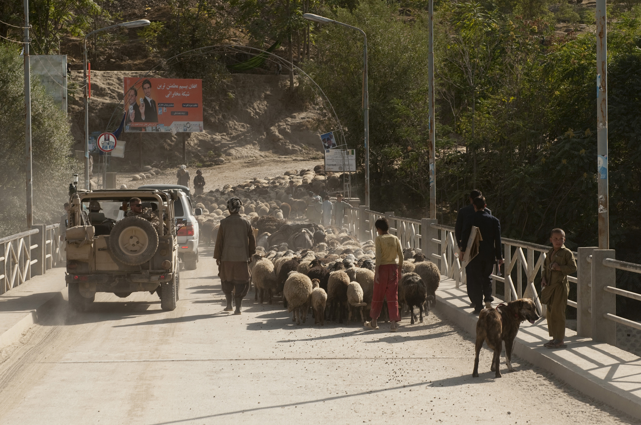
The Teshkan Bridge in Badashkhan is a bridge across the Kokcha River. Highway 302, which crosses the bridge, is the only road connection between Badashkhan and the rest of Afghanistan. In 1999 the bridge was a strategic resource fought over by two competing militia leaders. In 2007 ISAF forces and Provincial Reconstruction Team Feyzabad reconstructed a bridge built by the Soviet Union The Soviet Union,. officially the Union of Soviet Socialist Republics. (USSR),. was a transcontinental country that spanned much of Eurasia from 1922 to 1991. A flagship communist state, it was nominally a federal union of fifteen national .... The new bridge took two months to build. A steel frame and a new surface were built on top of the existing bridge, using the existing bridge pier. The Governor of Badashkhan presided over the ribbon-cutting on October 16, 2007, when the bridge was recommissioned. References {{coord missing, Afghanistan Road bridges in Afghanistan Bridge ... [...More Info...] [...Related Items...] OR: [Wikipedia] [Google] [Baidu] |
List Of Rivers Of Afghanistan
This is a list of rivers wholly or partly in Afghanistan, arranged geographically by river basin. Flowing into the Arabian Sea *''Indus River (Pakistan)'' **Gomal River ***Kundar River ***Zhob River **Kurram River ** Kabul River ***Bara River ***Kunar River ****Pech River ****Landai Sin River *** Surkhab ***Alingar River ***Panjshir River ****Ghorband River *****Salang River ***Logar River Flowing into endorheic basins Sistan Basin *Harut River (or Ardaskan River) *Farah River *Helmand River **Khash River **Arghandab River ***Dori River ****Tarnak River ****Arghistan River *****Lora River **Musa Qala River ** Tirin River **Kaj River Ab-i Istada *Ghazni RiverSome sources indicate that the Ab-e Istadeh lake has a seasonal outlet to the Lora River, a tributary of the Arghistan River in the Helmand basin. SeIntegrated Water Resources Management for the Sistan Closed Inland Deltapages 7-8 ** Jilga River Karakum Desert * Harirud **Jam River *Murghab River **Kushk Riv ... [...More Info...] [...Related Items...] OR: [Wikipedia] [Google] [Baidu] |
Ai-Khanoum
Ai-Khanoum (, meaning ''Lady Moon''; uz, Oyxonim) is the archaeological site of a Hellenistic city in Takhar Province, Afghanistan. The city, whose original name is unknown, was probably founded by an early ruler of the Seleucid Empire and served as a military and economic centre for the rulers of the Greco-Bactrian Kingdom until its destruction BC. Rediscovered in 1961, the ruins of the city were excavated by a French team of archaeologists until the outbreak of conflict in Afghanistan in the late 1970s. The city was probably founded between 300 and 285 BC by an official acting on the orders of Seleucus I Nicator or his son Antiochus I Soter, the first two rulers of the Seleucid dynasty. It was originally thought to have been founded by Alexander the Great, quite possibly as Alexandria Oxiana, but this theory is now considered unlikely. There is a possibility that the site was known to the earlier Achaemenid Empire, who established a small fort nearby. Locat ... [...More Info...] [...Related Items...] OR: [Wikipedia] [Google] [Baidu] |
Rustaq District, Afghanistan
Rustaq District is a district of Takhar Province, northern Afghanistan. The district centre is the town of Rostaq. As recently as 2020, the district was considered to be under government control, as opposed to control by the Taliban. However, the district has had issues with illegal armed men. Geography Rustaq has an area of 1915 square kilometers, comparatively equivalent to Maui. The district has the Rustaq River, or the Ab-i Rustaq, running through the district, emptying into the Panj River. Some streams run to the Kokcha River. Location This district borders 12 other districts. Going clockwise from the north, they are Chah Ab District, Shahri Buzurg District, Argo District, Tishkan District, Kishim District, Kalafgan District, Taluqan District, Hazar Sumuch District, Khwaja Ghar District, Dashti Qala District, Khwaja Bahauddin District, and finally Yangi Qala District. Shahri Buzurg, Argo, Tishkan, and Kishim districts are all located in Badakhshan Province, with all ... [...More Info...] [...Related Items...] OR: [Wikipedia] [Google] [Baidu] |
Argo District
Argo District ( / ) is one of the 28 districts in Badakhshan Province, Afghanistan Afghanistan, officially the Islamic Emirate of Afghanistan,; prs, امارت اسلامی افغانستان is a landlocked country located at the crossroads of Central Asia and South Asia. Referred to as the Heart of Asia, it is bordere .... It was created in 2005 from part of Fayzabad District and is home to approximately 45,000 residents. On 2 May 2014, there were two mudslides in the district occurring on the side of a mountain, affecting the villages of either Aab Barik or Hargu. References Districts of Badakhshan Province {{Badakhshan-geo-stub ... [...More Info...] [...Related Items...] OR: [Wikipedia] [Google] [Baidu] |
Baharak, Afghanistan
Baharak is a small town and seat of Baharak District Badakhshan Province in north-eastern Afghanistan. It is roughly 15 kilometers from Jurm, on the Kokcha River. Baharak Girls' School was opened on December 17, 2006, by Munshi Abdul Majeed the Governor of Badakhshan Province, it serves about 3000 girls who attend in three separate shifts during the day. Climate Baharak has a humid continental climate (Köppen Köppen is a German surname. Notable people with the surname include: * Bernd Köppen (born 1951), German pianist and composer * Carl Köppen (1833-1907), German military advisor in Meiji era Japan * Edlef Köppen (1893–1939), German author and ...: ''Dsb'') with warm, dry summers and cold, snowy winters. References Populated places in Baharak District {{Badakhshan-geo-stub ... [...More Info...] [...Related Items...] OR: [Wikipedia] [Google] [Baidu] |
Jurm District
Jurm District (Persian: جورم ولسوالۍ) is one of the 28 districts of Badakhshan Province in northeast Afghanistan. The district capital is a town named Jurm. The district is 3 hours from the center of the province in Fayzabad, and is home to approximately 41,910 residents. The highest point of the Afghan Hindu Kush The Hindu Kush is an mountain range in Central and South Asia to the west of the Himalayas. It stretches from central and western Afghanistan, Quote: "The Hindu Kush mountains run along the Afghan border with the North-West Frontier Provinc ... is located in Jurm District, at 6729 meters. The district consist of clusters and villages. Ferghamenj, Kyb, Kyteb, Ularyb, Ferghameru, Khustak, and Iskan are the clusters. Each cluster contain villages; the district is largely Tajik speaking. References External linksMapat the Afghanistan Information Management Services Districts of Badakhshan Province {{Badakhshan-geo-stub ... [...More Info...] [...Related Items...] OR: [Wikipedia] [Google] [Baidu] |
Yamgan District
Yamgan District is one of the 29 districts of Badakhshan Province in eastern Afghanistan. It was created in 2005 from part of the Baharak District and is home to approximately 20,000 residents, mostly Ismailis. History During the Afghan Civil War the area was under Taliban influence from 2015 to 2019, on September of that year Afghan National Security Forces The Afghan National Security Forces (ANSF), also known as the Afghan National Defense and Security Forces (ANDSF), were the military and internal security forces of the Islamic Republic of Afghanistan. Structure The Afghan National Security Forc ... declared they had full control over it. On late March 2020 the district was fully captured by the Taliban. References External linksMapat the Afghanistan Information Management Services Districts of Badakhshan Province {{Badakhshan-geo-stub ... [...More Info...] [...Related Items...] OR: [Wikipedia] [Google] [Baidu] |
Kuran Wa Munjan District
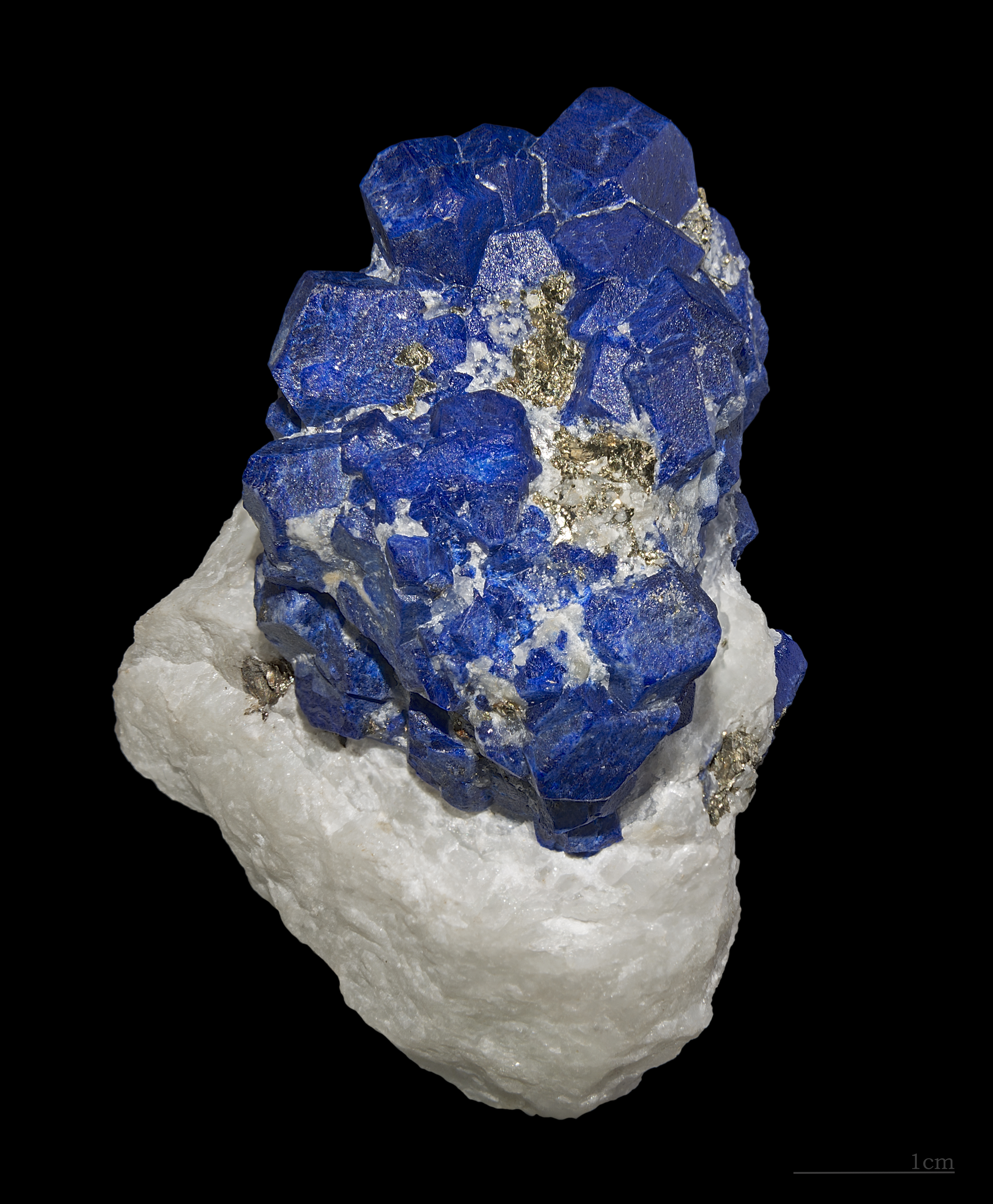
Kuran wa Munjan District is one of the 28 districts of Badakhshan Province in eastern Afghanistan. Located in the Hindu Kush mountains, the district is home to approximately 8,000 residents. The district administrative center is Kuran wa Munjan. The district is in the southwest corner of the province, and is bordered on its northeast side by the Jurm and Zebak Districts. Most of the district's boundaries are adjacent to other Afghan provinces, but a very small section on the eastern edge of the district lies on the international border between Afghanistan and Pakistan. The epicenter of the October 26 2015 Hindu Kush earthquake was 45 km north of here. Famous valleys include the Koksha Valley Koksha ( prs, , mnj, , ps, کوکشه) is a valley that is located in Badakhshan's Kuran Wa Munjan District in Afghanistan. Koksha is famous for its lapis lazuli found in the mines of Sar-e-Sang since the 3rd millennium BC. Koksha Valley i ..., which is famous for its mi ... [...More Info...] [...Related Items...] OR: [Wikipedia] [Google] [Baidu] |


