|
Kuran Wa Munjan District
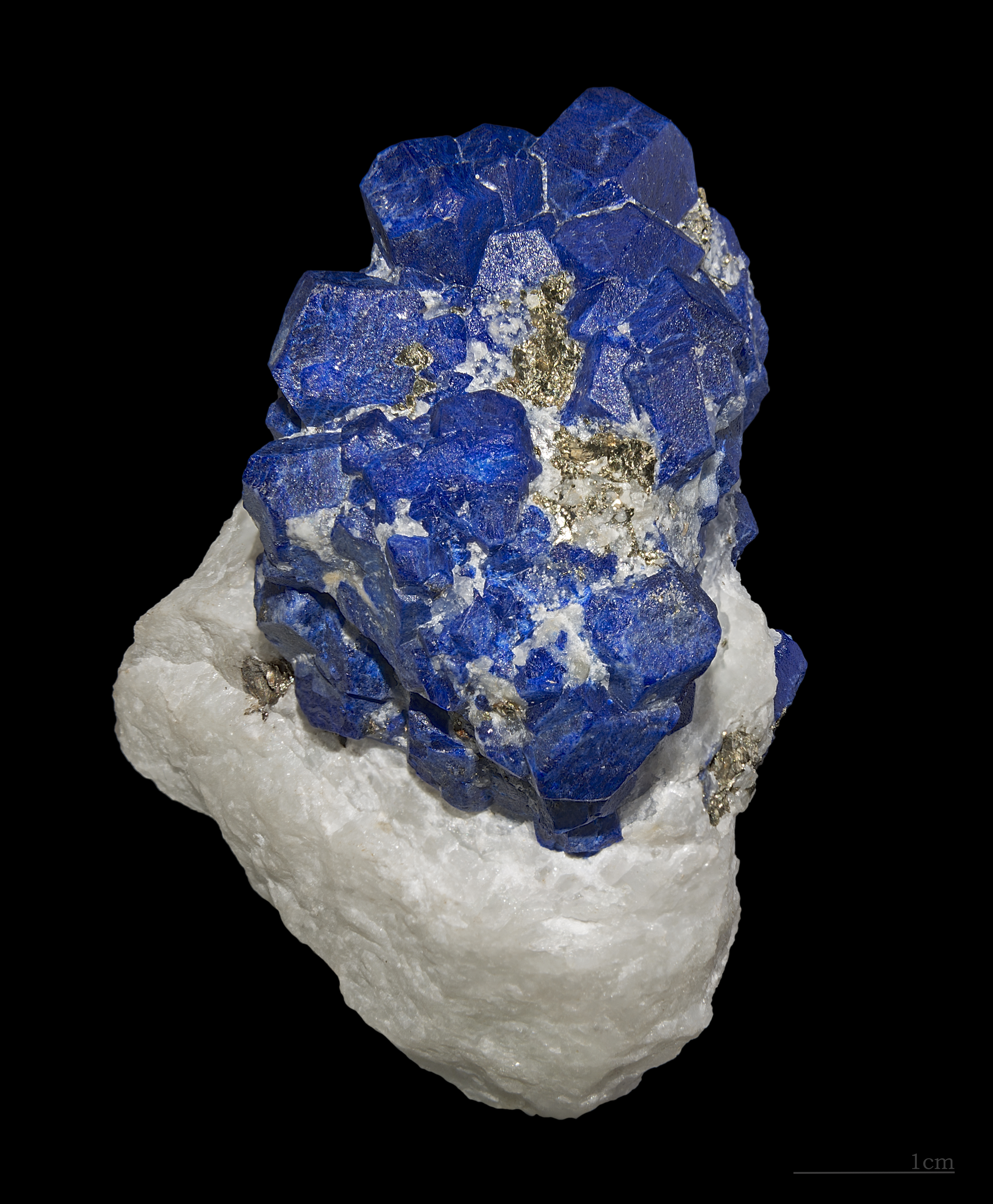
Kuran wa Munjan District is one of the 28 districts of Badakhshan Province in eastern Afghanistan. Located in the Hindu Kush mountains, the district is home to approximately 8,000 residents. The district administrative center is Kuran wa Munjan. The district is in the southwest corner of the province, and is bordered on its northeast side by the Jurm and Zebak Districts. Most of the district's boundaries are adjacent to other Afghan provinces, but a very small section on the eastern edge of the district lies on the international border between Afghanistan and Pakistan. The epicenter of the October 26 2015 Hindu Kush earthquake was 45 km north of here. Famous valleys include the Koksha Valley Koksha ( prs, , mnj, , ps, کوکشه) is a valley that is located in Badakhshan's Kuran Wa Munjan District in Afghanistan. Koksha is famous for its lapis lazuli found in the mines of Sar-e-Sang since the 3rd millennium BC. Koksha Valley i ..., which is famous for its mi ... [...More Info...] [...Related Items...] OR: [Wikipedia] [Google] [Baidu] |
Provinces Of Afghanistan
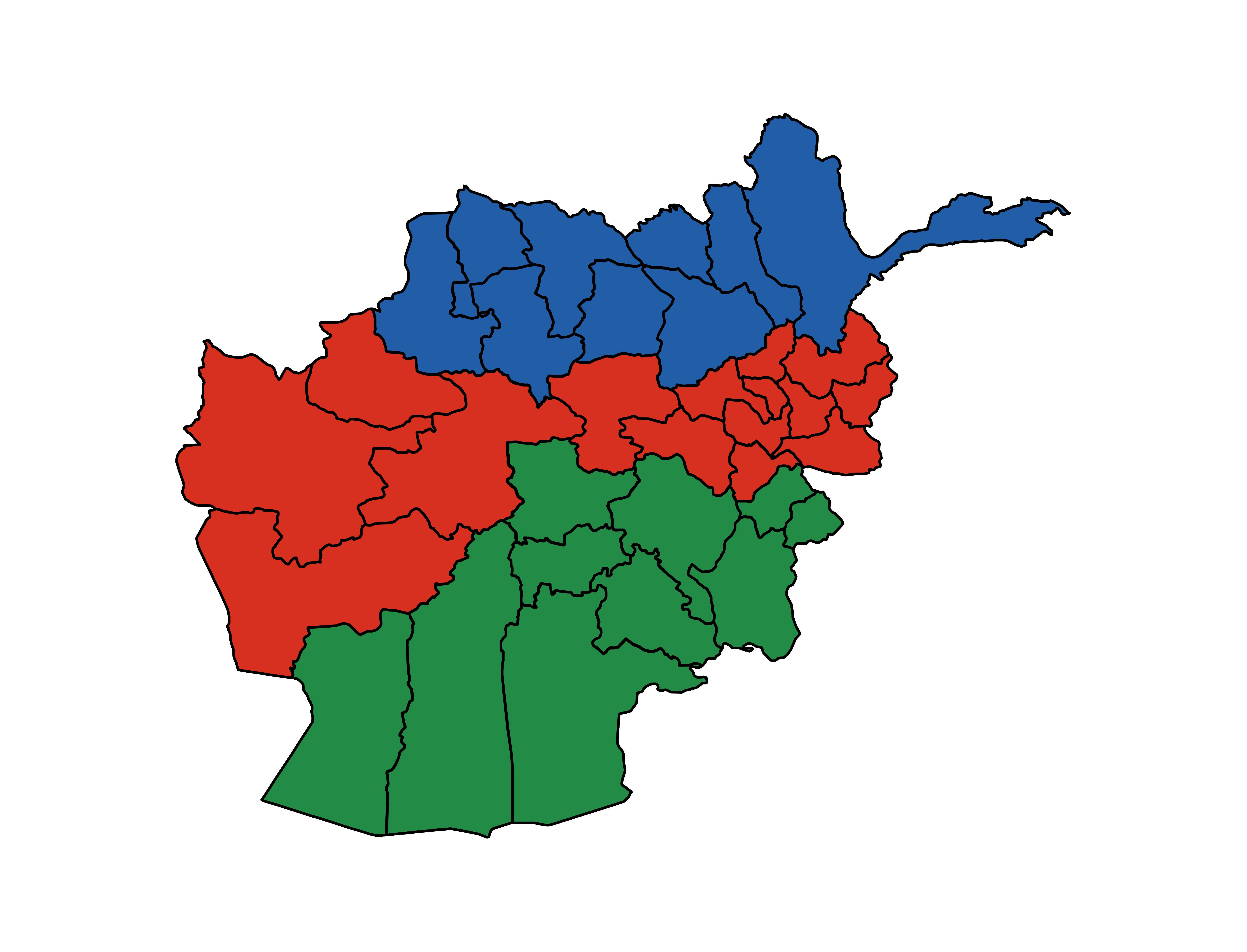
Afghanistan is divided into 34 provinces (, '' wilåyat''). The provinces of Afghanistan are the primary administrative divisions. Each province encompasses a number of districts or usually over 1,000 villages. Provincial governors played a critical role in the reconstruction of the Afghan state following the creation of the new government under Hamid Karzai. According to international security scholar Dipali Mukhopadhyay, many of the provincial governors of the western-backed government were former warlords who were incorporated into the political system. Provinces of Afghanistan Regions of Afghanistan UN Regions Former provinces of Afghanistan During Afghanistan's history it had a number of provinces in it. It started out as just Kabul, Herat, Qandahar, and Balkh but the number of provinces increased and by 1880 the provinces consisted of Balkh, Herat, Qandahar, Ghazni, Jalalabad, and Kabul. * Southern Province – dissolved in 1964 to create Paktia Provinc ... [...More Info...] [...Related Items...] OR: [Wikipedia] [Google] [Baidu] |
Badakhshan Province
Badakhshan Province (Persian/ Uzbek: , ''Badaxšān'') is one of the 34 provinces of Afghanistan, located in the northeastern part of the country. It is bordered by Tajikistan's Gorno-Badakhshan in the north and the Pakistani regions of Lower and Upper Chitral and Gilgit-Baltistan in the southeast. It also has a 91-kilometer (57-mile) border with China in the east. It is part of a broader historical Badakhshan region, parts of which now also lie in Tajikistan and China. The province contains 22 districts, over 1,200 villages and approximately 1 055 00people. Fayzabad, Badakhshan, Fayzabad serves as the provincial capital. Resistance activity has been reported in the province since the 2021 Taliban takeover of Afghanistan. Etymology Badakhshan's name comes from the Middle Persian word "badaxš", which is an official title. The word "ān" is a suffix which demonstrates a place's name; therefore the word "badaxšān" means a place belonging to a person called "badaxš". Duri ... [...More Info...] [...Related Items...] OR: [Wikipedia] [Google] [Baidu] |
Districts Of Afghanistan
The districts of Afghanistan, known as ''wuleswali'' ( ps, ولسوالۍ, ''wuləswāləi''; fa, شهرستان, ''shahrestān'') are secondary-level administrative units, one level below provinces. The Afghan government issued its first district map in 1973.''Afghanistan; Districts and Codes by Province'', Edition 2.0, AID / Rep. DC&A Mapping Unit, October 1991, Peshawar, Pakista/ref> It recognized 325 districts, counting ''wuleswalis'' (districts), ''alaqadaries'' (sub-districts), and ''markaz-e-wulaiyat'' (provincial center districts). In the ensuing years, additional districts have been added through splits, and some eliminated through merges. In June 2005, the Afghan government issued a map of 398 districts. It was widely adopted by many information management systems, though usually with the addition of ''Sharak-e-Hayratan'' for 399 districts in total. It remains the ''de facto'' standard as of late 2018, despite a string of government announcements of the creation of ... [...More Info...] [...Related Items...] OR: [Wikipedia] [Google] [Baidu] |
Afghanistan
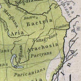
Afghanistan, officially the Islamic Emirate of Afghanistan,; prs, امارت اسلامی افغانستان is a landlocked country located at the crossroads of Central Asia and South Asia. Referred to as the Heart of Asia, it is bordered by Pakistan to the Durand Line, east and south, Iran to the Afghanistan–Iran border, west, Turkmenistan to the Afghanistan–Turkmenistan border, northwest, Uzbekistan to the Afghanistan–Uzbekistan border, north, Tajikistan to the Afghanistan–Tajikistan border, northeast, and China to the Afghanistan–China border, northeast and east. Occupying of land, the country is predominantly mountainous with plains Afghan Turkestan, in the north and Sistan Basin, the southwest, which are separated by the Hindu Kush mountain range. , Demographics of Afghanistan, its population is 40.2 million (officially estimated to be 32.9 million), composed mostly of ethnic Pashtuns, Tajiks, Hazaras, and Uzbeks. Kabul is the country's largest city and ser ... [...More Info...] [...Related Items...] OR: [Wikipedia] [Google] [Baidu] |
Hindu Kush
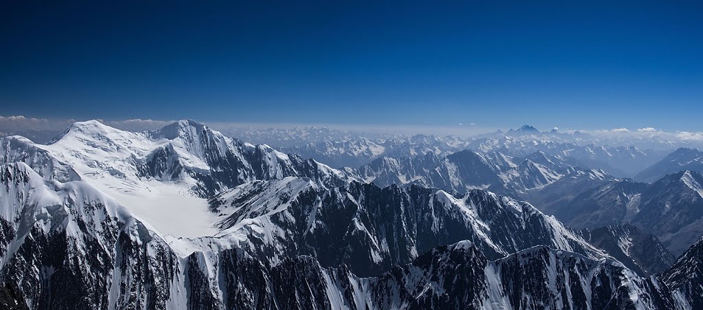
The Hindu Kush is an mountain range in Central and South Asia to the west of the Himalayas. It stretches from central and western Afghanistan, Quote: "The Hindu Kush mountains run along the Afghan border with the North-West Frontier Province of Pakistan". into northwestern Pakistan and far southeastern Tajikistan. The range forms the western section of the ''Hindu Kush Himalayan Region'' (''HKH''); to the north, near its northeastern end, the Hindu Kush buttresses the Pamir Mountains near the point where the borders of China, Pakistan and Afghanistan meet, after which it runs southwest through Pakistan and into Afghanistan near their border. The eastern end of the Hindu Kush in the north merges with the Karakoram Range.Karakoram Range: MOUNTAINS, ASIA Encyclopædia Britannica Towards its s ... [...More Info...] [...Related Items...] OR: [Wikipedia] [Google] [Baidu] |
Kuran Wa Munjan
Kurān wa Munjān, also spelled Kiran wa Munjan (‘Alāqahdārī Kirān wa Munjān) or Koran va Monjan, ( fa, کران و منجان) is a village in Badakhshan Province in north-eastern Afghanistan. It is the capital of Kuran wa Munjan District. Climate Owing to its altitude, Kuran wa Munjan features a subarctic climate (''Dsc'') bordering on a tundra climate (''ET'') under the Köppen climate classification. It has brief, pleasant summers and very cold, snowy winters. Winters are extremely long with below-freezing months from October until May. Summers are very short and the seasonal lag Seasonal lag is the phenomenon whereby the date of maximum average air temperature at a geographical location on a planet is delayed until some time after the date of maximum insolation (i.e. the summer solstice). This also applies to the minimum ... prevailed as August is the warmest month of the year with an average temperature of . The coldest month January has an average temperature o ... [...More Info...] [...Related Items...] OR: [Wikipedia] [Google] [Baidu] |
Jurm District
Jurm District (Persian: جورم ولسوالۍ) is one of the 28 districts of Badakhshan Province in northeast Afghanistan. The district capital is a town named Jurm. The district is 3 hours from the center of the province in Fayzabad, and is home to approximately 41,910 residents. The highest point of the Afghan Hindu Kush The Hindu Kush is an mountain range in Central and South Asia to the west of the Himalayas. It stretches from central and western Afghanistan, Quote: "The Hindu Kush mountains run along the Afghan border with the North-West Frontier Provinc ... is located in Jurm District, at 6729 meters. The district consist of clusters and villages. Ferghamenj, Kyb, Kyteb, Ularyb, Ferghameru, Khustak, and Iskan are the clusters. Each cluster contain villages; the district is largely Tajik speaking. References External linksMapat the Afghanistan Information Management Services Districts of Badakhshan Province {{Badakhshan-geo-stub ... [...More Info...] [...Related Items...] OR: [Wikipedia] [Google] [Baidu] |
Zebak District
Zebak ( fa, زیبک) is one of the 29 districts of Badakhshan province in northeastern Afghanistan. It is home to an estimated 8,749 residents, most living in Zebak, the district's capital Capital may refer to: Common uses * Capital city, a municipality of primary status ** List of national capital cities * Capital letter, an upper-case letter Economics and social sciences * Capital (economics), the durable produced goods used f .... Sanglechi-Ishkashmi language, also referred to as ''Zebaki'', is spoken in the district. References External linksMapat the Afghanistan Information Management Services Districts of Badakhshan Province {{Badakhshan-geo-stub ... [...More Info...] [...Related Items...] OR: [Wikipedia] [Google] [Baidu] |
Provinces Of Afghanistan
Afghanistan is divided into 34 provinces (, '' wilåyat''). The provinces of Afghanistan are the primary administrative divisions. Each province encompasses a number of districts or usually over 1,000 villages. Provincial governors played a critical role in the reconstruction of the Afghan state following the creation of the new government under Hamid Karzai. According to international security scholar Dipali Mukhopadhyay, many of the provincial governors of the western-backed government were former warlords who were incorporated into the political system. Provinces of Afghanistan Regions of Afghanistan UN Regions Former provinces of Afghanistan During Afghanistan's history it had a number of provinces in it. It started out as just Kabul, Herat, Qandahar, and Balkh but the number of provinces increased and by 1880 the provinces consisted of Balkh, Herat, Qandahar, Ghazni, Jalalabad, and Kabul. * Southern Province – dissolved in 1964 to create Paktia Provinc ... [...More Info...] [...Related Items...] OR: [Wikipedia] [Google] [Baidu] |
Durand Line
The Durand Line ( ps, د ډیورنډ کرښه; ur, ), forms the Pakistan–Afghanistan border, a international land border between Pakistan and Afghanistan in South Asia. The western end runs to the border with Iran and the eastern end to the border with China. The Durand Line was established in 1893 as the international border between India and the Emirate of Afghanistan by Mortimer Durand, a British diplomat of the Indian Civil Service, and Abdur Rahman Khan, the Afghan Emir, to fix the limit of their respective spheres of influence and improve diplomatic relations and trade. The British considered Afghanistan to be an independent state at the time, although they controlled its foreign affairs and diplomatic relations. The single-page Agreement, dated 12 November 1893, contains seven short articles, including a commitment not to exercise interference beyond the Durand Line. A joint British-Afghan demarcation survey took place starting from 1894, covering some of the bo ... [...More Info...] [...Related Items...] OR: [Wikipedia] [Google] [Baidu] |
Pakistan
Pakistan ( ur, ), officially the Islamic Republic of Pakistan ( ur, , label=none), is a country in South Asia. It is the world's List of countries and dependencies by population, fifth-most populous country, with a population of almost 243 million people, and has the world's Islam by country#Countries, second-largest Muslim population just behind Indonesia. Pakistan is the List of countries and dependencies by area, 33rd-largest country in the world by area and 2nd largest in South Asia, spanning . It has a coastline along the Arabian Sea and Gulf of Oman in the south, and is bordered by India to India–Pakistan border, the east, Afghanistan to Durand Line, the west, Iran to Iran–Pakistan border, the southwest, and China to China–Pakistan border, the northeast. It is separated narrowly from Tajikistan by Afghanistan's Wakhan Corridor in the north, and also shares a maritime border with Oman. Islamabad is the nation's capital, while Karachi is its largest city and fina ... [...More Info...] [...Related Items...] OR: [Wikipedia] [Google] [Baidu] |
2015 Hindu Kush Earthquake
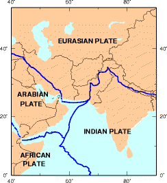
The October 2015 Hindu Kush earthquake was a magnitude 7.5 earthquake that struck South Asia on 26 October 2015, at 13:39 AFT (14:09 PKT; 14:39 IST; 09:09 UTC) with the epicenter 45 km north of Kuran wa Munjan, Afghanistan, at a depth of 212.5 km. By 5 November, it was estimated that at least 399 people were killed, mostly in Pakistan. Tremors were felt in Pakistan, Uzbekistan, Turkmenistan, Tajikistan and Kyrgyzstan. According to the United States Geological Survey (USGS), Pakistan is located in one of the most earthquake active zones in the world. The earthquake was also felt in New Delhi, in both Pakistan's Azad Kashmir territory, and the Indian state of Jammu and Kashmir and as far as Lucknow and in the prefectures of Kashgar, Aksu, Hotan, and Kizilsu in Xinjiang, China while damage was also reported in Afghan capital Kabul. The earthquake was also felt in the Nepalese capital of Kathmandu. Background The Himalayan mountains, pushed up by the collision of ... [...More Info...] [...Related Items...] OR: [Wikipedia] [Google] [Baidu] |
