|
Kanthirava Narasaraja I
Kanthirava Narasaraja Wodeyar I (1615 – 31 July 1659) was the twelfth maharaja of the Kingdom of Mysore from 1638 to 1659. Accession The previous ruler, Raja Wodeyar II, Kanthirava Narasaraja Wodeyar's cousin, was poisoned on the orders of his ''dalvoy'' (commander-in-chief), Vikramaraya, within a year of becoming the maharaja. The 23-year-old Kanthirava Narasaraja I, who had earlier been adopted by the widow of Raja Wodeyar I, became, in 1638, the new ''maharaja'' of Mysore. Before becoming the king of Mysore, he lived in Terakanambi near Gundalpet, Chamarajanagar District. Rule Soon after his accession, he was called on to defend Srirangapatna against the invasions of the Adil Shahis of Bijapur, a defence which he mounted with great loss for the enemy. In the fashion of the two ''wodeyars'' before him, he continued to expand the Mysore dominions. This included taking Satyamangalam from the Nayaks of Madurai in the south, unseating the Chingalvas from their base in Piriya ... [...More Info...] [...Related Items...] OR: [Wikipedia] [Google] [Baidu] |
Maharaja Of Mysore
The maharaja of Mysore was the king and principal ruler of the southern Indian Kingdom of Mysore and briefly of Mysore State in the Indian Dominion roughly between the mid- to late-1300s and 1950. In title, the role has been known by different names over time, from ''poleygar'' (Kannada, ''pāLegāra'', for 'chieftain') during the early days of the fiefdom to ''raja'' (Sanskrit and Kannada, king–of especially a small region) during its early days as a kingdom to ''maharaja'' (Sanskrit and Kannada, reatking–of a formidable kingdom) for the rest of its period. In terms of succession, the successor was either a hereditary inheritor or, in case of no issue, handpicked by the reigning monarch or his privy council. All rulers under the Sanskrit-Kannada titles of ''raja'' or ''maharaja'' were exclusively from the house of Wadiyar. As India gained Independence from British Crown in 1947, Crown allies, most of which were princely India, ceded into the Dominion of India by 1950. ... [...More Info...] [...Related Items...] OR: [Wikipedia] [Google] [Baidu] |
Yelahanka
Yelahanka is now a suburb of Bangalore in the state of Karnataka and one of the zones of BBMP. It is the oldest part of present Municipal Bengaluru (Bangalore) city and is in the north of the city. It is Nadaprabhu Kempegowda I, of the Yelahanka Prabhu clans, who laid the foundation of present-day Bengaluru through the creation of a "mud fort town" in 1537 CE History The city of Yelahanka had been in existence prior to the 12th century. The region was called 'Ilaipakka Naadu' during the rule of Cholas. A stone tablet of 1267 A.D found in Doddaballapur mentions Dechi Devarasa, ruling the region with Yelahanka as his capital under the aegis of Hoysala monarch 'Narasimha (Third)'. Later, during Hoysala rein, the city came to be known as 'Elavanka' and gradually shifted to 'Yelahanka'. It was also known as Elavank. Of the numerous Rulers of different dynasties who ruled with Yelahanka as their Capital, the Kempe Gowdas are the most acclaimed. ''Hiriya Kempe Gowda'' (Kempe Gowda ... [...More Info...] [...Related Items...] OR: [Wikipedia] [Google] [Baidu] |
Kannada Language
Kannada (; ಕನ್ನಡ, ), originally romanised Canarese, is a Dravidian language spoken predominantly by the people of Karnataka in southwestern India, with minorities in all neighbouring states. It has around 47 million native speakers, and was additionally a second or third language for around 13 million non-native speakers in Karnataka. Kannada was the court language of some of the most powerful dynasties of south and central India, namely the Kadambas, Chalukyas, Rashtrakutas, Yadava Dynasty or Seunas, Western Ganga dynasty, Wodeyars of Mysore, Nayakas of Keladi Hoysalas and the Vijayanagara empire. The official and administrative language of the state of Karnataka, it also has scheduled status in India and has been included among the country's designated classical languages.Kuiper (2011), p. 74R Zydenbos in Cushman S, Cavanagh C, Ramazani J, Rouzer P, ''The Princeton Encyclopedia of Poetry and Poetics: Fourth Edition'', p. 767, Princeton University ... [...More Info...] [...Related Items...] OR: [Wikipedia] [Google] [Baidu] |
British India
The provinces of India, earlier presidencies of British India and still earlier, presidency towns, were the administrative divisions of British governance on the Indian subcontinent. Collectively, they have been called British India. In one form or another, they existed between 1612 and 1947, conventionally divided into three historical periods: *Between 1612 and 1757 the East India Company set up Factory (trading post), factories (trading posts) in several locations, mostly in coastal India, with the consent of the Mughal emperors, Maratha Empire or local rulers. Its rivals were the merchant trading companies of Portugal, Denmark, the Netherlands, and France. By the mid-18th century, three ''presidency towns'': Madras, Bombay and Calcutta, had grown in size. *During the period of Company rule in India (1757–1858), the company gradually acquired sovereignty over large parts of India, now called "presidencies". However, it also increasingly came under British government over ... [...More Info...] [...Related Items...] OR: [Wikipedia] [Google] [Baidu] |
Madras Presidency
The Madras Presidency, or the Presidency of Fort St. George, also known as Madras Province, was an administrative subdivision (presidency) of British India. At its greatest extent, the presidency included most of southern India, including the whole of the Indian states of Tamil Nadu, Andhra state and some parts of Kerala, Karnataka, Odisha and the union territory of Lakshadweep. The city of Madras was the winter capital of the Presidency and Ootacamund or Ooty, the summer capital. The coastal regions and northern part of Island of Ceylon at that time was a part of Madras Presidency from 1793 to 1798 when it was created a Crown colony. Madras Presidency was neighboured by the Kingdom of Mysore on the northwest, Kingdom of Cochin on the southwest, and the Kingdom of Hyderabad on the north. Some parts of the presidency were also flanked by Bombay Presidency ( Konkan) and Central Provinces and Berar (Madhya Pradesh). In 1639, the English East India Company purchased the vi ... [...More Info...] [...Related Items...] OR: [Wikipedia] [Google] [Baidu] |
Christianity
Christianity is an Abrahamic monotheistic religion based on the life and teachings of Jesus of Nazareth. It is the world's largest and most widespread religion with roughly 2.38 billion followers representing one-third of the global population. Its adherents, known as Christians, are estimated to make up a majority of the population in 157 countries and territories, and believe that Jesus is the Son of God, whose coming as the messiah was prophesied in the Hebrew Bible (called the Old Testament in Christianity) and chronicled in the New Testament. Christianity began as a Second Temple Judaic sect in the 1st century Hellenistic Judaism in the Roman province of Judea. Jesus' apostles and their followers spread around the Levant, Europe, Anatolia, Mesopotamia, the South Caucasus, Ancient Carthage, Egypt, and Ethiopia, despite significant initial persecution. It soon attracted gentile God-fearers, which led to a departure from Jewish customs, and, a ... [...More Info...] [...Related Items...] OR: [Wikipedia] [Google] [Baidu] |
Jesuit
, image = Ihs-logo.svg , image_size = 175px , caption = ChristogramOfficial seal of the Jesuits , abbreviation = SJ , nickname = Jesuits , formation = , founders = , founding_location = , type = Order of clerics regular of pontifical right (for men) , headquarters = Generalate:Borgo S. Spirito 4, 00195 Roma-Prati, Italy , coords = , region_served = Worldwide , num_members = 14,839 members (includes 10,721 priests) as of 2020 , leader_title = Motto , leader_name = la, Ad Majorem Dei GloriamEnglish: ''For the Greater Glory of God'' , leader_title2 = Superior General , leader_name2 = Fr. Arturo Sosa, SJ , leader_title3 = Patron saints , leader_name3 = , leader_title4 = Ministry , leader_name4 = Missionary, educational, literary works , main_organ = La Civiltà Cattolica ... [...More Info...] [...Related Items...] OR: [Wikipedia] [Google] [Baidu] |
Coromandel Coast
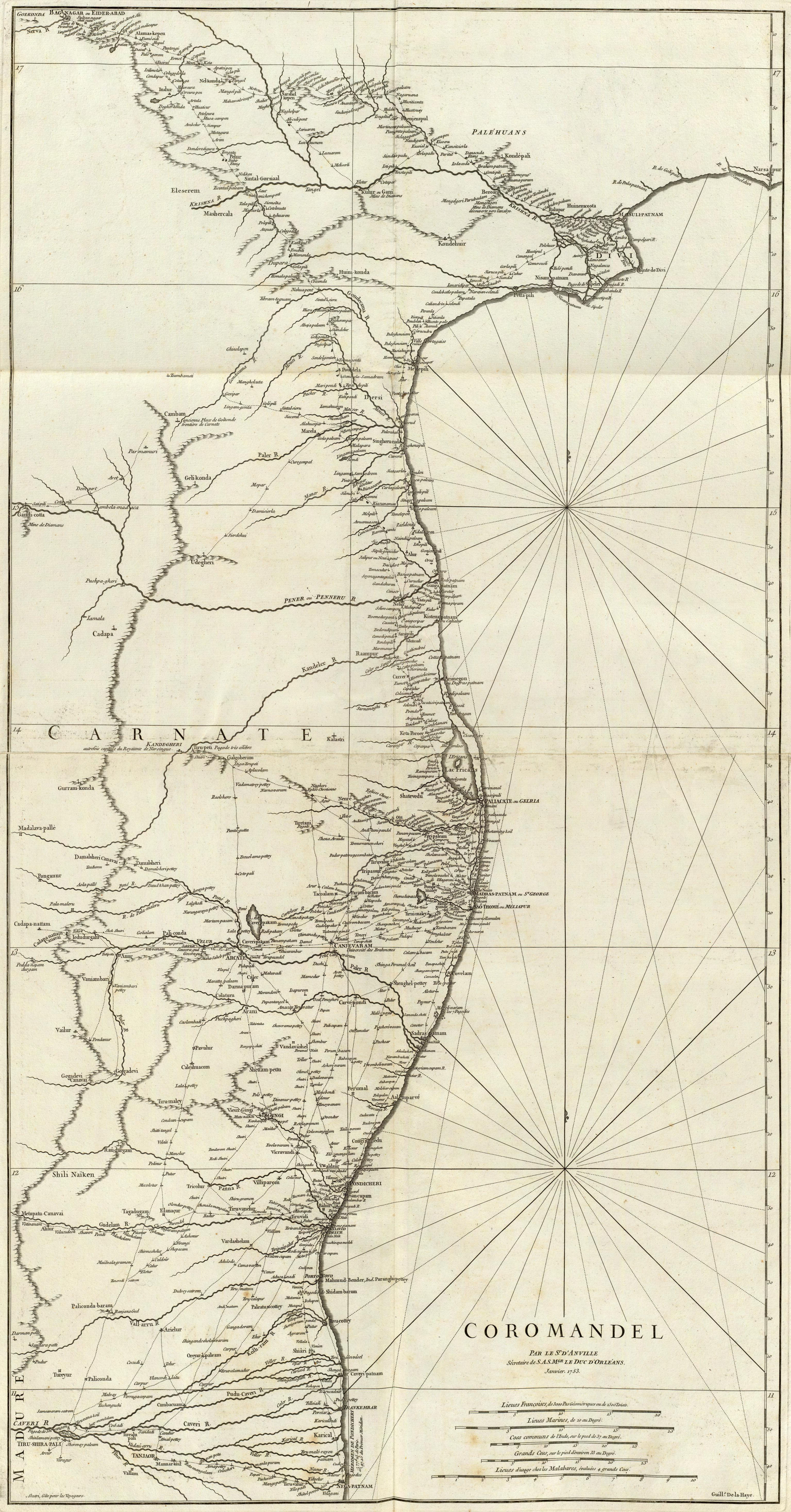
The Coromandel Coast is the southeastern coastal region of the Indian subcontinent, bounded by the Utkal Plains to the north, the Bay of Bengal to the east, the Kaveri delta to the south, and the Eastern Ghats to the west, extending over an area of about 22,800 square kilometres. The coast has an average elevation of 80 metres and is backed by the Eastern Ghats, a chain of low lying and flat-topped hills. In historical Muslim sources from the 12th century onward, the Coromandel Coast was called Maʿbar. Etymology The land of the Chola dynasty was called ''Cholamandalam'' (சோழ மண்டலம்) in Tamil, translated as ''The realm of the Cholas'', from which the Portuguese derived the name ''Coromandel''.''The Land of the Tamulians and Its Missions'', by Eduard Raimund Baierlein, James Dunning BakerSouth Indian Coins – Page 61 by T. Desikachari – Coins, Indic – 1984Indian History – Page 112''Annals of Oriental Research'' – Page 1 by University of Madras � ... [...More Info...] [...Related Items...] OR: [Wikipedia] [Google] [Baidu] |
Kanara
Kanara, also known as Karavali is the historically significant stretch of land situated by the southwestern coast of India, alongside the Arabian Sea in the present-day Indian state of Karnataka. The region comprises three civil districts, namely: Uttara Kannada, Udupi, and Dakshina Kannada. Etymology According to historian Severino da Silva, the ancient name for this region is ''Parashurama Srushti'' (creation of Parashurama). According to him and Stephen Fuchs, the name ''Canara'' is the invention of Portuguese, Dutch, and English people who visited the area for trade from the early sixteenth century onwards. The Bednore Dynasty, under whose rule this tract was at that time, was known to them as the Kannada Dynasty, i.e., the dynasty speaking the Kannada language. "Karāvalli", the Kannada word for 'coast', is the term used by Kannada-speakers to refer to this region. The letter 'd' being always pronounced like 'r' by the Europeans, the district was named by them as ... [...More Info...] [...Related Items...] OR: [Wikipedia] [Google] [Baidu] |
Malabar Coast
The Malabar Coast is the southwestern coast of the Indian subcontinent. Geographically, it comprises the wettest regions of southern India, as the Western Ghats intercept the moisture-laden monsoon rains, especially on their westward-facing mountain slopes. The term is used to refer to the entire Indian coast from the western coast of Konkan to the tip of India at Kanyakumari. The peak of Anamudi, which is also the point of highest altitude in India outside the Himalayas, and Kuttanad, which is the point of least elevation in India, lie on the Malabar Coast. Kuttanad, also known as ''The Rice Bowl of Kerala'', has the lowest altitude in India, and is also one of the few places in the world where cultivation takes place below sea level. The region parallel to the Malabar Coast gently slopes from the eastern highland of Western Ghats ranges to the western coastal lowland. The moisture-laden winds of the Southwest monsoon, on reaching the southernmost point of the Indian Pe ... [...More Info...] [...Related Items...] OR: [Wikipedia] [Google] [Baidu] |
Southern India
South India, also known as Dakshina Bharata or Peninsular India, consists of the peninsular southern part of India. It encompasses the States and union territories of India, Indian states of Andhra Pradesh, Karnataka, Kerala, Tamil Nadu, and Telangana, as well as the union territory, union territories of Lakshadweep and Puducherry (union territory), Puducherry, comprising 19.31% of India's area () and 20% of India's population. Covering the southern part of the peninsular Deccan Plateau, South India is bounded by the Bay of Bengal in the east, the Arabian Sea in the west and the Indian Ocean in the south. The geography of the region is diverse with two mountain ranges – the Western Ghats, Western and Eastern Ghats – bordering the plateau heartland. The Godavari River, Godavari, Krishna River, Krishna, Kaveri, Tungabhadra River, Tungabhadra, Periyar River, Periyar, Bharathappuzha, Pamba River, Pamba, Thamirabarani River, Thamirabarani, Palar River, Palar, and Vaigai River, Va ... [...More Info...] [...Related Items...] OR: [Wikipedia] [Google] [Baidu] |
Missionaries
A missionary is a member of a religious group which is sent into an area in order to promote its faith or provide services to people, such as education, literacy, social justice, health care, and economic development.Thomas Hale 'On Being a Missionary' 2003, William Carey Library Pub, . In the Latin translation of the Bible, Jesus Christ says the word when he sends the disciples into areas and commands them to preach the gospel in his name. The term is most commonly used in reference to Christian missions, but it can also be used in reference to any creed or ideology. The word ''mission'' originated in 1598 when Jesuits, the members of the Society of Jesus sent members abroad, derived from the Latin ( nom. ), meaning 'act of sending' or , meaning 'to send'. By religion Buddhist missions The first Buddhist missionaries were called "Dharma Bhanaks", and some see a missionary charge in the symbolism behind the Buddhist wheel, which is said to travel all over the earth bri ... [...More Info...] [...Related Items...] OR: [Wikipedia] [Google] [Baidu] |


