|
Josephine Nesbit
Josephine May Nesbit (also known as Josie Nesbit; December 23, 1894 – August 16, 1993) was an American nurse who served in the Army Nurse Corps. She was second-in-command of the Angels of Bataan, Army nurses stationed in the Philippine Islands during World War II who were the largest group of American women taken as prisoners of war. Nesbit was noted for her "humane, dynamic leadership style." She was credited with the survival of the nurses during the years they were held in captivity at Santo Tomas Internment Camp. Early life and education Nesbit was born on her family's farm near Butler, Missouri on December 23, 1894. She was the seventh of ten children and experienced a difficult early childhood. As a child, she woke up before daylight to begin her chores and worked on the farm throughout the day. By the time Nesbit was 12 years old, both her parents had died, leaving her and her siblings orphaned. She first lived with her grandmother and later lived with a cousin in Ka ... [...More Info...] [...Related Items...] OR: [Wikipedia] [Google] [Baidu] |
Butler, Missouri
Butler is a city in Bates County, Missouri, United States and is part of the Kansas City metropolitan area. The population was 4,219 at the 2010 census. The county seat of Bates County, the city is named for William Orlando Butler, a noted American military and political figure of the early and mid-19th century. It is located approximately south of Kansas City, Missouri on U.S. Route 71-Interstate 49. History When originally laid out in April 1852, Butler was a short distance from its current location, with John C. Kennett being recognized as the first settler to build a home. The plat for Butler was filed in August, 1853 and consisted of five lots on fifty-five acres of donated land. The first county seat for Bates County was Papinville. After a large portion of the county was split off to form Vernon County in 1855, Papinville was no longer near the geographic center, and Butler was selected in 1856 as the county seat. County officials shortly thereafter selected the contr ... [...More Info...] [...Related Items...] OR: [Wikipedia] [Google] [Baidu] |
Manila
Manila ( , ; fil, Maynila, ), officially the City of Manila ( fil, Lungsod ng Maynila, ), is the capital of the Philippines, and its second-most populous city. It is highly urbanized and, as of 2019, was the world's most densely populated city proper. Manila is considered to be a global city and rated as an Alpha – City by Globalization and World Cities Research Network (GaWC). It was the first chartered city in the country, designated as such by the Philippine Commission Act 183 of July 31, 1901. It became autonomous with the passage of Republic Act No. 409, "The Revised Charter of the City of Manila", on June 18, 1949. Manila is considered to be part of the world's original set of global cities because its commercial networks were the first to extend across the Pacific Ocean and connect Asia with the Spanish Americas through the galleon trade; when this was accomplished, it marked the first time in world history that an uninterrupted chain of trade routes circling ... [...More Info...] [...Related Items...] OR: [Wikipedia] [Google] [Baidu] |
Malinta Tunnel
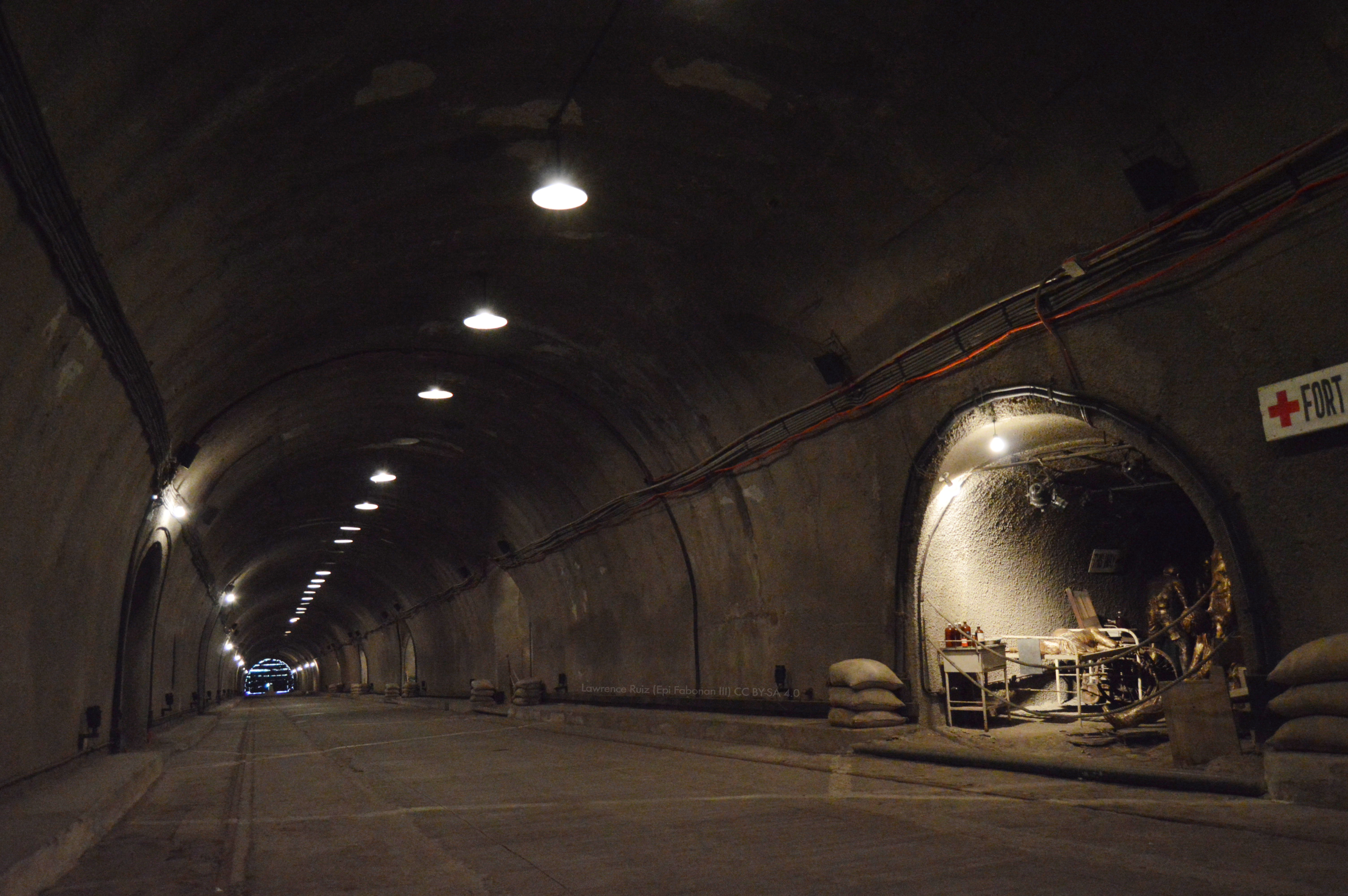
The Malinta Tunnel is a tunnel complex built by the United States Army Corps of Engineers on the island of Corregidor in the Philippines. It was initially used as a bomb-proof storage and personnel bunker, but was later equipped as a 1,000-bed hospital. The main tunnel, running east to west, is long, wide and high. Branching off from this main shaft are 13 lateral tunnels on the north side and 11 lateral tunnels on the south side. Each lateral averaged in length and in width. Name The Malinta Tunnel derives its name from Malinta Hill, a rise through which its shaft is bored. ''Malinta'' is Tagalog for "many leeches", ''linta'' being the local word for "leech". Construction Its construction, without benefit of new equipment or funds apportioned by the United States Congress due to agreements reached during the Washington Naval Conference, began in 1932 and the main tunnel and 25 laterals were completed in 1934. Other construction on laterals continued right up to the ... [...More Info...] [...Related Items...] OR: [Wikipedia] [Google] [Baidu] |
Manila Bay
Manila Bay ( fil, Look ng Maynila) is a natural harbor that serves the Port of Manila (on Luzon), in the Philippines. Strategically located around the capital city of the Philippines, Manila Bay facilitated commerce and trade between the Philippines and its neighboring countries,Jacinto, G.S., Azanza, R.V., Velasquez, I.B. and Siringan, F.P.(2006)."Manila Bay:Environmental Challenges and Opportunities" in Wolanski, E.(ed.) The Environment in Asia Pacific Harbours. Springer: Dordrecht, Netherlands. p309-328. becoming the gateway for socio-economic development even prior to Spanish occupation. With an area of , and a coastline of , Manila Bay is situated in the western part of Luzon and is bounded by Cavite and Metro Manila on the east, Bulacan and Pampanga on the north, and Bataan on the west and northwest.Jacinto, G.S., Velasquez, I.B., San Diego-McGlone, M.L., Villanoy, C.L. and Siringan, F.B.(2006)."Biophysical Environment of Manila Bay - Then and Now", in Wolanski, E.(ed.)Th ... [...More Info...] [...Related Items...] OR: [Wikipedia] [Google] [Baidu] |
Corregidor
Corregidor ( tl, Pulo ng Corregidor, ) is an island located at the entrance of Manila Bay in the southwestern part of Luzon in the Philippines, and is considered part of the Province of Cavite. Due to this location, Corregidor has historically been fortified with coastal artillery batteries to defend the entrance of Manila Bay and Manila itself from attacks by enemy warships. Located inland, Manila is the nation's largest city and has been the most important seaport in the Philippines for centuries, from the colonial rule of Spain, Japan, and the United States, up through the establishment of the Third Philippine Republic in 1946. Corregidor (Fort Mills) is the largest of the islands that formed the harbor defenses of Manila Bay, together with El Fraile Island (Fort Drum), Caballo Island (Fort Hughes), and Carabao Island (Fort Frank), which were all fortified during the American colonial period. The island was also the site of a small military airfield, as part of the defense. ... [...More Info...] [...Related Items...] OR: [Wikipedia] [Google] [Baidu] |
Boeing B-17 Flying Fortress
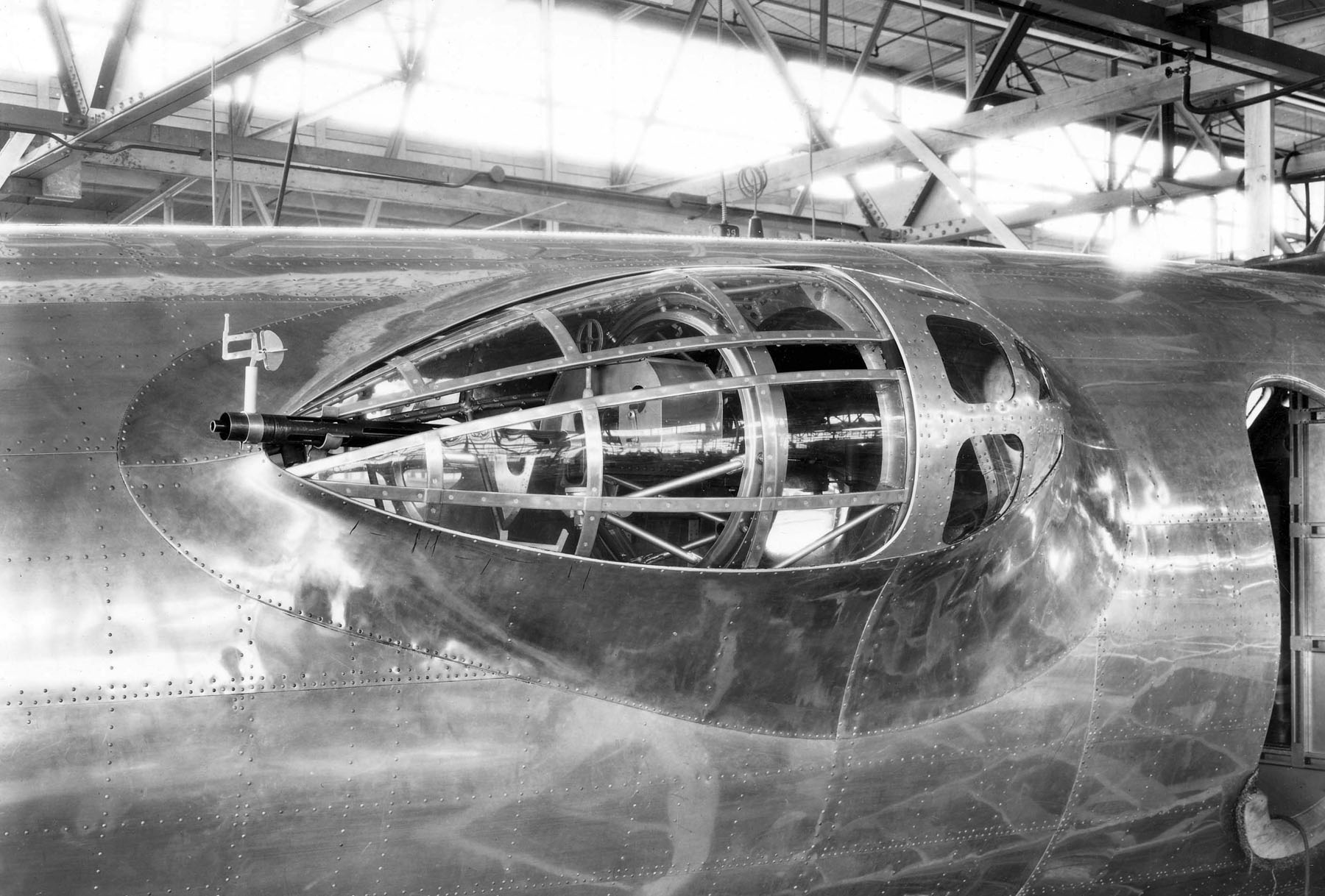
The Boeing B-17 Flying Fortress is a four-engined heavy bomber developed in the 1930s for the United States Army Air Corps (USAAC). Relatively fast and high-flying for a bomber of its era, the B-17 was used primarily in the European Theater of Operations and dropped more bombs than any other aircraft during World War II. It is the third-most produced bomber of all time, behind the four-engined Consolidated B-24 Liberator and the multirole, twin-engined Junkers Ju 88. It was also employed as a transport, antisubmarine aircraft, drone controller, and search-and-rescue aircraft. In a USAAC competition, Boeing's prototype Model 299/XB-17 outperformed two other entries but crashed, losing the initial 200-bomber contract to the Douglas B-18 Bolo. Still, the Air Corps ordered 13 more B-17s for further evaluation, then introduced it into service in 1938. The B-17 evolved through numerous design advances but from its inception, the USAAC (later, the USAAF) promoted the aircraft a ... [...More Info...] [...Related Items...] OR: [Wikipedia] [Google] [Baidu] |
Clark Air Base
Clark Air Base is a Philippine Air Force base on Luzon Island in the Philippines, located west of Angeles City, about northwest of Metro Manila. Clark Air Base was previously a United States military facility, operated by the U.S. Air Force under the aegis of Pacific Air Forces (PACAF) and their predecessor organizations from 1903 to 1991. The base covered with a military reservation extending north that covered another . The base was a stronghold of the combined Philippine and American forces during the final months of World War II and a backbone of logistical support during the Vietnam War until 1975. Following the departure of American forces in 1991 due to the eruption of Mount Pinatubo, the base became the site of Clark International Airport, as well as the Clark Freeport Zone and the Air Force City of the Philippine Air Force. In April 2016, an Air Contingent of USAF A-10s and HH-60s was deployed from U.S. air bases in Pyeongtaek and Okinawa to Clark. The Air Con ... [...More Info...] [...Related Items...] OR: [Wikipedia] [Google] [Baidu] |
Baguio
Baguio ( , ), officially the City of Baguio ( ilo, Siudad ti Baguio; fil, Lungsod ng Baguio), is a 1st class highly urbanized city in the Cordillera Administrative Region, Philippines. It is known as the "Summer Capital of the Philippines", owing to its cool climate since the city is located approximately above mean sea level, often cited as in the Luzon tropical pine forests ecoregion, which also makes it conducive for the growth of mossy plants, orchids and pine trees, to which it attributes its other moniker as the "City of Pines". Baguio was established as a hill station by the United States in 1900 at the site of an Ibaloi village known as ''Kafagway''. It was the United States' only hill station in Asia. Baguio is classified as a Highly-Urbanized City (HUC). It is geographically located within Benguet, serving as the provincial capital from 1901 to 1916, but has since been administered independently from the province following its conversion into a chartered cit ... [...More Info...] [...Related Items...] OR: [Wikipedia] [Google] [Baidu] |
Japan Self-Defense Forces
The Japan Self-Defense Forces ( ja, 自衛隊, Jieitai; abbreviated JSDF), also informally known as the Japanese Armed Forces, are the unified ''de facto''Since Article 9 of the Japanese Constitution outlaws the formation of armed forces, the JSDF cannot be considered a fully-fledged military force. military forces of Japan established in 1954. The self-defence forces consists of the Japan Ground Self-Defense Force, the Japan Maritime Self-Defense Force, and the Japan Air Self-Defense Force. They are controlled by the Ministry of Defense, with the Prime Minister as commander-in-chief. In recent years, the JSDF has engaged in international peacekeeping operations with the United Nations. Tensions with North Korea have reignited debate over the status of the JSDF and its relationship to Japanese society. Since 2010, the JSDF has refocused from countering the former Soviet Union to the People's Republic of China, also since 2022 Russian invasion of Ukraine the JSDF also conside ... [...More Info...] [...Related Items...] OR: [Wikipedia] [Google] [Baidu] |
Pearl Harbor
Pearl Harbor is an American lagoon harbor on the island of Oahu, Hawaii, west of Honolulu. It was often visited by the Naval fleet of the United States, before it was acquired from the Hawaiian Kingdom by the U.S. with the signing of the Reciprocity Treaty of 1875. Much of the harbor and surrounding lands are now a United States Navy deep-water naval base. It is also the headquarters of the United States Pacific Fleet. The U.S. government first obtained exclusive use of the inlet and the right to maintain a repair and coaling station for ships here in 1887. The surprise attack by the Imperial Japanese Navy on December 7, 1941, led the United States to declare war on the Empire of Japan, making the attack on Pearl Harbor the immediate cause of the United States' entry into World War II. History Pearl Harbor was originally an extensive shallow embayment called ''Wai Momi'' (meaning, “Waters of Pearl”) or ''Puuloa'' (meaning, “long hill”) by the Hawaiians. Puuloa was r ... [...More Info...] [...Related Items...] OR: [Wikipedia] [Google] [Baidu] |
Honolulu
Honolulu (; ) is the capital and largest city of the U.S. state of Hawaii, which is in the Pacific Ocean. It is an unincorporated county seat of the consolidated City and County of Honolulu, situated along the southeast coast of the island of Oahu, and is the westernmost and southernmost major U.S. city. Honolulu is Hawaii's main gateway to the world. It is also a major hub for business, finance, hospitality, and military defense in both the state and Oceania. The city is characterized by a mix of various Asian, Western, and Pacific cultures, reflected in its diverse demography, cuisine, and traditions. ''Honolulu'' means "sheltered harbor" or "calm port" in Hawaiian; its old name, ''Kou'', roughly encompasses the area from Nuuanu Avenue to Alakea Street and from Hotel Street to Queen Street, which is the heart of the present downtown district. The city's desirability as a port accounts for its historical growth and importance in the Hawaiian archipelago and the broader P ... [...More Info...] [...Related Items...] OR: [Wikipedia] [Google] [Baidu] |


.jpeg)


