|
Jiuliao River Ecological Park
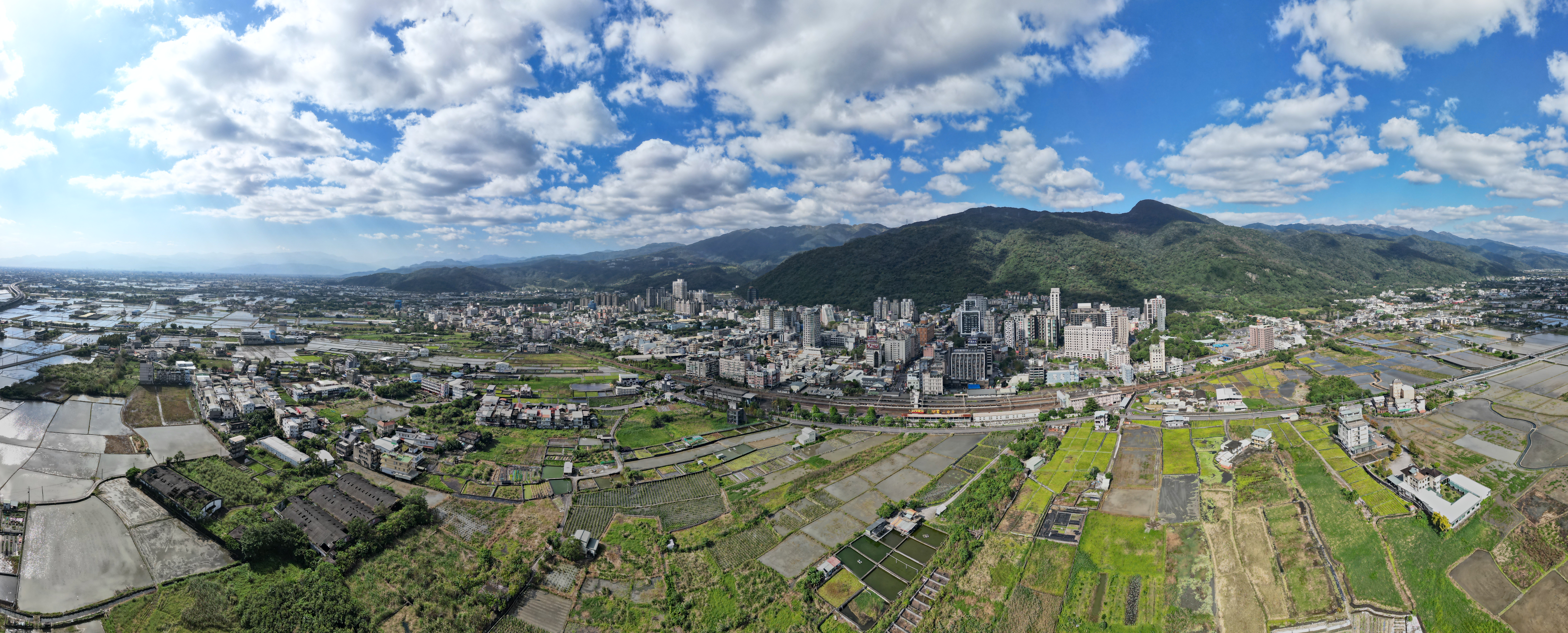
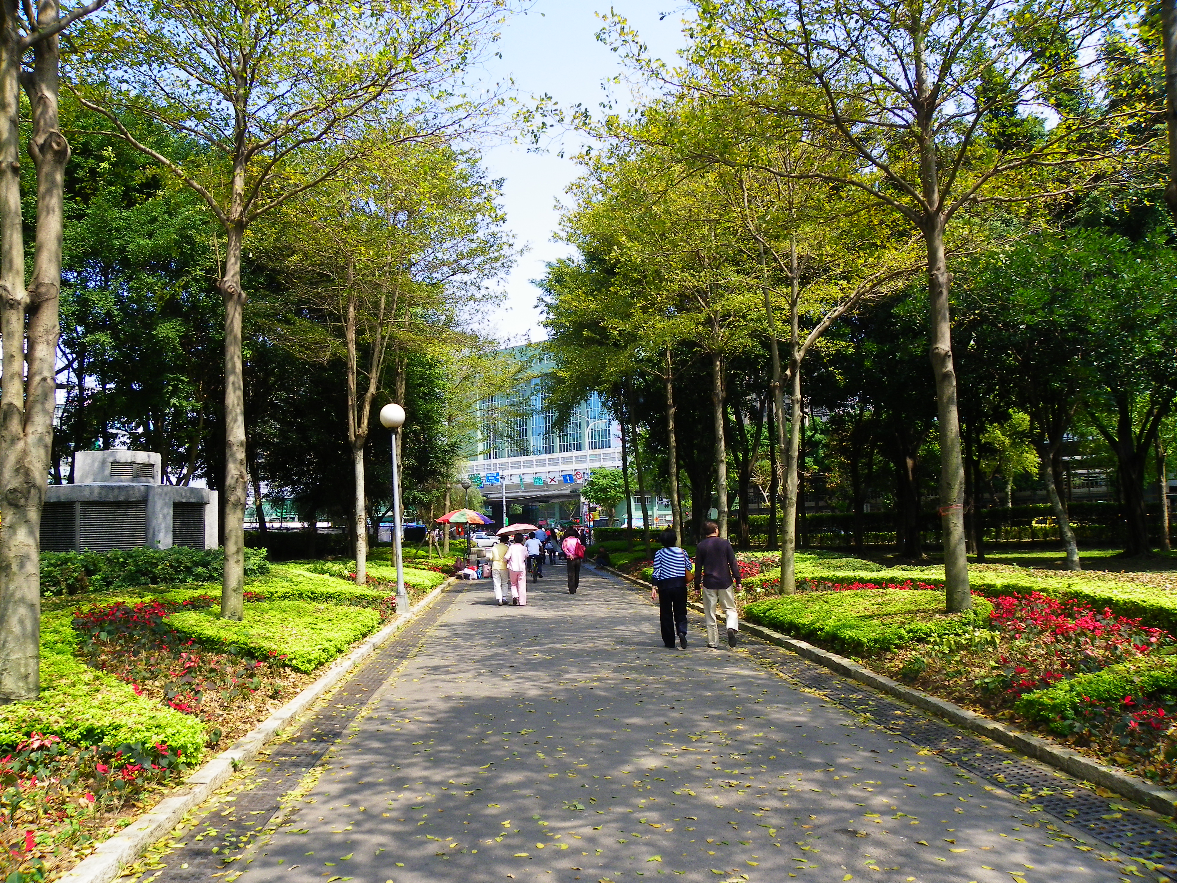
Jinhua Park () is a park in Lunpi Village, Datong Township, Yilan County, Taiwan. Geology The park is located along the Jiuiao River which its upstream is originated from Xueshan in Heping District, Taichung. Architecture The park features various facilities such as barbecue area and exhibitions, as well as 1.8 km long trail. See also * List of parks in Taiwan * List of tourist attractions in Taiwan Popular tourist attractions in Taiwan include the following: Attractions Historical buildings * Beihai Tunnel, Beigan () * Beihai Tunnel, Nangan () * Daxi Wude Hall () * Ete ... References Geography of Yilan County, Taiwan Parks in Yilan County {{Taiwan-geo-stub ... [...More Info...] [...Related Items...] OR: [Wikipedia] [Google] [Baidu] |
Park
A park is an area of natural, semi-natural or planted space set aside for human enjoyment and recreation or for the protection of wildlife or natural habitats. Urban parks are urban green space, green spaces set aside for recreation inside towns and cities. National parks and country parks are green spaces used for recreation in the countryside. State parks and provincial parks are administered by sub-national government states and agencies. Parks may consist of grassy areas, rocks, soil and trees, but may also contain buildings and other artifacts such as monuments, fountains or playground structures. Many parks have fields for playing sports such as baseball and football, and paved areas for games such as basketball. Many parks have trails for walking, biking and other activities. Some parks are built adjacent to bodies of water or watercourses and may comprise a beach or boat dock area. Urban parks often have benches for sitting and may contain picnic tables and barbecue gr ... [...More Info...] [...Related Items...] OR: [Wikipedia] [Google] [Baidu] |
Datong, Yilan
Datong Township () is a mountain indigenous township in the southwestern part of Yilan County, Taiwan. It is the second largest township in Yilan County after Nan'ao Township. Geography It is predominantly populated by Taiwanese aborigines of the Atayal Tribe. The township is dominated by rugged mountains and wide river valleys. Most settlements in the county are located along the Lanyang River valley which runs from the central mountains of Taiwan into the Lanyang Plain. * Area: 657.54 km2 * Population: 6,127 people (2014) Administration The villages of Datong include Daping, Fuxing, Hanxi, Leshui, Lunpi, Mao'an, Nanshan, Siji, Songluo and Yingshi. It was formerly the "Aboriginal Area" of Ratō District, Taihoku Prefecture during Japanese rule. Economy Economic activities include trucking silt from the Lanyang River for use in cement production and cultivation of tea, cabbage and betel nut palms. Infrastructure * Qingshui Geothermal Power Plant Tourist attractio ... [...More Info...] [...Related Items...] OR: [Wikipedia] [Google] [Baidu] |
Yilan County, Taiwan
Yilan County, alternately spelled I-lan, is a County (Taiwan), county in northeastern Taiwan, Republic of China. Name The name ''Yilan'' derives from the Taiwanese indigenous peoples, indigenous Kavalan people. Other former names in reference to this area in the Yilan Plain include ''Kabalan'', ''Kavalan'', ''Kavaland'', ''kap-a-lan'', ''Yiland'' and ''Gilan''. Before 2009, the county's official name was transliterated as Ilan. History Early history Since early ages, many people have traveled from far places to Yilan. Taiwanese aborigines, Indigenous tribes that have settled in Yilan are Kavalan people and Atayal people. The Kavalan people came by the sea and lived by the river at Yilan Plain since around 1,000 years ago. They mostly speak the Austronesian languages. Their settlements consisted of small villages along rivers with around 40-50 communities scattered around the area with a total population of approximately 10,000 people. The Atayal people came by crossing ... [...More Info...] [...Related Items...] OR: [Wikipedia] [Google] [Baidu] |
Taiwan
Taiwan, officially the Republic of China (ROC), is a country in East Asia, at the junction of the East and South China Seas in the northwestern Pacific Ocean, with the People's Republic of China (PRC) to the northwest, Japan to the northeast, and the Philippines to the south. The territories controlled by the ROC consist of 168 islands, with a combined area of . The main island of Taiwan, also known as ''Formosa'', has an area of , with mountain ranges dominating the eastern two-thirds and plains in the western third, where its highly urbanised population is concentrated. The capital, Taipei, forms along with New Taipei City and Keelung the largest metropolitan area of Taiwan. Other major cities include Taoyuan, Taichung, Tainan, and Kaohsiung. With around 23.9 million inhabitants, Taiwan is among the most densely populated countries in the world. Taiwan has been settled for at least 25,000 years. Ancestors of Taiwanese indigenous peoples settled the isla ... [...More Info...] [...Related Items...] OR: [Wikipedia] [Google] [Baidu] |
Xueshan
Xueshan, formerly known as and by other names, is a mountain in the Heping District of Taichung, Taiwan. It is the 2nd-highest mountain in Taiwan and in East Asia, at above sea level. It is located in the Shei-Pa National Park and is visible in good weather from hills near Taiwan's capital Taipei. Names ''Xuěshān'' is the pinyin romanization of the Chinese name meaning "Snow" or "Snowy Mountain". The same name was romanized as Hsüehshan using the Wade-Giles system. During the Qing Dynasty, the mountain was known to Westerners as It was also known as (properly, ''Sānchāshān'') from a Chinese name meaning "3-Forked" or "3-Prong Mountain". During Japan's occupation of Taiwan, improved surveys showed that Xueshan was shorter than Yushan on Taiwan but taller than in the Japanese Islands. Its name was accordingly changed to Tsugitakayama(次高山), meaning "Next-" or "Second-Highest Mountain", in 1923. History The Japanese governor-general designated Xueshan p ... [...More Info...] [...Related Items...] OR: [Wikipedia] [Google] [Baidu] |
Heping District, Taichung
Heping District () is a mountain indigenous district in eastern Taichung, Taiwan, and it is the largest district of Taichung City. It is also the largest district in Taiwan by area. It is the geographic center of Taiwan. History After the handover of Taiwan from Japan to the Republic of China in 1945, Heping was organized as a Mountain indigenous township of Taichung County. On 7 June 1973, two northeast most villages of the township were separated to form a new county-level division, which was Lishan Constructing Administrative Bureau (). However, the bureau was dissolved on 18 February 1982 and the two villages were returned to the township. On 25 December 2010, Taichung County was merged with Taichung City and Heping was upgraded to a district of the city. Geography The district covers an area of , making it the largest district in Taichung as well as in Taiwan. Demographics As of 2016, the district comprises 10,707 residents, of which around 4,000 are Atayal people. E ... [...More Info...] [...Related Items...] OR: [Wikipedia] [Google] [Baidu] |
Taichung
Taichung (, Wade–Giles: ''Tʻai²-chung¹'', pinyin: ''Táizhōng''), officially Taichung City, is a special municipality located in central Taiwan. Taichung has approximately 2.8 million residents and is the second most populous city of Taiwan, as well as the most populous city in Central Taiwan. It serves as the core of the Taichung–Changhua metropolitan area, the second largest metropolitan area in Taiwan. Located in the Taichung Basin, the city was initially developed from several scattered hamlets helmed by the Taiwanese indigenous peoples. It was constructed to be the new capital of Taiwan Province and renamed as " Taiwan-fu" in the late Qing dynastic era between 1887 and 1894. During the Japanese era from 1895, the urban planning of present-day city of Taichung was performed and developed by the Japanese. From the start of ROC rule in 1945, the urban area of Taichung was organized as a provincial city up until 25 December 2010, when the original provincial city and ... [...More Info...] [...Related Items...] OR: [Wikipedia] [Google] [Baidu] |
List Of Parks In Taiwan
This is a list of parks in Taiwan, Republic of China. Taipei * 228 Peace Memorial Park * Bailing Sport Park * Bangka Park * Beitou Park * Bihu Park * Chengmei Riverside Park * Daan Forest Park * Dahu Park * Dajia Riverside Park * Fudekeng Environmental Restoration Park * Guandu Nature Park * Guanshan Riverside Park * Jieshou Park * Meiti Riverside Park * Nangang Park * Nanxing Park * Rongxing Garden Park * Sanmin Park * Shanshuilu Eco Park * Shingyi Plaza * Shuangxi Park and Chinese Garden * Songshan Cultural and Creative Park * Taipei Botanical Garden * Taipei Water Park * Xinzhong Park * Yingfeng Riverside Park * Youth Park * Zhongshan Linear Park New Taipei * Erchong Lotus Park * Erchong Riverside Park * Kinchen Park * Stone Sculpture Park Taichung * Fengle Sculpture Park * Lüshun Park * Taichung Metropolitan Park * Taichung New Capital Ecological Park * Taichung Park Kaohsiung * Central Park * Dapingding Tropical Botanical Garden * Jhon ... [...More Info...] [...Related Items...] OR: [Wikipedia] [Google] [Baidu] |
List Of Tourist Attractions In Taiwan
Popular tourist attractions in Taiwan include the following: Attractions Historical buildings * Beihai Tunnel, Beigan () * Beihai Tunnel, Nangan () * Daxi Wude Hall () * Eternal Golden Castle * First Guesthouse * Fongyi Tutorial Academy * Former British Consulate at Takao * Former Japanese Navy Fongshan Communication Center * Former Tainan Weather Observatory * Fort Provintia * Fort Santo Domingo * Fort Zeelandia * Fuxing Barn * Great South Gate * Gulongtou Zhenwei Residence * Hobe Fort * Jhen Wen Academy * Kaohsiung Grand Hotel * Keelung Fort Commander's Official Residence * Lee Teng-fan's Ancient Residence * Lin Family Mansion and Garden * Meinong East Gate Tower * Moving Castle * Niumatou Site * North Gate of Xiong Town * Presidential Office Building * Qihou Fort * Qing Dynasty Taiwan Provincial Administration Hall * Shihlin Paper Mill * Taipei Guest House * Tianma Tea House * Walls of Taipei * Wist ... [...More Info...] [...Related Items...] OR: [Wikipedia] [Google] [Baidu] |
Geography Of Yilan County, Taiwan
Geography (from Greek: , ''geographia''. Combination of Greek words ‘Geo’ (The Earth) and ‘Graphien’ (to describe), literally "earth description") is a field of science devoted to the study of the lands, features, inhabitants, and phenomena of Earth. The first recorded use of the word γεωγραφία was as a title of a book by Greek scholar Eratosthenes (276–194 BC). Geography is an all-encompassing discipline that seeks an understanding of Earth and its human and natural complexities—not merely where objects are, but also how they have changed and come to be. While geography is specific to Earth, many concepts can be applied more broadly to other celestial bodies in the field of planetary science. One such concept, the first law of geography, proposed by Waldo Tobler, is "everything is related to everything else, but near things are more related than distant things." Geography has been called "the world discipline" and "the bridge between the human and th ... [...More Info...] [...Related Items...] OR: [Wikipedia] [Google] [Baidu] |


