|
Jitiri
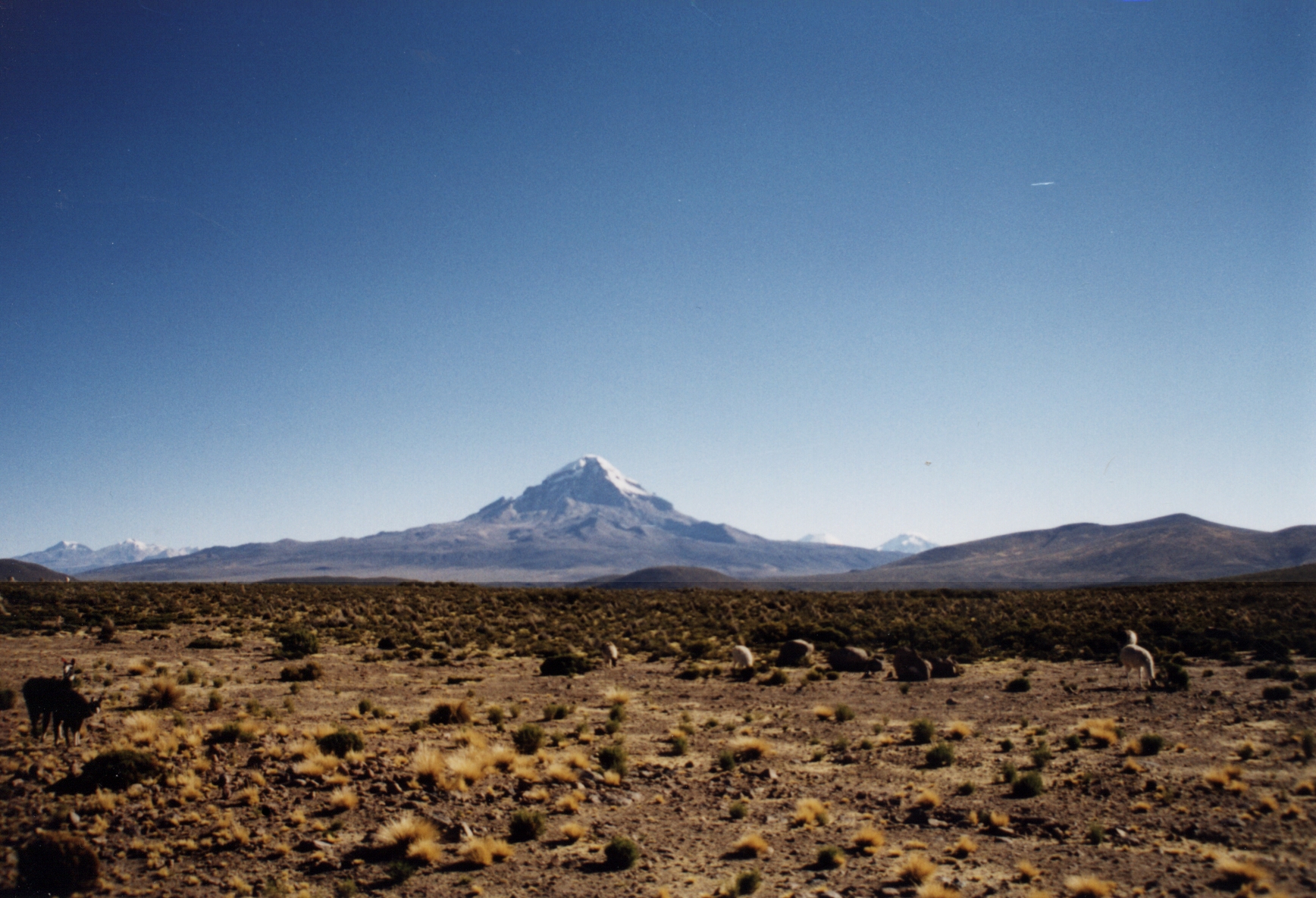
Jitiri is a volcano in the Andes, located in the Cordillera Occidental of Bolivia in the Oruro Department, Sajama Province, Turco Municipality, Cosapa Canton. It is situated south-east of the extinct Sajama volcano, between the volcano Chullkani in the south-west and the village Cosapa in the north-east. See also * Asu Asuni * Laram Q'awa * Kunturiri * Uyarani Uyarani is a volcano in the Cordillera Occidental in the Andes of Bolivia. It is situated in the Oruro Department, Sajama Province, Turco Municipality, Turco Canton. [...More Info...] [...Related Items...] OR: [Wikipedia] [Google] [Baidu] |
Uyarani
Uyarani is a volcano in the Cordillera Occidental in the Andes of Bolivia. It is situated in the Oruro Department, Sajama Province, Turco Municipality, Turco Canton. population data and map It lies south-east of the extinct Sajama volcano and the Chullkani volcano and south-west of the volcanic complex, between the Challwiri River and the Lauca River
The Lauca River is a binational river. It originates in the Chilean Altiplano of the Arica and P ...
[...More Info...] [...Related Items...] OR: [Wikipedia] [Google] [Baidu] |
Asu Asuni
Asu Asuni (Aymara ''asu'' newborn creature, the reduplication signifies there is a group or a complex of something, ''-ni'' a nominal suffix to indicate ownership, "the one with some newborn creatures") is a mountain in a volcanic complex in the Cordillera Occidental in the Andes of Bolivia. It is located in the Oruro Department, Sajama Province, Turco Municipality, Turco Canton. It is situated southeast of the extinct Sajama volcano (3 km), between the Chullkani Chullkani (possibly a broken name from Aymara Chullunkhäni ("the one with the icicles"), Hispanicized spelling ''Chullcani'') is a volcano in the Cordillera Occidental in the Andes of Bolivia. It is located in the Oruro Department, Sajama Provi ... volcano in the west (3 km) and Turco in the east, at the National Route 27. See also * Jitiri * Laram Q'awa * Kunturiri (Bolivia-Chile) * Kunturiri (Sajama) * Uyarani References Volcanoes of Oruro Department {{Oruro-geo-stub ... [...More Info...] [...Related Items...] OR: [Wikipedia] [Google] [Baidu] |
Bolivia
, image_flag = Bandera de Bolivia (Estado).svg , flag_alt = Horizontal tricolor (red, yellow, and green from top to bottom) with the coat of arms of Bolivia in the center , flag_alt2 = 7 × 7 square patchwork with the (top left to bottom right) diagonals forming colored stripes (green, blue, purple, red, orange, yellow, white, green, blue, purple, red, orange, yellow, from top right to bottom left) , other_symbol = , other_symbol_type = Dual flag: , image_coat = Escudo de Bolivia.svg , national_anthem = " National Anthem of Bolivia" , image_map = BOL orthographic.svg , map_width = 220px , alt_map = , image_map2 = , alt_map2 = , map_caption = , capital = La Paz Sucre , largest_city = , official_languages = Spanish , languages_type = Co-official languages , languages ... [...More Info...] [...Related Items...] OR: [Wikipedia] [Google] [Baidu] |
Oruro Department
Oruro (; Quechua: ''Uru Uru''; Aymara: ''Ururu'') is a department of Bolivia, with an area of . Its capital is the city of Oruro. According to the 2012 census, the Oruro department had a population of 494,178. Provinces of Oruro The department is divided into 16 provinces which are further subdivided into municipalities and cantons. Note: Eduardo Abaroa Province (#5) is both north of and south of Sebastián Pagador Province (#6). Government The chief executive officer of Bolivian departments (since May 2010) is the governor; until then, the office was called the prefect, and until 2006 the prefect was appointed by the president of Bolivia. The current governor, Santos Tito of the Movement for Socialism – Political Instrument for the Sovereignty of the Peoples, was elected on 4 April 2010. The chief legislative body of the department is the Departmental Legislative Assembly, a body also first elected on 4 April 2010. It consists of 33 members: 16 elected by each ... [...More Info...] [...Related Items...] OR: [Wikipedia] [Google] [Baidu] |
Sajama Province
Sajama is a province in the northwestern parts of the Bolivian Oruro Department. Location ''Sajama'' province is one of the sixteen provinces in the Oruro Department. It is located between 17° 39' and 18° 39' South and between 67° 38' and 68° 45' West. The province borders the La Paz Department in the north-west, the Republic of Chile in the west, Sabaya Province in the south-west, Litoral Province in the south-east, Carangas Province in the east, and San Pedro de Totora Province in the north-east. The province extends over 120 km from north to south, and 135 km from east to west. Geography The highest mountain in the province is the extinct Sajama volcano in the Sajama National Park. Other mountains are listed below:Bolivian IGM map 1:50,000 Cerro Uyarani Hoja 5838-I Population The main language of the province is Aymara, spoken by 90.4%, while 88.6% of the population speak Spanish and 4.2% Quechua (1992). The population increased from 7,891 inhabitants ... [...More Info...] [...Related Items...] OR: [Wikipedia] [Google] [Baidu] |
Turco Municipality
Turco Municipality is the second municipal section of the Sajama Province in the Oruro Department in Bolivia, and was founded on February 15, 1957.Plan de desarollo municipal Municipio de Turco (Spanish) Its seat is Turco, situated 154 km west of at an altitude of 3,860 m. The municipality covers an area of 3,973 km², not taking into account the area of Laca Laca Canton. It is bordered to the north by the Curahuara de Carangas Municipality and , to the south b ... [...More Info...] [...Related Items...] OR: [Wikipedia] [Google] [Baidu] |
Andes
The Andes, Andes Mountains or Andean Mountains (; ) are the longest continental mountain range in the world, forming a continuous highland along the western edge of South America. The range is long, wide (widest between 18°S – 20°S latitude), and has an average height of about . The Andes extend from north to south through seven South American countries: Venezuela, Colombia, Ecuador, Peru, Bolivia, Chile, and Argentina. Along their length, the Andes are split into several ranges, separated by intermediate depressions. The Andes are the location of several high plateaus—some of which host major cities such as Quito, Bogotá, Cali, Arequipa, Medellín, Bucaramanga, Sucre, Mérida, El Alto and La Paz. The Altiplano plateau is the world's second-highest after the Tibetan plateau. These ranges are in turn grouped into three major divisions based on climate: the Tropical Andes, the Dry Andes, and the Wet Andes. The Andes Mountains are the highest mountain ra ... [...More Info...] [...Related Items...] OR: [Wikipedia] [Google] [Baidu] |
Cordillera Occidental (Bolivia)
Topographic map of Bolivia showing (east to west) plains of Cordill.html" ;"title="Geology of Bolivia#Lowlands and Sub-Andean zone">Sub-Andean Zone in red, Cordillera Oriental (Bolivia)">Eastern Cordillera in white, Altiplano in gray, and Western Cordillera in white The Cordillera Occidental or Western Cordillera of Bolivia is part of the Andes (that is also part of the American Cordillera), a mountain range characterized by volcanic activity, making up the natural border with Chile and starting in the north with Juqhuri and ending in the south at the Licancabur volcano, which is on the southern limit of Bolivia with Chile. The border goes through the innominated point located at two-thirds of elevation of Licancabur's northeastern slope at the southwestermost point of Bolivia at 22° 49' 41" south and 67° 52' 35" west. The climate of the region is cold and inadequate for animal and plant life. Its main feature is its ground, in which are large quantities of metallic minerals i ... [...More Info...] [...Related Items...] OR: [Wikipedia] [Google] [Baidu] |
Volcano
A volcano is a rupture in the crust of a planetary-mass object, such as Earth, that allows hot lava, volcanic ash, and gases to escape from a magma chamber below the surface. On Earth, volcanoes are most often found where tectonic plates are diverging or converging, and most are found underwater. For example, a mid-ocean ridge, such as the Mid-Atlantic Ridge, has volcanoes caused by divergent tectonic plates whereas the Pacific Ring of Fire has volcanoes caused by convergent tectonic plates. Volcanoes can also form where there is stretching and thinning of the crust's plates, such as in the East African Rift and the Wells Gray-Clearwater volcanic field and Rio Grande rift in North America. Volcanism away from plate boundaries has been postulated to arise from upwelling diapirs from the core–mantle boundary, deep in the Earth. This results in hotspot volcanism, of which the Hawaiian hotspot is an example. Volcanoes are usually not created where two tectonic ... [...More Info...] [...Related Items...] OR: [Wikipedia] [Google] [Baidu] |
Brazilian Journal Of Geology
''Brazilian Journal of Geology'' (formerly ''Revista Brasileira de Geociências'') is a quarterly peer-reviewed scientific journal published by the Sociedade Brasileira de Geologia, Brazil's main geology society. The journal covers the field of geology and related earth sciences, in Brazil, South America, and Antarctica Antarctica () is Earth's southernmost and least-populated continent. Situated almost entirely south of the Antarctic Circle and surrounded by the Southern Ocean, it contains the geographic South Pole. Antarctica is the fifth-largest co ..., including oceanic regions adjacent to these regions. The journal was established in 1971 and articles are published in English and Portuguese. The journal replaced the ''Boletim da Sociedade Brasileira de Geologia'' established in 1952. The journal is sponsored by Petrobras. References External links * Geology journals Geology of South America Geology of Brazil Publications established in 1971 Multili ... [...More Info...] [...Related Items...] OR: [Wikipedia] [Google] [Baidu] |
Nevado Sajama
Nevado Sajama (; ) is an extinct stratovolcano and the highest peak in Bolivia. The mountain is located in Sajama Province, in Oruro Department. It is situated in Sajama National Park and is a composite volcano consisting of a stratovolcano on top of several lava domes. It is not clear when it erupted last but it may have been during the Pleistocene or Holocene. The mountain is covered by an ice cap, and ''Polylepis tarapacana'' trees occur up to elevation. Geography and geomorphology Nevado Sajama is located in the Sajama Province of the Oruro Department in Bolivia, about from the border with Chile. Cholcani volcano lies southeast of Sajama, and another neighbouring volcano, Pomerape, resembles Sajama in its appearance. A road runs along the southeastern flank of the volcano, with additional roads completing a circle around Sajama. The village of Sajma lies on its western foot, with the village of Caripe to the northeast of the mountain and Lagunas to the southwest, and th ... [...More Info...] [...Related Items...] OR: [Wikipedia] [Google] [Baidu] |
Laram Q'awa (Charaña)
Laram Q'awa (Aymara ''larama'' blue, ''q'awa'' little river, ditch, crevice, fissure, gap in the earth, "blue brook" or "blue ravine", Hispanicized spellings ''Laram Khaua, Larancagua'') is a mountain in the Andes. According to the Bolivian IGM map 1:50,000 'Nevados Payachata Hoja 5739-I' it is situated on Bolivian terrain in the La Paz Department, Pacajes Province (Charaña Municipality), at the border with Chile. It lies north-west of the mountains Kunturiri, Phaq'u Q'awa and another mountain on the border named Laram Q'awa ''(Laram Khaua)''. One of three different rivers of this area called Kunturiri ''(Condoriri)'' originates north-east of the mountain near Phaq'u Q'awa. It flows in a bow along the northern slopes of Laram Q'awa towards Chile. (unnamed, north-west of Phaq'u Q'awa ''(Paco Khau)'') See also * Jach'a Kunturiri * Sajama National Park Sajama National Park is a national park located in the Oruro Department, Bolivia. It borders Lauca National Park in Chil ... [...More Info...] [...Related Items...] OR: [Wikipedia] [Google] [Baidu] |

.jpg)


