|
Sajama Province
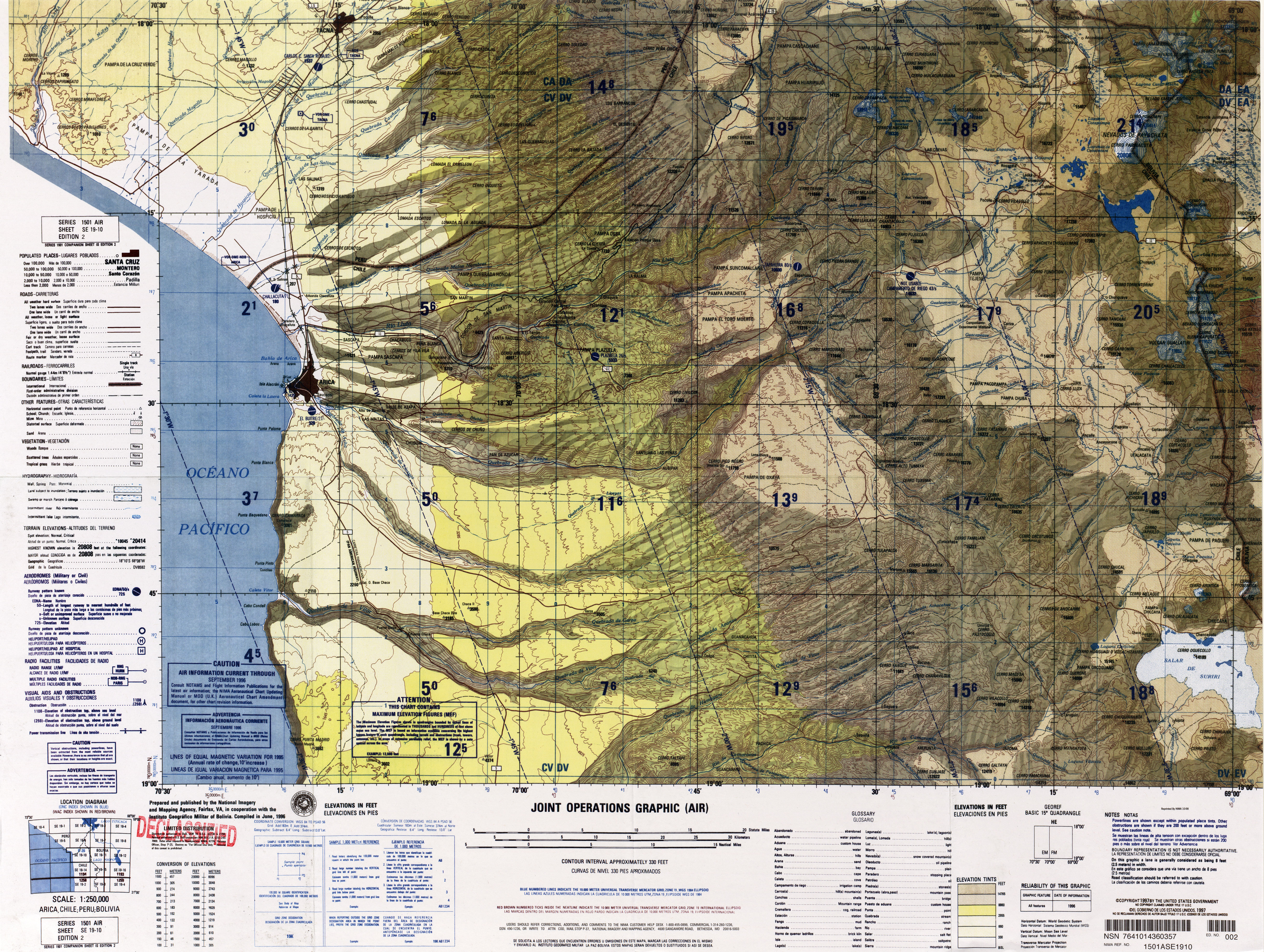
Sajama is a province in the northwestern parts of the Bolivian Oruro Department. Location ''Sajama'' province is one of the sixteen provinces in the Oruro Department. It is located between 17° 39' and 18° 39' South and between 67° 38' and 68° 45' West. The province borders the La Paz Department in the north-west, the Republic of Chile in the west, Sabaya Province in the south-west, Litoral Province in the south-east, Carangas Province in the east, and San Pedro de Totora Province in the north-east. The province extends over 120 km from north to south, and 135 km from east to west. Geography The highest mountain in the province is the extinct Sajama volcano in the Sajama National Park. Other mountains are listed below:Bolivian IGM map 1:50,000 Cerro Uyarani Hoja 5838-I Population The main language of the province is Aymara, spoken by 90.4%, while 88.6% of the population speak Spanish and 4.2% Quechua (1992). The population increased from 7,891 inhabitants ( ... [...More Info...] [...Related Items...] OR: [Wikipedia] [Google] [Baidu] |
Provinces Of Bolivia
A province is the second largest administrative division in Bolivia, after a department. Each department is divided into provinces. There are 112 provinces. The country's provinces are further divided into 337 municipalities which are administered by an alcalde and municipal council. List of provinces Beni Department Chuquisaca Department Cochabamba Department La Paz Department Oruro Department Pando Department Potosí Department Santa Cruz Department Tarija Department See also * Departments of Bolivia * Municipalities of Bolivia Municipalities in Bolivia are administrative divisions of the entire national territory governed by local elections. Municipalities are the third level of administrative divisions, below departments and provinces. Some of the provinces consist of ... Sources Instituto Nacional de Estadística - Bolivia(Spanish) {{Articles on second-level administrative divisions of South American countries Subd ... [...More Info...] [...Related Items...] OR: [Wikipedia] [Google] [Baidu] |
Latitude
In geography, latitude is a coordinate that specifies the north– south position of a point on the surface of the Earth or another celestial body. Latitude is given as an angle that ranges from –90° at the south pole to 90° at the north pole, with 0° at the Equator. Lines of constant latitude, or ''parallels'', run east–west as circles parallel to the equator. Latitude and ''longitude'' are used together as a coordinate pair to specify a location on the surface of the Earth. On its own, the term "latitude" normally refers to the ''geodetic latitude'' as defined below. Briefly, the geodetic latitude of a point is the angle formed between the vector perpendicular (or ''normal'') to the ellipsoidal surface from the point, and the plane of the equator. Background Two levels of abstraction are employed in the definitions of latitude and longitude. In the first step the physical surface is modeled by the geoid, a surface which approximates the mean sea level over the ocean ... [...More Info...] [...Related Items...] OR: [Wikipedia] [Google] [Baidu] |
Chunkarani
Chunkarani ( Aymara ''chunkara'' pointed mountain, ''-ni'' a suffix to indicate ownership, "the one with a pointed mountain", Hispanicized spelling ''Chungarani'') is a mountain in the Andes of Bolivia. It lies in the Oruro Department, Sajama Province, on the border of the Curahuara de Carangas Municipality and the Turco Municipality. ''(Chingurani)'' Chunkarani is situated north-east of the volcanic complex of Asu Asuni Asu Asuni (Aymara ''asu'' newborn creature, the reduplication signifies there is a group or a complex of something, ''-ni'' a nominal suffix to indicate ownership, "the one with some newborn creatures") is a mountain in a volcanic complex in the .... References Mountains of Oruro Department {{Oruro-geo-stub ... [...More Info...] [...Related Items...] OR: [Wikipedia] [Google] [Baidu] |
Chullkani
Chullkani (possibly a broken name from Aymara Chullunkhäni ("the one with the icicles"), Hispanicized spelling ''Chullcani'') is a volcano in the Cordillera Occidental in the Andes of Bolivia. It is located in the Oruro Department, Sajama Province, Turco Municipality. It lies near two lower peaks both named Wayna Chullunkhäni ("young Chullunkhäni"). The eastern one called Wayna Chullunkhäni (Hispanicized ''Huayna Chulluncani'') lies at , and the one northwest of Chullkani, also spelled ''Huayna Chuluncani'', lies at at a creek named Wayna Chullkani ''(Huayna Chullcani)''. Activity at Chullkani commenced in the upper Miocene with the cryptodome Ch'ankha Muqu. This lava dome is formed by porphyritic andesite and has dimensions of at an altitude of . Later, southeast of Chullkani formed the rhyolitic Yapu Qullu lava dome. Crystalline flows named Thuwas Qalani ''(Tobas Khalani)'' are up to thick and contain lithic fragments and pumice. Chullkani proper formed 6.13± 0.12 Ma ... [...More Info...] [...Related Items...] OR: [Wikipedia] [Google] [Baidu] |
Chilli Qhata . Chilli Qhata lies south-west of the mountain Q'aysiri and east of Janq'u Jaqhi.
Chilli Qhata ( Aymara ''chilli'' deep, ''qhata'' knee pit, "deep knee pit", also spelled ''Chillicata'') is a mountain in the Andes of Bolivia. It is situated in the Oruro Department, Sajama Province, at the border of the Curahuara de Carangas Municipality and the Turco Municipality Turco Municipality is the second Municipalities of Bolivia, municipal section of the Sajama Province in the Oruro Department in Bolivia, and was founded on February 15, 1957. References Mountains of Oruro Department {{Oruro-geo-stub ...[...More Info...] [...Related Items...] OR: [Wikipedia] [Google] [Baidu] |
Chachakumani (Oruro)
Chachakumani ( Quechua ''chachakuma'' a medical plant, ''-ni'' an Aymara suffix to indicate ownership, "the one with ''chachakuma'', Hispanicized spelling ''Chachacomani'') is a mountain in the Cordillera Occidental in the Andes of Bolivia. It is situated in the Oruro Department, Sajama Province, in the west of the Turco Municipality. Chachakumani lies south of Muru Qullu, northeast of Umurata and Kuntur Ikiña and southeast of Uqi Uqini Uqi Uqini (Aymara ''uqi uqi'' a species of plant, ''uqi'' brown, grey brown, the reduplication indicates that there is a group or a complex of something, ''-ni'' a suffix to indicate ownership, "the one with the ''uqi uqi'' plant" or "the one with .... The Jaruma River flows between Muru Qullu and Chachakumani. It is a tributary of the Sajama River. References Mountains of Oruro Department {{Oruro-geo-stub ... [...More Info...] [...Related Items...] OR: [Wikipedia] [Google] [Baidu] |
Ari Qullu Phujru , Chachacomani Canton, south-east of the volcanic complex of Kimsa Chata. Turco Municipality:population data and map.
Ari Qullu Phujru ( Aymara ''ari'' pointed, sharp, ''qullu'' mountain, ''phujru'' hole or pit in the earth without water, not very deep, "pointed mountain hole", also spelled ''Ari Kkollu Phujro, Arikkollu Phujru'') is a mountain in the Cordillera Occidental in the Andes of Bolivia. It is situated in the Oruro Department, Sajama Province, Turco Municipality Turco Municipality is the second Municipalities of Bolivia, municipal section of the Sajama Province in the Oruro Department in Bolivia, and was founded on February 15, 1957. References [...More Info...] [...Related Items...] OR: [Wikipedia] [Google] [Baidu] |
Sajama National Park
Sajama National Park is a national park located in the Oruro Department, Bolivia. It borders Lauca National Park in Chile. The park is home to the indigenous Aymara people, whose influential ancient culture can be seen in various aspects throughout the park. The park hosts many cultural and ecological sites, and is a hub of ecotourism. Many different indigenous plants and animals are exclusive to this area; therefore its continued conservation is of great ecological importance. Management of the park operates under a co-administrative approach, with local people and park conservationists engaging in a constant dialogue regarding park upkeep and policy. History Sajama National Park is Bolivia's oldest national park. The park lies within the Central Andean dry puna ecoregion. It features a spectacular Andean landscape, with elevations ranging from 4,200 to 6,542 meters (13,780 to 21,463 ft). It contains the snowy cone of the volcano Sajama, the highest mountain in Bolivia a ... [...More Info...] [...Related Items...] OR: [Wikipedia] [Google] [Baidu] |
San Pedro De Totora Province
San Pedro de Totora is a province in the northern parts of the Bolivian department of Oruro. Location San Pedro de Totora province is one of the sixteen provinces in the Oruro Department. It is located between 17° 41' and 18° 06' South and between 67° 33' and 67° 58' West. The province borders La Paz Department in the north, Sajama Province in the west and southwest, Carangas Province in the southeast, and Nor Carangas Province in the east. The province extends over 50 km from north to south, and 45 km from east to west. Geography Some of the highest mountains of the province are listed below:Bolivian IGM map 1:50,000 Curahuara de Carangas 5940-III Population Main idiom of the province is Aymara, spoken by 90%, while 72.5% of the population speak Spanish and 3% Quechua (1992). The population increased from 4,040 inhabitants (1992 census) to 4,941 (2001 census), an increase of 22.3%. - 43% of the population are younger than 15 years old (1992). 99% of the ... [...More Info...] [...Related Items...] OR: [Wikipedia] [Google] [Baidu] |
Carangas Province
Carangas is a province in the northern parts of the Bolivian department of Oruro. Location ''Carangas'' province is one of sixteen provinces in the Oruro Department. It is located between 17° 59' and 18° 54' South and between 67° 09' and 67° 45' West. It borders San Pedro de Totora Province in the northwest, Sajama Province in the west, Litoral Province in the southwest, Sud Carangas Province in the southeast, Saucarí Province in the east, and Nor Carangas Province in the northeast. The province extends over 105 km from North to South, and 75 km from east to west. Population The main language of the province is Aymara, spoken by 94%, while 84% of the population speak Spanish and 13% Quechua. The population increased from 7,930 inhabitants (1992 census) to 10,505 (2001 census), an increase of 32.5%. - 43.1% of the population is younger than 15 years old. 92.5% of the population have no access to electricity, 98.1% have no sanitary facilities. 79.8% of the po ... [...More Info...] [...Related Items...] OR: [Wikipedia] [Google] [Baidu] |
Litoral Province (Bolivia)
Litoral (or ''Litoral de Atacama'') is a province in the southwestern parts of the Bolivian Oruro Department. Its seat is Huachacalla. Location Litoral Province is one of sixteen provinces in the Oruro Department. It is located between 18° 32' and 19° 04' South and between 67° 29' and 68° 06' West. The province borders Sajama Province in the north, Sabaya Province in the west and south, Sud Carangas Province in the southeast, and Carangas Province in the northeast. The province extends over 65 km from north to south, and 55 km from east to west. Population The main language of the province is Spanish, spoken by 89.8%, while 76.0% of the population speak Aymara and 13.7% Quechua. The population increased from 2,087 inhabitants (1992 census) to 4,555 (2001 census), an increase of more than 100%. - 34.5% of the population are younger than 15 years old. 94.5% of the population have no access to electricity, 90.5% have no sanitary facilities. 78.0% of the p ... [...More Info...] [...Related Items...] OR: [Wikipedia] [Google] [Baidu] |
Sabaya Province
Sabaya (formerly: Atahuallpa) is a province in the central parts of the Bolivian Oruro Department. Its seat is Sabaya. Location Sabaya Province is one of sixteen provinces in the Oruro Department. It is located between 18° 35' and 19° 39' South and between 67° 31' and 68° 39' West. It borders Sajama Province in the north, the Republic of Chile and Puerto de Mejillones Province in the west, the Potosí Department in the southwest, the Ladislao Cabrera Province in the southeast, and the Litoral Province in the northeast. The province extends over 160 km from northwest to southeast, and 50 km from northeast to southwest. Geography One of the highest peaks of the province is Pukintika on the border to Chile. Other mountains are listed below:BIGM map 1:50,000 Cerro Capitan Hoja 5837-III Climate Population The main language in the province is Spanish, spoken by 92%, 67% of the population speak Aymara and 9% speak Quechua. The population increased from 3,567 i ... [...More Info...] [...Related Items...] OR: [Wikipedia] [Google] [Baidu] |


