|
Isunngua
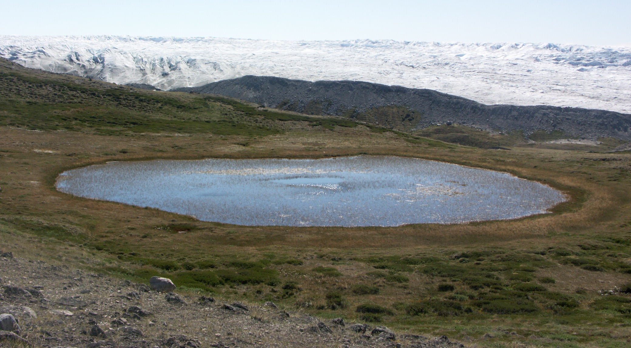
Isunngua (old spelling: ''Isúngua'') is a highland in the Qeqqata municipality in central-western Greenland, located immediately west of the Greenland Ice Sheet edge. In large part it is covered by the tundra, although in the immediate vicinity of the Sermersuaq ice sheet it gradually becomes exposed, barren, and largely devoid of life. The climate is polar continental, with the area receiving very little rainfall. Isunngua is a calving site for reindeer. Geography Isunngua is notable for a gravel road which leads through it towards the edge of the Greenland Ice Sheet, located east of Kangerlussuaq, and due to trivial approach it remains a popular tourist target, although very few hikers make the journey on foot, or explore the neighboring glaciers. The highland is bounded from the north by the Isunnguata Sermia glacier, from the south by Russell Glacier and Aajuitsup Tasia lake, and from the west by Sanningasoq twin lake. Both glaciers flow to the west from the ice sh ... [...More Info...] [...Related Items...] OR: [Wikipedia] [Google] [Baidu] |
Russell Glacier (Greenland)
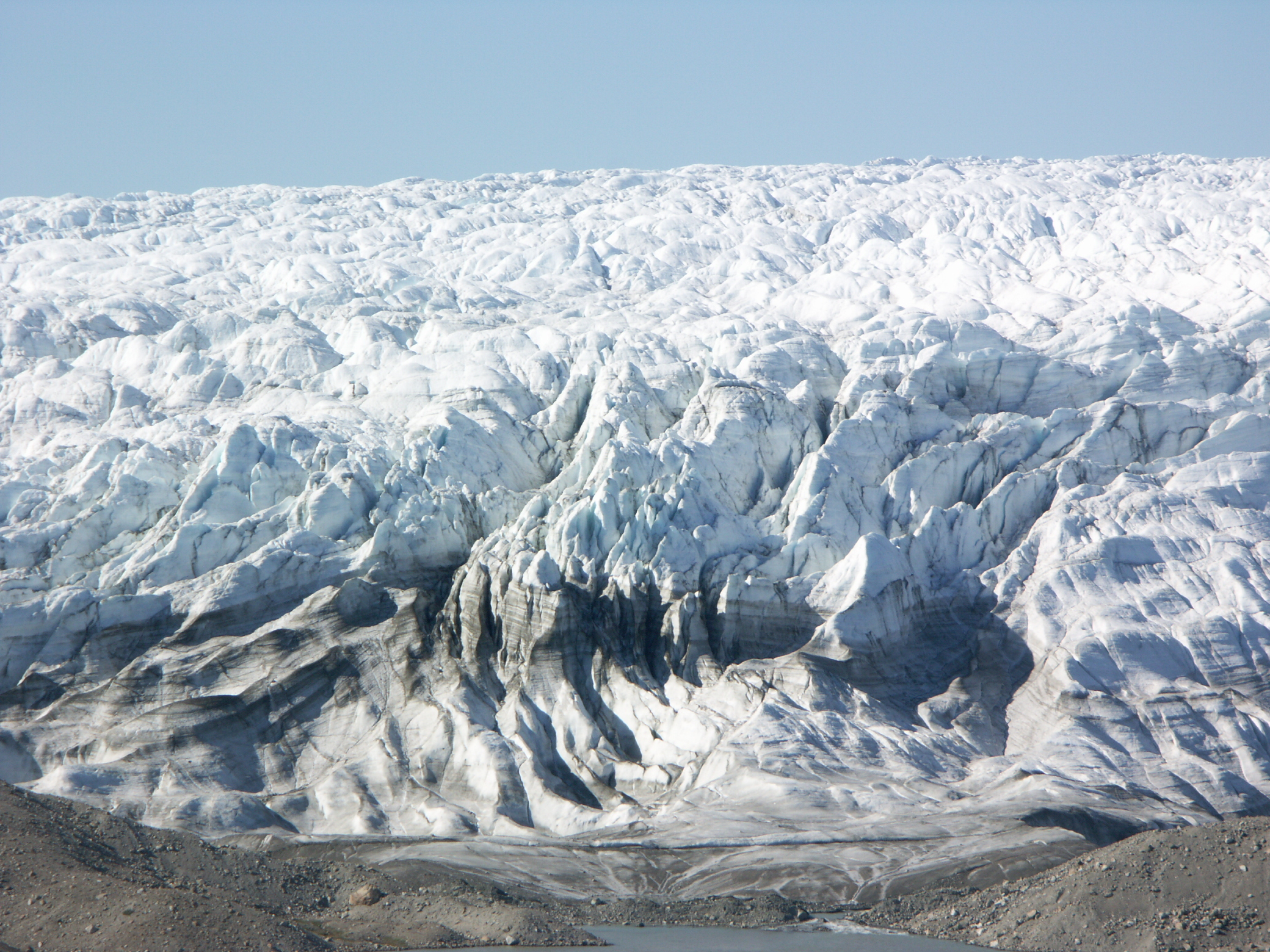
Russell Glacier ( da, Russells Gletscher) is a glacier in the Qeqqata municipality in central-western Greenland. It flows from the Greenland ice sheet ( kl, Sermersuaq) in the western direction. The front of the glacier is located east of Kangerlussuaq. It is active, advancing every year, and, due to easy access from Kangerlussuaq, it remains a popular place for tourists to visit. Geography The ice sheet outflow ending in Russell Glacier is bounded on the north by the tundra highland of Isunngua and on the south by an exposed, barren, flattened ridge of Akuliarusiarsuk. Several meltwater outflow streams from the base of the glacier form the Akuliarusiarsuup Kuua river, which flows west-southwest towards Kangerlussuaq. The sandur basin of the outflow river forming the valley of the same name ( da, Sandflugtdalen) is very shallow; shallow enough to form quicksand fields several kilometers long. Directly to the west of the glacier is a large lake, the 2x10km Aajuitsup Tasia. ... [...More Info...] [...Related Items...] OR: [Wikipedia] [Google] [Baidu] |
Kangerlussuaq
Kangerlussuaq (; ; da, Søndre Strømfjord), is a settlement in western Greenland in the Qeqqata municipality located at the head of the fjord of the same name. It is Greenland's main air transport hub and the site of Greenland's largest commercial airport. The airport dates from American settlement during and after World War II, when the site was known as Bluie West-8 and then Sondrestrom Air Base. The Kangerlussuaq area is also home to Greenland's most diverse terrestrial fauna, including muskoxen, caribou, and gyrfalcons. The settlement's economy and population of 508 is almost entirely reliant on the airport and tourist industry. Geography Kangerlussuaq occupies an alluvial flatland on the far end of the 190 km long Kangerlussuaq Fjord, straddling both sides of the Qinnguata Kuussua river estuary. East of Kangerlussuaq there is a confluence of the two major regional rivers, the Qinnguata Kuussua and Akuliarusiarsuup Kuua. The valley of the latter forms large quicksa ... [...More Info...] [...Related Items...] OR: [Wikipedia] [Google] [Baidu] |
Sanningasoq
Sanningasoq (old spelling: ''Sáningassoq'') is a large oligotrophic twin lake in central-western , in the |
Kettle (landform)
A kettle (also known as a kettle lake, kettle hole, or pothole) is a depression/hole in an outwash plain formed by retreating glaciers or draining floodwaters. The kettles are formed as a result of blocks of dead ice left behind by retreating glaciers, which become surrounded by sediment deposited by meltwater streams as there is increased friction. The ice becomes buried in the sediment and when the ice melts, a depression is left called a kettle hole, creating a dimpled appearance on the outwash plain. Lakes often fill these kettles; these are called kettle hole lakes. Another source is the sudden drainage of an ice-dammed lake. When the block melts, the hole it leaves behind is a kettle. As the ice melts, ramparts can form around the edge of the kettle hole. The lakes that fill these holes are seldom more than deep and eventually fill with sediment. In acid conditions, a kettle bog may form but in alkaline conditions, it will be kettle peatland. Overview Kettles are fluviog ... [...More Info...] [...Related Items...] OR: [Wikipedia] [Google] [Baidu] |
Skanska
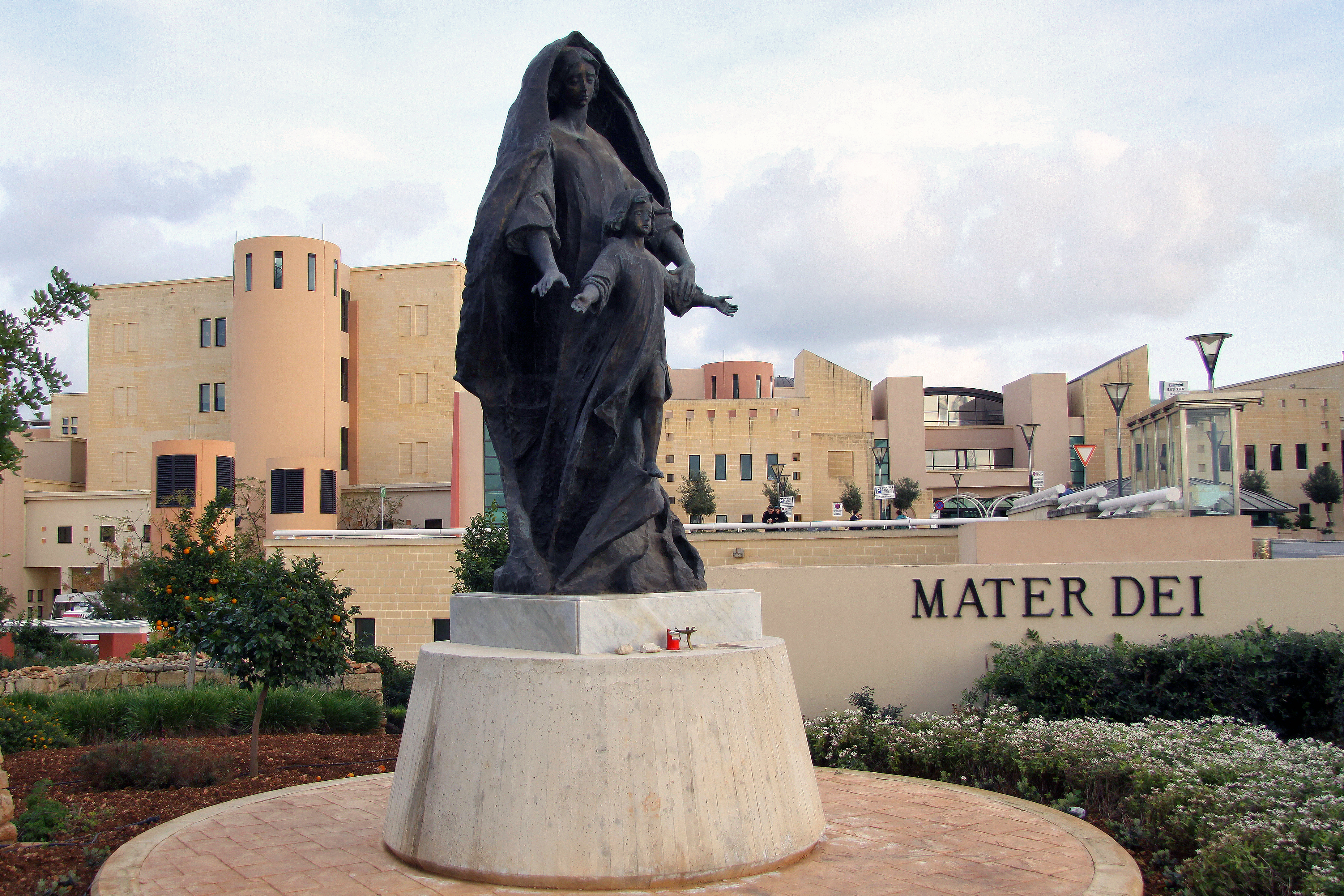
Skanska AB () is a multinational construction and development company based in Sweden. Skanska is the fifth-largest construction company in the world according to ''Construction Global'' magazine. Notable Skanska projects include renovation of the United Nations Headquarters, the World Trade Center Transportation Hub project, Moynihan Train Hall, 30 St Mary Axe, MetLife Stadium, Mater Dei Hospital, among others. History Aktiebolaget Skånska Cementgjuteriet (Scanian Cement Casting Ltd) was established in Malmö, Sweden, in 1887 by Rudolf Fredrik Berg and started by manufacturing concrete products.Skanska: History It quickly diversified into a construction company and within ten years the company received its first international order. The company played an important role in building Sweden's infrastructure i ... [...More Info...] [...Related Items...] OR: [Wikipedia] [Google] [Baidu] |
Aajuitsup Tasia
Aajuitsup Tasia (old spelling: ''Aujuitsup Tasia'') is a large lake in central-western Greenland, in the Qeqqata municipality. It is located approximately northeast of Kangerlussuaq. It is of elongated oval shape, with its western shore at and its eastern shore at . Aajuitsup Tasia is an oligotrophic lake of depth, covering an area of 1,350ha. Geography The 2x10 km lake is separated from the Akuliarusiarsuup Kuua valley and Kangerlussuaq in the south by a low tundra ridge − part of the Kangaamiut dike swarm. To the west lies a sibling Sanningasoq twin lake. To the north-east lies the wide highland of Isunngua. The surface of Aajuitsup Tasia is almost level with the surface of the neighboring meltwater lake, an outflow of Russell Glacier. The altitude differential produces an outflowing boggy stream flowing from Aajuitsup Tasia to the unnamed meltwater lake, allowing Aajuitsup Tasia to retain its freshwater character despite being directly in the glacier outflow path. ... [...More Info...] [...Related Items...] OR: [Wikipedia] [Google] [Baidu] |
Kettle (landform)
A kettle (also known as a kettle lake, kettle hole, or pothole) is a depression/hole in an outwash plain formed by retreating glaciers or draining floodwaters. The kettles are formed as a result of blocks of dead ice left behind by retreating glaciers, which become surrounded by sediment deposited by meltwater streams as there is increased friction. The ice becomes buried in the sediment and when the ice melts, a depression is left called a kettle hole, creating a dimpled appearance on the outwash plain. Lakes often fill these kettles; these are called kettle hole lakes. Another source is the sudden drainage of an ice-dammed lake. When the block melts, the hole it leaves behind is a kettle. As the ice melts, ramparts can form around the edge of the kettle hole. The lakes that fill these holes are seldom more than deep and eventually fill with sediment. In acid conditions, a kettle bog may form but in alkaline conditions, it will be kettle peatland. Overview Kettles are fluviog ... [...More Info...] [...Related Items...] OR: [Wikipedia] [Google] [Baidu] |
Turbidity
Turbidity is the cloudiness or haziness of a fluid caused by large numbers of individual particles that are generally invisible to the naked eye, similar to smoke in air. The measurement of turbidity is a key test of water quality. Fluids can contain suspended solid matter consisting of particles of many different sizes. While some suspended material will be large enough and heavy enough to settle rapidly to the bottom of the container if a liquid sample is left to stand (the settable solids), very small particles will settle only very slowly or not at all if the sample is regularly agitated or the particles are colloidal. These small solid particles cause the liquid to appear turbid. Turbidity (or haze) is also applied to transparent solids such as glass or plastic. In plastic production, haze is defined as the percentage of light that is deflected more than 2.5° from the incoming light direction. Causes and effects Turbidity in open water may be caused by growth of phyto ... [...More Info...] [...Related Items...] OR: [Wikipedia] [Google] [Baidu] |
Danish Language
Danish (; , ) is a North Germanic language spoken by about six million people, principally in and around Denmark. Communities of Danish speakers are also found in Greenland, the Faroe Islands, and the northern German region of Southern Schleswig, where it has minority language status. Minor Danish-speaking communities are also found in Norway, Sweden, the United States, Canada, Brazil, and Argentina. Along with the other North Germanic languages, Danish is a descendant of Old Norse, the common language of the Germanic peoples who lived in Scandinavia during the Viking Era. Danish, together with Swedish, derives from the ''East Norse'' dialect group, while the Middle Norwegian language (before the influence of Danish) and Norwegian Bokmål are classified as ''West Norse'' along with Faroese and Icelandic. A more recent classification based on mutual intelligibility separates modern spoken Danish, Norwegian, and Swedish as "mainland (or ''continental'') Scandinavian", while I ... [...More Info...] [...Related Items...] OR: [Wikipedia] [Google] [Baidu] |
Greenlandic Language
Greenlandic ( kl, kalaallisut, link=no ; da, grønlandsk ) is an Eskimo–Aleut language with about 56,000 speakers, mostly Greenlandic Inuit in Greenland. It is closely related to the Inuit languages in Canada such as Inuktitut. It is the most widely spoken Eskimo–Aleut language. Greenlandic has been the sole official language of the Greenlandic autonomous territory since June 2009, which is a move by the Naalakkersuisut, the government of Greenland, to strengthen the language in its competition with the colonial language, Danish. The main variety is Kalaallisut, or West Greenlandic. The second variety is Tunumiit oraasiat, or East Greenlandic. The language of the Thule Inuit of Greenland, Inuktun or Polar Eskimo, is a recent arrival and a dialect of Inuktitut. Greenlandic is a polysynthetic language that allows the creation of long words by stringing together roots and suffixes. The language's morphosyntactic alignment is ergative, treating both the argument (subject) ... [...More Info...] [...Related Items...] OR: [Wikipedia] [Google] [Baidu] |
Europe
Europe is a large peninsula conventionally considered a continent in its own right because of its great physical size and the weight of its history and traditions. Europe is also considered a Continent#Subcontinents, subcontinent of Eurasia and it is located entirely in the Northern Hemisphere and mostly in the Eastern Hemisphere. Comprising the westernmost peninsulas of Eurasia, it shares the continental landmass of Afro-Eurasia with both Africa and Asia. It is bordered by the Arctic Ocean to the north, the Atlantic Ocean to the west, the Mediterranean Sea to the south and Asia to the east. Europe is commonly considered to be Boundaries between the continents of Earth#Asia and Europe, separated from Asia by the drainage divide, watershed of the Ural Mountains, the Ural (river), Ural River, the Caspian Sea, the Greater Caucasus, the Black Sea and the waterways of the Turkish Straits. "Europe" (pp. 68–69); "Asia" (pp. 90–91): "A commonly accepted division between Asia and E ... [...More Info...] [...Related Items...] OR: [Wikipedia] [Google] [Baidu] |
Finland
Finland ( fi, Suomi ; sv, Finland ), officially the Republic of Finland (; ), is a Nordic country in Northern Europe. It shares land borders with Sweden to the northwest, Norway to the north, and Russia to the east, with the Gulf of Bothnia to the west and the Gulf of Finland across Estonia to the south. Finland covers an area of with a population of 5.6 million. Helsinki is the capital and largest city, forming a larger metropolitan area with the neighbouring cities of Espoo, Kauniainen, and Vantaa. The vast majority of the population are ethnic Finns. Finnish, alongside Swedish, are the official languages. Swedish is the native language of 5.2% of the population. Finland's climate varies from humid continental in the south to the boreal in the north. The land cover is primarily a boreal forest biome, with more than 180,000 recorded lakes. Finland was first inhabited around 9000 BC after the Last Glacial Period. The Stone Age introduced several differ ... [...More Info...] [...Related Items...] OR: [Wikipedia] [Google] [Baidu] |


