|
Italy–Switzerland Border
The border between the modern states of Switzerland and Italy extends for , from the French-Swiss-Italian tripoint at Mont Dolent in the west to the Austrian-Swiss-Italian tripoint near Piz Lad in the east. Much of the border runs across the High Alps, rising above as it passes east of Dufourspitze, but it also descends to the lowest point in Switzerland as it passes Lago Maggiore at below . It is the longest border of both Italy and of Switzerland. History The border is a product of the Napoleonic period, established with the provisional constitution of the Helvetic Republic of 15 January 1798, restored in 1815. While this border existed as a border of Switzerland from 1815, there was only a unified Italian state to allow the existence of a "Swiss-Italian border" with the formation of the Kingdom of Italy in 1861, it previously comprised the borders between Switzerland and the Kingdom of Sardinia, the Kingdom of Lombardy–Venetia and the province of Cisleithania of Austria- ... [...More Info...] [...Related Items...] OR: [Wikipedia] [Google] [Baidu] |
Ascona Depuis Monte Cimetta
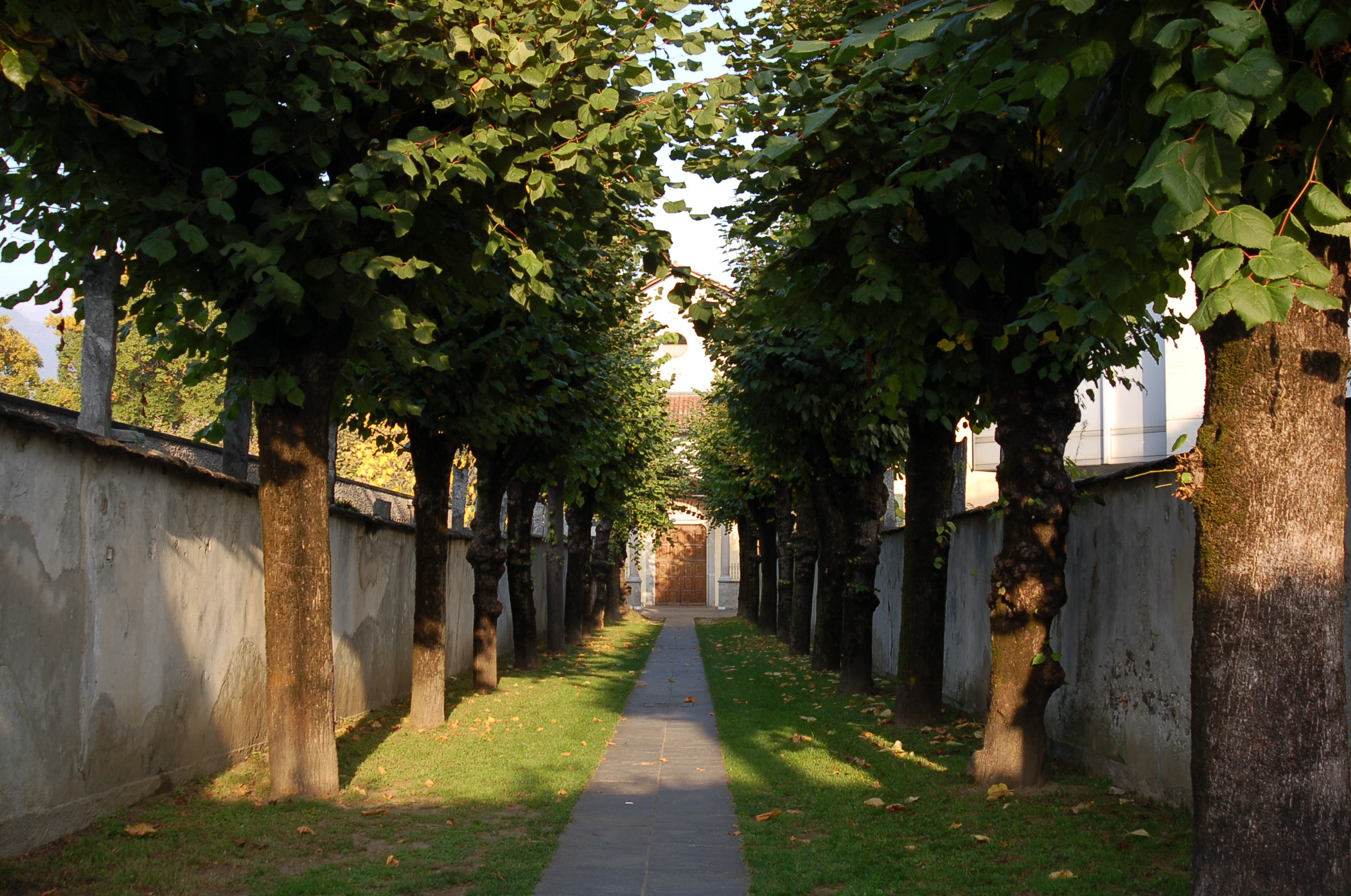
300px, Ascona Ascona ( lmo, label= Ticinese, Scona ) is a municipality in the district of Locarno in the canton of Ticino in Switzerland. It is located on the shore of Lake Maggiore. The town is a popular tourist destination and holds the yearly Ascona Jazz Festival. History Prehistory The oldest archaeological finds in Ascona (at S. Materno and S. Michele) go back to the beginnings of the Late Bronze Age. During the expansion of the cemetery in 1952, a necropolis was discovered at S. Materno, where 21 cremation urns were discovered. The urns were either simply buried or covered with a stone slab box. They contained cremated bones and, in some cases, bronze grave goods. Of particular interest are the bronze brooches, which are among the oldest that have been found so far in Switzerland. They also provide important evidence for the relationship of this area to the cultures of the Italian Peninsula. The grave goods have similarities with those from the final phase of the so-ca ... [...More Info...] [...Related Items...] OR: [Wikipedia] [Google] [Baidu] |
Cisleithania
Cisleithania, also ''Zisleithanien'' sl, Cislajtanija hu, Ciszlajtánia cs, Předlitavsko sk, Predlitavsko pl, Przedlitawia sh-Cyrl-Latn, Цислајтанија, Cislajtanija ro, Cisleithania uk, Цислейтанія, Tsysleitaniia it, Cisleitania , officially The Kingdoms and Lands Represented in the Imperial Council, () was the northern and western part of Austria-Hungary, the Dual Monarchy created in the Compromise of 1867—as distinguished from ''Transleithania'' (i.e., the Hungarian Lands of the Crown of Saint Stephen east of beyond"the Leitha River). This name for the region was a common, but unofficial one. The Cisleithanian capital was Vienna, the residence of the Austrian emperor. The territory had a population of 28,571,900 in 1910. It reached from Vorarlberg in the west to the Kingdom of Galicia and Lodomeria and the Duchy of Bukovina (today part of Ukraine and Romania) in the east, as well as from the Kingdom of Bohemia in the north to the Kingdom of Dalmatia (t ... [...More Info...] [...Related Items...] OR: [Wikipedia] [Google] [Baidu] |
Grand Golliat
The Grand Golliat (also spelled ''Grand Golliaz'') is a mountain of the Pennine Alps, located between the Petit Col Ferret and the Great St. Bernard Pass. At 3,238 metres above sea level, its summit straddles the border between Switzerland and Italy, separating the Swiss canton of Valais from the Italian region of Aosta Valley , Valdostan or Valdotainian it, Valdostano (man) it, Valdostana (woman)french: Valdôtain (man)french: Valdôtaine (woman) , population_note = , population_blank1_title = Official languages , population_blank1 = Italian French .... The name ''Golliat'' comes from "gouilles" or small lakes located on the Italian side of the mountain. orsieres.ch. Retrieved on 2011-10-18 The Grand Golliat is the southernmost mountain rising ... [...More Info...] [...Related Items...] OR: [Wikipedia] [Google] [Baidu] |
South Tyrol
it, Provincia Autonoma di Bolzano – Alto Adige lld, Provinzia Autonoma de Balsan/Bulsan – Südtirol , settlement_type = Autonomous province , image_skyline = , image_alt = , image_caption = , image_flag = Flag_of_South_Tyrol.svg , flag_alt = , image_shield = Suedtirol CoA.svg , shield_size = x100px , shield_alt = Coat of arms of Tyrol , anthem = , image_map = Bolzano in Italy.svg , map_alt = , map_caption = Map highlighting the location of the province of South Tyrol in Italy (in red) , coordinates = , coordinates_footnotes = , subdivision_type = Country , subdivision_name = Italy , subdivision_type1 = R ... [...More Info...] [...Related Items...] OR: [Wikipedia] [Google] [Baidu] |
Grisons
The Grisons () or Graubünden,Names include: *german: (Kanton) Graubünden ; * Romansh: ** rm, label= Sursilvan, (Cantun) Grischun ** rm, label=Vallader, (Chantun) Grischun ** rm, label= Puter, (Chantun) Grischun ** rm, label=Surmiran, (Cantun) Grischun ** rm, label= Sutsilvan, (Cantùn) Grischùn ** rm, label=Rumantsch Grischun, (Chantun) Grischun; * it, (Cantone dei) Grigioni ; *french: (Canton des) Grisons . See also other names. more formally the Canton of the Grisons or the Canton of Graubünden, is one of the twenty-six cantons of Switzerland. It has eleven regions, and its capital is Chur. The German name of the canton, , translates as the "Grey Leagues", referring to the canton's origin in three local alliances, the Three Leagues. The other native names also refer to the Grey League: in Sutsilvan, in the other forms of Romansh, and in Italian. ''" Rhaetia"'' is the Latin name for the area. The Alpine ibex is the canton's heraldic symbol. The largest and easter ... [...More Info...] [...Related Items...] OR: [Wikipedia] [Google] [Baidu] |
Lombardy
Lombardy ( it, Lombardia, Lombard language, Lombard: ''Lombardia'' or ''Lumbardia' '') is an administrative regions of Italy, region of Italy that covers ; it is located in the northern-central part of the country and has a population of about 10 million people, constituting more than one-sixth of Italy's population. Over a fifth of the Italian gross domestic product (GDP) is produced in the region. The Lombardy region is located between the Alps mountain range and tributaries of the Po river, and includes Milan, the largest metropolitan area in the country, and among the largest in the European Union (EU). Of the fifty-eight UNESCO World Heritage Sites in Italy, eleven are in Lombardy. Virgil, Pliny the Elder, Ambrose, Gerolamo Cardano, Caravaggio, Claudio Monteverdi, Antonio Stradivari, Cesare Beccaria, Alessandro Volta and Alessandro Manzoni; and popes Pope John XXIII, John XXIII and Pope Paul VI, Paul VI originated in the area of modern-day Lombardy region. Etymology The name ... [...More Info...] [...Related Items...] OR: [Wikipedia] [Google] [Baidu] |
Ticino
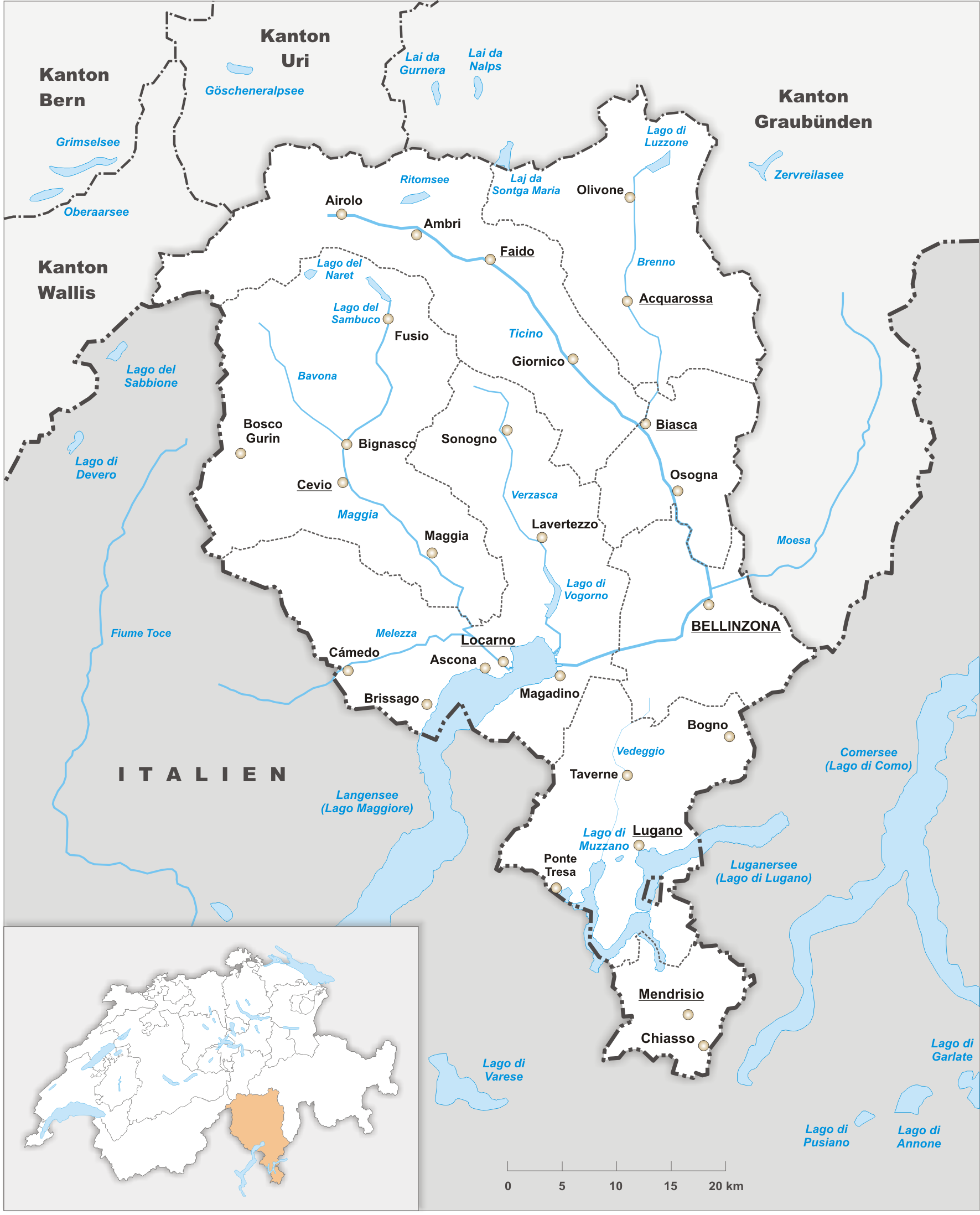
Ticino (), sometimes Tessin (), officially the Republic and Canton of Ticino or less formally the Canton of Ticino,, informally ''Canton Ticino'' ; lmo, Canton Tesin ; german: Kanton Tessin ; french: Canton du Tessin ; rm, Chantun dal Tessin . is one of the 26 cantons forming the Swiss Confederation. It is composed of eight districts and its capital city is Bellinzona. It is also traditionally divided into the Sopraceneri and the Sottoceneri, respectively north and south of Monte Ceneri. Red and blue are the colours of its flag. Ticino is the southernmost canton of Switzerland. It is one of the three large southern Alpine cantons, along with Valais and the Grisons. However, unlike all other cantons, it lies almost entirely south of the Alps, and has no natural access to the Swiss Plateau. Through the main crest of the Gotthard and adjacent mountain ranges, it borders the canton of Valais to the northwest, the canton of Uri to the north and the canton of Grisons to the northea ... [...More Info...] [...Related Items...] OR: [Wikipedia] [Google] [Baidu] |
Piedmont
it, Piemontese , population_note = , population_blank1_title = , population_blank1 = , demographics_type1 = , demographics1_footnotes = , demographics1_title1 = , demographics1_info1 = , demographics1_title2 = , demographics1_info2 = , demographics1_title3 = , demographics1_info3 = , timezone1 = CET , utc_offset1 = +1 , timezone1_DST = CEST , utc_offset1_DST = +2 , postal_code_type = , postal_code = , area_code_type = ISO 3166 code , area_code = IT-21 , blank_name_sec1 = GDP (nominal) , blank_info_sec1 = €137 billion (2018) , blank1_name_sec1 = GDP per capita , blank1_info_sec1 = €31,500 (2018) , blank2_name_sec1 = HDI (2019) , blank2_info_sec1 = 0.898 · 10th of 21 , blank_name_sec2 = NUTS Region , blank_info_sec2 = ITC1 , website www.regione ... [...More Info...] [...Related Items...] OR: [Wikipedia] [Google] [Baidu] |
Aosta Valley
, Valdostan or Valdotainian it, Valdostano (man) it, Valdostana (woman)french: Valdôtain (man)french: Valdôtaine (woman) , population_note = , population_blank1_title = Official languages , population_blank1 = Italian French , demographics_type1 = Citizenship , demographics1_footnotes = , demographics1_title1 = Italian , demographics1_info1 = 95% , demographics1_title2 = , demographics1_info2 = , demographics1_title3 = , demographics1_info3 = , timezone1 = CET , utc_offset1 = +1 , timezone1_DST = CEST , utc_offset1_DST = +2 , postal_code_type = , postal_code = , area_code_type = ISO 3166 code , area_code = IT-23 , blank_name_sec1 = GDP (nominal) , blank_info_sec1 = €4.9 billion (2018) , blank1_name_sec1 = GDP per capita , blank1_info_sec1 = €38,900 (2018) , blank2_name_sec1 = HDI ... [...More Info...] [...Related Items...] OR: [Wikipedia] [Google] [Baidu] |
Valais
Valais ( , , ; frp, Valês; german: Wallis ), more formally the Canton of Valais,; german: Kanton Wallis; in other official Swiss languages outside Valais: it, (Canton) Vallese ; rm, (Chantun) Vallais. is one of the cantons of Switzerland, 26 cantons forming the Switzerland, Swiss Confederation. It is composed of thirteen districts and its capital and largest city is Sion, Switzerland, Sion. The flag of the canton is made of thirteen stars representing the districts, on a white-red background. Valais is situated in the southwestern part of Switzerland, the country. It borders the cantons of Canton of Vaud, Vaud and Canton of Bern, Bern to the north, the cantons of Canton of Uri, Uri and Ticino to the east, as well as Italy to the south and France to the west. It is one of the three large southern Alps, Alpine cantons, along with Ticino and the Grisons, which encompass a vast diversity of ecosystems. It is a bilingual canton, French language, French and German language, German ... [...More Info...] [...Related Items...] OR: [Wikipedia] [Google] [Baidu] |
Swisstopo
Swisstopo is the official name for the Swiss Federal Office of Topography (in German language, German: ''Bundesamt für Landestopografie''; French language, French: ''Office fédéral de topographie''; Italian language, Italian: ''Ufficio federale di topografia''; Romansh language, Romansh: ''Uffizi federal da topografia''), Switzerland's national mapping agency. The current name was made official in 2002. It had been in use as the domain name for the institute's homepage, swisstopo.ch, since 1997. Maps The main class of products produced by Swisstopo are topographical maps on seven different Scale (map), scales. Swiss maps have been praised for their accuracy and quality. Regular maps * 1:25.000. This is the most detailed map, useful for many purposes. Those are popular with tourists, especially for famous areas like Zermatt and St. Moritz. These maps cost CHF 13.50 each (2004). 208 maps on this scale are published at regular intervals. The first map published on this scale ... [...More Info...] [...Related Items...] OR: [Wikipedia] [Google] [Baidu] |
European Union Customs Union
The European Union Customs Union (EUCU), formally known as the Community Customs Union, is a customs union which consists of all the member states of the European Union (EU), Monaco, and the British Overseas Territory of Akrotiri and Dhekelia. Some detached territories of EU states do not participate in the customs union, usually as a result of their geographic separation. In addition to the EUCU, the EU is in customs unions with Andorra, San Marino and Turkey (with the exceptions of certain goods), through separate bilateral agreements.Customs unions, Taxation and Customs Union European Commission. Retrieved 20 August 2016. There are no [...More Info...] [...Related Items...] OR: [Wikipedia] [Google] [Baidu] |


