|
Interstate 70 (Missouri)
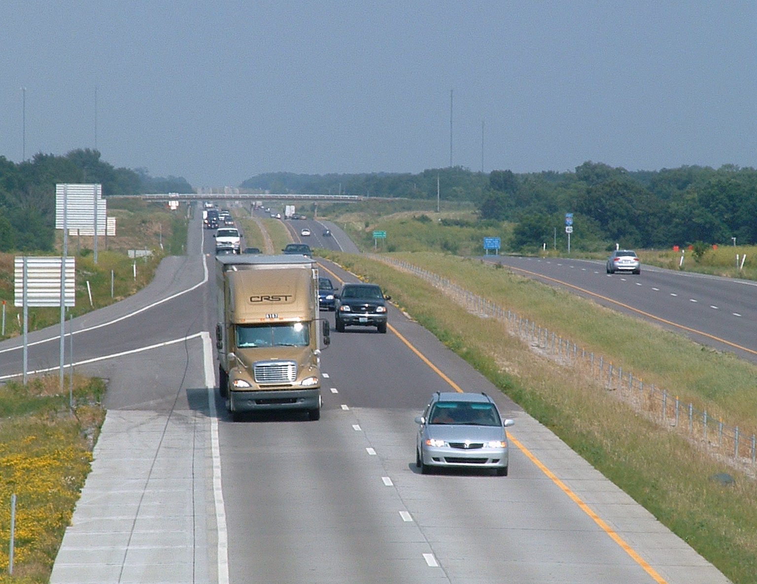
Interstate 70 (I-70) in the US state of Missouri is generally parallel to the Missouri River. This section of the transcontinental Interstate begins at the Kansas state line on the Lewis and Clark Viaduct, running concurrently with U.S. Route 24 (US 24), US 40, and US 169, and the east end is on the Stan Musial Veterans Memorial Bridge in St. Louis. Route description Crossing into Missouri on the Lewis and Clark Viaduct, I-70 immediately encounters the Alphabet Loop, a small but complex loop of freeways with all of its exits having the number 2 and a letter suffix that uses the entire alphabet (except I, O, and Z). I-70 runs concurrently with I-35 once it enters into the Loop. Both Interstates maintain the concurrency until they approach the northeastern corner of the Loop. Back at the northwest corner, US 169 splits off to the north, leaving four routes concurrent with each other. There is a large interchange with Route 9 in the ... [...More Info...] [...Related Items...] OR: [Wikipedia] [Google] [Baidu] |
Kansas
Kansas () is a state in the Midwestern United States. Its capital is Topeka, and its largest city is Wichita. Kansas is a landlocked state bordered by Nebraska to the north; Missouri to the east; Oklahoma to the south; and Colorado to the west. Kansas is named after the Kansas River, which in turn was named after the Kansa Native Americans who lived along its banks. The tribe's name (natively ') is often said to mean "people of the (south) wind" although this was probably not the term's original meaning. For thousands of years, what is now Kansas was home to numerous and diverse Native American tribes. Tribes in the eastern part of the state generally lived in villages along the river valleys. Tribes in the western part of the state were semi-nomadic and hunted large herds of bison. The first Euro-American settlement in Kansas occurred in 1827 at Fort Leavenworth. The pace of settlement accelerated in the 1850s, in the midst of political wars over the slavery debate. Wh ... [...More Info...] [...Related Items...] OR: [Wikipedia] [Google] [Baidu] |
Missouri
Missouri is a U.S. state, state in the Midwestern United States, Midwestern region of the United States. Ranking List of U.S. states and territories by area, 21st in land area, it is bordered by eight states (tied for the most with Tennessee): Iowa to the north, Illinois, Kentucky and Tennessee to the east, Arkansas to the south and Oklahoma, Kansas and Nebraska to the west. In the south are the Ozarks, a forested highland, providing timber, minerals, and recreation. The Missouri River, after which the state is named, flows through the center into the Mississippi River, which makes up the eastern border. With more than six million residents, it is the List of U.S. states and territories by population, 19th-most populous state of the country. The largest urban areas are St. Louis, Kansas City, Missouri, Kansas City, Springfield, Missouri, Springfield and Columbia, Missouri, Columbia; the Capital city, capital is Jefferson City, Missouri, Jefferson City. Humans have inhabited w ... [...More Info...] [...Related Items...] OR: [Wikipedia] [Google] [Baidu] |
Kansas City Royals
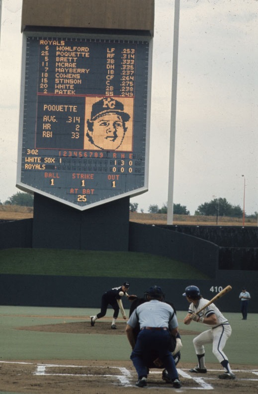
The Kansas City Royals are an American professional baseball team based in Kansas City, Missouri. The Royals compete in Major League Baseball (MLB) as a member club of the American League (AL) Central division. The team was founded as an expansion franchise in 1969, and has played in four World Series, winning in 1985 and 2015, and losing in 1980 and 2014. Outside of a dominant 10 year stretch between 1976 to 1985, and a brief, albeit dominant resurgence from 2014 to 2015, the Royals have been one of the worst franchises in baseball, missing the playoffs 34 of the previous 36 years. The name "Royals" pays homage to the American Royal, a livestock show, horse show, rodeo, and championship barbecue competition held annually in Kansas City since 1899, as well as the identical names of two former Negro league baseball teams that played in the first half of the 20th century. (One a semi-pro team based in Kansas City in the 1910s and 1920s that toured the Midwest and a California ... [...More Info...] [...Related Items...] OR: [Wikipedia] [Google] [Baidu] |
Kansas City Metropolitan Area
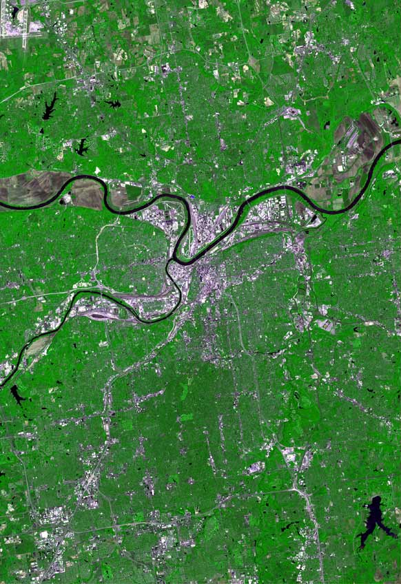
The Kansas City metropolitan area is a bi-state metropolitan area anchored by Kansas City, Missouri. Its 14 counties straddle the border between the U.S. states of Missouri (9 counties) and Kansas (5 counties). With and a population of more than 2.2 million people, it is the second-largest metropolitan area centered in Missouri (after Greater St. Louis) and is the largest metropolitan area in Kansas, though Wichita is the largest metropolitan area centered in Kansas. Alongside Kansas City, Missouri, these are the suburbs with populations above 100,000: Overland Park, Kansas; Kansas City, Kansas; Olathe, Kansas; Independence, Missouri; and Lee's Summit, Missouri. Business enterprises and employers include Cerner Corporation (the largest, with almost 10,000 local employees and about 20,000 global employees), AT&T Inc., AT&T, BNSF Railway, GEICO, Asurion, T-Mobile (formerly Sprint Corporation, Sprint), Black & Veatch, AMC Theatres, Citigroup, Garmin, Hallmark Cards, Macquarie Grou ... [...More Info...] [...Related Items...] OR: [Wikipedia] [Google] [Baidu] |
Beltway
A ring road (also known as circular road, beltline, beltway, circumferential (high)way, loop, bypass or orbital) is a road or a series of connected roads encircling a town, city, or country. The most common purpose of a ring road is to assist in reducing traffic volumes in the urban centre, such as by offering an alternate route around the city for drivers who do not need to stop in the city core. Ring roads can also serve to connect suburbs to each other, allowing efficient travel between them. Nomenclature The name "ring road" is used for the majority of metropolitan circumferential routes in Europe, such as the Berliner Ring, the Brussels Ring, the Amsterdam Ring, the Boulevard Périphérique around Paris and the Leeds Inner and Outer ring roads. Australia, Pakistan and India also use the term ring road, as in Melbourne's Western Ring Road, Lahore's Lahore Ring Road and Hyderabad's Outer Ring Road. In Canada the term is the most commonly used, with "orbital" also used, ... [...More Info...] [...Related Items...] OR: [Wikipedia] [Google] [Baidu] |
Interstate 670 (Kansas–Missouri)
Interstate 670 (I-670) is a connector highway between I-70 in Kansas City, Kansas, and I-70 in Kansas City, Missouri. The highway provides a more direct route through Downtown Kansas City than the older mainline I-70 and avoids the sharp turn (and reduced speed limit) of the latter at the west end of the Intercity Viaduct. I-670 also makes up the south side of Kansas City's Downtown Loop, where it passes under the southern half of the Kansas City Convention Center. The road crosses the Kansas River and the West Bottoms, the former location of the Kansas City Stockyards, on the I-670 Viaduct. The leg of the highway west of I-35 is known as the Jay B. Dillingham Freeway. Jay B. Dillingham was a former president of the Stockyards. Route description I-670 begins in Kansas City, Kansas, as ramps from I-70/ U.S. Route 24 (US 24)/ US 40/ US 169 meet to form the freeway just before a bridge over the Kansas River, which is located just south of its confluen ... [...More Info...] [...Related Items...] OR: [Wikipedia] [Google] [Baidu] |
Interstate 29 In Missouri
Interstate 29 (I-29) is a north–south Interstate Highway in the Midwestern United States that begins in Missouri. It travels through the Kansas City and St. Joseph metropolitan areas before exiting the state and entering Iowa. Almost all of I-29 in Missouri lies in an area called the Platte Purchase that was not originally part of Missouri when the state entered the Union in 1821. Route description I-29 begins at I-70 in Kansas City in a concurrency with I-35 and U.S. Route 71 (US 71) at the Downtown Loop. It crosses over the Missouri River via the Bond Bridge. I-29 and I-35 separate in northern Kansas City, with I-29 turning northwest with US 71 running concurrent with it. It passes near Kansas City International Airport and near there is concurrent with I-435. I-29 then exits the Kansas City area. It enters the eastern portion of St. Joseph while downtown St. Joseph is served by I-229, a loop of I-29. After exiting St. Joseph, US 71 separates fro ... [...More Info...] [...Related Items...] OR: [Wikipedia] [Google] [Baidu] |
Missouri Route 9
Route 9 is a highway in the Kansas City, Missouri area. Its northern terminus is at Interstate 29/U.S. Route 71 in Kansas City North; its southern terminus is at Interstate 35/Interstate 70/U.S. Route 24/ U.S. Route 40 in downtown Kansas City. Even though both termini are in Kansas City, it passes through other towns and cities. It is carried across the Missouri River by the Heart of America Bridge between downtown Kansas City, Missouri and North Kansas City, Missouri. In North Kansas City, the highway serves as a main thoroughfare, Burlington Street. History Route 9 was created in 1922 as Route 59 and was renumbered in the early 1930s when US 59 entered Missouri. Junction list References External links 009 009 may refer to: * OO9, gauge model railways * O09, FAA identifier for Round Valley Airport * 0O9, FAA identifier for Ward Field, see List of airports in California * British secret agent 009, see 00 Agent * BA 009, see British Airways Flight 9 * ... [...More Info...] [...Related Items...] OR: [Wikipedia] [Google] [Baidu] |
Interstate 35 In Missouri
Interstate 35 (I-35) is an Interstate Highway that stretches from Laredo, Texas, in the south to Duluth in the north. The portion of it through Missouri travels nearly from just south of Kansas City, through the Downtown Loop, and across the Missouri River before leaving the downtown area. North of Kansas City, the highway travels north-northeast toward the Iowa state line near Eagleville, paralleling U.S. Route 69 (US 69). Route description Kansas City metropolitan area I-35 enters Missouri southwest of Downtown Kansas City as a six-lane highway. After merging with Southwest Trafficway (exit 1A) and Broadway Boulevard (exit 1B), it becomes an eight-lane freeway and continues north to downtown, where it serves as the west and north legs of the Downtown Loop. Along the loop's northern edge, I-35 runs concurrent with I-70 immediately west of Broadway Boulevard and carries six lanes of traffic with a speed limit of . After leaving the loop, I-29 begins, ... [...More Info...] [...Related Items...] OR: [Wikipedia] [Google] [Baidu] |
Exit Number
An exit number is a number assigned to a road junction, usually an exit from a freeway. It is usually marked on the same sign as the destinations of the exit. In some countries, such as the United States, it is also marked on a sign in the gore. Exit numbers typically reset at political borders such as state lines. Some non-freeways use exit numbers. Typically these are rural roads built to expressway standards, and either only the actual exits are numbered, or the at-grade intersections are also numbered. An extreme case of this is in New York City, where the Grand Concourse and Linden Boulevard were given sequential numbers, one per intersection (both boulevards no longer have exit numbers as of 2011). A milder version of this has been recently used on the West Side Highway, also in New York, where only the major intersections are numbered (possibly to match the planned exits on the cancelled Westway freeway). Another case is the Nanaimo Parkway in Nanaimo, British Columbi ... [...More Info...] [...Related Items...] OR: [Wikipedia] [Google] [Baidu] |
Alphabet Loop
The Downtown Loop, also called the Alphabet Loop, is a complex layout of highways in downtown Kansas City, Missouri involving 23 exits, four Interstate Highways, four U.S. Highways and numerous city streets. Each exit in the highway loop is numbered 2 and suffixed with every letter of the alphabet except I, O, and Z (I and O look similar to 1 and 0 on the exit tabs; Z is not needed). The entire circumference of the loop is just over . Description Alphabetically, the letter suffixes begin with A in the northwest corner of the loop and proceed forward in a clockwise direction around the loop. Eastbound on the north side of the loop (EB I-70/NB I-35), one encounters A through G; then H through M southbound on the east side (EB I-70/SB US 71); then N through U westbound on the south side (WB I-670); and finally V through Y northbound on the west side (NB I-35 alone). Interstate 70 enters the southeast corner of the loop and moves north forming the east and north sides of the loop a ... [...More Info...] [...Related Items...] OR: [Wikipedia] [Google] [Baidu] |
Stan Musial Veterans Memorial Bridge
The Stan Musial Veterans Memorial Bridge (known as the New Mississippi River Bridge until its formal naming in 2013 and informally known as the "Stan Span") is a bridge across the Mississippi River in the United States between St. Clair County, Illinois, and the city of St. Louis, Missouri. Built between April 19, 2010, and July 2013, the bridge opened on February 9, 2014. The cable-stayed bridge has a main span of 1,500 feet (457 m). Features The main span of the bridge is in length, part of a total span of . It is wide. Cables stretch from the bridge deck to the tops of two A-shaped towers, which reach above I-70. The new bridge's main span is supported by of stay-cable strand, enough for nearly two round trips from St. Louis to Chicago. Nearly 15,000 tons of structural steel are used, along with 8,600 tons of reinforcing steel. Some of concrete are in the foundation, deck slab, and towers. At its completion, the bridge was the third-longest cable-stayed bridge in ... [...More Info...] [...Related Items...] OR: [Wikipedia] [Google] [Baidu] |


