|
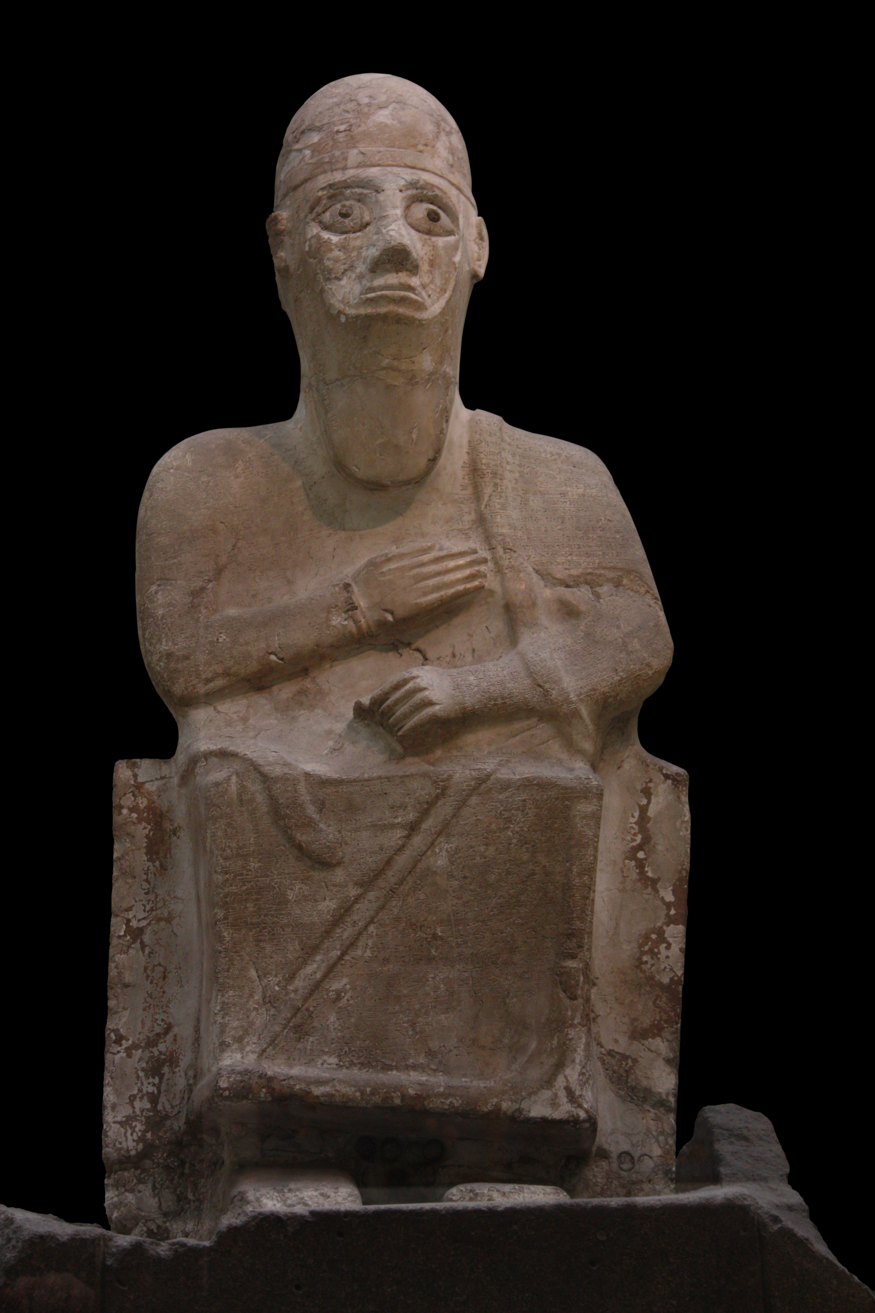
Idrimi Of Alalakh
Idrimi was the king of Alalakh c. 1490–1465 BC, or around 1450 BC. He is known, mainly, from an inscription on his statue found at Alalakh by Leonard Woolley in 1939.Longman III, Tremper, (1991)Fictional Akkadian Autobiography: A Generic and Comparative Study Eisenbraums, Winona Lake, Indiana, p. 60: "...discovered by Sir Leonard Woolley in 1939...Although found in the debris of Level IB (ca. 1200 B.C.), the statue was dated by most scholars back to Level IV (ca. 1500 B.C.)..." According to that inscription, he was a son of Ilim-Ilimma I the king of Halab, now Aleppo, who would have been deposed by the new regional master, Barattarna, king of Mitanni. Idrimi would have succeeded in gaining the throne of Alalakh with the assistance of a group known as the ''Habiru'', founding the kingdom of Mukish as a vassal to the Mitanni state. He also invaded the Hittite territories to the north, resulting in a treaty with the country Kizzuwatna. Jacob Lauinger considers Idrimi as a histori ... [...More Info...] [...Related Items...] OR: [Wikipedia] [Google] [Baidu] |
Statue Of King Idrimi-IMG 4553-black
A statue is a free-standing sculpture in which the realistic, full-length figures of persons or animals are carved or cast in a durable material such as wood, metal or stone. Typical statues are life-sized or close to life-size; a sculpture that represents persons or animals in full figure but that is small enough to lift and carry is a statuette or figurine, whilst one more than twice life-size is a colossal statue. Statues have been produced in many cultures from prehistory to the present; the oldest-known statue dating to about 30,000 years ago. Statues represent many different people and animals, real and mythical. Many statues are placed in public places as public art. The world's tallest statue, ''Statue of Unity'', is tall and is located near the Narmada dam in Gujarat, India. Color Ancient statues often show the bare surface of the material of which they are made. For example, many people associate Greek classical art with white marble sculpture, but there is evidenc ... [...More Info...] [...Related Items...] OR: [Wikipedia] [Google] [Baidu] |
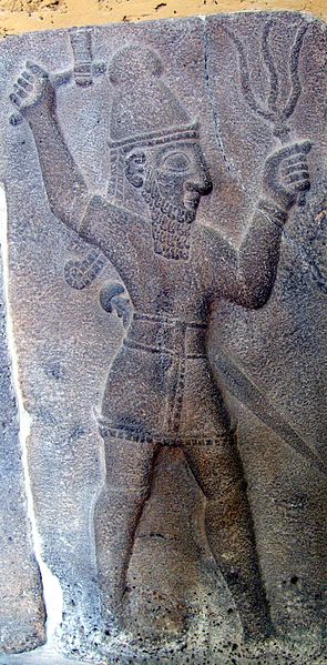
Teshub
Teshub (also written Teshup, Teššup, or Tešup; cuneiform ; hieroglyphic Luwian , read as ''Tarhunzas'';Annick Payne (2014), ''Hieroglyphic Luwian: An Introduction with Original Texts'', 3rd revised edition, Wiesbaden: Harrassowitz Verlag, p. 159. Ugaritic 𐎚𐎘𐎁, ''TṮB'') was the Hurrian god of sky, thunder, and storms. Taru was the name of a similar Hattic storm god, whose mythology and worship as a primary deity continued and evolved through descendant Luwian and Hittite cultures. In these two, Taru was known as ''Tarhun / Tarhunt- / Tarhuwant- / Tarhunta'', names derived from the Anatolian root ''*tarh'' "to defeat, conquer". Taru/Tarhun/Tarhunt was ultimately assimilated into and identified with the Hurrian Teshub around the time of the religious reforms of Muwatalli II, ruler of the Hittite New Kingdom in the early 13th century BCE. [...More Info...] [...Related Items...] OR: [Wikipedia] [Google] [Baidu] |
Slave Treaty Tablet
Slavery and enslavement are both the state and the condition of being a slave—someone forbidden to quit one's service for an enslaver, and who is treated by the enslaver as property. Slavery typically involves slaves being made to perform some form of work while also having their location or residence dictated by the enslaver. Many historical cases of enslavement occurred as a result of breaking the law, becoming indebted, or suffering a military defeat; other forms of slavery were instituted along demographic lines such as race. Slaves may be kept in bondage for life or for a fixed period of time, after which they would be granted freedom. Although slavery is usually involuntary and involves coercion, there are also cases where people voluntarily enter into slavery to pay a debt or earn money due to poverty. In the course of human history, slavery was a typical feature of civilization, and was legal in most societies, but it is now outlawed in most countries of the w ... [...More Info...] [...Related Items...] OR: [Wikipedia] [Google] [Baidu] |
Battle Of Kadesh
The Battle of Kadesh or Battle of Qadesh took place between the forces of the New Kingdom of Egypt under Ramesses II and the Hittite Empire under Muwatalli II at the city of Kadesh on the Orontes River, just upstream of Lake Homs near the modern Lebanon–Syria border. The battle is generally dated to 1274 BC from the Egyptian chronology, and is the earliest pitched battle in recorded history for which details of tactics and formations are known. It is believed to have been the largest chariot battle ever fought, involving between 5,000 and 6,000 chariots in total. As a result of discovery of multiple Kadesh inscriptions and the Egyptian–Hittite peace treaty, it is the best documented battle in all of ancient history. Background After expelling the Hyksos' 15th Dynasty around 1550 BC, the Egyptian New Kingdom rulers became more aggressive in reclaiming control of their state's borders. Thutmose I, Thutmose III and his son and coregent Amenhotep II fought battles from Meg ... [...More Info...] [...Related Items...] OR: [Wikipedia] [Google] [Baidu] |
Ramesses II
Ramesses II ( egy, wikt:rꜥ-ms-sw, rꜥ-ms-sw ''Rīʿa-məsī-sū'', , meaning "Ra is the one who bore him"; ), commonly known as Ramesses the Great, was the third pharaoh of the Nineteenth Dynasty of Egypt. Along with Thutmose III he is often regarded as the greatest, most celebrated, and most powerful pharaoh of the New Kingdom of Egypt, New Kingdom, itself the most powerful period of Ancient Egypt. The name ''Ramesses'' is pronounced variously . Transliteration of Ancient Egyptian, Other spellings include Rameses and Ramses; in grc-koi, Ῥαμέσσης, Rhaméssēs. He is known as Ozymandias in Greek sources ( grc-koi, Ὀσυμανδύας, translit=Osymandýas), from the first part of Ramesses's regnal name, , "The Maat of Ra is powerful, Chosen of Ra". His successors and later Egyptians called him the "Great Ancestor". At age fourteen, he was appointed prince regent by his father, Seti I. Most Egyptologists today believe he assumed the throne on 31 May 1279 BC, bas ... [...More Info...] [...Related Items...] OR: [Wikipedia] [Google] [Baidu] |
Tablet BM131493
Tablet may refer to: Medicine * Tablet (pharmacy), a mixture of pharmacological substances pressed into a small cake or bar, colloquially called a "pill" Computing * Tablet computer, a mobile computer that is primarily operated by touching the screen * Graphics tablet or digitizing tablet, a computer input device for capturing hand-drawn images and graphics * Tablet, a section of columns in a range of rows in Google's Bigtable NoSQL database Confectionery * Tablet (confectionery), a medium-hard, sugary confection from Scotland * Tableting, a confectionery manufacturing process * A type of chocolate bar Inscription, printing, and writing media * Clay tablet, one of the earliest known writing mediums * Wax tablet, used by scribes as far back as ancient Greece * Notebook of blank or lined paper, usually bound with glue or staples along one edge * Stele, slab of stone or wood erected as a monument or marker * ''Tabula ansata'', tablets with handles * Vindolanda tablets, Roman era w ... [...More Info...] [...Related Items...] OR: [Wikipedia] [Google] [Baidu] |
Nuhašše
Nuhašše, also Nuhašša, was a region in northwestern Syria that flourished in the 2nd millennium BC. It was a federacy ruled by different kings who collaborated and probably had a high king. Nuhašše changed hands between different powers in the region such as Egypt, Mitanni and the Hittites. It rebelled against the latter which led Šuppiluliuma I to attack and annex the region. Name, borders and society The name "Nuhašše" is Semitic meaning rich or prosperous. Nuhašše stretched from the Euphrates valley in the east to the Orontes valley in the west between Hamath in the south and Aleppo in the north; it did not include Ebla and it was separated from the Euphrates river by Emar and Ashtata. In the west, it reached the Orontes river only if it included the region of Niya which is debated. The main city was named Ugulzat (possibly modern Khan Shaykhun). Hittite texts mention the "Kings of Nuhašše", indicating that the region consisted of a number of petty kingdoms that ... [...More Info...] [...Related Items...] OR: [Wikipedia] [Google] [Baidu] |
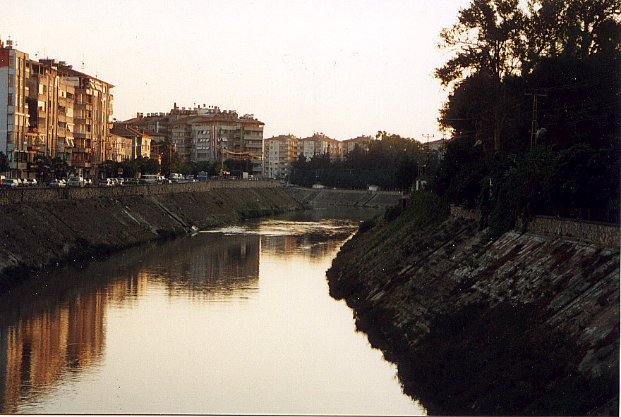
Orontes River
The Orontes (; from Ancient Greek , ) or Asi ( ar, العاصي, , ; tr, Asi) is a river with a length of in Western Asia that begins in Lebanon, flowing northwards through Syria before entering the Mediterranean Sea near Samandağ in Turkey. As the chief river of the northern Levant, the Orontes was the site of several major battles. Among the most important cities on the river are Homs, Hama, Jisr al-Shughur, and Antakya (the ancient Antioch, which was also known as "Antioch on the Orontes"). Names In the 9th century BCE, the ancient Assyrians referred to the river as Arantu, and the nearby Egyptians called it Araunti. The etymology of the name is unknown, yet some sources indicate that it might be derived from ''Arnt'' which means "lioness" in Syriac languages; others called it ''Alimas'', a "water goddess" in Aramaic. However, ''Arantu'' gradually became "Orontes" in Greek. In the Greek epic poem '' Dionysiaca'' (circa 400 CE), the river is said to have been named after ... [...More Info...] [...Related Items...] OR: [Wikipedia] [Google] [Baidu] |
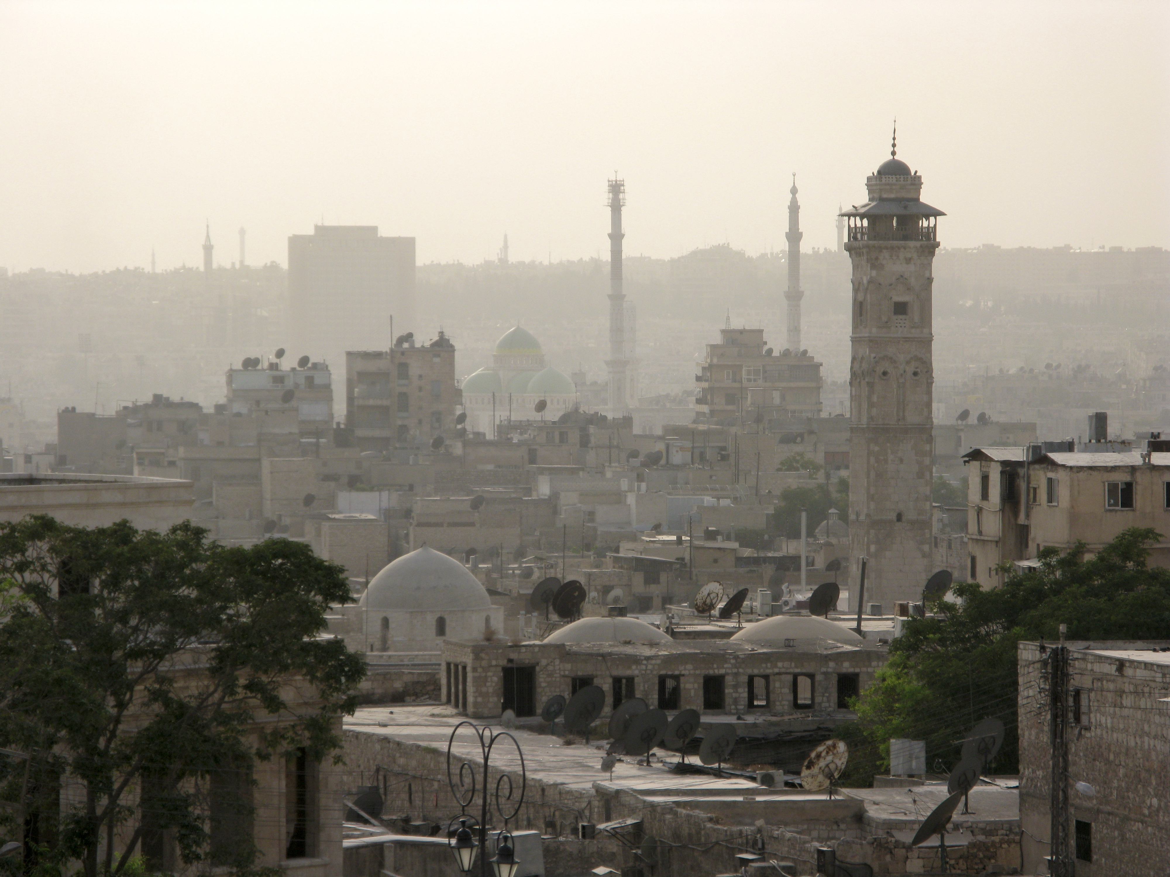
Halab
)), is an adjective which means "white-colored mixed with black". , motto = , image_map = , mapsize = , map_caption = , image_map1 = , mapsize1 = , map_caption1 = , pushpin_map = Syria#Mediterranean east#Asia#Syria Aleppo , pushpin_label_position = left , pushpin_relief = yes , pushpin_mapsize = , pushpin_map_caption = Location of Aleppo in Syria , coordinates = , subdivision_type = Country , subdivision_name = , subdivision_type1 = Governorate , subdivision_type2 = District , subdivision_type3 = Subdistrict , subdivision_name1 = Aleppo Governorate , subdivision_name2 = Mount Simeon (Jabal Semaan) , subdivision_name3 = Mount Simeon ( ... [...More Info...] [...Related Items...] OR: [Wikipedia] [Google] [Baidu] |
Canaan
Canaan (; Phoenician: 𐤊𐤍𐤏𐤍 – ; he, כְּנַעַן – , in pausa – ; grc-bib, Χανααν – ;The current scholarly edition of the Greek Old Testament spells the word without any accents, cf. Septuaginta : id est Vetus Testamentum graece iuxta LXX interpretes. 2. ed. / recogn. et emendavit Robert Hanhart. Stuttgart : Dt. Bibelges., 2006 . However, in modern Greek the accentuation is , while the current (28th) scholarly edition of the New Testament has . ar, كَنْعَانُ – ) was a Semitic-speaking civilization and region in the Ancient Near East during the late 2nd millennium BC. Canaan had significant geopolitical importance in the Late Bronze Age Amarna Period (14th century BC) as the area where the spheres of interest of the Egyptian, Hittite, Mitanni and Assyrian Empires converged or overlapped. Much of present-day knowledge about Canaan stems from archaeological excavation in this area at sites such as Tel Hazor, Tel Megiddo, En Esur ... [...More Info...] [...Related Items...] OR: [Wikipedia] [Google] [Baidu] |
Emar
) , image = View_from_the_Byzantine_Tower_at_Meskene,_ancient_Barbalissos.jpg , alt = , caption = View from the Byzantine Tower at Meskene, ancient Barbalissos , map_type = Syria , map_alt = , map_size = 200 , location = Near Maskanah, Aleppo Governorate, Syria , region = Lake Assad shoreline , coordinates = , type = settlement , part_of = , length = , width = , area = , height = , builder = , material = , built = , abandoned = 1187 BC , epochs = , cultures = Amorite , dependency_of = Ebla, Yamhad, Carchemish , occupants = , event = , excavations = 1972–19761996–2002 , archaeologists = Jean-Claude Margueron , condition = , ownership = Public , public_access = Yes , website = , notes = Emar (modern Tell Meskene) is an archaeological site in Aleppo Governorate, northern Syria. It sits in the great bend of the mid-Euphrates, now on the shoreline of the man-made Lake Assad near the town of Mask ... [...More Info...] [...Related Items...] OR: [Wikipedia] [Google] [Baidu] |


_in_the_Battle_of_Khadesh.jpg)


