|
Ice Harbor Lock And Dam
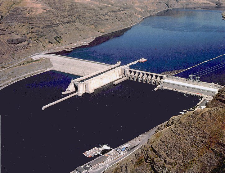
Ice Harbor Lock and Dam is a hydroelectric, concrete gravity run-of-the-river dam in the northwest United States. On the lower Snake River in southeastern Washington, it bridges Walla Walla and Franklin counties. Located northeast of Burbank and east of Pasco, river mile 9.7, the dam's name comes from a tiny bay in the river where boats once tied up to wait for upstream ice-jams to break up. Construction began in June 1955; the main structure and three generators were completed in 1961, with an additional three generators finished in 1976. Generating capacity is 603 megawatts, with an overload capacity of 693 MW. The spillway has ten gates and is in length. Dam system Built and operated by the U.S. Army Corps of Engineers, Ice Harbor Dam is part of the Columbia River Basin system of dams. Visitor center Inside the dam on the south side of the river is a large visitor center that has been recently updated to include a new film "The Snake - Rive ... [...More Info...] [...Related Items...] OR: [Wikipedia] [Google] [Baidu] |
Snake River
The Snake River is a major river of the greater Pacific Northwest region in the United States. At long, it is the largest tributary of the Columbia River, in turn, the largest North American river that empties into the Pacific Ocean. The Snake River rises in western Wyoming, then flows through the Snake River Plain of southern Idaho, the rugged Hells Canyon on the Oregon–Idaho border and the rolling Palouse Hills of Washington (state), Washington, emptying into the Columbia River at the Tri-Cities, Washington, Tri-Cities in the Columbia Basin of Eastern Washington. The Snake River drainage basin encompasses parts of six U.S. states (Idaho, Washington, Oregon, Utah, Nevada, and Wyoming) and is known for its varied geologic history. The Snake River Plain was created by a volcanic hotspot (geology), hotspot which now lies underneath the Snake River headwaters in Yellowstone National Park. Gigantic glacial-retreat flooding episodes during the previous Last glacial period, Ice Ag ... [...More Info...] [...Related Items...] OR: [Wikipedia] [Google] [Baidu] |
Columbia River
The Columbia River (Upper Chinook: ' or '; Sahaptin: ''Nch’i-Wàna'' or ''Nchi wana''; Sinixt dialect'' '') is the largest river in the Pacific Northwest region of North America. The river rises in the Rocky Mountains of British Columbia, Canada. It flows northwest and then south into the U.S. state of Washington, then turns west to form most of the border between Washington and the state of Oregon before emptying into the Pacific Ocean. The river is long, and its largest tributary is the Snake River. Its drainage basin is roughly the size of France and extends into seven US states and a Canadian province. The fourth-largest river in the United States by volume, the Columbia has the greatest flow of any North American river entering the Pacific. The Columbia has the 36th greatest discharge of any river in the world. The Columbia and its tributaries have been central to the region's culture and economy for thousands of years. They have been used for transportation since a ... [...More Info...] [...Related Items...] OR: [Wikipedia] [Google] [Baidu] |
Nez Perce Tribe
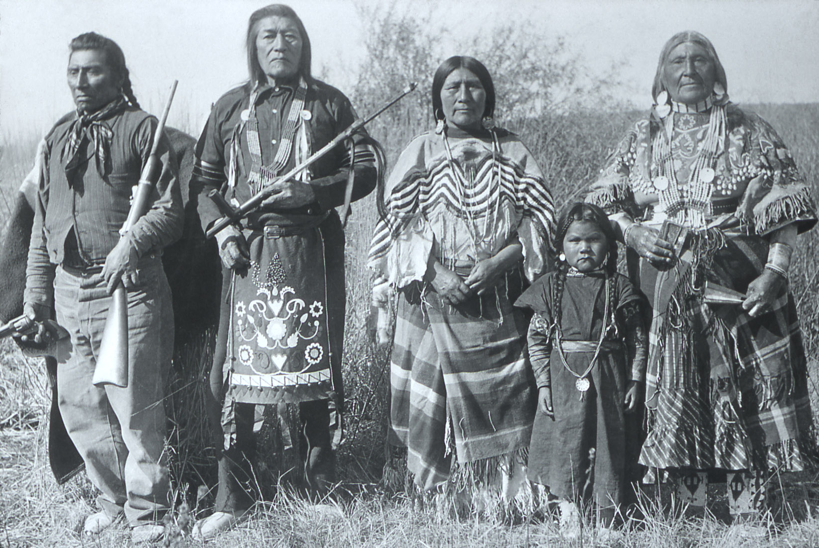
The Nez Percé (; autonym in Nez Perce language: , meaning "we, the people") are an Indigenous people of the Plateau who are presumed to have lived on the Columbia River Plateau in the Pacific Northwest region for at least 11,500 years.Ames, Kenneth and Alan Marshall. 1980. "Villages, Demography and Subsistence Intensification on the Southern Columbia Plateau". ''North American Archeologist'', 2(1): 25–52." Members of the Sahaptin language group, the Nimíipuu were the dominant people of the Columbia Plateau for much of that time, especially after acquiring the horses that led them to breed the appaloosa horse in the 18th century. Prior to first contact with European colonial people the Nimiipuu were economically and culturally influential in trade and war, interacting with other indigenous nations in a vast network from the western shores of Oregon and Washington, the high plains of Montana, and the northern Great Basin in southern Idaho and northern Nevada. French explor ... [...More Info...] [...Related Items...] OR: [Wikipedia] [Google] [Baidu] |
Bannock People
The Bannock tribe were originally Northern Paiute but are more culturally affiliated with the Northern Shoshone. They are in the Great Basin classification of Indigenous People. Their traditional lands include northern Nevada, southeastern Oregon, southern Idaho, and western Wyoming. Today they are enrolled in the federally recognized Shoshone-Bannock Tribes of the Fort Hall Reservation of Idaho, located on the Fort Hall Indian Reservation. History The Northern Paiute have a history of trade with surrounding tribes. In the 1700s, the bands in eastern Oregon traded with the tribes to the north, who by 1730 had acquired the horse. In the mid-18th century, some bands developed a horse culture and split off to become the Bannock tribe. The horse gave the tribe a greater range, from Oregon to northern Nevada, southern Idaho, and western Wyoming. They forayed from there on the Bannock Trail to Montana and Canada to hunt buffalo. The Bannock have traditionally made pottery, utensi ... [...More Info...] [...Related Items...] OR: [Wikipedia] [Google] [Baidu] |
Confederated Tribes Of The Umatilla Indian Reservation
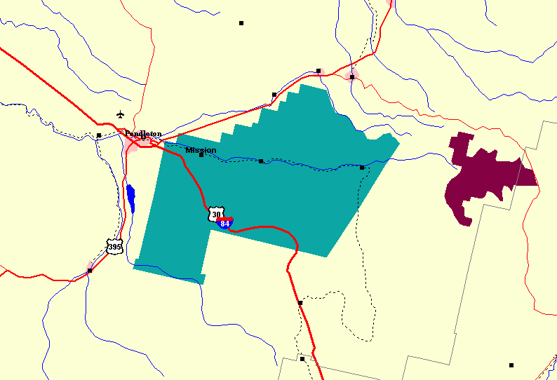
The Confederated Tribes of the Umatilla Indian Reservation are the federally recognized confederations of three Sahaptin-speaking Native American tribes who traditionally inhabited the Columbia River Plateau region: the Cayuse, Umatilla, and Walla Walla. When the leaders of the Walla Walla, Cayuse, and Umatilla peoples signed the Treaty of Walla Walla with the United States in 1855, they ceded of their homeland that is now northeastern Oregon and southeastern Washington. This was done in exchange for a reservation of and the promise of annuities in the form of goods and supplies. The tribes share the Reservation, which consists of in Umatilla County, in northeast Oregon state. The tribes have created a joint political structure as part of their confederation. The tribal offices are just east of Pendleton, Oregon. Almost half of the reservation land is owned by non-Native Americans; the reservation includes significant portions of the Umatilla River watershed. In 2013 the ... [...More Info...] [...Related Items...] OR: [Wikipedia] [Google] [Baidu] |
Yakama Nation
The Yakama Indian Reservation (spelled Yakima until 1994) is a Native American reservation in Washington state of the federally recognized tribe known as the Confederated Tribes and Bands of the Yakama Nation. The tribe is made up of Klikitat, Palus, Wallawalla, Wanapam, Wenatchi, Wishram, and Yakama peoples. Geography The reservation is located on the east side of the Cascade Mountains in southern Washington state. The eastern portion of Mount Adams lies within this territory. According to the United States Census Bureau, the reservation covers 2,185.94 square miles (5,661.56 km²) and the population in 2000 was 31,799. It lies primarily in Yakima and the northern edge of Klickitat counties. The largest city on the reservation is Toppenish. About 80% of the reservation's land is held in Tribal sovereignty in the United States, trust by the federal government for the benefit of the tribe and tribal members.Mark T. BakerThe Hollow Promise of Tribal Power to Control t ... [...More Info...] [...Related Items...] OR: [Wikipedia] [Google] [Baidu] |
Little Goose Dam
Little Goose Lock and Dam is a hydroelectric, concrete, run-of-the-river dam in the northwest United States, on the lower Snake River in southeast Washington. At the dam, the river is the border between Columbia and Whitman counties; it is northeast of Starbuck and north of Dayton. Construction began in June 1963 on what was Little Goose Island. The main structure and three generators were completed in 1970, with an additional three generators finished in 1978. Generating capacity is , with an overload capacity of ; the spillway has eight gates and is in length. Little Goose Dam is part of the Columbia River Basin system of dams. Lake Bryan, named for Doctor Enoch Albert Bryan, is formed behind the dam. The lake stretches to the base of Lower Granite Dam, upstream. Lake Herbert G. West, formed from Lower Monumental Dam runs downstream from the base of the dam. ;Navigation lock * Single-lift * wide * long See also *List of dams in the Columbia River wat ... [...More Info...] [...Related Items...] OR: [Wikipedia] [Google] [Baidu] |
Lower Granite Dam
Lower Granite Lock and Dam is a concrete gravity Run-of-the-river hydroelectricity, run-of-the-river dam in the northwest United States. On the lower Snake River in southeastern Washington (state), Washington, it bridges Whitman County, Washington, Whitman and Garfield County, Washington, Garfield counties. Opened in 1975, the dam is located south of Colfax, Washington, Colfax and north of Pomeroy, Washington, Pomeroy. Lower Granite Dam is part of the Columbia River, Columbia River Basin system of dams, built and operated by the United States Army, U.S. Army United States Army Corps of Engineers, Corps of Engineers; power generated is distributed by the Bonneville Power Administration (BPA). Behind the dam, Lower Granite Lake extends east to the confluence with the Clearwater River (Idaho), Clearwater River at Lewiston, Idaho, and allowed the city to become a port. The first barge to Portland, Oregon, Portland on the navigation route was loaded with wheat and departed Lewiston ... [...More Info...] [...Related Items...] OR: [Wikipedia] [Google] [Baidu] |
Yakima Herald-Republic
The ''Yakima Herald-Republic'' is a newspaper published in Yakima, Washington, and distributed throughout Yakima, Kittitas and Klickitat counties as well as northwest Benton County. It is Washington state's seventh-largest daily newspaper. The newspaper traces its roots to the late 19th century. Harte-Hanks bought the ''Herald-Republic'' in 1972 from the Robertson family. Harte-Hanks sold the paper to an affiliate of MediaNews Group in 1986. It is now part of The Seattle Times Company, which purchased the paper in 1991. The newspaper was printed in Yakima until 2021, when The Seattle Times Company announced it would sell the ''Herald-Republic''s headquarters and printing plant. The newspaper will instead be printed in Walla Walla by the ''Walla Walla Union-Bulletin The ''Walla Walla Union-Bulletin'' (U-B) is a newspaper based in Walla Walla, Washington and owned by the Seattle Times Company. It publishes daily except Saturdays. History The modern ''Union-Bulletin'' can trac ... [...More Info...] [...Related Items...] OR: [Wikipedia] [Google] [Baidu] |
Hanford Site
The Hanford Site is a decommissioned nuclear production complex operated by the United States federal government on the Columbia River in Benton County in the U.S. state of Washington. The site has been known by many names, including SiteW and the Hanford Nuclear Reservation. Established in 1943 as part of the Manhattan Project, the site was home to the Hanford Engineer Works and B Reactor, the first full-scale plutonium production reactor in the world. Plutonium manufactured at the site was used in the first atomic bomb, which was tested in the Trinity nuclear test, and in the Fat Man bomb that was used in the bombing of Nagasaki. During the Cold War, the project expanded to include nine nuclear reactors and five large plutonium processing complexes, which produced plutonium for most of the more than sixty thousand weapons built for the U.S. nuclear arsenal. Nuclear technology developed rapidly during this period, and Hanford scientists produced major technological ... [...More Info...] [...Related Items...] OR: [Wikipedia] [Google] [Baidu] |
Wahluke Slope AVA
Established in 2006 The Wahluke Slope AVA Wahluke, was named after a Native American word for "watering place," is an American Viticultural area located within Grant County, Washington and is home to more than 20 vineyards and at least three wine production facilities. It is part of the larger Columbia Valley AVA. The 80,490 acre region features approximately 8,931 acres of vineyards: nearly 15 percent of the total wine grape acreage in the state. Top grape varieties: Merlot, Syrah, Cabernet Sauvignon, Riesling, Chardonnay, and Chenin Blanc, but this area is primarily known for Merlot and Cabernet Sauvignon. Geography and climate The Wahluke Slope AVA is located in the Wahluke Slope of Grant County, Washington. It extends from the Columbia River in the west, the Hanford Site boundary in the southwest, the north bank of the Columbia River on the south up to the Wahluke Slope Wildlife Refuge in the east, and along the elevation of the Saddle Mountains on the north. Wahluke Sl ... [...More Info...] [...Related Items...] OR: [Wikipedia] [Google] [Baidu] |


.png)

