|
Halutza
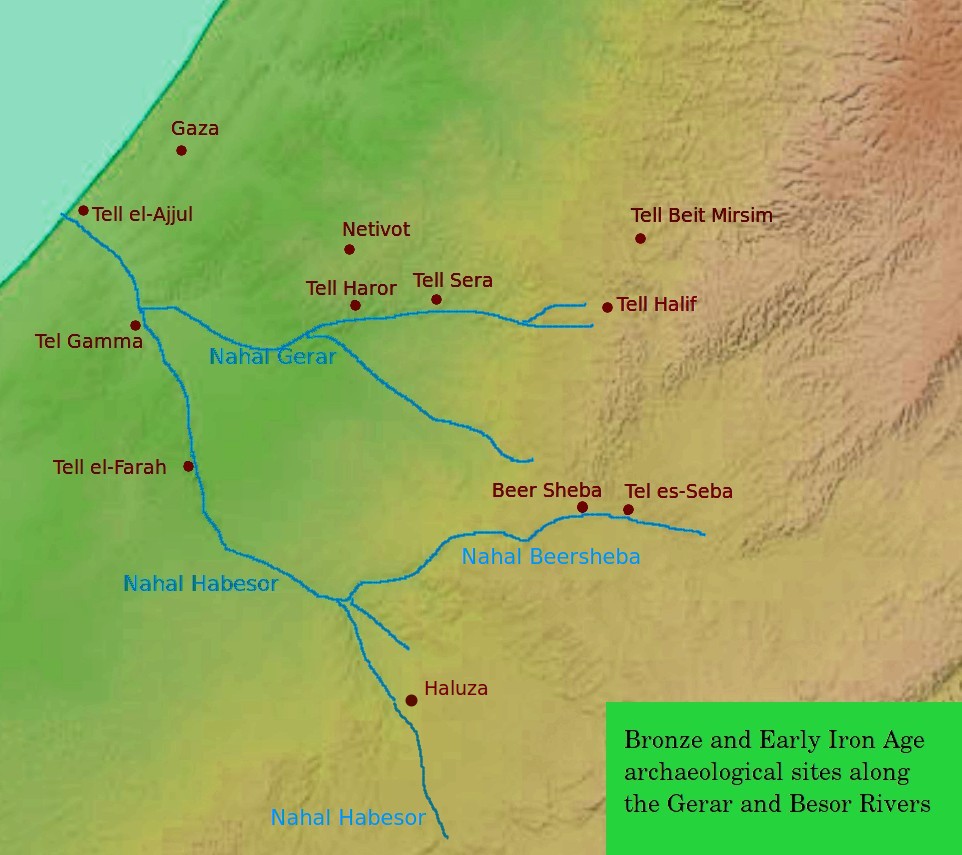
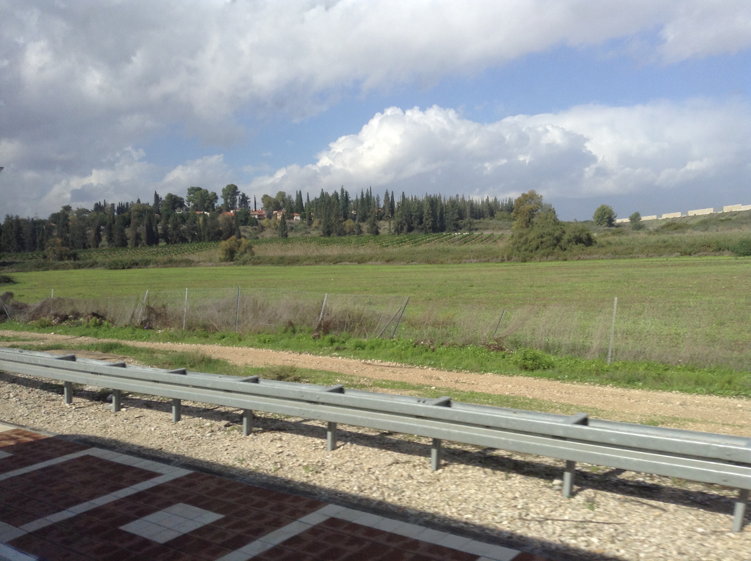
The ancient city of Halasa or Chellous ( gr, Χελλοὺς), Elusa () in the Byzantine period, was a city in the Negev near present-day Kibbutz Mash'abei Sadeh that was once part of the Nabataean Incense Route. It lay on the route from Petra to Gaza.Carta's Official Guide to Israel, 1983. Today it is known as Haluza ( he, חלוצה), and during periods of Arab habitation it was known as al-Khalūṣ ( ar, الخلوص; Early Muslim period) and Al-Khalasa (; 20th century). In the 5th century it was surrounded by vineyards and was famous for its wines. Due to its historic importance, UNESCO declared Haluza a World Heritage Site along with Mamshit, Avdat and Shivta. Name in ancient sources The city is called 'Chellous' (Χελλοὺς) in the Greek text of Judith, i, 9 (seJdt 1:9in NABRE), a work probably dating to the 1st century BCE. It is also mentioned in the 2nd century CE by Ptolemy, Peutinger's Table, Stephanus Byzantius (fl. 6th century; as being formerly in th ... [...More Info...] [...Related Items...] OR: [Wikipedia] [Google] [Baidu] |
Mashabei Sadeh
Mashabei Sadeh ( he, מַשְׁאַבֵּי שָׂדֶה) is a kibbutz in southern Israel. Located in the Negev desert, it falls under the jurisdiction of Ramat HaNegev Regional Council. In it had a population of . History The kibbutz was established in 1947 in the Halutza dunes, and was originally known as Mashabim (Hebrew: משאבים, lit. ''Resources''). During the 1948 Arab-Israeli War the kibbutz was attacked by the Egyptian army, but was retained by Israel. After the war ended it relocated to its present site. It was renamed Mashabei Sadeh in honour of Palmach leader Yitzhak Sadeh who died in 1952. File:חלוצה - הקמת ישוב חדש בנגב-JNF012130.jpeg, Halutza 1947 File:משאבים - מראה כללי-JNF001053.jpeg, Halutza 1947 Economy Apart from agriculture (field crops, poultry and dairy), the kibbutz breeds shrimp using special aquaculture techniques. It is also the only kibbutz in Israel to breed the Australian fish Barramundi The barramundi ... [...More Info...] [...Related Items...] OR: [Wikipedia] [Google] [Baidu] |
Avdat
Avdat ( he, עבדת, ar, عبدة, ''Abdah''), also known as Abdah and Ovdat and Obodat, is a site of a ruined Nabataean city in the Negev desert in southern Israel. It was the most important city on the Incense Route after Petra, between the 1st century BCE and the 7th century CE. It was founded in the 3rd century BCE, and inhabited by Nabataeans, Romans, Byzantines, and during the early Islamic period.Yedioth Ahronoth (6 October 2009)"Avdat National Park vandalized" Retrieved on April 3, 2012. Avdat was a seasonal camping ground for Nabataean caravans travelling along the early Petra–Gaza road (Darb es-Sultan) in the 3rd – late 2nd century BCE. The city's original name was changed to Avdat in honor of Nabataean King Obodas I, who, according to tradition, was revered as a deity and was buried there. History Before the end of the 1st century BCE a temple platform (the acropolis) was created along the western edge of the plateau. Recent excavations have shown that the town c ... [...More Info...] [...Related Items...] OR: [Wikipedia] [Google] [Baidu] |
Southern District (Israel)
The Southern District ( he, מחוז הדרום, ''Meḥoz HaDarom''; ar, لواء الجنوب) is one of Israel's six administrative districts, the largest in terms of land area but the most sparsely populated. It covers most of the Negev desert, as well as the Arava valley. The population of the Southern District is 1,086,240 and its area is 14,185 km2. Its population is 79.66% Jewish and 12.72% Arab (mostly Muslim), with 7.62% of other origins. The district capital is Beersheba, while the largest city is Ashdod. Beersheba's dormitory towns of Omer, Meitar, and Lehavim are affluent on an Israel scale, while the development towns of Dimona, Sderot, Netivot, Ofakim, and Yeruham and the seven Bedouin cities are lower on the socio-economic scale. [...More Info...] [...Related Items...] OR: [Wikipedia] [Google] [Baidu] |
5th Century
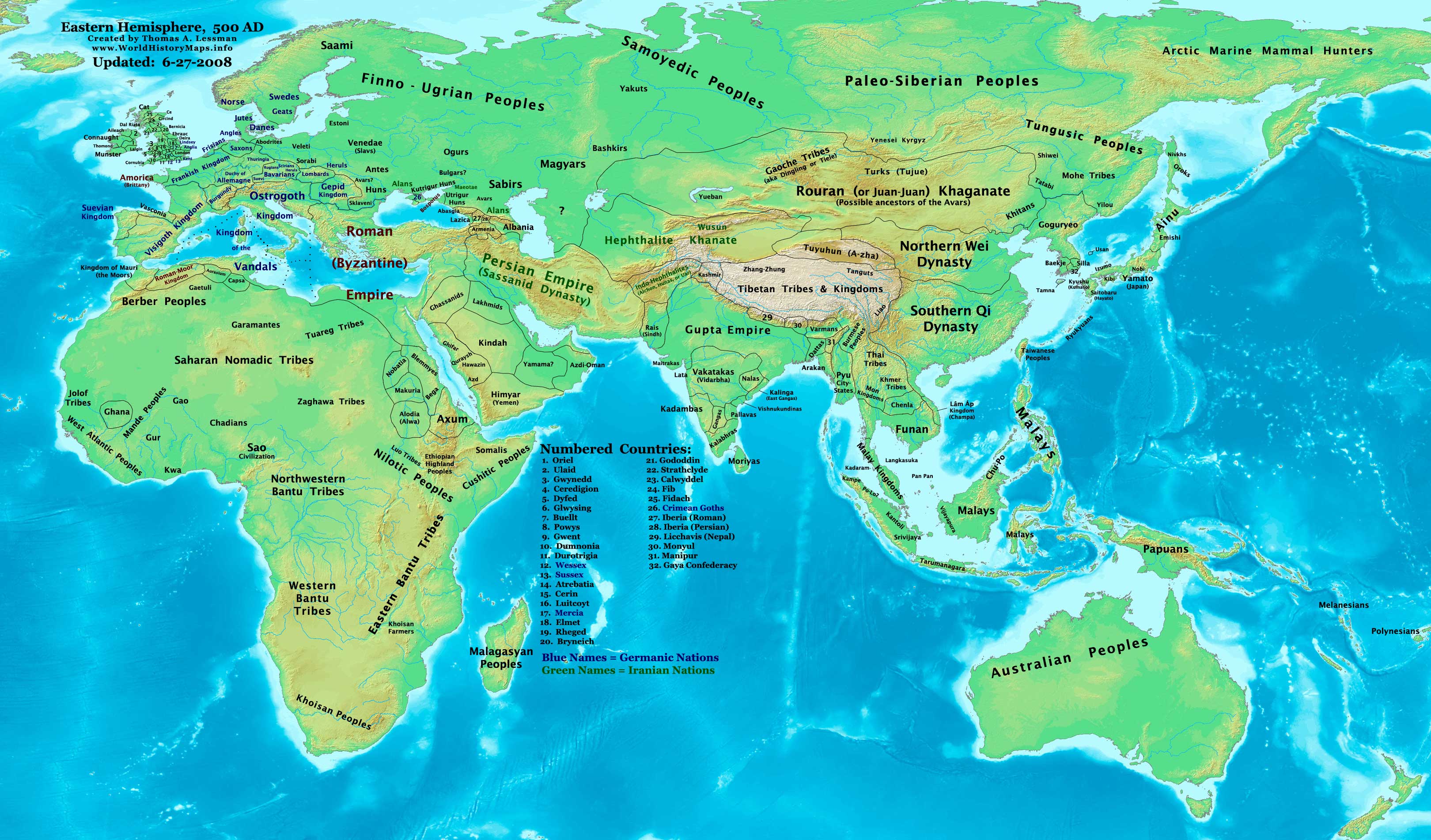
The 5th century is the time period from 401 ( CDI) through 500 ( D) ''Anno Domini'' (AD) or Common Era (CE) in the Julian calendar. The 5th century is noted for being a period of migration and political instability throughout Eurasia. It saw the collapse of the Western Roman Empire, which came to an end in 476 AD. This empire had been ruled by a succession of weak emperors, with the real political might being increasingly concentrated among military leaders. Internal instability allowed a Visigoth army to reach and ransack Rome in 410. Some recovery took place during the following decades, but the Western Empire received another serious blow when a second foreign group, the Vandals, occupied Carthage, capital of an extremely important province in Africa. Attempts to retake the province were interrupted by the invasion of the Huns under Attila. After Attila's defeat, both Eastern and Western empires joined forces for a final assault on Vandal North Africa, but this campaign was ... [...More Info...] [...Related Items...] OR: [Wikipedia] [Google] [Baidu] |
Jerome
Jerome (; la, Eusebius Sophronius Hieronymus; grc-gre, Εὐσέβιος Σωφρόνιος Ἱερώνυμος; – 30 September 420), also known as Jerome of Stridon, was a Christian presbyter, priest, Confessor of the Faith, confessor, theologian, and historian; he is commonly known as Saint Jerome. Jerome was born at Stridon, a village near Emona on the border of Dalmatia (Roman province), Dalmatia and Pannonia. He is best known for his translation of the Bible into Latin (the translation that became known as the Vulgate) and his commentaries on the whole Bible. Jerome attempted to create a translation of the Old Testament based on a Hebrew version, rather than the Septuagint, as Vetus Latina, Latin Bible translations used to be performed before him. His list of writings is extensive, and beside his biblical works, he wrote polemical and historical essays, always from a theologian's perspective. Jerome was known for his teachings on Christian moral life, especially to th ... [...More Info...] [...Related Items...] OR: [Wikipedia] [Google] [Baidu] |
Palaestina Tertia
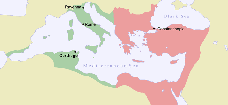
Palaestina Salutaris or Palaestina Tertia was a Byzantine (Eastern Roman) province, which covered the area of the Negev, Sinai (except the north western coast) and south-west of Transjordan, south of the Dead Sea. The province, a part of the Diocese of the East, was split from Arabia Petraea during the reforms of Diocletian in c.300 CE, and existed until the Muslim Arab conquests of the 7th century. Background In 106, the territories east of Damascus and south to the Red Sea were annexed from the Nabataean kingdom and reformed into the province of Arabia with a capital Petra and Bostra (north and south). The province was enlarged by Septimius Severus in 195, and is believed to have split into two provinces: Arabia Minor or Arabia Petraea and Arabia Maior, both subject to imperial legates ranking as ''consularis'', each with a legion. By the 3rd century, the Nabataeans had stopped writing in Aramaic and begun writing in Greek instead, and by the 4th century they had partially c ... [...More Info...] [...Related Items...] OR: [Wikipedia] [Google] [Baidu] |
Arabia Petraea
Arabia Petraea or Petrea, also known as Rome's Arabian Province ( la, Provincia Arabia; ar, العربية البترائية; grc, Ἐπαρχία Πετραίας Ἀραβίας) or simply Arabia, was a frontier province of the Roman Empire beginning in the 2nd century. It consisted of the former Nabataean Kingdom in Jordan, southern Levant, the Sinai Peninsula and northwestern Arabian Peninsula. Its capital was Petra. It was bordered on the north by Syria, on the west by Judaea (merged with Syria from AD 135) and Egypt, and on the south and east by the rest of Arabia, known as Arabia Deserta and Arabia Felix. The territory was annexed by Emperor Trajan, like many other eastern frontier provinces of the Roman Empire, but held onto, unlike Armenia, Mesopotamia and Assyria, well after Trajan's rule, its desert frontier being called the Limes Arabicus. It produced the Emperor Philippus, who was born around 204. As a frontier province, it included a desert populated by Arabic ... [...More Info...] [...Related Items...] OR: [Wikipedia] [Google] [Baidu] |
Stephanus Byzantius
Stephanus or Stephan of Byzantium ( la, Stephanus Byzantinus; grc-gre, Στέφανος Βυζάντιος, ''Stéphanos Byzántios''; centuryAD), was a Byzantine grammarian and the author of an important geographical dictionary entitled ''Ethnica'' (). Only meagre fragments of the dictionary survive, but the epitome is extant, compiled by one Hermolaus, not otherwise identified. Life Nothing is known about the life of Stephanus, except that he was a Greek grammarian who was active in Constantinople, and lived after the time of Arcadius and Honorius, and before that of Justinian II. Later writers provide no information about him, but they do note that the work was later reduced to an epitome by a certain Hermolaus, who dedicated his epitome to Justinian; whether the first or second emperor of that name is meant is disputed, but it seems probable that Stephanus flourished in Byzantium in the earlier part of the sixth century AD, under Justinian I. The ''Ethnica'' Even as an epi ... [...More Info...] [...Related Items...] OR: [Wikipedia] [Google] [Baidu] |
Peutinger's Table
' (Latin Language, Latin for "The Peutinger Map"), also referred to as Peutinger's Tabula or Peutinger Table, is an illustrated ' (ancient Roman road map) showing the layout of the ''cursus publicus'', the road network of the Roman Empire. The map is a 13th-century parchment copy of a possible Roman original. It covers Europe (without the Iberian Peninsula and the British Isles), North Africa, and parts of Asia, including the Middle East, Persia, and India. According to one hypothesis, the existing map is based on a document of the 4th or 5th century that contained a copy of the world map originally prepared by Marcus Vipsanius Agrippa, Agrippa during the reign of the emperor Augustus (27 BC – AD 14). However, Emily Albu has suggested that the existing map could instead be based on an original from the Carolingian period. The map was likely stolen by the renowned humanist Conrad Celtes, who bequeathed it to his friend, the economist and archaeologist Konrad Peutinger, who gave ... [...More Info...] [...Related Items...] OR: [Wikipedia] [Google] [Baidu] |
Ptolemy
Claudius Ptolemy (; grc-gre, Πτολεμαῖος, ; la, Claudius Ptolemaeus; AD) was a mathematician, astronomer, astrologer, geographer, and music theorist, who wrote about a dozen scientific treatises, three of which were of importance to later Byzantine, Islamic, and Western European science. The first is the astronomical treatise now known as the '' Almagest'', although it was originally entitled the ''Mathēmatikē Syntaxis'' or ''Mathematical Treatise'', and later known as ''The Greatest Treatise''. The second is the ''Geography'', which is a thorough discussion on maps and the geographic knowledge of the Greco-Roman world. The third is the astrological treatise in which he attempted to adapt horoscopic astrology to the Aristotelian natural philosophy of his day. This is sometimes known as the ''Apotelesmatika'' (lit. "On the Effects") but more commonly known as the '' Tetrábiblos'', from the Koine Greek meaning "Four Books", or by its Latin equivalent ''Quadrip ... [...More Info...] [...Related Items...] OR: [Wikipedia] [Google] [Baidu] |
NABRE
The New American Bible Revised Edition (NABRE) is an English-language Catholic translation of the Bible, the first major update in 20 years to the New American Bible (NAB), which was translated by members of the Catholic Biblical Association and originally published in 1970. Released on March 9, 2011, the NABRE consists of the 1986 revision of the NAB New Testament with a fully revised Old Testament approved by the United States Conference of Catholic Bishops in 2010. Approved for private use and study by Catholics, the NABRE has not received approval for Catholic liturgical use. Although the revised Lectionary based on the original New American Bible is still the sole translation approved for use at Mass in the dioceses of the United States, the NABRE New Testament is currently being revised so that American Catholics can read the same Bible translation in personal study and devotion that they hear in Mass. The use of NABRE has received strong criticism from conservative Cathol ... [...More Info...] [...Related Items...] OR: [Wikipedia] [Google] [Baidu] |
Book Of Judith
The Book of Judith is a deuterocanonical book, included in the Septuagint and the Catholic and Eastern Orthodox Christian Old Testament of the Bible, but excluded from the Hebrew canon and assigned by Protestants to the apocrypha. It tells of a Jewish widow, Judith, who uses her beauty and charm to destroy an Assyrian general and save Israel from oppression. The surviving Greek manuscripts contain several historical anachronisms, which is why some Protestant scholars now consider the book non-historical: a parable, a theological novel, or perhaps the first historical novel. The name Judith (), meaning "Praised" or "Jewess", is the feminine form of Judah. Historical context Original language It is not clear whether the Book of Judith was originally written in Hebrew or in Greek. The oldest existing version is in the Septuagint, and might either be a translation from Hebrew or composed in Greek. Details of vocabulary and phrasing point to a Greek text written in a language m ... [...More Info...] [...Related Items...] OR: [Wikipedia] [Google] [Baidu] |


