|
HNLMS Willem Van Der Zaan (ML-2)
HNLMS ''Willem van der Zaan'' (ML-2/N82/F824/A880) was a minelayer of the Royal Netherlands Navy that was commissioned only days before the start of World War II in September 1939. She served in England, in the Netherlands East Indies, and as a convoy escort in the Indian Ocean before returning to The Netherlands in 1945. She then served again in the Netherlands East Indies and Dutch West Indies until 1950 when she was rebuilt and reclassified as a frigate. From 1961 she was used as an accommodation and repair ship until struck in 1970 and sold for scrap. She was named in honour of the 17th century ''Schout-bij-nacht'' Willem Van Der Zaan. Service history World War II The ship was laid down by the ''Nederlandse Droogdok Maatschappij'' ("Dutch Drydock Company") at Amsterdam, on 18 January 1938, and launched on 15 December 1938. After sea trials the ship was commissioned on 21 August 1939, just before the outbreak of the war. On 3 September 1939 the ''Willem van der Zaan'' commenc ... [...More Info...] [...Related Items...] OR: [Wikipedia] [Google] [Baidu] |
Willem Van Der Zaan
Willem van der Zaan (29 June 1621 – 17 March 1669) was a Dutch Admiral. His name is often given in the 17th century spelling Zaen. Biography Willem was born in Amsterdam. He joined the Dutch navy at a young age and had risen to the rank of captain by 1652. He took part in the First Anglo-Dutch War from 1652–1654, fighting in the Battle of Dungeness on the ''Prinses Aemilia'', and on the ''Campen'' (after the previous captain, his brother Joris van der Zaan, had been killed in the Battle of Portland; in the same battle his other brother, Huybrecht van der Zaan, was killed also) in the Battle of the Gabbard and the Battle of Scheveningen. In 1655 he was made a full captain. In 1656 he commands the ''Zuyderhuys'', having on board his nephew, the son of Huybrecht, Cornelis van der Zaan, later a captain also. In 1657 he participated in an action in the Mediterranean under Vice-Admiral Michiel de Ruyter, during which he captured the French warship ''Chasseur'', caught while illega ... [...More Info...] [...Related Items...] OR: [Wikipedia] [Google] [Baidu] |
Java Class Cruiser
The ''Java'' class was a class of light cruisers of the Royal Netherlands Navy, with the lead ship named after the island of Java in the Dutch East Indies. Originally, three ships were planned: ''Java'', ''Sumatra'', and ''Celebes''. ''Celebes'' was intended to be the flagship of the naval commander in the Dutch East Indies, and therefore she was slightly bigger than the other two ships. However, the contract was cancelled with 30 tons of material already prepared (a new ship, was later built to fill that requirement). The class was designed by the Dutch with technical oversight by the German company Krupp, and constructed in the Netherlands. Armed with ten guns, they were of comparable capability to the German and British cruisers designs of the time. However, these were not turret-mounted, and by the time the cruisers were finally launched after all the delays caused by the upheaval of World War I (''Sumatra'' in 1920, ''Java'' in 1921), the ships had already become ... [...More Info...] [...Related Items...] OR: [Wikipedia] [Google] [Baidu] |
Jakarta
Jakarta (; , bew, Jakarte), officially the Special Capital Region of Jakarta ( id, Daerah Khusus Ibukota Jakarta) is the capital and largest city of Indonesia. Lying on the northwest coast of Java, the world's most populous island, Jakarta is the largest city in Southeast Asia and serves as the diplomatic capital of ASEAN. The city is the economic, cultural, and political centre of Indonesia. It possesses a province-level status and has a population of 10,609,681 as of mid 2021.Badan Pusat Statistik, Jakarta, 2022. Although Jakarta extends over only , and thus has the smallest area of any Indonesian province, its metropolitan area covers , which includes the satellite cities Bogor, Depok, Tangerang, South Tangerang, and Bekasi, and has an estimated population of 35 million , making it the largest urban area in Indonesia and the second-largest in the world (after Tokyo). Jakarta ranks first among the Indonesian provinces in human development index. Jakarta's busin ... [...More Info...] [...Related Items...] OR: [Wikipedia] [Google] [Baidu] |
Tanjung Priok
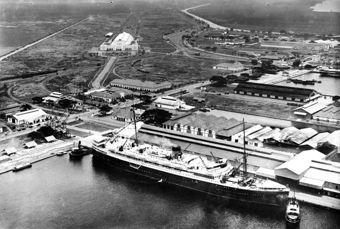
Tanjung Priok is a district of North Jakarta, Indonesia. It hosts the western part of the city's main harbor, the Port of Tanjung Priok (located in Tanjung Priok District and Koja District). The district of Tanjung Priok is bounded by Laksamana Yos Sudarso Tollway and Sunter River canal to the east, by Kali Japat, Kali Ancol, and the former Kemayoran Airport to the southwest, by Sunter Jaya Road and Sunter Kemayoran Road to the south, and by Jakarta Bay to the north. History Before human development, the coastal area of what is now Tanjung Priok was an area of brackish water with swamp and mangrove forest. The old harbor of Jakarta During the colonial era, Batavia at first relied on the Sunda Kelapa harbor area. This meant that Batavia had a harbor system like many others cities. I.e. an anchorage at sea at some distance from the city, and a city harbor where smaller ships could attach to a quay. It meant that big ships like the Dutch East Indiamen and later ships safely anc ... [...More Info...] [...Related Items...] OR: [Wikipedia] [Google] [Baidu] |
Port Louis
Port Louis (french: Port-Louis; mfe, label= Mauritian Creole, Polwi or , ) is the capital city of Mauritius. It is mainly located in the Port Louis District, with a small western part in the Black River District. Port Louis is the country's economic, cultural and political centre, and most populous city. It is administered by the Municipal City Council of Port Louis. According to the 2012 census conducted by Statistics Mauritius, the population was 147,066. History Port Louis was used as a harbour by the Dutch settlers from 1606, when they started to refer to the area as ''Harbour of Tortoises''. In 1736, under French government, it became the administrative centre of Mauritius and a major reprovisioning halt for French ships during their passage between Asia and Europe, around the Cape of Good Hope. The Port is named in honour of King Louis XV. During this period of French colonization, Mauritius was known as Ile de France. The French governor at that time, Bertrand-Franç ... [...More Info...] [...Related Items...] OR: [Wikipedia] [Google] [Baidu] |
Durban
Durban ( ) ( zu, eThekwini, from meaning 'the port' also called zu, eZibubulungwini for the mountain range that terminates in the area), nicknamed ''Durbs'',Ishani ChettyCity nicknames in SA and across the worldArticle on ''news24.com'' from 25 October 2017. Retrieved 2021-03-05.The names and the naming of Durban Website ''natalia.org.za'' (pdf). Retrieved 2021-03-05. is the third most populous city in after and |
Cape Town
Cape Town ( af, Kaapstad; , xh, iKapa) is one of South Africa's three capital cities, serving as the seat of the Parliament of South Africa. It is the legislative capital of the country, the oldest city in the country, and the second largest (after Johannesburg). Colloquially named the ''Mother City'', it is the largest city of the Western Cape province, and is managed by the City of Cape Town metropolitan municipality. The other two capitals are Pretoria, the executive capital, located in Gauteng, where the Presidency is based, and Bloemfontein, the judicial capital in the Free State, where the Supreme Court of Appeal is located. Cape Town is ranked as a Beta world city by the Globalization and World Cities Research Network. The city is known for its harbour, for its natural setting in the Cape Floristic Region, and for landmarks such as Table Mountain and Cape Point. Cape Town is home to 66% of the Western Cape's population. In 2014, Cape Town was named the best place ... [...More Info...] [...Related Items...] OR: [Wikipedia] [Google] [Baidu] |
Freetown
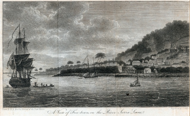
Freetown is the capital and largest city of Sierra Leone. It is a major port city on the Atlantic Ocean and is located in the Western Area of the country. Freetown is Sierra Leone's major urban, economic, financial, cultural, educational and political centre, as it is the seat of the Government of Sierra Leone. The population of Freetown was 1,055,964 at the 2015 census. The city's economy revolves largely around its harbour, which occupies a part of the estuary of the Sierra Leone River in one of the world's largest natural deep water harbours. Although the city has traditionally been the homeland of the Sierra Leone Creole people, the population of Freetown is ethnically, culturally, and religiously diverse. The city is home to a significant population of all of Sierra Leone's ethnic groups, with no single ethnic group forming more than 27% of the city's population. As in virtually all parts of Sierra Leone, the Krio language of the Sierra Leone Creole people is Freetown's ... [...More Info...] [...Related Items...] OR: [Wikipedia] [Google] [Baidu] |
Azores
) , motto =( en, "Rather die free than subjected in peace") , anthem= ( en, "Anthem of the Azores") , image_map=Locator_map_of_Azores_in_EU.svg , map_alt=Location of the Azores within the European Union , map_caption=Location of the Azores within the European Union , subdivision_type=Sovereign state , subdivision_name=Portugal , established_title=Settlement , established_date=1432 , established_title3=Autonomous status , established_date3=30 April 1976 , official_languages=Portuguese , demonym= ( en, Azorean) , capital_type= Capitals , capital = Ponta Delgada (executive) Angra do Heroísmo (judicial) Horta (legislative) , largest_city = Ponta Delgada , government_type=Autonomous Region , leader_title1=Representative of the Republic , leader_name1=Pedro Manuel dos Reis Alves Catarino , leader_title2= President of the Legislative Assembly , leader_name2= Luís Garcia , leader_title3= President of the Regional Government , leader_name3=José Manuel Bolieiro , le ... [...More Info...] [...Related Items...] OR: [Wikipedia] [Google] [Baidu] |
Ponta Delgada (Azores)
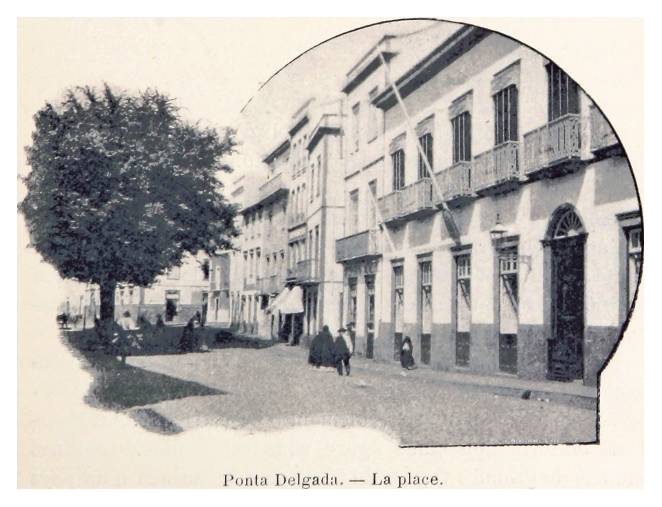
Ponta Delgada (; ) is the largest municipality (''concelho'') and economic capital of the Autonomous Region of the Azores in Portugal. It is located on São Miguel Island, the largest and most populous in the archipelago. As of 2021, it has 67,287 inhabitants, in an area of . There are 17,629 residents in the three central civil parishes that comprise the historical city: São Pedro, São Sebastião, and São José. Ponta Delgada became the region's administrative capital under the revised constitution of 1976; the judiciary and Catholic See remained in the historical capital of Angra do Heroísmo while the Legislative Assembly of the Azores was established in Horta. History The origin of the placename Ponta Delgada (Portuguese for ''delicate or thin point'') was elaborated by the famous Portuguese chronicler, Father Gaspar Frutuoso, who wrote: In around 1450, Pêro de Teive established a small fishing village that eventually grew into the urban agglomeration in Santa ... [...More Info...] [...Related Items...] OR: [Wikipedia] [Google] [Baidu] |
Port Of Hull
The Port of Hull is a port at the confluence of the River Hull and the Humber Estuary in Kingston upon Hull, in the East Riding of Yorkshire, England. Seaborne trade at the port can be traced to at least the 13th century, originally conducted mainly at the outfall of the River Hull, known as The Haven, or later as the Old Harbour. In 1773, the Hull Dock Company was formed and Hull's first dock built on land formerly occupied by Hull town walls. In the next half century a ring of docks was built around the Old Town on the site of the former fortifications, known as the Town Docks. The first was The Dock (1778), (or The Old Dock, known as Queen's Dock after 1855), followed by Humber Dock (1809) and Junction Dock (1829). An extension, Railway Dock (1846), was opened to serve the newly built Hull and Selby Railway. The first dock east of the river, Victoria Dock, opened in 1850. Docks along the banks of the Humber to the west were begun in 1862 with the construction of the We ... [...More Info...] [...Related Items...] OR: [Wikipedia] [Google] [Baidu] |
Immingham
Immingham is a town, civil parish and ward in the North East Lincolnshire unitary authority of England. It is situated on the south-west bank of the Humber Estuary, and is north-west from Grimsby. The region was relatively unpopulated and undeveloped until the early 1900s, when the Great Central Railway began developing its Immingham Dock; as a consequence of the dock development, and of nearby post-Second World War large scale industrial developments Immingham developed from a minor place into a significant town during the 20th century. The Port of Immingham & Grimsby was the largest port in the United Kingdom by tonnage with 54 million tonnes of cargo passing through in 2019. Geography Council ward The Immingham Ward of North East Lincolnshire Council includes Stallingborough, Healing and Habrough. As of 2018, its elected councillors are Stewart Swinburn (Conservative), David Bolton (Labour), and David Watson (Labour). Population of the ward in 2001 was 11,804 per ... [...More Info...] [...Related Items...] OR: [Wikipedia] [Google] [Baidu] |


_(cropped).jpg)


