|
Höllentalanger Hut
The Höllentalanger Hut (1,381 m) is a managed hut owned by the German Alpine Club in the Wetterstein Mountains of Bavaria, in the district of Garmisch-Partenkirchen. The hut lies in a narrow defile between the Höllental-Blassen and Waxenstein-Riffelwand crest and is open from the end of May to mid-October. It has more than 80 bedspaces. Its predecessor, with 80 bedspaces, was demolished in September 2013 in order to make way for an entirely new hut. It was built in 2014/15 and opened on 23 August 2015. History The Hut category, category 1 hut was built in 1894 and has had its present appearance since 1925 when it was extended. Since 2004 a completely new hut has been in planning. The cost of construction has been assessed by the German Alpine Club at €2.3M. The new hut is intended to take the extreme avalanche situation in the Höllental into account. The winter room was closed by the authorities in 2004 or 2005 due to the avalanche danger in winter. The demolition of the o ... [...More Info...] [...Related Items...] OR: [Wikipedia] [Google] [Baidu] |
Höllental (Wetterstein)
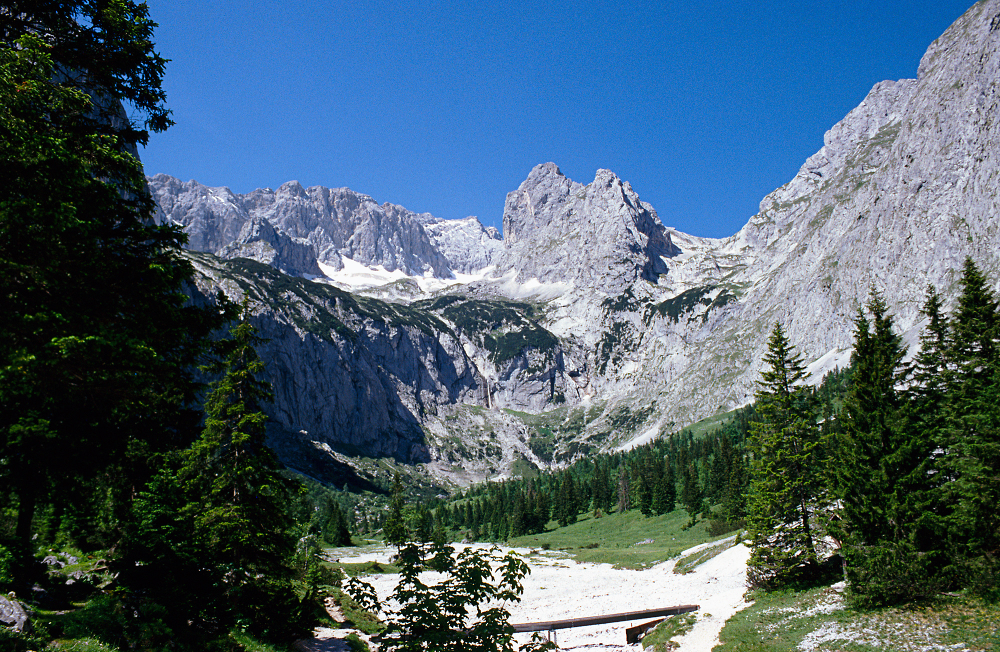
The ''Höllental'', English translation "Hell Valley" or "Valley of Hell" is one of the routes on the German side leading up the Zugspitze on the German-Austrian border in the northern Alps. It is located in the district of Garmisch-Partenkirchen. See also *Zugspitze The Zugspitze (), at above sea level, is the highest peak of the Wetterstein Mountains as well as the highest mountain in Germany. It lies south of the town of Garmisch-Partenkirchen, and the Austria–Germany border runs over its western su ... * Höllental on the German Wikipedia ZUGSPITZE 360° atop the Zugspitze via the Höllental External links Valleys of the Alps Valleys of Bavaria Canyons and gorges of Germany {{GarmischPartenkirchendistrict-geo-stub ... [...More Info...] [...Related Items...] OR: [Wikipedia] [Google] [Baidu] |
Osterfelderkopf
Osterfelderkopf (elevation ) is a summit of the Wetterstein range in the German state of Bavaria. Alpinism The Osterfelderkopf lies below the northern ridge of the Alpspitze and the ''Höllentorkopf''. It is only a few meters away from the top station of the ''Alpspitzbahn'' cablecar and is part of the skiing area Garmisch Classic. Besides skiing there are various other alpine activities with the Osterfelderkopf at the starting point. Several Via Ferrata are reachable from the Osterfelderkopf, being ''Nordwandsteig'' and ''Mauerläufersteig'' to Bernadeinkopf, and ''Alpspitzferrata'' to Alpspitze. A famous climbing route close by leading to the Zugspitze is the ''Jubiläumsgrat''. The Osterfelderkopf is also a starting point for paragliding Paragliding is the recreational and competitive adventure sport of flying paragliders: lightweight, free-flying, foot-launched glider aircraft with no rigid primary structure. The pilot sits in a harness or lies supine in a cocoon ... [...More Info...] [...Related Items...] OR: [Wikipedia] [Google] [Baidu] |
Bergverlag Rother
Bergverlag Rother is a German publisher with its headquarters in Oberhaching, Upper Bavaria. Since 1950 the company, that formerly went under the name of ''Bergverlag Rudolf Rother'', has published the Alpine Club Guides in cooperation with the German Alpine Club (DAV), the Austrian Alpine Club (ÖAV) and the South Tyrol Alpine Club. Rother publish a "famous series of English language guides" covering most of the popular walking destinations in the Alps and Europe. History The company was founded on 16 November 1920 in Munich Munich ( ; german: München ; bar, Minga ) is the capital and most populous city of the States of Germany, German state of Bavaria. With a population of 1,558,395 inhabitants as of 31 July 2020, it is the List of cities in Germany by popu ... by Rudolf Rother sen., a bookseller and mountaineer, and is one of the oldest and most important specialist Alpine publishers. [...More Info...] [...Related Items...] OR: [Wikipedia] [Google] [Baidu] |
Alpenvereinsführer
The ''Alpine Club Guides'' (german: Alpenvereinsführer, commonly shortened to ''AV Führer'' or ''AVF'') are the standard series of Alpine guides that cover all the important mountain groups in the Eastern Alps. They are produced jointly by the German (DAV), Austrian (ÖAV) and South Tyrol Alpine Clubs (AVS). They have been published since 1950 by the firm of Bergverlag Rother in Munich, Germany. The AV guides contain all the routes – hiking trails, mountain hut approaches and summit climbs as well as ice and high mountain routes and ''klettersteigs'' in each mountain range. The descriptions are factual and dry, with few illustrations - rather unlike mountain books by e.g. Walter Pause – and despite introductory sections require general Alpine knowledge and experience. Examples are the ''AVF Allgäuer Alpen'' and the ''AVF Verwallgruppe''.The AV guides are often used as the basis for other publications and complement the Alpine Club maps or other map series. Available guid ... [...More Info...] [...Related Items...] OR: [Wikipedia] [Google] [Baidu] |
Klettersteig
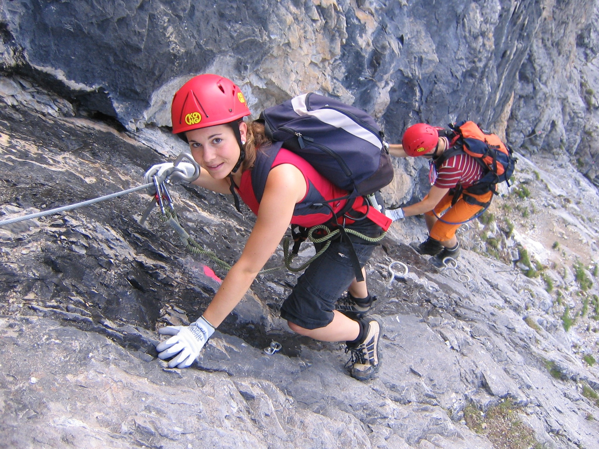
A via ferrata (Italian language, Italian for "iron path", plural ''vie ferrate'' or in English ''via ferratas'') is a protected climbing route found in the Alps and certain other locations. The term "via ferrata" is used in most countries and languages except notably in German-speaking regions, which use ''Klettersteig''—"climbing path" (plural ''Klettersteige''). Infrastructure A via ferrata is a climbing route that employs steel cables, rungs or ladders, fixed to the rock to which the climbers affix #Safety and equipment, a harness with two leashes, which allows the climbers to secure themselves to the metal fixture and limit any fall. The cable and other fixtures, such as iron rungs (stemples), pegs, carved steps, and ladders and bridges, provide both footings and handholds, as well. This allows climbing on otherwise dangerous routes without the risks of unprotected scrambling and climbing or the need for technical climbing equipment. They expand the opportunities for acce ... [...More Info...] [...Related Items...] OR: [Wikipedia] [Google] [Baidu] |
Alpspitze
The Alpspitze is a mountain, 2628 m, in Bavaria, Germany. Its pyramidal peak is the symbol of Garmisch-Partenkirchen and is one of the best known and most attractive mountains of the Northern Limestone Alps. It is made predominantly of Wetterstein limestone from the Upper Triassic. Ascent Several ''klettersteigs'' run up the Alpspitze. The shortest ascent starts at the valley station of ''Osterfelderkopf'' (2,033 m) on the Alpspitze Cable Car from Garmisch-Partenkirchen. From the Osterfelderkopf the Alpspitze may be climbed either directly along the Alpspitz-Ferrata, an easy, mostly protected and much frequented ''klettersteig'' (ca. 2 hours from the Osterfelderkopf) or the summit may be reached on the North Face Climb (''Nordwandsteig''), which runs in a curve to the east into the Oberkar cirque and from there along the left-hand edge of the cirque to the top. Another ascent runs from the col of ''Grießkarscharte'' (2,460 m), which is reached either from th ... [...More Info...] [...Related Items...] OR: [Wikipedia] [Google] [Baidu] |
Höllentalferner
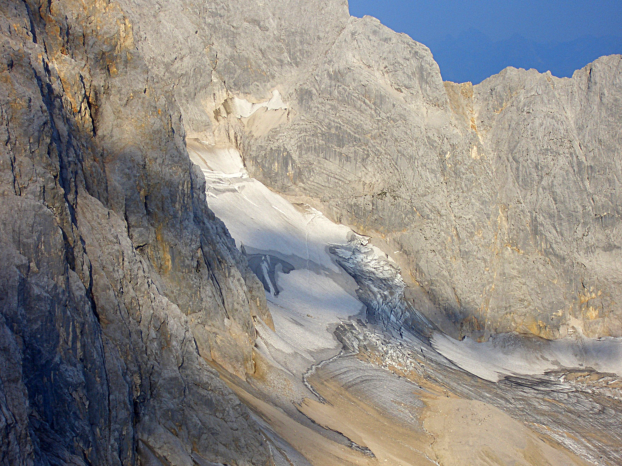
The Höllentalferner is a glacier in the western Wetterstein Mountains. It is a cirque glacier that covers the upper part of the Höllental valley and its location in a rocky bowl between the Riffelwandspitzen and Germany's highest mountain, the Zugspitze, means that it is well-protected from direct sunshine. Geography With an area of (as of 2006)''Höllentalferner - Topographie'' at www.lrz.de. Accessed on 24 December 2010 it is almost as big as the nearby Northern , the largest glacier in Germany. It is about long and up to wide. It is the only German glacier with a proper glacial tongue. In spite of its relatively low elevation of just 2,570 m ... [...More Info...] [...Related Items...] OR: [Wikipedia] [Google] [Baidu] |
Zugspitze
The Zugspitze (), at above Normalhöhennull, sea level, is the highest peak of the Wetterstein Mountains as well as the highest mountain in Germany. It lies south of the town of Garmisch-Partenkirchen, and the Austria–Germany border runs over its western summit. South of the mountain is the ''Zugspitzplatt'', a high karst plateau with numerous caves. On the flanks of the Zugspitze are three glaciers, including the two largest in Germany: the Schneeferner#Northern Schneeferner, Northern Schneeferner with an area of 30.7 hectares and the Höllentalferner with an area of 24.7 hectares. The third is the Schneeferner#Southern Schneeferner, Southern Schneeferner which covers 8.4 hectares. The Zugspitze was first climbed on 27 August 1820 by Josef Naus, his survey assistant, Maier, and mountain guide, Johann Georg Tauschl. Today there are three normal routes to the summit: one from the Höllental (Wetterstein), Höllental valley to the northeast; another out of the Reintal (Wetterste ... [...More Info...] [...Related Items...] OR: [Wikipedia] [Google] [Baidu] |
Top Station
A top station or upper stationFor example, se''Chairlift Blausee (upper station)''at www.outdooractive.com. Retrieved 15 May 2019. is usually the highest station of an aerial lift, a funicular, a T-bar lift or a rack railway. The lowest station is the valley station. Passengers or skiers usually alight at the top station. Top stations on a cable car may be ordinary buildings with a docking bay or open steel structures. Gondola lifts have horizontally arranged top stations. The top stations on chair lifts may have a simple jump-off point or a more substantial design. Gallery File:Dachstein-berg2.jpg, Dachstein cable car, Austria File:Saentis-Gebaeude.jpg, The ''Saentisbahn'', Switzerland File:Mount Roberts Tramway in Juneau, Alaska.jpg, Mount Roberts Tramway, Juneau, Alaska File:Telecabina Masada.JPG, Masada cableway, Israel File:10_Sommet_TS.JPG, Top station of a simple chair lift File:Bergstation Carmenna.jpg, Top station of the Aroser Weisshorn, Carmenna Chairlift, Arosa File ... [...More Info...] [...Related Items...] OR: [Wikipedia] [Google] [Baidu] |


