|
Zugspitze
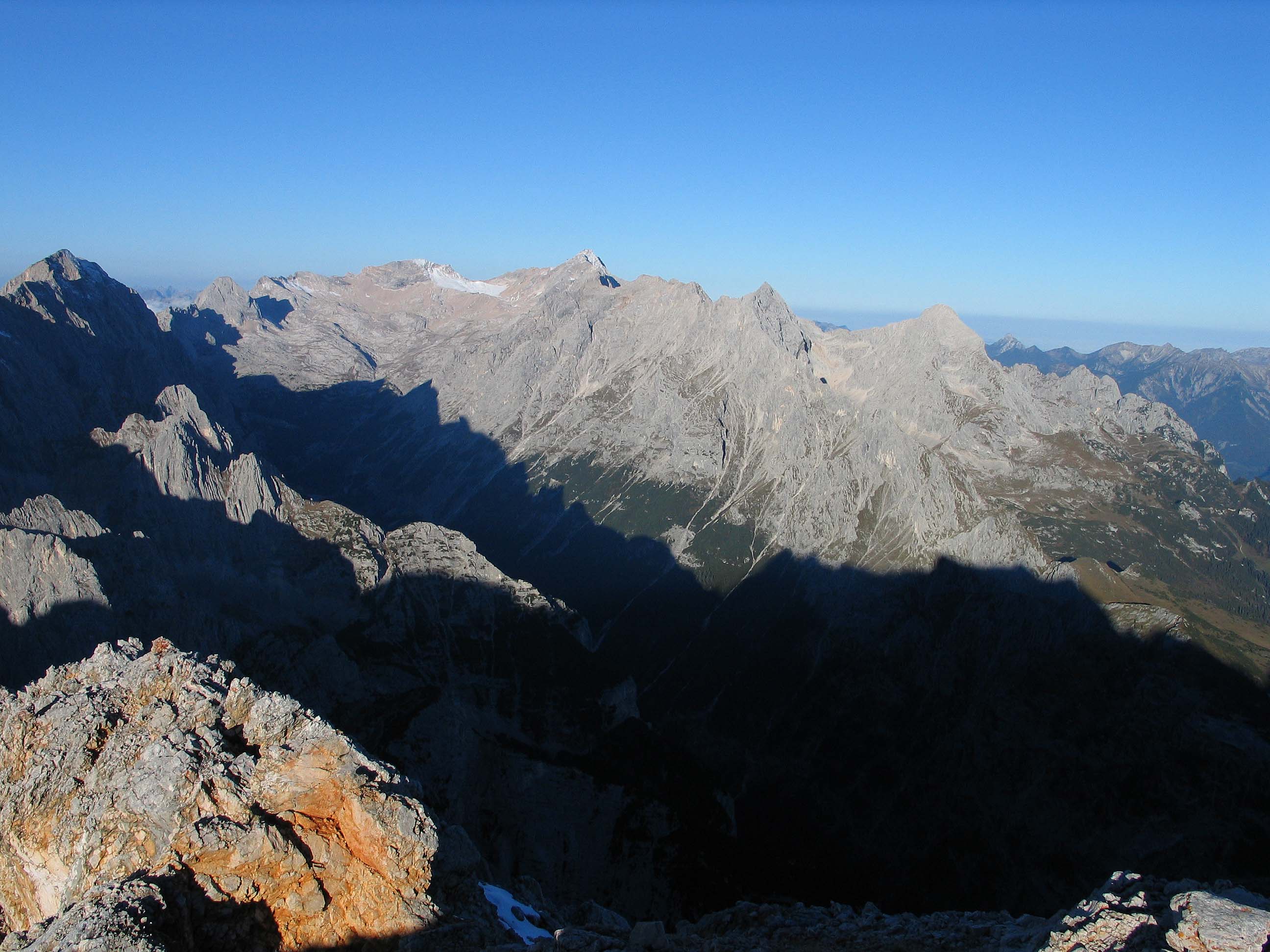
The Zugspitze (), at above Normalhöhennull, sea level, is the highest peak of the Wetterstein Mountains as well as the highest mountain in Germany. It lies south of the town of Garmisch-Partenkirchen, and the Austria–Germany border runs over its western summit. South of the mountain is the ''Zugspitzplatt'', a high karst plateau with numerous caves. On the flanks of the Zugspitze are three glaciers, including the two largest in Germany: the Schneeferner#Northern Schneeferner, Northern Schneeferner with an area of 30.7 hectares and the Höllentalferner with an area of 24.7 hectares. The third is the Schneeferner#Southern Schneeferner, Southern Schneeferner which covers 8.4 hectares. The Zugspitze was first climbed on 27 August 1820 by Josef Naus, his survey assistant, Maier, and mountain guide, Johann Georg Tauschl. Today there are three normal routes to the summit: one from the Höllental (Wetterstein), Höllental valley to the northeast; another out of the Reintal (Wetterste ... [...More Info...] [...Related Items...] OR: [Wikipedia] [Google] [Baidu] |
Wettersteingebirge
The Wetterstein mountains (german: Wettersteingebirge), colloquially called Wetterstein, is a mountain group in the Northern Limestone Alps within the Eastern Alps. It is a comparatively compact range located between Garmisch-Partenkirchen, Mittenwald, Seefeld in Tirol and Ehrwald along the border between Germany (Bavaria) and Austria (Tyrol). Zugspitze, the highest peak is at the same time the highest mountain in Germany. The Wetterstein mountains are an ideal region for mountaineers and climbers. Mountain walkers sometimes need to allow for significant differences in elevation. The proximity of the range to the south German centres of population, the scenic landscape and its good network of cable cars and lifts mean that the mountains are heavily frequented by tourists for most of the year. There are, however, places in the Wetterstein that are rarely or never visited by people. Neighbouring ranges The Wetterstein borders on the following other mountain ranges of ... [...More Info...] [...Related Items...] OR: [Wikipedia] [Google] [Baidu] |
Wetterstein Mountains
The Wetterstein mountains (german: Wettersteingebirge), colloquially called Wetterstein, is a mountain group in the Northern Limestone Alps within the Eastern Alps. It is a comparatively compact range located between Garmisch-Partenkirchen, Mittenwald, Seefeld in Tirol and Ehrwald along the border between Germany (Bavaria) and Austria (Tyrol). Zugspitze, the highest peak is at the same time the highest mountain in Germany. The Wetterstein mountains are an ideal region for mountaineers and climbers. Mountain walkers sometimes need to allow for significant differences in elevation. The proximity of the range to the south German centres of population, the scenic landscape and its good network of cable cars and lifts mean that the mountains are heavily frequented by tourists for most of the year. There are, however, places in the Wetterstein that are rarely or never visited by people. Neighbouring ranges The Wetterstein borders on the following other mountain ranges of t ... [...More Info...] [...Related Items...] OR: [Wikipedia] [Google] [Baidu] |
Schneeferner
} The Schneeferner in the Bavarian Alps is Germany's highest and largest glacier.''Kaltgestellter Gletscher'' at www.sueddeutsche.de. Accessed on 23 Dec 2010 Geography Schneeferner glacier is located on the '''', a plateau south of the country's highest peak, the , that descends from west to east and forms the head of the Reintal valley. The |
Jubiläumsgrat
The Jubiläumsgrat ("Jubilee Arête") or Jubiläumsweg ("Jubilee Way"), also nicknamed ''Jubi'' in climbing circles, is the name given to the climbing route along the arête between the Zugspitze (2,962 m) and the Hochblassen (2,706 m) (hence it is also called the ''Blassenkamm'' which means "Blassen Crest"). In front of its northwestern end, at the wind gap known as ''Falsche Grießkarscharte'', climbers normally cross over to the Alpspitze (2,628 m) or down to the Matheisen cirque. Along the arête the three peaks of the Höllentalspitzen (2,740 m), the Vollkarspitze (2,630 m) and several rises have to be assailed or circumnavigated. The route is a serious, high Alpine tour and not, as often described, a ''Klettersteig''. History Its name goes back to the founding members of the Munich branch of the German Alpine Club who, in 1894 in return for being honoured at the 25th anniversary of the branch, initially donated 900 marks, so that a "Jubilee Way" could be financed. By ... [...More Info...] [...Related Items...] OR: [Wikipedia] [Google] [Baidu] |
Garmisch-Partenkirchen
Garmisch-Partenkirchen (; Bavarian: ''Garmasch-Partakurch''), nicknamed Ga-Pa, is an Alpine ski town in Bavaria, southern Germany. It is the seat of government of the district of Garmisch-Partenkirchen (abbreviated ''GAP''), in the Oberbayern region, which borders Austria. Nearby is Germany's highest mountain, Zugspitze, at above sea level. The town is known as the site of the 1936 Winter Olympic Games, the first to include alpine skiing, and hosts a variety of winter sports competitions. History Garmisch (in the west) and Partenkirchen (in the east) were separate towns for many centuries, and still maintain quite separate identities. Partenkirchen originated as the Roman town of ''Partanum'' on the trade route from Venice to Augsburg and is first mentioned in the year A.D. 15. Its main street, Ludwigsstrasse, follows the original Roman road. Garmisch was first mentioned some 800 years later as ''Germaneskau'' ("German District"), suggesting that at some po ... [...More Info...] [...Related Items...] OR: [Wikipedia] [Google] [Baidu] |
Josef Naus
Josef Naus (1793–1871) was an officer and surveying technician, known for leading the first ascent of Germany's highest mountain, the Zugspitze. Variations of his name are Karl Naus or Joseph Naus. Life and career Naus was born on 29 August 1793 in Lechaschau / Tyrol or, according to other sources, Reutte.''Bosls bayerische Biographie'' by Karl Bosl. Accessed on 9 Apr 2011. He was the son of a judge and came from a family that had probably immigrated from Belgium or the Netherlands to Tyrol in the 17th century. As a young man Naus studied surveying. He joined the |
Fern Pass
Fern Pass (elevation 1212 m) is a mountain pass in the Tyrolean Alps in Austria. It is located between the Lechtal Alps on the west and the Mieming Mountains on the east. The highest peak in Germany, the Zugspitze is only 13.5 km away to the northeast. The pass lies between the Grubigstein (2233 m) on the northwest, the Wannig (2493 m) on the southeast, and the Loreakopf (2471 m) on the west. History The pass was created when a huge mountain slide (actually the collapse of an entire mountain, with an estimated volume of 1 km3; the third-largest mountain slide ever in the eastern Alps) filled part of the valley to a height of 300–400 meters, distributing its boulders up to 16 km away. While it was initially believed that this had happened at least 12,000 years B.P. as a consequence of the strong temperature increase and intense run-off after the end of the last deglaciation, pollen analysis performed as early as 1940 had already indicated an age of not much ... [...More Info...] [...Related Items...] OR: [Wikipedia] [Google] [Baidu] |
Reintal (Wetterstein)
The Reintal ("Rein Valley") is the name given to the upper and lower valleys of the River Partnach between the ''Zugspitzplatt'' plateau and the Partnachklamm gorge. A hiking route to Germany's highest mountain, the Zugspitze runs through the valley. The valley was formed during the Würm Ice Age by the Reintal Glacier and then deepened by the Partnach in the post-ice age period after the retreat of the glacier to the periphery of the Schneefernerkopf mountain. The upper Reintal, which was shaped by the glacier and today forms a U-shaped glacial valley, ends between the ''Hohe Gaifkopf'' in the west and the Schachen in the east. The lower Reintal lies in the area of the former glacial lake of the Loisach Glacier, into which the Reintal Glacier flowed from the southwest. It is a V-shaped valley and has been predominantly shaped by the Partnach river. Together with the Höllental valley to the north, the Reintal divides the Wetterstein Mountains into several ridges. The north ... [...More Info...] [...Related Items...] OR: [Wikipedia] [Google] [Baidu] |
Höllental (Wetterstein)
The ''Höllental'', English translation "Hell Valley" or "Valley of Hell" is one of the routes on the German side leading up the Zugspitze on the German-Austrian border in the northern Alps. It is located in the district of Garmisch-Partenkirchen. See also *Zugspitze The Zugspitze (), at above sea level, is the highest peak of the Wetterstein Mountains as well as the highest mountain in Germany. It lies south of the town of Garmisch-Partenkirchen, and the Austria–Germany border runs over its western su ... * Höllental on the German Wikipedia ZUGSPITZE 360° atop the Zugspitze via the Höllental External links Valleys of the Alps Valleys of Bavaria Canyons and gorges of Germany {{GarmischPartenkirchendistrict-geo-stub ... [...More Info...] [...Related Items...] OR: [Wikipedia] [Google] [Baidu] |
Höllentalferner
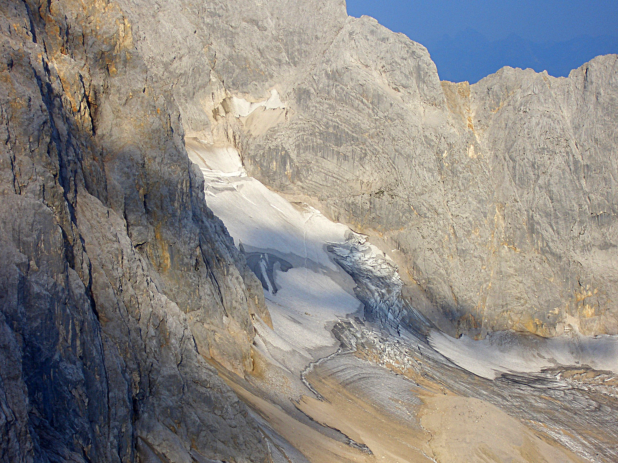
The Höllentalferner is a glacier in the western Wetterstein Mountains. It is a cirque glacier that covers the upper part of the Höllental valley and its location in a rocky bowl between the Riffelwandspitzen and Germany's highest mountain, the Zugspitze, means that it is well-protected from direct sunshine. Geography With an area of (as of 2006)''Höllentalferner - Topographie'' at www.lrz.de. Accessed on 24 December 2010 it is almost as big as the nearby Northern , the largest glacier in Germany. It is about long and up to wide. It is the only German glacier with a proper glacial tongue. In spite of its relatively low elevation of just 2,570 m ... [...More Info...] [...Related Items...] OR: [Wikipedia] [Google] [Baidu] |
Austria–Germany Border
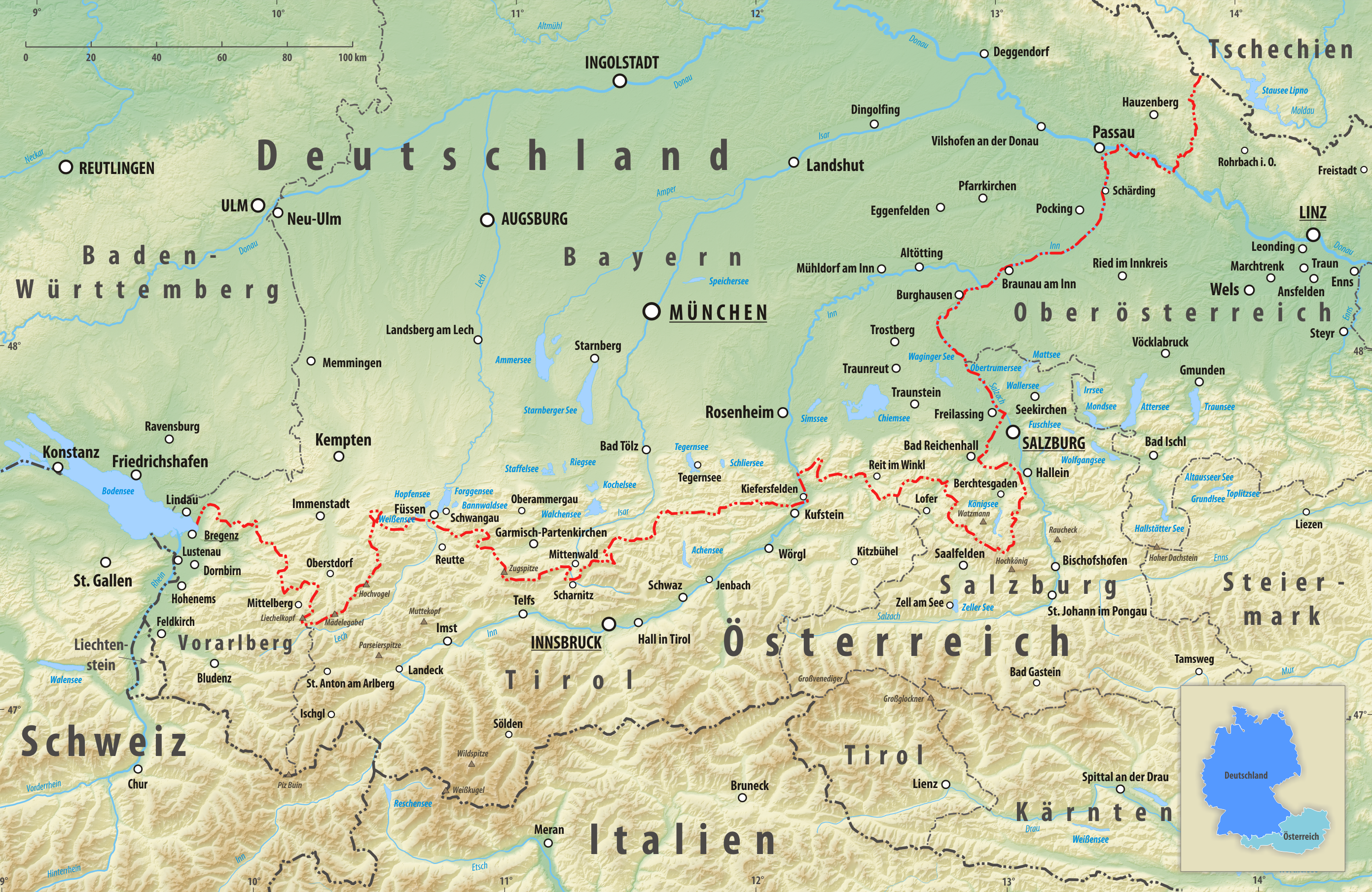
The Austria–Germany border () has a length of or in the south of Germany and the north of Austria in central Europe. It is the longest border of both Austria and Germany with another country. Route The border runs roughly from east to west. The eastern point is located at the border tripoint of Germany, Austria, and the Czech Republic, at , near the village of Schwarzenberg am Böhmerwald. The western point is located at the border tripoint of Germany, Austria, and Switzerland, at approximately , in Lake Constance. The border is long, but a straight line between the endpoints is long. Besides Lake Constance, the border does not pass through any significant body of water, but it follows the Inn and Danube rivers along the eastern part. The Austrian states of Vorarlberg, Tyrol, Salzburg, and Upper Austria run along the international border, as does the German state of Bavaria. Tripoints The eastern point is located at the border tripoint of Germany, Austria and the Czech ... [...More Info...] [...Related Items...] OR: [Wikipedia] [Google] [Baidu] |
Normalhöhennull
' ("standard elevation zero") or NHN is a vertical datum used in Germany. In geographical terms, NHN is the reference plane for the normal height of a topographical eminence height above mean sea level used in the 1932 German Mean Height Reference System ('). The plane is in the shape of a quasi-geoid. The reference height is a geodetic, fixed point on the New Church of St. Alexander at Wallenhorst in the German state of Lower Saxony. The geopotential height of this point was calculated in 1986 as part of the United European Levelling Network (UELN), based on the Amsterdam Ordnance Datum. Definition The NHN plane is a theoretical reference plane. It is derived by deducting normal heights from the normal plumb line. The difference between the resulting quasi-geoid and the reference ellipsoid is called the height anomaly or quasi-geoid height. Change-over from NN to NHN Since 1 January 2000 the whole of Germany has changed its height system over to normal heights based on ... [...More Info...] [...Related Items...] OR: [Wikipedia] [Google] [Baidu] |


