|
Hutoushan Reservoir
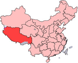
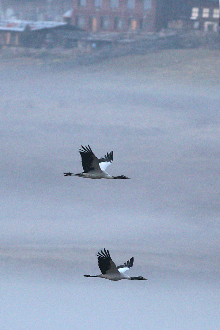
Hutoushan Reservoir (, ''Hutoushan Shuiku'') is a man made reservoir in Lhünzhub County, Tibet, to the north of the city of Lhasa. It is an important wintering place for black-necked cranes and other migratory birds. Location The reservoir lies in Qangka Township, Lhünzhub County. The villages of Gana, Tiangacun, Seronggang and Zhujiecun lie near the lake. The reservoir is bordered by large swamps and wet meadows, and has abundant plants and shellfish. It takes its name from a nearby mountain, whose shape was said to resemble a tiger's head. The Hutuoshan Reservoir is the largest in Tibet, with planned total storage of . The reservoir lies in the Pengbo River valley. Black-necked cranes The endangered Black-necked crane The black-necked Crane (''Grus nigricollis'') is a medium-sized crane in Asia that breeds on the Tibetan Plateau and remote parts of India and Bhutan. It is 139 cm (55 in) long with a 235 cm (7.8 ft) wingspan, and it weighs ...s mig ... [...More Info...] [...Related Items...] OR: [Wikipedia] [Google] [Baidu] |
Lhünzhub County
Lhünzhub County, also called Lhundrub or Linzhou County, is a county in Lhasa towards the north-east of the main center of Chengguan, Tibet, China. It covers an area of and as of 2000 had a population of 50,895 people, almost all classified as rural. The southern portion, the Pengbo River Valley, contains fertile arable land, while the colder and more mountainous northern portion primarily supports grazing. The county has many monasteries, including the Reting Monastery. Geography and climate Lhünzhub County is located in central Tibet around northeast of metropolitan Lhasa. It includes the Pengbo River Valley and the upper reaches of the Lhasa River. It covers an area of . The county is geologically complex, with an average elevation of . Mineral resources include lead, zinc, copper, silver, gold and gypsum. A spur of the Nyainqêntanglha mountains crosses the whole territory, dividing it into a southern and northern part. In the south the Pengbo valley has an average ... [...More Info...] [...Related Items...] OR: [Wikipedia] [Google] [Baidu] |
Tibet
Tibet (; ''Böd''; ) is a region in East Asia, covering much of the Tibetan Plateau and spanning about . It is the traditional homeland of the Tibetan people. Also resident on the plateau are some other ethnic groups such as Monpa people, Monpa, Tamang people, Tamang, Qiang people, Qiang, Sherpa people, Sherpa and Lhoba peoples and now also considerable numbers of Han Chinese and Hui people, Hui settlers. Since Annexation of Tibet by the People's Republic of China, 1951, the entire plateau has been under the administration of the People's Republic of China, a major portion in the Tibet Autonomous Region, and other portions in the Qinghai and Sichuan provinces. Tibet is the highest region on Earth, with an average elevation of . Located in the Himalayas, the highest elevation in Tibet is Mount Everest, Earth's highest mountain, rising 8,848.86 m (29,032 ft) above sea level. The Tibetan Empire emerged in the 7th century. At its height in the 9th century, the Tibet ... [...More Info...] [...Related Items...] OR: [Wikipedia] [Google] [Baidu] |
Lhasa
Lhasa (; Lhasa dialect: ; bo, text=ལྷ་ས, translation=Place of Gods) is the urban center of the prefecture-level city, prefecture-level Lhasa (prefecture-level city), Lhasa City and the administrative capital of Tibet Autonomous Region in Southwest China. The inner urban area of Lhasa City is equivalent to the administrative borders of Chengguan District (), which is part of the wider prefectural Lhasa City. Lhasa is the second most populous urban area on the Tibetan Plateau after Xining and, at an altitude of , Lhasa is one of the List of highest large cities, highest cities in the world. The city has been the religious and administrative capital of Tibet since the mid-17th century. It contains many culturally significant Tibetan Buddhism, Tibetan Buddhist sites such as the Potala Palace, Jokhang Temple and Norbulingka Palaces. Toponymy Lhasa literally translates to "place of gods" ( , god; , place) in the Standard Tibetan, Tibetan language. Chengguan literally tra ... [...More Info...] [...Related Items...] OR: [Wikipedia] [Google] [Baidu] |
Black-necked Crane
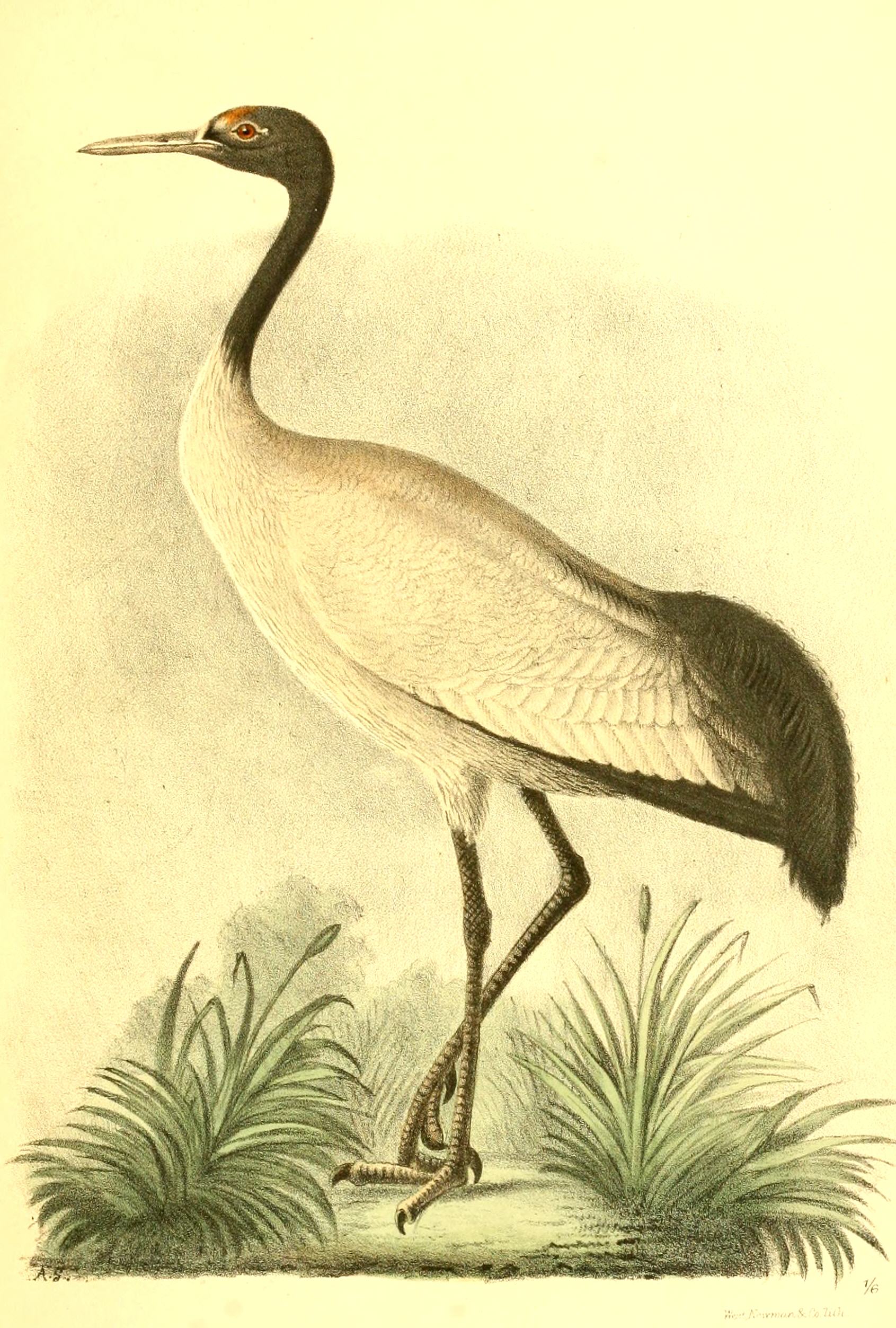
The black-necked Crane (''Grus nigricollis'') is a medium-sized crane in Asia that breeds on the Tibetan Plateau and remote parts of India and Bhutan. It is 139 cm (55 in) long with a 235 cm (7.8 ft) wingspan, and it weighs 5.5 kg (12 lbs). It is whitish-gray, with a black head, red crown patch, black upper neck and legs, and white patch to the rear of the eye. It has black primaries and secondaries. Both sexes are similar. Some populations are known to make seasonal movements. It is revered in Buddhist traditions and culturally protected across much of its range. A festival in Bhutan celebrates the bird while the Indian union territory of Ladakh has designated it as the state bird. Description This medium-sized crane is mostly grey with a black head and neck. The lores and crown are naked and dull red. A small patch of white feathers are present below and behind the eye. The tail is black and makes it easy to distinguish at a distance from the si ... [...More Info...] [...Related Items...] OR: [Wikipedia] [Google] [Baidu] |
Gana, Tibet
This is an alphabetical list of all populated places, including cities, towns and villages, in the Tibet Autonomous Region of western China. A *Alamdo *Alhar *Arza *Asog B * Baga *Bagar * Baidi *Baima *Baimai *Baixoi *Bamda *Banag *Banbar *Banggaidoi *Bangkor *Bangru *Bangxing * Baqên *Bar *Bêba *Bei *Bênqungdo *Bilung *Birba * Biru *Bogkamba *Boindoi *Bolo *Bongba *Boqê *Bumgyê *Bungona’og *Bünsum * Burang *Bushêngcaka C * Caina *Cakaxiang *Camco *Cawarong * Cazê *Cêgnê *Cêngdo *Cêri *Cêrwai *Chabug *Chacang *Chagla * Chagna *Chagyoi *Cha’gyüngoinba *Chalükong *Chamco *Chamda *Chamoling *Changgo *Changlung *Changmar *Charing *Chatang *Chawola *Chêcang *Chênggo *Chepzi *Chibma *Chido *Chigu *Chongkü *Chongsar *Chowa *Chubalung *Chubarong *Chuka *Chumba *Chumbu *Chunduixiang *Co Nyi *Cocholung * Codoi *Cogo * Coka *Comai *Cona (Tsona) *Co’nga *Congdü *Conggo * Coqên *Coyang * Cuoma *Cuozheqiangma D *Dagdong *Dagmo *Dagri *Dagring *Dagzhuka *D ... [...More Info...] [...Related Items...] OR: [Wikipedia] [Google] [Baidu] |
Tiangacun
This is an alphabetical list of all populated places, including cities, towns and villages, in the Tibet Autonomous Region of western China. A *Alamdo *Alhar * Arza *Asog B * Baga *Bagar * Baidi *Baima *Baimai *Baixoi *Bamda *Banag *Banbar * Banggaidoi *Bangkor *Bangru *Bangxing * Baqên *Bar *Bêba *Bei *Bênqungdo *Bilung *Birba * Biru *Bogkamba *Boindoi *Bolo *Bongba *Boqê *Bumgyê *Bungona’og *Bünsum * Burang *Bushêngcaka C * Caina *Cakaxiang *Camco *Cawarong * Cazê *Cêgnê * Cêngdo *Cêri *Cêrwai *Chabug * Chacang *Chagla * Chagna *Chagyoi *Cha’gyüngoinba *Chalükong * Chamco *Chamda *Chamoling *Changgo *Changlung *Changmar *Charing *Chatang *Chawola *Chêcang * Chênggo * Chepzi *Chibma *Chido *Chigu *Chongkü *Chongsar *Chowa *Chubalung *Chubarong *Chuka *Chumba *Chumbu * Chunduixiang *Co Nyi *Cocholung * Codoi *Cogo * Coka *Comai *Cona (Tsona) *Co’nga *Congdü *Conggo * Coqên *Coyang * Cuoma *Cuozheqiangma D *Dagdong *Dagmo *Dagri *Dagring *Dag ... [...More Info...] [...Related Items...] OR: [Wikipedia] [Google] [Baidu] |
Seronggang
Seronggang is a village in the Tibet Autonomous Region, in China China, officially the People's Republic of China (PRC), is a country in East Asia. It is the world's most populous country, with a population exceeding 1.4 billion, slightly ahead of India. China spans the equivalent of five time zones and .... Populated places in Tibet Lhünzhub County {{Tibet-geo-stub ... [...More Info...] [...Related Items...] OR: [Wikipedia] [Google] [Baidu] |
Zhujiecun
Zhujia (Tibetan: , ) is a village in Lhünzhub County in the Lhasa Prefecture of Tibet Autonomous Region, in China. It lies by road west of Lhünzhub, near Hutoushan Reservoir. By road it is from Lhasa Lhasa (; Lhasa dialect: ; bo, text=ལྷ་ས, translation=Place of Gods) is the urban center of the prefecture-level city, prefecture-level Lhasa (prefecture-level city), Lhasa City and the administrative capital of Tibet Autonomous Regio ..., but considerably nearer to the north as the road forks around much further to the east first before approaching Lhünzhub and Zhujia. It appears to have been a township of Lhünzhub County, covering 126 square kilometers, with a population of 4000 at one point, with 12 village committees. However, the National Bureau of Statistics now lists Zhujia as a village and no longer as an official township-level division of Lhünzhub County. See also References Populated places in Lhasa (prefecture-level city) Lhünzhub County ... [...More Info...] [...Related Items...] OR: [Wikipedia] [Google] [Baidu] |
Pengbo River
The Pengbo River is a tributary of the Lhasa River that runs through the western part of Lhünzhub County, Lhasa municipality, Tibet, China. Location The Pengbo River is one of the main tributaries of the Lhasa River, located in Lhünzhub County. The river valley holds the Hutoushan Reservoir, the largest reservoir in Tibet, with total storage of . Environment There are three natural forests in the river basin. A 2013 report said that although the Lhasa Municipal Forestry Bureau was undertaking an extensive afforestation program, half of the seedlings planted along the Peng Po river died in the dry season due to sandy soil and lack of water. The valley is home to black-necked cranes, who spend their nights on Hutoushan Reservoir during the winter, foraging in the farmland in the day. A protected area of has been established for the black-necked cranes. In 1996 there were about 4,000 of the birds, most of whom spent their winters in the valleys of the Nyanga, Lhasa and Pengbo ri ... [...More Info...] [...Related Items...] OR: [Wikipedia] [Google] [Baidu] |
Black-necked Crane
The black-necked Crane (''Grus nigricollis'') is a medium-sized crane in Asia that breeds on the Tibetan Plateau and remote parts of India and Bhutan. It is 139 cm (55 in) long with a 235 cm (7.8 ft) wingspan, and it weighs 5.5 kg (12 lbs). It is whitish-gray, with a black head, red crown patch, black upper neck and legs, and white patch to the rear of the eye. It has black primaries and secondaries. Both sexes are similar. Some populations are known to make seasonal movements. It is revered in Buddhist traditions and culturally protected across much of its range. A festival in Bhutan celebrates the bird while the Indian union territory of Ladakh has designated it as the state bird. Description This medium-sized crane is mostly grey with a black head and neck. The lores and crown are naked and dull red. A small patch of white feathers are present below and behind the eye. The tail is black and makes it easy to distinguish at a distance from the si ... [...More Info...] [...Related Items...] OR: [Wikipedia] [Google] [Baidu] |
Reservoirs And Dams In Tibet
A reservoir (; from French ''réservoir'' ) is an enlarged lake behind a dam. Such a dam may be either artificial, built to store fresh water or it may be a natural formation. Reservoirs can be created in a number of ways, including controlling a watercourse that drains an existing body of water, interrupting a watercourse to form an embayment within it, through excavation, or building any number of retaining walls or levees. In other contexts, "reservoirs" may refer to storage spaces for various fluids; they may hold liquids or gasses, including hydrocarbons. ''Tank reservoirs'' store these in ground-level, elevated, or buried tanks. Tank reservoirs for water are also called cisterns. Most underground reservoirs are used to store liquids, principally either water or petroleum. Types Dammed valleys Dammed reservoirs are artificial lakes created and controlled by a dam constructed across a valley, and rely on the natural topography to provide most of the basin of the res ... [...More Info...] [...Related Items...] OR: [Wikipedia] [Google] [Baidu] |


