|
Hugill
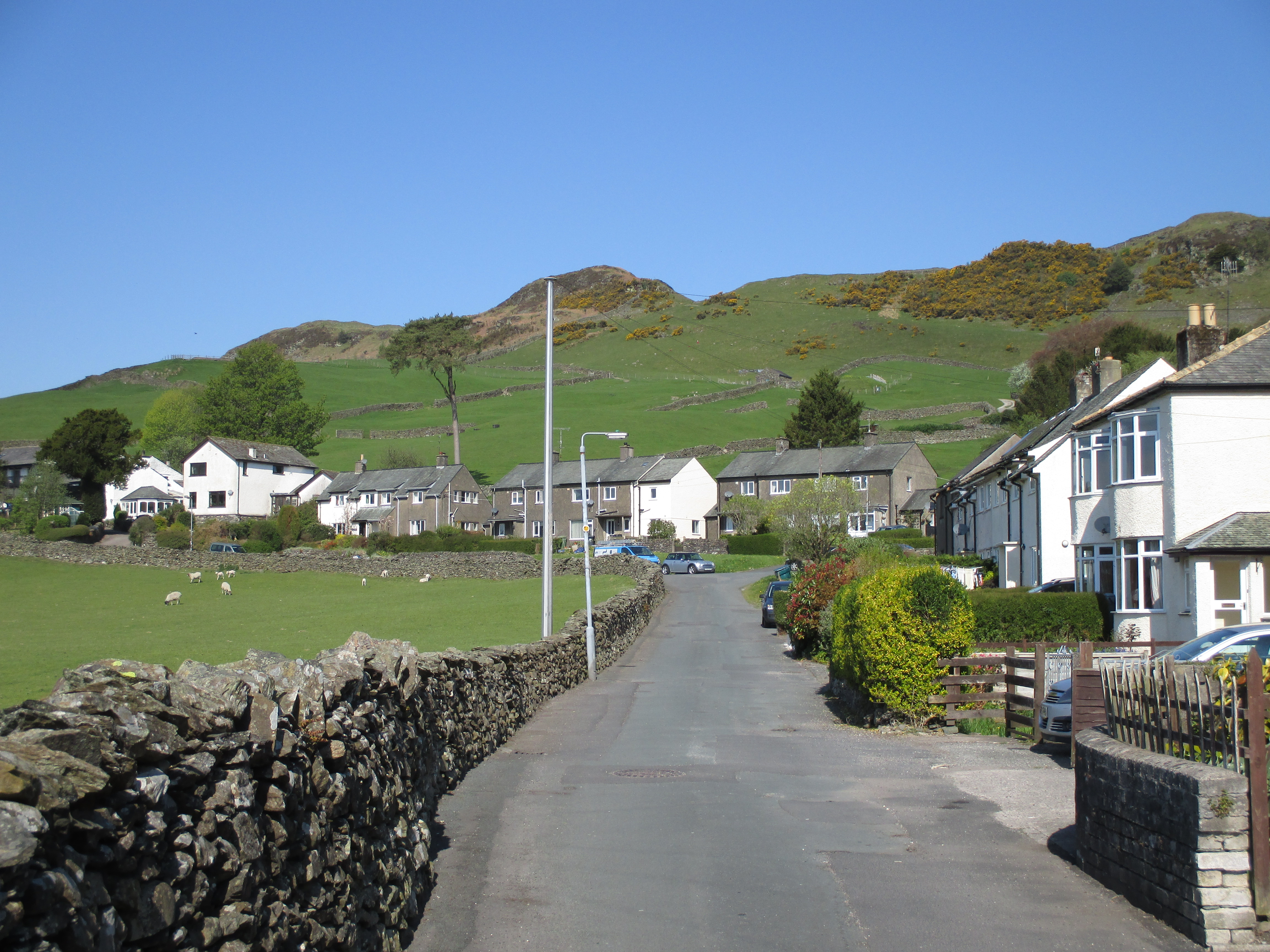
Hugill is a civil parish in the South Lakeland district of the English county of Cumbria. Hugill includes the village of Ings and the hamlets of Grassgarth, and Reston plus a large part of the village of Staveley and the west bank of the River Kent north of Barley Bridge. It was formerly a part of the Barony of Kendal. In the 2001 census the parish had a population of 416, increasing at the 2011 census to 446. Approximately 60% of the population live in Staveley or the Kent valley. In the 1870s, Hugill was described as :''The township lies on the Kendal and Windermere railway, 2 miles E of Windermere; and contains the hamlets of Ings, Grass-Garth, and BorwickFold. Reston Scar is a prominent feature in the valley.'' Staveley with Ings Parish Council represents the three civil parishes of Hugill, Nether Staveley and Over Staveley. It has produced two ambitious Parish Plans, which have set out ''"aspirations for the future."'' that are concerned with improving the environme ... [...More Info...] [...Related Items...] OR: [Wikipedia] [Google] [Baidu] |
Listed Buildings In Hugill
Hugill is a civil parish in the South Lakeland District of Cumbria, England. It contains nine listed buildings that are recorded in the National Heritage List for England. Of these, two are listed at Grade II*, the middle of the three grades, and the others are at Grade II, the lowest grade. The parish is in the Lake District National Park and is almost completely rural, the only settlement being the village of Ings. Most of the listed buildings are farmhouses and farm buildings, the others being a country house An English country house is a large house or mansion in the English countryside. Such houses were often owned by individuals who also owned a town house. This allowed them to spend time in the country and in the city—hence, for these peopl ..., a monument, a church, and a school later used as a parish hall. __NOTOC__ Key Buildings References Citations Sources * * * * * * * * * * * {{DEFAULTSORT:Hugill Lists of listed buildings in Cumb ... [...More Info...] [...Related Items...] OR: [Wikipedia] [Google] [Baidu] |
Ings, Cumbria
Ings is a village in the South Lakeland district of Cumbria, England. It lies on the course on the River Gowan and A591 road, east of Windermere. Ings is located in the parish of Hugill, historically a part of Westmorland. The Grade II*-listed St Anne's Church is located within the village. See also *Listed buildings in Hugill Hugill is a civil parish in the South Lakeland District of Cumbria, England. It contains nine listed buildings that are recorded in the National Heritage List for England. Of these, two are listed at Grade II*, the middle of the three gr ... References External links Cumbria County History Trust: Hugill(nb: provisional research only – see Talk page) Villages in Cumbria South Lakeland District {{Cumbria-geo-stub ... [...More Info...] [...Related Items...] OR: [Wikipedia] [Google] [Baidu] |
Hugill Fell
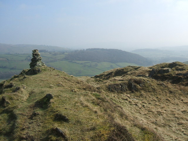
Hugill Fell is a hill in the English Lake District, near Staveley, Cumbria Cumbria ( ) is a ceremonial and non-metropolitan county in North West England, bordering Scotland. The county and Cumbria County Council, its local government, came into existence in 1974 after the passage of the Local Government Act 1972. Cumb ..., on the western side of the Kentmere valley. It is the subject of a chapter of Wainwright's book '' The Outlying Fells of Lakeland''. It reaches and Wainwright's walk is an ascent from Staveley and return on the same route. There is a cairn on the summit. References Fells of the Lake District {{Cumbria-geo-stub ... [...More Info...] [...Related Items...] OR: [Wikipedia] [Google] [Baidu] |
The Outlying Fells Of Lakeland
''The Outlying Fells of Lakeland'' is a 1974 book written by Alfred Wainwright dealing with hills in and around the Lake District of England. It differs from Wainwright's '' Pictorial Guides'' in that each of its 56 chapters describes a walk, sometimes taking in several summits, rather than a single fell. This has caused some confusion on the part of authors attempting to prepare a definitive list of peaks. The Outlying Fells do not form part of the 214 hills generally accepted as making up the Wainwrights, but they are included in Category 2B of the ''Hill Walkers' Register'' maintained by the Long Distance Walkers Association. The book The first edition was published in 1974 by ''The Westmorland Gazette''. It was republished by Michael Joseph in 1992 () and a second edition, revised by Chris Jesty, was published by the Wainwright Society in 2020 (). The first edition is uniform with the seven volumes of Wainwright's ''Pictorial Guides'', with a yellow band at head and fo ... [...More Info...] [...Related Items...] OR: [Wikipedia] [Google] [Baidu] |
Staveley, Cumbria
Staveley () is a village in the South Lakeland district, in Cumbria, England. Historic counties of England, Historically part of Westmorland, it is situated northwest of Kendal where the River Kent is joined by its tributary the River Gowan, Cumbria, Gowan. It is also known as Staveley-in-Westmorland and Staveley-in-Kendal to distinguish it from Staveley-in-Cartmel (a small village near Newby Bridge which is now in Cumbria but was previously in Lancashire). There are three civil parishes – Nether Staveley, Over Staveley and Hugill (part). Their total population at the 2011 Census was 1,593 but this includes those living in the hamlet of Ings, Cumbria, Ings in Hugill parish. Governance Historic counties of England, Historically within the county of Westmorland, it became part of the new non-metropolitan county of Cumbria in 1974. Staveley is divided between three civil parishes; * The village south of the rivers Gowan and Kent is in Nether Staveley, * Most of the village nor ... [...More Info...] [...Related Items...] OR: [Wikipedia] [Google] [Baidu] |
High Knott
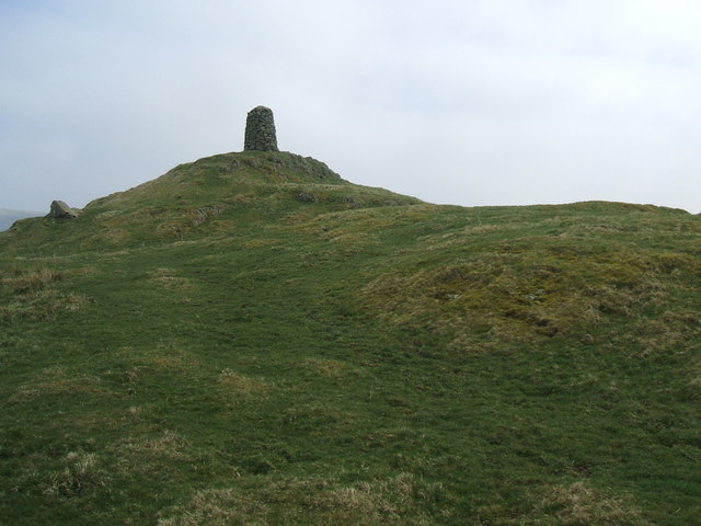
High Knott, marked on some Ordnance Survey maps as Williamson's Monument, is a hill in the eastern part of the English Lake District, near Staveley, Cumbria. The monument on its summit was built by the Reverend T. Williamson in 1803, in memory of his father Thomas Williamson, who had climbed the fell every day before breakfast. The fell is the subject of a chapter of Wainwright's book ''The Outlying Fells of Lakeland''. It reaches and Wainwright's route starts near the 17th-century Ulthwaite Bridge on the River Kent, climbing High Knott and then making a clockwise circuit to the early British village site at Hugill and ''"over the pleasant heights on the west side of mid-Kentmere Kentmere is a valley, village and civil parish in the Lake District National Park, a few miles from Kendal in the South Lakeland district of Cumbria, England. Historically in Westmorland, at the 2011 census Kentmere had a population of 1 ..."''. Access to the summit is (at May 2016) forbidde ... [...More Info...] [...Related Items...] OR: [Wikipedia] [Google] [Baidu] |
Barony Of Kendal
The Barony of Kendal is a subdivision of the English Historic counties of England, historic county of Westmorland. It is one of two ancient barony (county division), baronies that make up the county, the other being the Barony of Westmorland (also known as North Westmorland, or the Barony of Appleby). In 1974, the entire county became part of the modern county of Cumbria and ceased to have an administrative function. At the same time, Kendal borough along with some other rural and urban districts in Westmorland was merged with the neighbouring parts of Lancashire, Furness and Cartmel, and also the Sedbergh Rural District of the West Riding of Yorkshire into the new South Lakeland district of the new county. The barony is the remnant of the English Feudal Baronies, feudal barony whose caput was at Kendal castle. The feudal barony had its own complex evolution, determined by the evolution of the families that owned it. For some purposes, it was therefore once considered to include ... [...More Info...] [...Related Items...] OR: [Wikipedia] [Google] [Baidu] |
Over Staveley
Over Staveley is a civil parish in South Lakeland, Cumbria, England. The parish comprises most of the village of Staveley north of the River Gowan, and areas of farmland and fell (including Brunt Knott) extending some north of the village. At the 2011 census it had a population of 437. The parish is within the Lake District National Park. It has a joint parish council with Hugill and Nether Staveley, formed in 2004 and called Staveley with Ings Parish Council. See also * Listed buildings in Over Staveley References External links Cumbria County History Trust: Staveley, Over(nb: provisional research only – see Talk page) * Staveley historical and genealogical information at GENUKI GENUKI is a genealogy web portal, run as a charitable trust. It "provides a virtual reference library of genealogical information of particular relevance to the UK and Ireland". It gives access to a large collection of information, with the emphas ... Civil parishes in Cumbria Sou ... [...More Info...] [...Related Items...] OR: [Wikipedia] [Google] [Baidu] |
Nether Staveley
Nether Staveley is a civil parish in South Lakeland, Cumbria, England. The parish comprises the part of the village of Staveley south of the River Gowan and River Kent The River Kent is a short river in the county of Cumbria in England. It originates in hills surrounding Kentmere, and flows for around 20 miles (32 km) into the north of Morecambe Bay. The upper reaches and the western bank of the estuary ..., and areas of farmland south of the village. In the 2001 census the parish had a population of 677, increasing at the 2011 census to 710. It has a joint parish council with Hugill and Over Staveley, formed in 2004 and called Staveley with Ings Parish Council. See also * Listed buildings in Nether Staveley References External links Cumbria County History Trust: Staveley, Nether(nb: provisional research only – see Talk page) * Civil parishes in Cumbria South Lakeland District {{Cumbria-geo-stub ... [...More Info...] [...Related Items...] OR: [Wikipedia] [Google] [Baidu] |
Civil Parishes In Cumbria
A civil parish in England is the lowest unit of local government in England, local government. There are 284 civil parishes in the ceremonial county of Cumbria, with most of the county being parished, and Allerdale, Borough of Copeland, Copeland, Eden District, Eden and South Lakeland being entirely parished. At the 2001 census, there were 359,692 people living in those 284 parishes, accounting for 73.8 per cent of the county's population. The extent of modern Civil parishes are largely geographically based on historic Church of England parish boundaries, which were ecclesiastical divisions that had acquired civil administration powers managed by the Vestry committee.Angus Winchester, 2000, ''Discovering Parish Boundaries''. Shire Publications. Princes Risborough, 96 pages History The Highways Act 1555 made parishes responsible for the upkeep of roads. Every adult inhabitant of the parish was obliged to work four days a year on the roads, providing their own tools, carts and ho ... [...More Info...] [...Related Items...] OR: [Wikipedia] [Google] [Baidu] |
Cumberland
Cumberland ( ) is a historic county in the far North West England. It covers part of the Lake District as well as the north Pennines and Solway Firth coast. Cumberland had an administrative function from the 12th century until 1974. From 1974 until 2023, Cumberland lay within Cumbria, a larger administrative area which also covered Westmorland and parts of Yorkshire and Lancashire. In April 2023, Cumberland will be revived as an administrative entity when Cumbria County Council is abolished and replaced by two unitary authorities; one of these is to be named Cumberland and will include most of the historic county, with the exception of Penrith and the surrounding area. Cumberland is bordered by the historic counties of Northumberland to the north-east, County Durham to the east, Westmorland to the south-east, Lancashire to the south, and the Scottish counties of Dumfriesshire and Roxburghshire to the north. Early history In the Early Middle Ages, Cumbria was part of t ... [...More Info...] [...Related Items...] OR: [Wikipedia] [Google] [Baidu] |
Ordnance Survey Of Hugill Civil Parish
Ordnance may refer to: Military and defense *Materiel in military logistics, including weapons, ammunition, vehicles, and maintenance tools and equipment. **The military branch responsible for supplying and developing these items, e.g., the United States Army Ordnance Corps *Artillery, often in a formal name, e.g., "Ordnance Survey". *Artillery shells, specifically unexploded ordnance. *Aircraft ordnance, weapons carried by and used by an aircraft. Places * Ordnance, Oregon, a former community near the Umatilla Chemical Depot * Ordnance Island, formerly a Royal Army Ordnance Corps depot, in St. George's Town, Bermuda Maps-related *Ordnance datum (from use in ballistics), a vertical datum used as the basis for deriving altitudes on maps *Ordnance Survey, the national mapping agency for Great Britain See also *Ordnance Corps (other) Ordnance Corps may refer to: *Royal Australian Army Ordnance Corps, the Corps within the Australian Army concerned with explosives and s ... [...More Info...] [...Related Items...] OR: [Wikipedia] [Google] [Baidu] |
