|
Horonobe
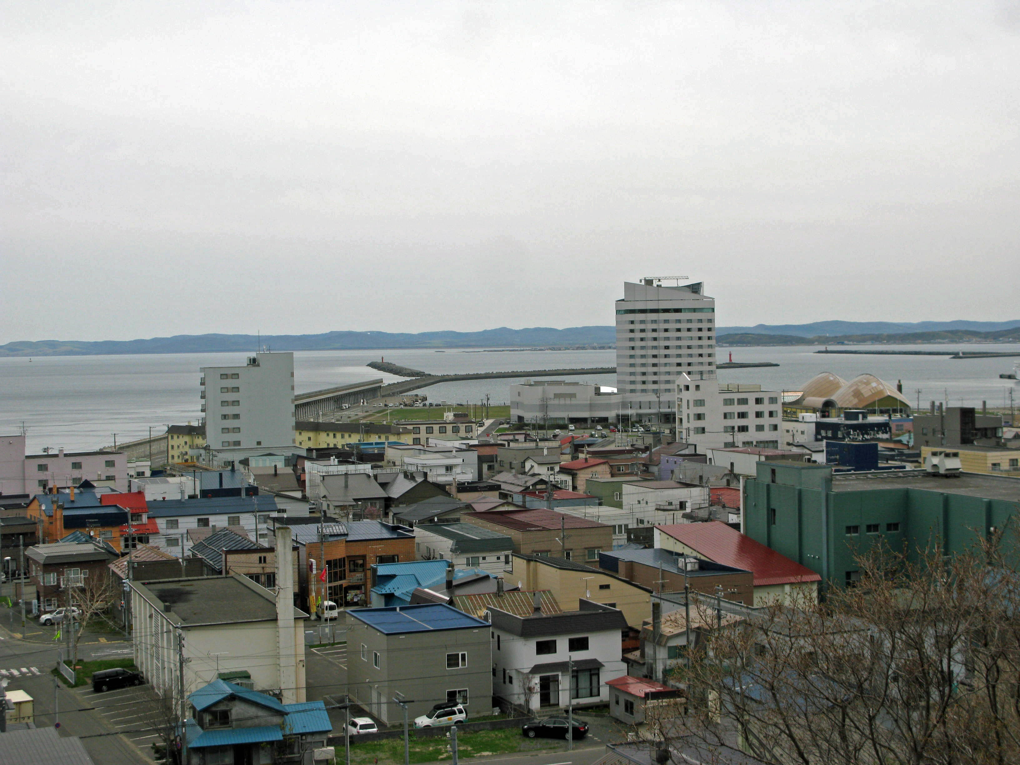
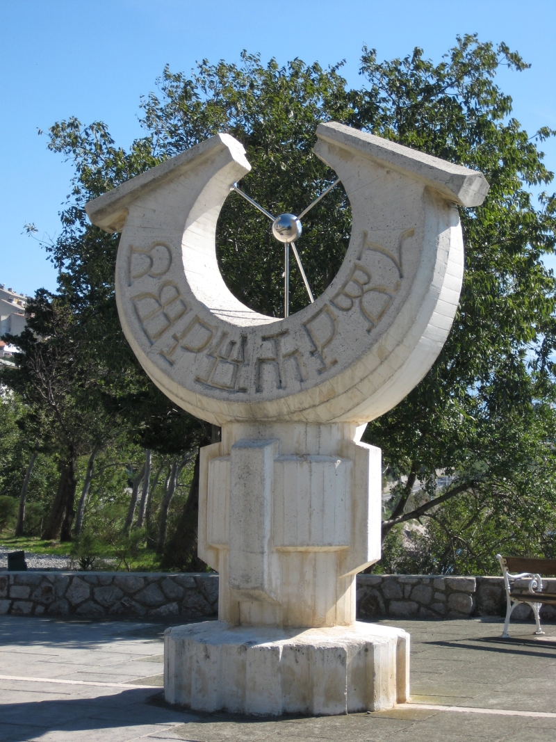
is a town located in Sōya Subprefecture, Hokkaido, Japan. There is a JR train station, Horonobe Station which connects Horonobe-town with other cities in Hokkaido. The word Horonobe originates from Poro-Nup. In Ainu language, poro means large and nup mean grassland, thus meaning a large uncultivated land. At the end of September 2016, the town had an estimated population of 2,415 and a density of 4.2 persons per km2. The total area is 574.27 km2. The north 45°latitude passes through this town. Horonobe is also known for its reindeer population and wind turbines located on its beaches. In October 2000, with the help of local government and NEDO,NEDO New Energy in Hokkaido, text in Japanese the Horonobe |
Sōya Main Line
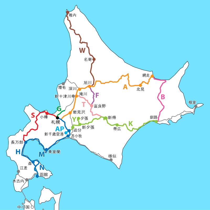
The is a Japanese railway line operated by Hokkaido Railway Company (JR Hokkaido) in Hokkaido. The line connects Asahikawa Station in Asahikawa and Wakkanai Station in Wakkanai, and is the northernmost railway line in Japan. The name comes from Sōya Subprefecture. On 19 November 2016, JR Hokkaido's President announced plans to rationalise the network by up to 1,237 km, or ~50% of the current network, including proposed conversion of the Nayoro - Wakkanai section of the Soya Line to Third Sector operation, but if local governments are not agreeable, the section will face closure. Services One '' Sōya'' limited express service operates each way between and daily, and two '' Sarobetsu'' limited express services also operate each way between Asahikawa and Wakkanai daily. All-stations "Local" train services operate between and , at approximately 1 to 2 hour intervals. All-stations "Local" train services operate between Nayoro and Wakkanai, at approximately 3 to 4 hour ... [...More Info...] [...Related Items...] OR: [Wikipedia] [Google] [Baidu] |
Horonobe Station
is a railway station in Horonobe, Teshio District, Hokkaidō, Japan. Lines *Hokkaido Railway Company **Sōya Main Line The is a Japanese railway line operated by Hokkaido Railway Company (JR Hokkaido) in Hokkaido. The line connects Asahikawa Station in Asahikawa and Wakkanai Station in Wakkanai, and is the northernmost railway line in Japan. The name comes fr ... Station W72 Layout The station contains three tracks, one side platform, and one island platform. Siding with hangars. Adjacent stations Stations of Hokkaido Railway Company Railway stations in Hokkaido Prefecture Railway stations in Japan opened in 1925 {{Hokkaido-rail-station-stub ... [...More Info...] [...Related Items...] OR: [Wikipedia] [Google] [Baidu] |
Sōya Subprefecture
is a subprefecture of Hokkaido Prefecture, Japan. Its population is estimated to be 77,500 as of July 31, 2004 and its area is . It is the northernmost subprefecture of Japan. Wakkanai Airport is located in Wakkanai. Rishiri Airport is located in Rishirifuji, Rishiri District. Geography Municipalities Mergers History *1897: Sōya Subprefecture established; Sōya, Esashi, Rishiri, Rebun Districts placed under its jurisdiction *1948: Toyotomi village (now town), Teshio District transferred from Rumoi Subprefecture is a subprefecture of Hokkaido Prefecture, Japan. As of 2011, it had a population of 52,627 and an area of . The population density of the subprefecture, 13 people per km2, is very low compared to the rest of Japan. The population of Rumoi Subpr ... *2010: Horonobe town, Teshio District transferred from Rumoi Subprefecture External links Official website Subprefectures in Hokkaido {{Hokkaido-geo-stub ... [...More Info...] [...Related Items...] OR: [Wikipedia] [Google] [Baidu] |
Hokkaido
is Japan's second largest island and comprises the largest and northernmost prefecture, making up its own region. The Tsugaru Strait separates Hokkaidō from Honshu; the two islands are connected by the undersea railway Seikan Tunnel. The largest city on Hokkaidō is its capital, Sapporo, which is also its only ordinance-designated city. Sakhalin lies about 43 kilometers (26 mi) to the north of Hokkaidō, and to the east and northeast are the Kuril Islands, which are administered by Russia, though the four most southerly are claimed by Japan. Hokkaidō was formerly known as ''Ezo'', ''Yezo'', ''Yeso'', or ''Yesso''. Nussbaum, Louis-Frédéric. (2005). "Hokkaidō" in Although there were Japanese settlers who ruled the southern tip of the island since the 16th century, Hokkaido was considered foreign territory that was inhabited by the indigenous people of the island, known as the Ainu people. While geographers such as Mogami Tokunai and Mamiya Rinzō explored the isla ... [...More Info...] [...Related Items...] OR: [Wikipedia] [Google] [Baidu] |
Teshio District, Hokkaido
is a district divided between Rumoi and Sōya Subprefectures, Hokkaido, Japan. At the end of 2009, the district has an estimated population of 13,937 and an area of 2039.11 km2, giving a population density of 6.83 persons per square kilometer. In 2010, the town of Horonobe was transferred from Rumoi Subprefecture to Sōya Subprefecture. Towns Rumoi Subprefecture * Enbetsu * Teshio Sōya Prefecture * Horonobe *Toyotomi The was a Japanese clan that ruled over the Japanese before the Edo period. Unity and conflict The most influential figure within the Toyotomi was Toyotomi Hideyoshi, one of the three "unifiers of Japan". Oda Nobunaga was another primary u ... Districts in Hokkaido {{Hokkaido-geo-stub ... [...More Info...] [...Related Items...] OR: [Wikipedia] [Google] [Baidu] |
Japan Atomic Energy Agency
The is an Independent Administrative Institution formed on October 1, 2005 by a merger of two previous semi-governmental organizations. While it inherited the activities of both JNC and JAERI, it also inherited the nickname of JAERI, "Genken" 原研, an abbreviated word for "nuclear research". On April 10, 2007, JAEA officially joined the GNEP alliance. The other members in the alliance are Areva, Washington Group International and BWX. It is expected that the experience gained from the Rokkasho centrifuge enrichment plant will be a key contribution from JAEA. On April 1, 2016, JAEA transferred some of its laboratories to the National Institute of Radiological Sciences (NIRS), and the NIRS body was renamed to the National Institutes for Quantum and Radiological Science and Technology (QST) which includes existing laboratories of the NIRS. In 2018 JAEA estimated it would need about 1.9 trillion yen ($17.1 billion) to decommission 79 facilities over 70 years. Overview *Est ... [...More Info...] [...Related Items...] OR: [Wikipedia] [Google] [Baidu] |
Deep Geological Repository
A deep geological repository is a way of storing hazardous or radioactive waste within a stable geologic environment (typically 200–1000 m deep). It entails a combination of waste form, waste package, engineered seals and geology that is suited to provide a high level of long-term isolation and containment without future maintenance. This will prevent any radioactive dangers. A number of mercury, cyanide and arsenic waste repositories are operating worldwide including Canada (Giant Mine) and Germany (potash mines in Herfa-Neurode and Zielitz) and a number of radioactive waste storages are under construction with the Onkalo in Finland being the most advanced. Principles and background Highly toxic waste that cannot be further recycled must be stored in isolation to avoid contamination of air, ground and underground water. Deep geological repository is a type of long-term storage that isolates waste in geological structures that are expected to be stable for millions of years, ... [...More Info...] [...Related Items...] OR: [Wikipedia] [Google] [Baidu] |
List Of Towns In Japan
A town (町; ''chō'' or ''machi'') is a local administrative unit in Japan. It is a local public body along with prefecture (''ken'' or other equivalents), city (''shi''), and village (''mura''). Geographically, a town is contained within a district. Note that the same word (町; ''machi'' or ''chō'') is also used in names of smaller regions, usually a part of a ward in a city. This is a legacy of when smaller towns were formed on the outskirts of a city, only to eventually merge into it. Towns See also * Municipalities of Japan * Japanese addressing system The Japanese addressing system is used to identify a specific location in Japan. When written in Japanese characters, addresses start with the largest geographical entity and proceed to the most specific one. When written in Latin characters, ad ... References {{reflist External links "Large_City_System_of_Japan";_graphic_shows_towns_compared_with_other_Japanese_city_types_at_p._1_[PDF_7_of_40/nowiki>">DF_7_of_4 ... [...More Info...] [...Related Items...] OR: [Wikipedia] [Google] [Baidu] |
Rumoi Subprefecture
is a subprefecture of Hokkaido Prefecture, Japan. As of 2011, it had a population of 52,627 and an area of . The population density of the subprefecture, 13 people per km2, is very low compared to the rest of Japan. The population of Rumoi Subprefecture represents 0.96% of the overall population of Hokkaido. Geography Rumoi Subprefecture stretches broadly across the coast of the Sea of Japan in northwestern Hokkaido. Municipalities Mergers Rivers The Rumoi River flows from Mount Poroshiri in the Hidaka Mountain range to the Sea of Japan. History Mashike Subprefecture was established as part of the administrative reforms of Hokkaido during the Meiji period (1868 – 1912). The capital was moved to Rumoi in 1914, and the subprefecture was renamed to Rumoi Subprefecture in the same year. Toyotomi Town) in Teshio District transferred to Sōya Subprefecture in 1948, and Horonobe was transferred to Sōya Subprefecture in 2010. Economy The fishing industries domin ... [...More Info...] [...Related Items...] OR: [Wikipedia] [Google] [Baidu] |
JR Hokkaido
The is one of the constituent companies of the Japan Railways Group (JR Group), and is often referred to using its official abbreviation of . It operates intercity and local rail services in Hokkaido, Japan. The company introduced Kitaca, a smart card ticketing system, in autumn 2008. At the time of its privatization in 1987, JR Hokkaido operated 21 railway lines totalling of narrow-gauge () track, as well as a ferry service to Aomori. Since then, that figure has dwindled to just below , as unprofitable lines have been shut down or spun off (in the case of the Hokkaidō Chihoku Kōgen Railway). The ferry service has also been replaced by the Seikan Tunnel. On 19 November 2016, JR Hokkaido's president announced plans to further rationalize its network by the withdrawal of services from up to 1,237 km, or about 50% of the current network, including closure of the remaining section of the Rumoi Main Line (the Rumoi - Mashike section closed on 4 December 2016), the Shin-Yuba ... [...More Info...] [...Related Items...] OR: [Wikipedia] [Google] [Baidu] |
45th Parallel North
The 45th parallel north is a circle of latitude that is 45 degrees north of Earth's equator. It crosses Europe, Asia, the Pacific Ocean, North America, and the Atlantic Ocean. The 45th parallel north is often called the halfway point between the equator and the North Pole, but the true halfway point is north of it (approximately between 45°08'36" and 45°08'37") because Earth is an oblate spheroid; that is, it bulges at the equator and is flattened at the poles. At this latitude, the sun is visible for 15 hours 37 minutes during the summer solstice, and 8 hours 46 minutes during the winter solstice. The midday Sun stands 21.6° above the southern horizon at the December solstice, 68.4° at the June solstice, and exactly 45.0° at either equinox. Around the world Starting at the Prime Meridian and heading eastwards, the parallel 45° north passes through: : Europe In Europe the 45th parallel hits the Bay of Biscay coast of France in the west. It crosses the river Rhôn ... [...More Info...] [...Related Items...] OR: [Wikipedia] [Google] [Baidu] |
Hokkaido Railway Company
The is one of the constituent companies of the Japan Railways Group (JR Group), and is often referred to using its official abbreviation of . It operates intercity and local rail services in Hokkaido, Japan. The company introduced Kitaca, a smart card ticketing system, in autumn 2008. At the time of its privatization in 1987, JR Hokkaido operated 21 railway lines totalling of narrow-gauge () track, as well as a ferry service to Aomori. Since then, that figure has dwindled to just below , as unprofitable lines have been shut down or spun off (in the case of the Hokkaidō Chihoku Kōgen Railway). The ferry service has also been replaced by the Seikan Tunnel. On 19 November 2016, JR Hokkaido's president announced plans to further rationalize its network by the withdrawal of services from up to 1,237 km, or about 50% of the current network, including closure of the remaining section of the Rumoi Main Line (the Rumoi - Mashike section closed on 4 December 2016), the Shin-Yuba ... [...More Info...] [...Related Items...] OR: [Wikipedia] [Google] [Baidu] |


