|
Hogback (sculpture)
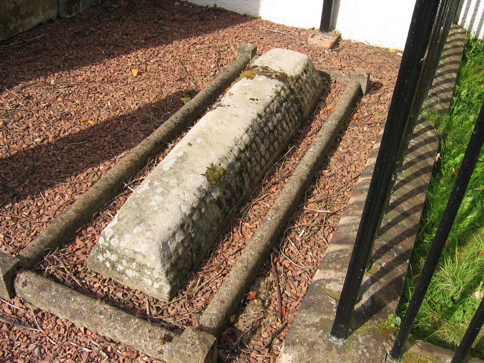
Hogbacks are stone carved Anglo-Scandinavian sculptures from 10th- to 12th-century England and Scotland. Singular hogbacks were found in Ireland and Wales. Hogbacks fell out of fashion by the beginning of the 11th century. Their function is generally accepted as grave markers. Similar grave markers have been found in Scandinavia. In Cornwall similar stones are known as ''coped stones''. Geography and description Hogbacks take the form of recumbent monuments, generally with a curved ('hogbacked') ridge, often also with outwardly curved sides. This shape, and the fact that they are frequently decorated with ' shingles' on either side of the central ridge, show that they are stylised 'houses' for the dead. The 'house' is of a Scandinavian longhouse type associated with the 'mead hall' feasting at Valhalla in pre-Christian Norse religion. One theory is that hogbacks originated among the Danish settlers who emigrated to northern England in the 870s. However, there is not sufficient re ... [...More Info...] [...Related Items...] OR: [Wikipedia] [Google] [Baidu] |
Yorkshire
Yorkshire ( ; abbreviated Yorks), formally known as the County of York, is a Historic counties of England, historic county in northern England and by far the largest in the United Kingdom. Because of its large area in comparison with other English counties, functions have been undertaken over time by its subdivisions, which have also been subject to History of local government in Yorkshire, periodic reform. Throughout these changes, Yorkshire has continued to be recognised as a geographic territory and cultural region. The name is familiar and well understood across the United Kingdom and is in common use in the media and the Yorkshire Regiment, military, and also features in the titles of current areas of civil administration such as North Yorkshire, South Yorkshire, West Yorkshire and the East Riding of Yorkshire. Within the borders of the historic county of Yorkshire are large stretches of countryside, including the Yorkshire Dales, North York Moors and Peak District nationa ... [...More Info...] [...Related Items...] OR: [Wikipedia] [Google] [Baidu] |
Govan Old Parish Church
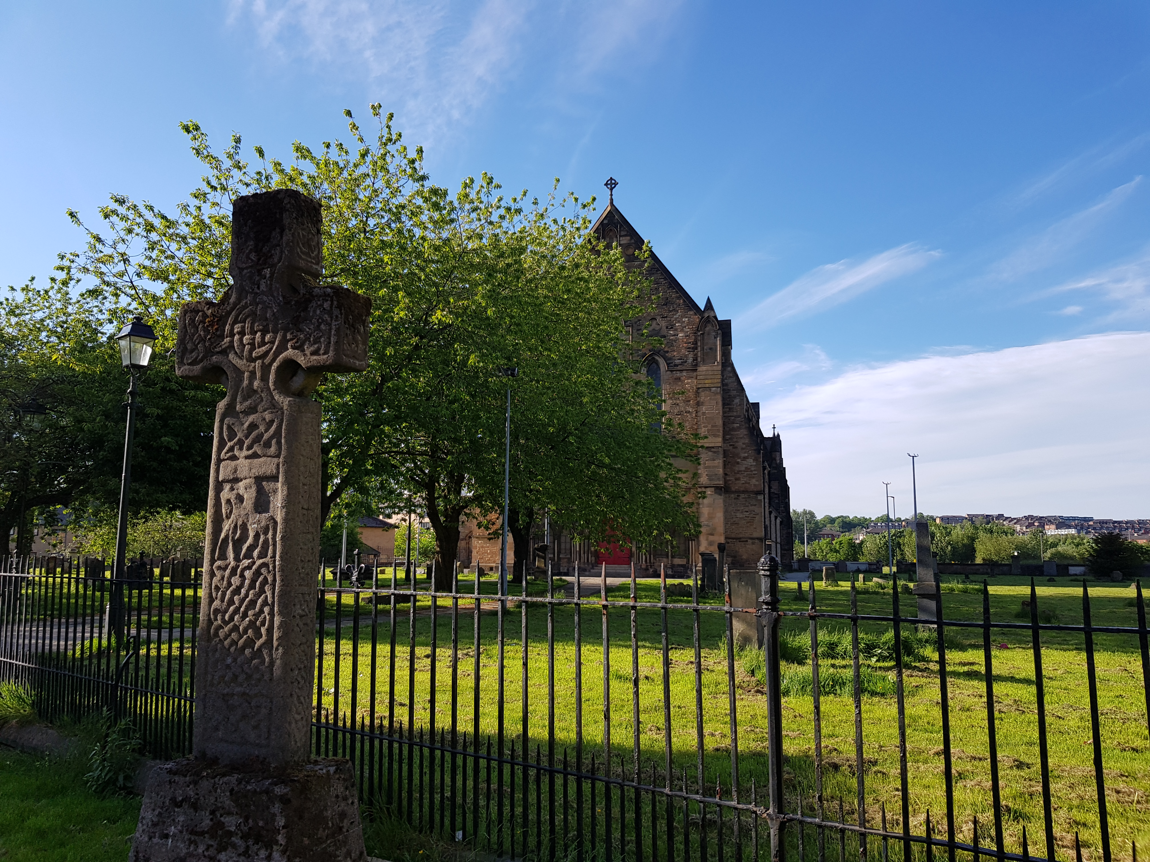
Govan Old Parish Church is the name of the original parish church serving Govan in Glasgow from the 5th or 6th century AD until 2007. In that year, the Church of Scotland united the two Govan congregations with Linthouse and established the parish church at Govan Cross, making Govan Old redundant. Govan Old is no longer used for regular Sunday services, but the building remains a place of worship with a daily morning service and is open to visitors in the afternoons. The church, dedicated to a Saint Constantine, occupies a Scottish Gothic Revival building of national significance (A-Listed by Historic Environment Scotland) within a churchyard designated a Scheduled Ancient Monument (Historic Environment Scotland). The church houses an internationally-significant collection of early medieval sculpture, known as the Govan Stones. All the carved stones come from the churchyard and include the Govan Sarcophagus, four upstanding crosses with figurative and interlace decoration, five ... [...More Info...] [...Related Items...] OR: [Wikipedia] [Google] [Baidu] |
Durham Cathedral
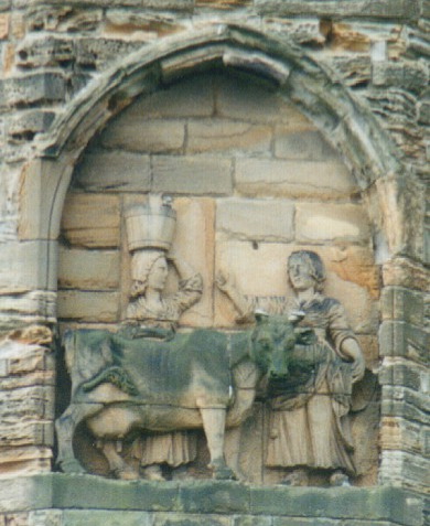
The Cathedral Church of Christ, Blessed Mary the Virgin and St Cuthbert of Durham, commonly known as Durham Cathedral and home of the Shrine of St Cuthbert, is a cathedral in the city of Durham, County Durham, England. It is the seat of the Bishop of Durham, the fourth-ranked bishop in the Church of England hierarchy. Building of the present Norman-era cathedral started in 1093, replacing the city's previous 'White Church'. In 1986 the cathedral and Durham Castle were designated a UNESCO World Heritage Site. Durham Cathedral's relics include: Saint Cuthbert's, transported to Durham by Lindisfarne monks in the 800s; Saint Oswald's head and the Venerable Bede's remains. The Durham Dean and Chapter Library contains: sets of early printed books, some of the most complete in England; the pre-Dissolution monastic accounts and three copies of '' Magna Carta''. From 1080 until 1836, the Bishop of Durham held the powers of an Earl Palatine. In order to protect the Anglo-S ... [...More Info...] [...Related Items...] OR: [Wikipedia] [Google] [Baidu] |
North Yorkshire
North Yorkshire is the largest ceremonial counties of England, ceremonial county (lieutenancy area) in England, covering an area of . Around 40% of the county is covered by National parks of the United Kingdom, national parks, including most of the Yorkshire Dales and the North York Moors. It is one of four counties in England to hold the name Yorkshire; the three other counties are the East Riding of Yorkshire, South Yorkshire and West Yorkshire. North Yorkshire may also refer to a non-metropolitan county, which covers most of the ceremonial county's area () and population (a mid-2016 estimate by the Office for National Statistics, ONS of 602,300), and is administered by North Yorkshire County Council. The non-metropolitan county does not include four areas of the ceremonial county: the City of York, Middlesbrough, Redcar and Cleveland and the southern part of the Borough of Stockton-on-Tees, which are all administered by Unitary authorities of England, unitary authorities. ... [...More Info...] [...Related Items...] OR: [Wikipedia] [Google] [Baidu] |
Brompton, Hambleton
Brompton is a village, civil parish and electoral ward in the Hambleton District of North Yorkshire, England, about north of the county town of Northallerton. Practically a suburb of the nearby county town, the village was near the site of a battle between English and Scots armies and was the location of mills producing linen goods from the 18th century onward. With 2,055 people this village has grown considerably since the 1800s. History The village is mentioned in the Domesday Book of 1086 as ''Bruntone'' in the Allerton hundred. Prior to the invasion, the manor was granted to ''Earl Edwin'', but subsequently granted in 1086 to the Crown and were added to the lands that were the possession of the Bishop of Durham St Cuthbert and remained so after 1086. In 1836 those lands were transferred to the see of Ripon. The village became an ecclesiastical parish in 1843. The etymology of the name is derived from a combination of the Old English word ''brōm'', meaning ''broom'' and ... [...More Info...] [...Related Items...] OR: [Wikipedia] [Google] [Baidu] |
Ingleby Arncliffe
Ingleby Arncliffe is a village and civil parish in the Hambleton district of North Yorkshire, England. It is situated between the A172 and A19 roads, north-east from Northallerton and south-east from the small market town of Stokesley, and is on the edge of the North York Moors National Park. The village is conjoined to its smaller neighbour, Ingleby Cross. Ingleby Arncliffe lies in the historic county of the North Riding of Yorkshire. History According to ''A Dictionary of British Place Names'', Ingleby is derived from the Old Scandinavian "Englar + by", meaning "farmstead or village of the Englishmen", and Arncliffe, Old English "earn + cliff", meaning "eagles' cliff". Ingleby Arncliffe Grade II* listed Anglican church is dedicated to All Saints. It dates from 1821 but includes 14th-century effigies An effigy is an often life-size sculptural representation of a specific person, or a prototypical figure. The term is mostly used for the makeshift dummies used for ... [...More Info...] [...Related Items...] OR: [Wikipedia] [Google] [Baidu] |
County Kildare
County Kildare ( ga, Contae Chill Dara) is a county in Ireland. It is in the province of Leinster and is part of the Eastern and Midland Region. It is named after the town of Kildare. Kildare County Council is the local authority for the county, which has a population of 246,977. Geography and subdivisions Kildare is the 24th-largest of Ireland's 32 counties in area and the seventh largest in terms of population. It is the eighth largest of Leinster's twelve counties in size, and the second largest in terms of population. It is bordered by the counties of Carlow, Laois, Meath, Offaly, South Dublin and Wicklow. As an inland county, Kildare is generally a lowland region. The county's highest points are the foothills of the Wicklow Mountains bordering to the east. The highest point in Kildare is Cupidstown Hill on the border with South Dublin, with the better known Hill of Allen in central Kildare. Towns and villages * Allen * Allenwood * Ardclough * Athy * Ballitore * Ball ... [...More Info...] [...Related Items...] OR: [Wikipedia] [Google] [Baidu] |
Castledermot
Castledermot () is an inland village in the south-east of Ireland in County Kildare, about from Dublin, and from the town of Carlow. The N9 road from Dublin to Waterford previously passed through the village but upon completion of a motorway bypass in 2010, it was re-designated the R448. History The earliest known Irish Parliament met at Castledermot on 18 June 1264. Also, the oldest intact window in Western Europe can be found in the town, being part of the ruins of a Franciscan Monastery. The window, although large, is only stonework. St. Laurence O'Toole, ( 1128 - 1180) or Lorcán Ua Tuathail, was born at Castledermot. In July 1903 the Gordon Bennett Cup passed through Castledermot. Public transport Bus The main bus route serving Castledermot is J.J. Kavanagh & Sons route 736 providing a limited number of daily services to Carlow, Waterford, Dublin and Dublin Airport. This service was reduced in 2015 which impacted local commuters and community members seeking ... [...More Info...] [...Related Items...] OR: [Wikipedia] [Google] [Baidu] |
Orkney
Orkney (; sco, Orkney; on, Orkneyjar; nrn, Orknøjar), also known as the Orkney Islands, is an archipelago in the Northern Isles of Scotland, situated off the north coast of the island of Great Britain. Orkney is 10 miles (16 km) north of the coast of Caithness and has about 70 islands, of which 20 are inhabited. The largest island, the Mainland, Orkney, Mainland, has an area of , making it the List of islands of Scotland, sixth-largest Scottish island and the List of islands of the British Isles, tenth-largest island in the British Isles. Orkney’s largest settlement, and also its administrative centre, is Kirkwall. Orkney is one of the 32 Subdivisions of Scotland, council areas of Scotland, as well as a Orkney (Scottish Parliament constituency), constituency of the Scottish Parliament, a Lieutenancy areas of Scotland, lieutenancy area, and an counties of Scotland, historic county. The local council is Orkney Islands Council, one of only three councils in Scotland with ... [...More Info...] [...Related Items...] OR: [Wikipedia] [Google] [Baidu] |
Northern Isles
The Northern Isles ( sco, Northren Isles; gd, Na h-Eileanan a Tuath; non, Norðreyjar; nrn, Nordøjar) are a pair of archipelagos off the north coast of mainland Scotland, comprising Orkney and Shetland. They are part of Scotland, as are the Hebrides. The climate is cool and temperate and much influenced by the surrounding seas. There are a total of 36 inhabited islands. The landscapes of the fertile agricultural islands of Orkney contrast with the more rugged Shetland islands to the north, where the economy is more dependent on fishing and on the oil wealth of the surrounding seas. Both island groups have a developing renewable energy industry. Both have a Picts, Pictish and Norse activity in the British Isles, Norse history. Both were part of the Norway, Kingdom of Norway until they were absorbed into the Kingdom of Scotland in the 15th century. They remained part of it until the 1707 formation of the Kingdom of Great Britain and the 1801 formation of the United Kingdom. ... [...More Info...] [...Related Items...] OR: [Wikipedia] [Google] [Baidu] |
Derbyshire
Derbyshire ( ) is a ceremonial county in the East Midlands, England. It includes much of the Peak District National Park, the southern end of the Pennine range of hills and part of the National Forest. It borders Greater Manchester to the north-west, West Yorkshire to the north, South Yorkshire to the north-east, Nottinghamshire to the east, Leicestershire to the south-east, Staffordshire to the west and south-west and Cheshire to the west. Kinder Scout, at , is the highest point and Trent Meadows, where the River Trent leaves Derbyshire, the lowest at . The north–south River Derwent is the longest river at . In 2003, the Ordnance Survey named Church Flatts Farm at Coton in the Elms, near Swadlincote, as Britain's furthest point from the sea. Derby is a unitary authority area, but remains part of the ceremonial county. The county was a lot larger than its present coverage, it once extended to the boundaries of the City of Sheffield district in South Yorkshire where it cov ... [...More Info...] [...Related Items...] OR: [Wikipedia] [Google] [Baidu] |


