|
Hin Namno National Park
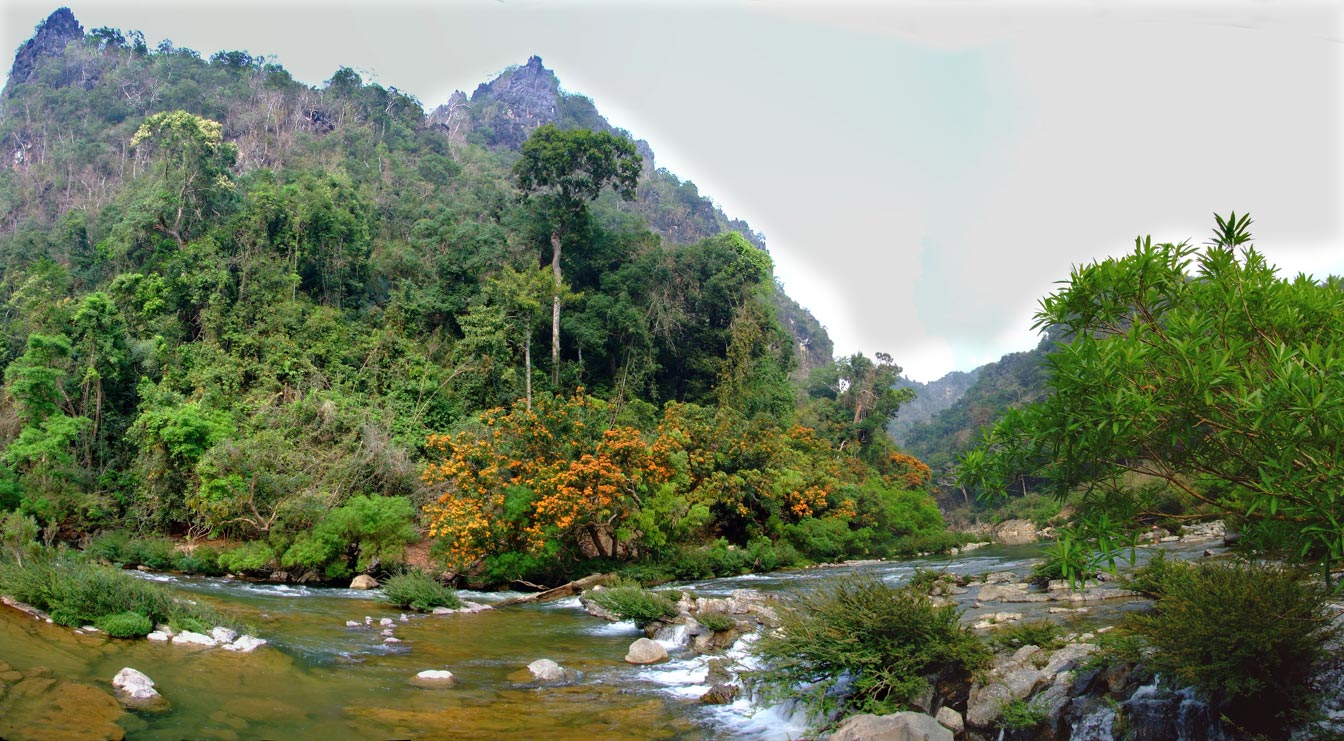
Hin Namno National Park (or ''Hin Nam No'') is in Boualapha District, Khammouane Province, Laos. The park borders Phong Nha-Kẻ Bàng National Park of Vietnam to the east and Nakai-Nam Theun National Park of Laos to the north. Hin Namno National Park was created by prime ministerial decree in January 2020. It is managed by the Ministry of Agriculture and Forestry (MAF). Hin Namno's distinctive feature is its karst formations. Were this park and Phong Nha-Kẻ Bàng to be combined into one contiguous park, it would be one of the largest protected karst regions in the world. In early-2021, Hin Namno was nominated for inclusion on the International Union for Conservation of Nature (IUCN) Green List of Protected and Conserved Areas. The IUCN Green List is a global standard for protected area management performance. It is seen as a precursor to a UNESCO World Heritage Site nomination. Species Hin Namno is home to 1,520 species of vascular plants and 536 vertebrate species. Imp ... [...More Info...] [...Related Items...] OR: [Wikipedia] [Google] [Baidu] |
UNESCO
The United Nations Educational, Scientific and Cultural Organization is a specialized agency of the United Nations (UN) aimed at promoting world peace and security through international cooperation in education, arts, sciences and culture. It has 193 member states and 12 associate members, as well as partners in the non-governmental, intergovernmental and private sector. Headquartered at the World Heritage Centre in Paris, France, UNESCO has 53 regional field offices and 199 national commissions that facilitate its global mandate. UNESCO was founded in 1945 as the successor to the League of Nations's International Committee on Intellectual Cooperation.English summary). Its constitution establishes the agency's goals, governing structure, and operating framework. UNESCO's founding mission, which was shaped by the Second World War, is to advance peace, sustainable development and human rights by facilitating collaboration and dialogue among nations. It pursues this objective t ... [...More Info...] [...Related Items...] OR: [Wikipedia] [Google] [Baidu] |
Xe Bang Fai River
The Xe Bang Fai River (''Nam Xebangfai'') is a river in Laos. It originates in the Annamite Range The Annamite Range or the Annamese Mountains (french: Chaîne annamitique; lo, ພູ ຫລວງ ''Phou Luang''; vi, Dãy (núi) Trường Sơn) is a major mountain range of eastern Indochina, extending approximately through Laos, Viet ... on the border between Laos and Vietnam at . It flows through Khammouane Province and Savannakhet Province. Xe Bang Fai River Cave Xe Bang Fai River Cave is in Hin Namno National Park in Khammouane Province. It is believed to be one of the largest river caves in the world with passages some 120 meters tall and 200 meters wide, and a subterranean channel seven kilometres long. Notes References External links Account of a visit to the Xe Bang Fai cave in 2014 Account of a second visit to the Xe Bang Fai cave, Tham Khoun Xe in 2015 Rivers of Laos Geography of Savannakhet province Geography of Khammouane province {{ ... [...More Info...] [...Related Items...] OR: [Wikipedia] [Google] [Baidu] |
Annamite Range
The Annamite Range or the Annamese Mountains (french: Chaîne annamitique; lo, ພູ ຫລວງ ''Phou Luang''; vi, Dãy (núi) Trường Sơn) is a major mountain range of eastern Indochina, extending approximately through Laos, Vietnam, and a small area in northeast Cambodia. The mountain range is also referred to variously as Annamese Range, Annamese Mountains, Annamese Cordillera, Annamite Mountains and Annamite Cordillera. The name "Annam" is the Vietnamese pronunciation and terminology of zh, c=安南 (Pinyin: ''Ān Nán''), meaning "to pacify the south" referring to Vietnam. The French adopted the word and used "Annamese" or "Annamite" to refer to the Vietnamese. The highest points of the range are the -high Phou Bia, the -high Phu Xai Lai Leng and the -high Ngoc Linh, Ngọc Linh (Ngoc Pan). The latter is located at the northwestern edge of the Triassic Kontum Massif in central Vietnam. Important mountain passes are the Nape Pass and the Mụ Giạ Pass. The A ... [...More Info...] [...Related Items...] OR: [Wikipedia] [Google] [Baidu] |
Giant Muntjac
The giant muntjac (''Muntiacus vuquangensis''), sometimes referred to as the large-antlered muntjac, is a species of muntjac deer. It is the largest muntjac species and was discovered in 1994 in Vũ Quang, Hà Tĩnh Province of Vietnam and in central Laos. During inundation of the Nakai Reservoir in Khammouane Province of Laos for thNam Theun 2 Multi-Purpose Project 38 giant muntjac were captured, studied, and released into the adjacent Nakai-Nam Theun National Protected Area. Subsequent radio-tracking of a sample of these animals showed the relocation was successful. The species is also located in parts of eastern Cambodia, as well as the Trường Sơn Mountains. The giant muntjac is commonly found in evergreen forests and weighs about . It has a red-brown coat and is an even-toed ungulate. Due to slash-and-burn agriculture, combined with hunting, the giant muntjac is considered critically endangered. It is preyed upon by animals such as the tiger and leopard. It is most cl ... [...More Info...] [...Related Items...] OR: [Wikipedia] [Google] [Baidu] |
Red-shanked Douc
The red-shanked douc (''Pygathrix nemaeus'') is an arboreal and diurnal Old World monkey belonging to the Colobinae subfamily. They are endemic to Laos, Vietnam and Cambodia. They are known for their bright colors and express exhibit sexual dimorphism through their body size. The species have been declared critically endangered by the International Union for Conservation of Nature, with the main threats being from hunting, habitat loss and pet trade. They are one of three species in the genus ''Pygathrix'', the other two being the black-shanked ('' P. nigripes'') and gray-shanked ('' P. cinerea'') doucs. Red-shanked doucs live in fission-fusion, multilevel societies that have a mean of 18 individuals per band. They are folivorous and consume mainly ''Acacia pruinescens, Ficus racemosa, Millettia nigrescens, Zanthoxylum avicennae'' and ''Castanopsis ceratacantha''. Their four-chambered stomachs that allow for bacterial fermentation help them with their high-fiber diet. Geograph ... [...More Info...] [...Related Items...] OR: [Wikipedia] [Google] [Baidu] |
Vascular Plant
Vascular plants (), also called tracheophytes () or collectively Tracheophyta (), form a large group of land plants ( accepted known species) that have lignified tissues (the xylem) for conducting water and minerals throughout the plant. They also have a specialized non-lignified tissue (the phloem) to conduct products of photosynthesis. Vascular plants include the clubmosses, horsetails, ferns, gymnosperms (including conifers), and angiosperms (flowering plants). Scientific names for the group include Tracheophyta, Tracheobionta and Equisetopsida ''sensu lato''. Some early land plants (the rhyniophytes) had less developed vascular tissue; the term eutracheophyte has been used for all other vascular plants, including all living ones. Historically, vascular plants were known as "higher plants", as it was believed that they were further evolved than other plants due to being more complex organisms. However, this is an antiquated remnant of the obsolete scala naturae, and the term ... [...More Info...] [...Related Items...] OR: [Wikipedia] [Google] [Baidu] |
World Heritage Site
A World Heritage Site is a landmark or area with legal protection by an international convention administered by the United Nations Educational, Scientific and Cultural Organization (UNESCO). World Heritage Sites are designated by UNESCO for having cultural, historical, scientific or other form of significance. The sites are judged to contain " cultural and natural heritage around the world considered to be of outstanding value to humanity". To be selected, a World Heritage Site must be a somehow unique landmark which is geographically and historically identifiable and has special cultural or physical significance. For example, World Heritage Sites might be ancient ruins or historical structures, buildings, cities, deserts, forests, islands, lakes, monuments, mountains, or wilderness areas. A World Heritage Site may signify a remarkable accomplishment of humanity, and serve as evidence of our intellectual history on the planet, or it might be a place of great natural beauty. A ... [...More Info...] [...Related Items...] OR: [Wikipedia] [Google] [Baidu] |
International Union For Conservation Of Nature
The International Union for Conservation of Nature (IUCN; officially International Union for Conservation of Nature and Natural Resources) is an international organization working in the field of nature conservation and sustainable use of natural resources. It is involved in data gathering and analysis, research, field projects, advocacy, and education. IUCN's mission is to "influence, encourage and assist societies throughout the world to conserve nature and to ensure that any use of natural resources is equitable and ecologically sustainable". Over the past decades, IUCN has widened its focus beyond conservation ecology and now incorporates issues related to sustainable development in its projects. IUCN does not itself aim to mobilize the public in support of nature conservation. It tries to influence the actions of governments, business and other stakeholders by providing information and advice and through building partnerships. The organization is best known to the wider pu ... [...More Info...] [...Related Items...] OR: [Wikipedia] [Google] [Baidu] |
Karst
Karst is a topography formed from the dissolution of soluble rocks such as limestone, dolomite, and gypsum. It is characterized by underground drainage systems with sinkholes and caves. It has also been documented for more weathering-resistant rocks, such as quartzite, given the right conditions. Subterranean drainage may limit surface water, with few to no rivers or lakes. However, in regions where the dissolved bedrock is covered (perhaps by debris) or confined by one or more superimposed non-soluble rock strata, distinctive karst features may occur only at subsurface levels and can be totally missing above ground. The study of ''paleokarst'' (buried karst in the stratigraphic column) is important in petroleum geology because as much as 50% of the world's hydrocarbon reserves are hosted in carbonate rock, and much of this is found in porous karst systems. Etymology The English word ''karst'' was borrowed from German in the late 19th century, which entered German much earlier ... [...More Info...] [...Related Items...] OR: [Wikipedia] [Google] [Baidu] |
Ministry Of Agriculture And Forestry (Laos)
The Ministry of Agriculture and Forestry of Laos (ກະຊວງ ກະສິກຳ ແລະ ປ່າໄມ້ in Lao language) is a ministry of the government of the Lao People's Democratic Republic (Lao PDR). Its acronym is MAF. The minister of Agriculture and Forestry is Lien Thikeo Lien Thikeo ( lo, ລຽນ ທິແກ້ວ) is a Laotian politician. He was Minister of Finance A finance minister is an executive or cabinet position in charge of one or more of government finances, economic policy and financial regulati .... Departments The ministry of Agriculture and Forestry is divided into several departments. * Permanent Secretary Office (PSO) * Department of Livestock and Fisheries (DOLF) * Department of Agriculture (DOA) * Department of Forestry (DOF) * Department of Inspection (DOIN) * Department of Irrigation (DOI) * Department of Organization and Personnel (DOAP) * Department of Planning and Finance (DoPF) * Department of Policy and Legal Affairs (DoPLA) ... [...More Info...] [...Related Items...] OR: [Wikipedia] [Google] [Baidu] |


_-Philadelphia_Zoo.jpg)


.jpg)