|
Hereford Railway (England)
The Hereford Railway was an early horse-drawn railway line in Herefordshire which operated over a 12 mile route from its junction with the Grosmont Railway at Monmouth Cap on the Welsh border to the River Wye at Hereford opening in September 1829. The line was designed by John Hodgkinson (who probably also engineered the connecting Llanvihangel and Grosmont lines) as a single track line with passing loops and occasional sidings to a gauge of 3 feet 6 inches using 3 and 4 foot L-section rails, manufactured it is assumed at Blaenavon and Nant-y-glo ironworks. From Monmouth Cap, the line was constructed on a route which initially coincides with that of the modern A465 in sweeping curves north towards Pontrilas but bridged the River Dore to enter the village before continuing northeast on the line of the modern road. Near Wormbridge it ran east to a line paralleling the Worm Brook before continuing to Hereford largely on the line followed by the later mainline railway, though devi ... [...More Info...] [...Related Items...] OR: [Wikipedia] [Google] [Baidu] |
Herefordshire
Herefordshire () is a county in the West Midlands of England, governed by Herefordshire Council. It is bordered by Shropshire to the north, Worcestershire to the east, Gloucestershire to the south-east, and the Welsh counties of Monmouthshire and Powys to the west. Hereford, the county town of Herefordshire has a population of approximately 61,000, making it the largest settlement in the county. The next biggest town is Leominster and then Ross-on-Wye. The county is situated in the historic Welsh Marches, Herefordshire is one of the most rural and sparsely populated counties in England, with a population density of 82/km2 (212/sq mi), and a 2021 population of 187,100 – the fourth-smallest of any ceremonial county in England. The land use is mostly agricultural and the county is well known for its fruit and cider production, and for the Hereford cattle breed. Constitution From 1974 to 1998, Herefordshire was part of the former non-metropolitan county of Hereford a ... [...More Info...] [...Related Items...] OR: [Wikipedia] [Google] [Baidu] |
Wormbridge
Wormbridge is a village and former civil parish in Herefordshire, England, about eight miles south-west of Hereford, on the A465 road at (). The neighbouring villages are Kilpeck, Didley, Howton, Treville, Ewyas Harold, Pontrilas and Crizeley. Until 1 April 2019 the civil parish was part of The Kilpeck Group Parish Council, the civil parish was then merged with Kilpeck. It is home to several local and larger businesses: Theale Fireplaces, Galanthus Gallery and Cafe, Bridges Childcare, Forge Garage and Tack Shop and NFU Mutual. The village previously had a small school, the building being rented from the Whitfield Estate (see below), until closed by Herefordshire Council due to decreasing numbers. The school building is now used by Bridges Childcare, which has been run successfully since 2003. Historic houses in the village include: Wormbridge Court, Wormbridge House, Fairacre (formerly Lyon Villa) and Trelough House. Wormbridge and its church were once owned by the K ... [...More Info...] [...Related Items...] OR: [Wikipedia] [Google] [Baidu] |
Early British Railway Companies
Early may refer to: History * The beginning or oldest part of a defined historical period, as opposed to middle or late periods, e.g.: ** Early Christianity ** Early modern Europe Places in the United States * Early, Iowa * Early, Texas * Early Branch, a stream in Missouri * Early County, Georgia Other uses * ''Early'' (Scritti Politti album), 2005 * ''Early'' (A Certain Ratio album), 2002 * Early (name) * Early effect, an effect in transistor physics * Early Records, a record label * the early part of the morning Morning is the period from sunrise to noon. There are no exact times for when morning begins (also true of evening and night) because it can vary according to one's lifestyle and the hours of daylight at each time of year. However, morning stric ... See also * Earley (other) {{disambiguation, geo ... [...More Info...] [...Related Items...] OR: [Wikipedia] [Google] [Baidu] |
Railway Lines Opened In 1829
Rail transport (also known as train transport) is a means of transport that transfers passengers and goods on wheeled vehicles running on rails, which are incorporated in Track (rail transport), tracks. In contrast to road transport, where the vehicles run on a prepared flat surface, rail vehicles (rolling stock) are directionally guided by the tracks on which they run. Tracks usually consist of steel rails, installed on Railroad tie, sleepers (ties) set in track ballast, ballast, on which the rolling stock, usually fitted with metal wheels, moves. Other variations are also possible, such as "slab track", in which the rails are fastened to a concrete foundation resting on a prepared subsurface. Rolling stock in a rail transport system generally encounters lower friction, frictional resistance than rubber-tyred road vehicles, so passenger and freight cars (carriages and wagons) can be coupled into longer trains. The rail transport operations, operation is carried out by a ... [...More Info...] [...Related Items...] OR: [Wikipedia] [Google] [Baidu] |
Transport In Herefordshire
Transport (in British English), or transportation (in American English), is the intentional movement of humans, animals, and goods from one location to another. Modes of transport include air, land ( rail and road), water, cable, pipeline, and space. The field can be divided into infrastructure, vehicles, and operations. Transport enables human trade, which is essential for the development of civilizations. Transport infrastructure consists of both fixed installations, including roads, railways, airways, waterways, canals, and pipelines, and terminals such as airports, railway stations, bus stations, warehouses, trucking terminals, refueling depots (including fueling docks and fuel stations), and seaports. Terminals may be used both for interchange of passengers and cargo and for maintenance. Means of transport are any of the different kinds of transport facilities used to carry people or cargo. They may include vehicles, riding animals, and pack animals. Vehicles ma ... [...More Info...] [...Related Items...] OR: [Wikipedia] [Google] [Baidu] |
Standard-gauge
A standard-gauge railway is a railway with a track gauge of . The standard gauge is also called Stephenson gauge (after George Stephenson), International gauge, UIC gauge, uniform gauge, normal gauge and European gauge in Europe, and SGR in East Africa. It is the most widely used track gauge around the world, with approximately 55% of the lines in the world using it. All high-speed rail lines use standard gauge except those in Russia, Finland, and Uzbekistan. The distance between the inside edges of the rails is defined to be 1435 mm except in the United States and on some heritage British lines, where it is defined in U.S. customary/Imperial units as exactly "four feet eight and one half inches" which is equivalent to 1435.1mm. History As railways developed and expanded, one of the key issues was the track gauge (the distance, or width, between the inner sides of the rails) to be used. Different railways used different gauges, and where rails of different gauge met ... [...More Info...] [...Related Items...] OR: [Wikipedia] [Google] [Baidu] |
Newport, Abergavenny And Hereford Railway
The Newport, Abergavenny and Hereford Railway was a railway company formed to connect the places in its name. When it sought Parliamentary authorisation, it was denied the southern section, and obliged to use the Monmouthshire Railway between Pontypool and Newport. It opened on 6 December 1853, and was part of an important chain of lines between south-east Wales and Birkenhead; mineral traffic in both directions was dominant. The London and North Western Railway hoped to exploit the line to form a network in South Wales, but that aspiration was not fully realised, and in 1860 the NA&HR merged with other railways to form the West Midland Railway, which soon amalgamated with the Great Western Railway in 1863. In order better to serve the ironworks in the South Wales Valleys, the NA&HR built the Taff Vale Extension Line, running west from Pontypool and cutting across several of the valleys, making connections with other companies' lines, eventually at twelve locations. The line wa ... [...More Info...] [...Related Items...] OR: [Wikipedia] [Google] [Baidu] |
A49 Road
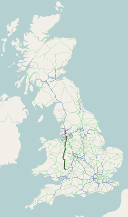
The A49 is an A road in western England, which traverses the Welsh Marches region. It runs north from Ross-on-Wye in Herefordshire via Hereford, Leominster, Ludlow, Shrewsbury and Whitchurch, then continues through central Cheshire to Warrington and Wigan before terminating at its junction with the A6 road just south of Bamber Bridge, near the junction of the M6, M65 and M61 motorways. The stretch between Ross-on-Wye and the A5 at Shrewsbury is a trunk road, maintained by National Highways. Lancashire From the A6 at Bamber Bridge, south of Preston, the road runs parallel to the M6 motorway, through Leyland towards Wigan. Through Ashton in Makerfield and Newton-le-Willows, reaching Warrington via Winwick. In June 2020, a new section of the A49 opened forming part of a link between Wigan town centre and junction 25 on the M6, the section it replaced being renumbered B5386. Cheshire From junction 9 of the M62, there is a dual-carriageway through Warrington, as far as L ... [...More Info...] [...Related Items...] OR: [Wikipedia] [Google] [Baidu] |
River Dore
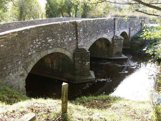
The River Dore (Welsh: ''Afon Aur'' lit: 'the river of gold') is a tributary of the River Monnow in Herefordshire, England. It rises on Cusop Hill, in the foothills of the Black Mountains, close to the border between England and Wales. It flows for through the villages of Dorstone, Peterchurch, Vowchurch, Abbey Dore and Pontrilas, before reaching the Monnow near Llangua. The Monnow itself is a tributary which flows into the River Wye at Monmouth. The name Dore probably derives from the Welsh word ''dŵr'', meaning "water". The word was later interpreted by the Norman French as ''"d'or"'', meaning "golden", and the river valley, through this misunderstanding, then became known in English as " Golden Valley". The river is noted for its fishing, including trout and grayling. In 2006, the Game & Wildlife Conservation Trust initiated a programme to clear the river of invasive mink, and repopulate it with water voles. As of 2022, there is a legal challenge against the ... [...More Info...] [...Related Items...] OR: [Wikipedia] [Google] [Baidu] |
Grosmont Railway
The Grosmont Railway was an early horse-drawn railway line in Monmouthshire completed in 1819. History The Grosmont Railway was constructed as an extension of the Llanvihangel Railway from its terminus at Llanvihangel Crucorney to Monmouth Cap on the border with Herefordshire. With a length of approximately seven miles (11 km), it was engineered by John Hodgkinson as a gauge plateway, and was horse drawn throughout. The Act of Parliament for the railway received royal assent on 20 May 1812, construction started in 1817 and the line opened in 1819. In 1829 the Hereford Railway was completed with an end-on connection with the Grosmont Railway at Monmouth Cap and extending the line to Wye Bridge at Hereford. The Grosmont Railway was sold in 1846 to the Newport, Abergavenny and Hereford Railway Company for £16,250, along with the Llanvihangel Railway for £21,750 and the Hereford Railway for £19,460. The new company replaced the combined tramroads with a standard-gaug ... [...More Info...] [...Related Items...] OR: [Wikipedia] [Google] [Baidu] |
Pontrilas
Pontrilas ('' en, Bridge over Three Rivers'') is a village in south Herefordshire, England, half a mile from the border with Wales. It is in the parish of Kentchurch and lies midway between Hereford and Abergavenny. In 2011 the main village contained 66 residential dwellings, as well as Pontrilas Business Park. The village name comes from the Welsh language, and means 'bridge over three rivers' due to the River Dore, Dulas brook and another smaller stream (which descends via Dineterwood but appears to have no specific name) meeting there. The main A465 road skirts the west of the village. The neighbouring villages include; Ewyas Harold, Llangua, Dulas, Wormbridge, Kilpeck, Bagwyllydiart, Abbey Dore and Howton. History There has been a settlement in the area since at least 1086 when the hamlet was called Elwistone, possibly originating from the Welsh names Elwin or Helys. Over the centuries there have been several variations of name e.g. Ailstone and Heliston. The latter ... [...More Info...] [...Related Items...] OR: [Wikipedia] [Google] [Baidu] |
A465 Road
The A465 is a trunk road that runs from Bromyard in Herefordshire, England to Llandarcy near Swansea in South Wales. The western half is known officially as the Neath to Abergavenny Trunk Road, but the section from Abergavenny to the Vale of Neath is more commonly referred to as the Heads of the Valleys Road because it links the northern heads of the South Wales Valleys. Approximately following the southern boundary of the Brecon Beacons National Park, the Ordnance Survey ''Pathfinder'' guide describes it as the unofficial border between rural and industrial South Wales. The A465 provides an alternative route between England and the counties in South West Wales and to the ferries to Ireland. Route The A465 runs south-west from Bromyard towards the River Lugg, from where it runs concurrently with the A4103 for a short distance before entering Hereford. After a short distance on the A49, it crosses the River Wye, the River Monnow and the border into Wales. The A465 meets the ... [...More Info...] [...Related Items...] OR: [Wikipedia] [Google] [Baidu] |


