|
Haytor
Haytor, also known as Haytor Rocks, Hay Tor, or occasionally Hey Tor, is a granite tor on the eastern edge of Dartmoor in the English county of Devon. Location The tor is at grid reference , near the village of Haytor Vale in the parish of Ilsington. There is an electoral ward with the same name. The population at the 2011 census is 2,862. History ''Idetordoune'' (1566), ''Ittor Doune'' (1687), ''Idetor'' (1737), ''Eator Down'' (1762) and ''Itterdown'' (1789) are a few recorded examples of earlier names by which Haytor was known. The name ''Haytor'' is of comparatively recent origin, and is probably a corruption of its old name and that of the Haytor Hundred, which covered the coastal area between the River Teign and River Dart, itself now considered to have been named after a lost village located somewhere between Totnes and Newton Abbot. In the 19th century steps were made to allow pedestrians up to the top of the tor and a metal handrail fixed to allow tourists easier ac ... [...More Info...] [...Related Items...] OR: [Wikipedia] [Google] [Baidu] |
Haytor Granite Tramway
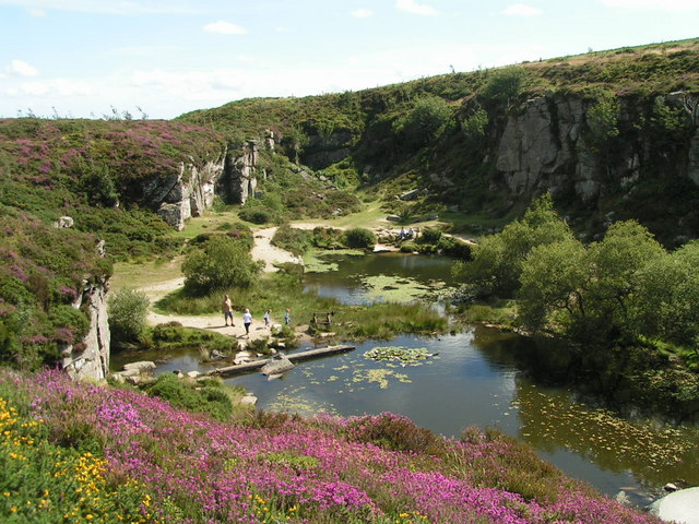
The Haytor Granite Tramway (also called Heytor) was a tramway built to convey granite from Haytor Down, Dartmoor, Devon to the Stover Canal. It was very unusual in that the track was formed of granite sections, shaped to guide the wheels of wagonway, horse-drawn wagons. It was built in 1820; the granite was in demand in the developing cities of England as masonry to construct public buildings and bridges. In 1850 the quarries employed about 100 men but by 1858 they had closed due to the availability of cheaper Cornwall, Cornish granite. The Haytor rocks and quarries are protected from development and disturbance as a Site of Special Scientific Interest. Operation and purpose The granite from the quarries near Haytor Rock was much in demand for construction work in the cities of England, but in an era when railways and reliable roads had not yet been developed, the transport of this heavy and bulky commodity was a significant problem. Coastal shipping was a practicable transport ... [...More Info...] [...Related Items...] OR: [Wikipedia] [Google] [Baidu] |
Dartmoor
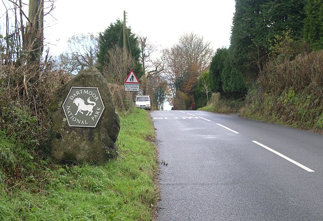
Dartmoor is an upland area in southern Devon, England. The moorland and surrounding land has been protected by National Park status since 1951. Dartmoor National Park covers . The granite which forms the uplands dates from the Carboniferous Period of geological history. The landscape consists of moorland capped with many exposed granite hilltops known as tors, providing habitats for Dartmoor wildlife. The highest point is High Willhays, above sea level. The entire area is rich in antiquities and archaeology. Dartmoor National Park is managed by the Dartmoor National Park Authority, whose 22 members are drawn from Devon County Council, local district councils and Government. Parts of Dartmoor have been used as military firing ranges for over 200 years. The public is granted extensive land access rights on Dartmoor (including restricted access to the firing ranges) and it is a popular tourist destination. Physical geography Geology Dartmoor includes the largest area of ... [...More Info...] [...Related Items...] OR: [Wikipedia] [Google] [Baidu] |
Haytor Vale
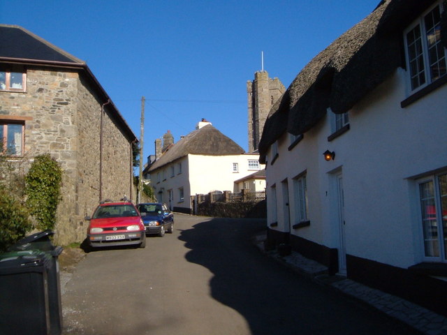
Ilsington is a village and civil parish situated on the eastern edge of Dartmoor, Devon, England. It is one of the largest parishes in the county, and includes the villages of Ilsington, Haytor Vale, Liverton and South Knighton. The parish is surrounded, clockwise from the north, by the parishes of Bovey Tracey, Teigngrace (a short border only), Newton Abbot, Ogwell (another short border), Bickington, Ashburton, Widecombe-in-the-Moor and Manaton. In 2001 the population of the parish was 2,444, greatly increased from the 886 residents recorded in 1901. The parish is represented in parliament by Mel Stride, as part of the Central Devon constituency. History The village is believed to be an ancient settlement – probably existing 200 to 300 years before the Norman Conquest. It is mentioned in the Domesday Book of 1086 as Ilestintona, and there is known to have been a church there since at least the 11th century. St. Michael's parish church, as seen today, dates back to the 15th ... [...More Info...] [...Related Items...] OR: [Wikipedia] [Google] [Baidu] |
Ilsington
Ilsington is a village and civil parish situated on the eastern edge of Dartmoor, Devon, England. It is one of the largest parishes in the county, and includes the villages of Ilsington, Haytor Vale, Liverton and South Knighton. The parish is surrounded, clockwise from the north, by the parishes of Bovey Tracey, Teigngrace (a short border only), Newton Abbot, Ogwell (another short border), Bickington, Ashburton, Widecombe-in-the-Moor and Manaton. In 2001 the population of the parish was 2,444, greatly increased from the 886 residents recorded in 1901. The parish is represented in parliament by Mel Stride, as part of the Central Devon constituency. History The village is believed to be an ancient settlement – probably existing 200 to 300 years before the Norman Conquest. It is mentioned in the Domesday Book of 1086 as Ilestintona, and there is known to have been a church there since at least the 11th century. St. Michael's parish church, as seen today, dates back to the 15th ... [...More Info...] [...Related Items...] OR: [Wikipedia] [Google] [Baidu] |
Dartmoor National Park Authority
The Dartmoor National Park Authority (DNPA) is a national park authority in England, legally responsible for Dartmoor in Devon. It came into existence in its present form in 1997, being preceded by a committee of Devon County Council (from 1951 to March 1974) and the Dartmoor National Park Committee from 1 April 1974. History Dartmoor, in the county of Devon, is 368 square miles (954 km2) in area. It was designated as one of the National Parks of England and Wales by statute in 1951; it has over 34,000 people living in it, and some 2.2 million people visited it in 2011. First incarnation For the first 23 years of its existence, Dartmoor National Park was administered by a special committee of Devon County Council,Mercer 2009, p. 326 the "Dartmoor Sub-Committee". During this time the major proposals dealt with by the committee included extensions of china clay workings and coniferous plantations (which did not take place); the erection of a television transmitting mast at No ... [...More Info...] [...Related Items...] OR: [Wikipedia] [Google] [Baidu] |
Stover Canal
The Stover Canal is a canal located in Devon, England. It was opened in 1792 and served the ball clay industry until it closed in the early 1940s. Today it is derelict, but the Stover Canal Society is aiming to restore it and reopen it to navigation. History The canal was built at a time when the ball clay industry was expanding, but transport of the bulky product was difficult. James Templer (1748–1813) of Stover House, Teigngrace, saw this as an opportunity, and began to construct the canal at his own expense in January 1790. He planned to reach Bovey Tracey, passing through Jewsbridge, near Heathfield en route, and to construct a branch to Chudleigh. Having invested over £1,000 in the project, he sought an Act of Parliament which would allow him to raise more capital, but although the Act was passed on 11 June 1792, he did not invoke its powers, as the canal had already reached Ventiford, Teigngrace and he did not extend it further. As built, the canal was long and inc ... [...More Info...] [...Related Items...] OR: [Wikipedia] [Google] [Baidu] |
Granite
Granite () is a coarse-grained (phaneritic) intrusive igneous rock composed mostly of quartz, alkali feldspar, and plagioclase. It forms from magma with a high content of silica and alkali metal oxides that slowly cools and solidifies underground. It is common in the continental crust of Earth, where it is found in igneous intrusions. These range in size from dikes only a few centimeters across to batholiths exposed over hundreds of square kilometers. Granite is typical of a larger family of ''granitic rocks'', or ''granitoids'', that are composed mostly of coarse-grained quartz and feldspars in varying proportions. These rocks are classified by the relative percentages of quartz, alkali feldspar, and plagioclase (the QAPF classification), with true granite representing granitic rocks rich in quartz and alkali feldspar. Most granitic rocks also contain mica or amphibole minerals, though a few (known as leucogranites) contain almost no dark minerals. Granite is nearly alway ... [...More Info...] [...Related Items...] OR: [Wikipedia] [Google] [Baidu] |
Devon County War Memorial
The Devon County War Memorial is a First World War memorial, designed by Sir Edwin Lutyens and situated on Cathedral Green in Exeter, the county town of Devon, in the south west of England. It is one of fifteen War Crosses designed by Lutyens with similar characteristics, and one of two to serve as a civic memorial in a city. The first proposal for the county's war memorial was to complete the construction of a cloister at Exeter Cathedral to be dedicated to Devon's war dead, but this scheme was abandoned due to lack of funds. After considering multiple proposals, the Devon County War Memorial Committee commissioned Lutyens to design a War Cross instead. The committee chose to site the memorial on the green of Exeter Cathedral after scouting several locations. A war memorial for Exeter itself was being considered concurrently, but the committees for the two projects failed to work together, resulting in two separate memorials—the county memorial by the cathedral and Exeter C ... [...More Info...] [...Related Items...] OR: [Wikipedia] [Google] [Baidu] |
River Teign
The River Teign is a river in the county of Devon, England. It is long and rises on Dartmoor, becomes an estuary just below Newton Abbot and reaches the English Channel at Teignmouth. Toponymy The river-name 'Teign' is first attested in an Anglo-Saxon charter of 739, where it appears as ''Teng''. The name is pre-Roman, related to the Welsh ''taen'' meaning 'sprinkling', and means simply 'stream'.Eilert Ekwall, ''The Concise Oxford Dictionary of English Place-names'', p.462. The river lends its name to several places, including Teigncombe, Drewsteignton, Canonteign, Teigngrace, Kingsteignton (at one time, one of England's largest villages), Bishopsteignton, Teignharvey, and the second largest settlement along its course, Teignmouth. However, the villages of Combeinteignhead and Stokeinteignhead, on the other side of the estuary from Bishopsteignton, are not named after the river. Course The River Teign rises on Dartmoor, as do many other major Devonian rivers. It has two sep ... [...More Info...] [...Related Items...] OR: [Wikipedia] [Google] [Baidu] |
Devon
Devon ( , historically known as Devonshire , ) is a ceremonial and non-metropolitan county in South West England. The most populous settlement in Devon is the city of Plymouth, followed by Devon's county town, the city of Exeter. Devon is a coastal county with cliffs and sandy beaches. Home to the largest open space in southern England, Dartmoor (), the county is predominately rural and has a relatively low population density for an English county. The county is bordered by Somerset to the north east, Dorset to the east, and Cornwall to the west. The county is split into the non-metropolitan districts of East Devon, Mid Devon, North Devon, South Hams, Teignbridge, Torridge, West Devon, Exeter, and the unitary authority areas of Plymouth, and Torbay. Combined as a ceremonial county, Devon's area is and its population is about 1.2 million. Devon derives its name from Dumnonia (the shift from ''m'' to ''v'' is a typical Celtic consonant shift). During the Briti ... [...More Info...] [...Related Items...] OR: [Wikipedia] [Google] [Baidu] |
Tor (rock Formation)
A tor, which is also known by geomorphologists as either a castle koppie or kopje, is a large, free-standing rock outcrop that rises abruptly from the surrounding smooth and gentle slopes of a rounded hill summit or ridge crest. In the South West of England, the term is commonly also used for the hills themselves – particularly the high points of Dartmoor in Devon and Bodmin Moor in Cornwall.Ehlen, J. (2004) ''Tor'' in Goudie, A., ed., pp. 1054-1056. ''Encyclopedia of Geomorphology.'' Routledge. London, England. Etymology Although English topographical names often have a Celtic etymology, the Oxford English Dictionary lists no cognates to the Old English word in either the Breton or Cornish languages (the Scottish Gaelic ''tòrr'' is thought to derive from the Old English word). It is therefore accepted that the English word ''Tor'' derives from the Old Welsh word ''tẁrr'' or ''twr'', meaning a cluster or heap. Formation Tors are landforms created by the erosion and weath ... [...More Info...] [...Related Items...] OR: [Wikipedia] [Google] [Baidu] |
London Bridge
Several bridges named London Bridge have spanned the River Thames between the City of London and Southwark, in central London. The current crossing, which opened to traffic in 1973, is a box girder bridge built from concrete and steel. It replaced a 19th-century stone-arched bridge, which in turn superseded a 600-year-old stone-built medieval structure. This was preceded by a succession of timber bridges, the first of which was built by the Roman founders of London. The current bridge stands at the western end of the Pool of London and is positioned upstream from previous alignments. The approaches to the medieval bridge were marked by the church of St Magnus-the-Martyr on the northern bank and by Southwark Cathedral on the southern shore. Until Putney Bridge opened in 1729, London Bridge was the only road crossing of the Thames downstream of Kingston upon Thames. London Bridge has been depicted in its several forms, in art, literature, and songs, including the nursery rh ... [...More Info...] [...Related Items...] OR: [Wikipedia] [Google] [Baidu] |


_by_Claes_Van_Visscher.jpg)