|
Hasbani
The Hasbani River ( ar, الحاصباني / ALA-LC: ''al-Ḥāṣbānī''; he, חצבני ''Ḥatzbaní'') or Snir Stream ( he, נחל שניר / ''Nahal Sənir''), is the major tributary of the Jordan River. Local natives in the mid-19th century knew the river as the Upper Jordan. The Hasbani River derives most of its discharge from two springs in Lebanon, the Wazzani and the Haqzbieh, the latter being a group of springs on the uppermost Hasbani. The Hasbani runs for in Lebanon before crossing the border at Ghajar and shortly after joining with the Banias and Dan Rivers at a point in northern Israel, to form the River Jordan. For about downstream of Ghajar, the Hasbani forms the border between Lebanon and the Golan Heights. The Wazzani's and the Haqzbieh's combined discharge averages 138 million m³ per year. About 20% of the Hasbani flow emerges from the Wazzani Spring at Ghajar, close to the Lebanese-Golan Heights border, about west of the base of Mount Hermon. The ... [...More Info...] [...Related Items...] OR: [Wikipedia] [Google] [Baidu] |
Headwater Diversion Plan (Jordan River)
The Headwater Diversion Plan was an Arab League plan to divert two of the three sources of the Jordan River, and prevent them from flowing into the Sea of Galilee, in order to thwart Israel's plans to use the water of the Hasbani and Banias in its National Water Carrier of Israel, National Water Carrier project for out-of-Basin irrigation. The plan was approved by the Arab League in 1964 but Israel prevented the project's development by conducting airstrikes in Syrian territory in April 1967. Background In 1955 the Jordan Valley Unified Water Plan, Unified (Johnston) Plan for the multinational development of Jordan River basin between the Water riparian rights holders was finalized. The Plan was accepted by the technical committees from both Israel and the Arab League. A discussion in the Knesset in July 1955 ended without a vote. The Arab Experts Committee approved the plan in September 1955 and referred it for final approval to the Arab League Council. On 11 October 1955, th ... [...More Info...] [...Related Items...] OR: [Wikipedia] [Google] [Baidu] |
Jordan River
The Jordan River or River Jordan ( ar, نَهْر الْأُرْدُنّ, ''Nahr al-ʾUrdunn'', he, נְהַר הַיַּרְדֵּן, ''Nəhar hayYardēn''; syc, ܢܗܪܐ ܕܝܘܪܕܢܢ ''Nahrāʾ Yurdnan''), also known as ''Nahr Al-Sharieat'' ( ar, نهر الشريعة), is a river in the Middle East that flows roughly north to south through the Sea of Galilee (Hebrew: כנרת Kinneret, Arabic: Bohayrat Tabaraya, meaning Lake of Tiberias) and on to the Dead Sea. Jordan and the Golan Heights border the river to the east, while the West Bank and Israel lie to its west. Both Jordan and the West Bank take their names from the river. The river holds major significance in Judaism and Christianity. According to the Bible, the Israelites crossed it into the Promised Land and Jesus of Nazareth was baptized by John the Baptist in it. Geography The Jordan River has an upper course from its sources to the Sea of Galilee (via the Bethsaida Valley), and a lower course south of ... [...More Info...] [...Related Items...] OR: [Wikipedia] [Google] [Baidu] |
Wazzani
Al Wazzani (Al-Ouazzani), also known as Arab Louaize or Aarab El Louaizeh,Water Wars in the Middle East: A Looming Threat, Hussein A. Amery, The Geographical Journal, Vol. 168, 2002 is a small Lebanese village in the Hasbaya District of the Nabatieh Governorate, on the banks of the Hasbani River. The village is located about 1 km from the Wazzani Spring, a major source of the Hasbani, which is a tributary of the Jordan River. The village has about 200 residents. In 2001 the Lebanese government installed a small pumping station with a 10 cm bore near the village, to supply water to the village as well the nearby villages al-Teiba and Ghajar. In March 2002 Lebanon also diverted part of the Hasbani to supply Wazzani village, an action that then Prime Minister of Israel, Ariel Sharon, said was a "casus belli" and could lead to war. 17 September 2 ... [...More Info...] [...Related Items...] OR: [Wikipedia] [Google] [Baidu] |
War Over Water (Jordan River)
The "War over Water", also the Battle over Water, refers to a series of confrontations between Israel and its Arab neighbors from November 1964 to May 1967 over control of water sources in the Jordan River drainage basin. History Early tensions: 1949–64 The 1949 Armistice Agreements which followed the 1948 Arab–Israeli War, created three demilitarized zones on the Israel-Syria border. The southernmost, and also the largest, stretched from the south-eastern part of the Sea of Galilee eastwards to the Yarmuk River where the borders of Israel, Jordan and Syria converge. The issue of water sharing from the Jordan–Yarmuk system turned out to be a major problem between Israel, Syria and Jordan. Small scale water-related skirmishes had occurred following the 1949 agreements. In July 1953, Israel began construction of an intake for its National Water Carrier at the Daughters of Jacob Jordan Bridge in the demilitarized zone north of the Sea of Galilee. Syrian artillery units ... [...More Info...] [...Related Items...] OR: [Wikipedia] [Google] [Baidu] |
Banias
Banias or Banyas ( ar, بانياس الحولة; he, בניאס, label=Modern Hebrew; Judeo-Aramaic, Medieval Hebrew: פמייס, etc.; grc, Πανεάς) is a site in the Golan Heights near a natural spring, once associated with the Greek god Pan. It had been inhabited for 2,000 years, until it was abandoned and destroyed following the Six Day War.How modern disputes have reshaped the ancient city of Banias : "In June 1967, the penultimate day of the Six Day War saw Israeli tanks storm into Banias in breach of a UN ceasefire accepted by Syria hours earlier. The Israeli general Moshe Dayan had decided to act u ... [...More Info...] [...Related Items...] OR: [Wikipedia] [Google] [Baidu] |
Jordan Valley Unified Water Plan
The Jordan Valley Unified Water Plan, commonly known as the "Johnston Plan", was a plan for the unified water resource development of the Jordan Valley. It was negotiated and developed by US ambassador Eric Johnston between 1953 and 1955, and based on an earlier plan commissioned by United Nations Relief and Works Agency for Palestine Refugees in the Near East (UNRWA). Modeled upon the Tennessee Valley Authority's engineered development plan, it was approved by technical water committees of all the regional riparian countries—Israel, Jordan, Lebanon and Syria.The UNRWA commissioned a plan for the development of the Jordan River; this became widely known as "The Johnston plan". The plan was modelled on the Tennessee Valley Authority development plan for the development of the Jordan River as a single unit. Greg Shapland, (1997''Rivers of Discord: International Water Disputes in the Middle East'' C. Hurst & Co. Publishers, p 14 Though the plan was rejected by the Arab League, ... [...More Info...] [...Related Items...] OR: [Wikipedia] [Google] [Baidu] |
Ghajar
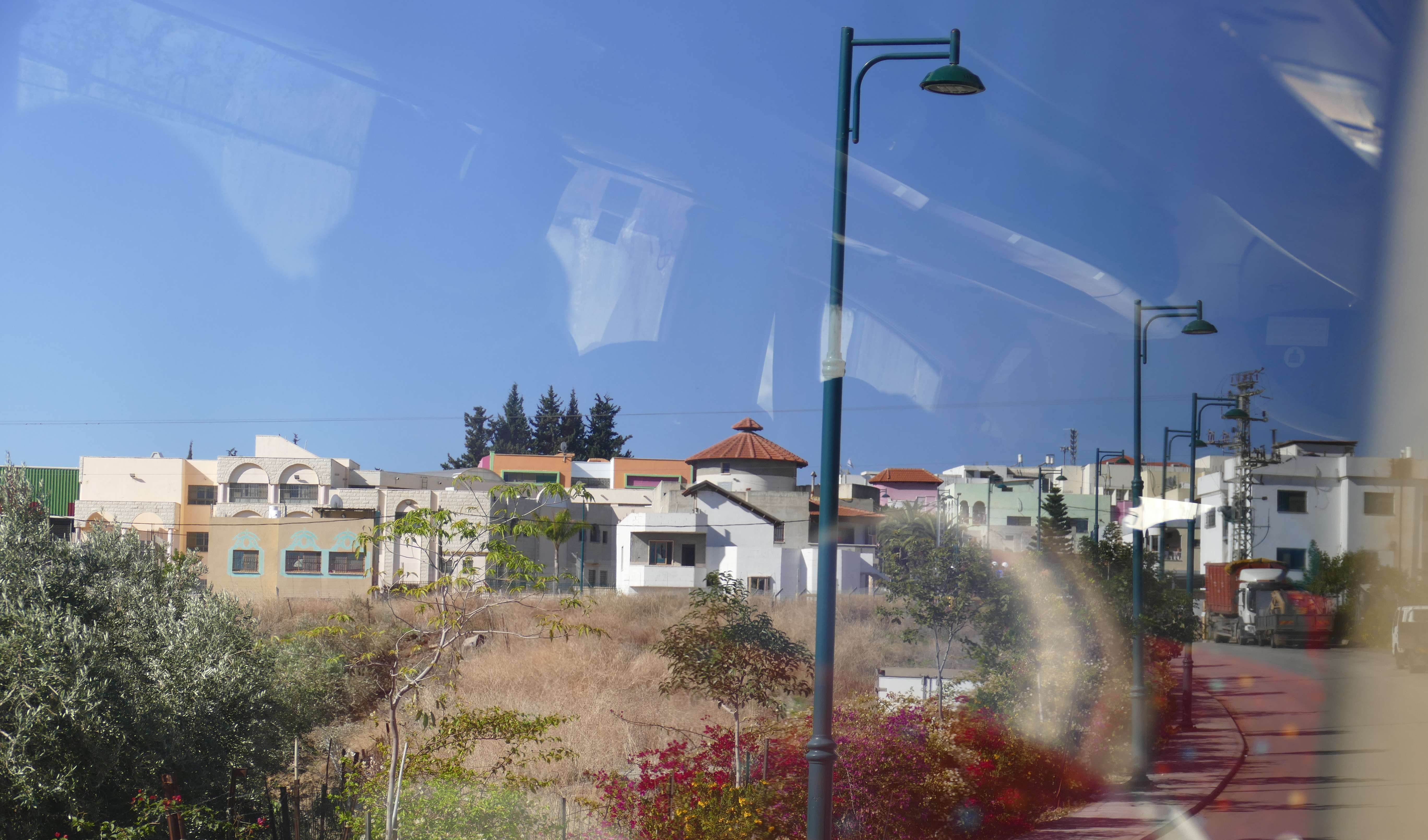
Ghajar ( ar, غجر, he, ע'ג'ר or ) is an Alawite-Arab village on the Hasbani River, on the border between Lebanon and the Israeli-occupied portion of Syria's Golan Heights. In , it had a population of . History Early history Control over Ghajar has changed hands many times. Three hundred years ago, the village was known as Taranjeh. It was renamed Ghajar under the rule of the Ottoman Empire, when the land was allegedly seized from the "villagers" by Kurds and forcibly sold. According to "local" legend, the Kurdish governor of Ghajar tried to ride his horse onto the tomb of a local holy man, Sheikh al-Arba'in. The horse refused and the following day a fire broke out, destroying the governor's shield and sword. The Kurds fled and quickly sold it back. Modern era In 1932, the residents of Ghajar, predominantly Alawites, were given the option of choosing their nationality and overwhelmingly chose to be a part of Syria, which has a sizable Alawite minority. Prior to the 1 ... [...More Info...] [...Related Items...] OR: [Wikipedia] [Google] [Baidu] |
Cairo
Cairo ( ; ar, القاهرة, al-Qāhirah, ) is the capital of Egypt and its largest city, home to 10 million people. It is also part of the largest urban agglomeration in Africa, the Arab world and the Middle East: The Greater Cairo metropolitan area, with a population of 21.9 million, is the 12th-largest in the world by population. Cairo is associated with ancient Egypt, as the Giza pyramid complex and the ancient cities of Memphis and Heliopolis are located in its geographical area. Located near the Nile Delta, the city first developed as Fustat, a settlement founded after the Muslim conquest of Egypt in 640 next to an existing ancient Roman fortress, Babylon. Under the Fatimid dynasty a new city, ''al-Qāhirah'', was founded nearby in 969. It later superseded Fustat as the main urban centre during the Ayyubid and Mamluk periods (12th–16th centuries). Cairo has long been a centre of the region's political and cultural life, and is titled "the city of a thousand m ... [...More Info...] [...Related Items...] OR: [Wikipedia] [Google] [Baidu] |
Syria
Syria ( ar, سُورِيَا or سُورِيَة, translit=Sūriyā), officially the Syrian Arab Republic ( ar, الجمهورية العربية السورية, al-Jumhūrīyah al-ʻArabīyah as-Sūrīyah), is a Western Asian country located in the Eastern Mediterranean and the Levant. It is a unitary republic that consists of 14 governorates (subdivisions), and is bordered by the Mediterranean Sea to the west, Turkey to the north, Iraq to the east and southeast, Jordan to the south, and Israel and Lebanon to the southwest. Cyprus lies to the west across the Mediterranean Sea. A country of fertile plains, high mountains, and deserts, Syria is home to diverse ethnic and religious groups, including the majority Syrian Arabs, Kurds, Turkmens, Assyrians, Armenians, Circassians, Albanians, and Greeks. Religious groups include Muslims, Christians, Alawites, Druze, and Yazidis. The capital and largest city of Syria is Damascus. Arabs are the largest ethnic group, and Mu ... [...More Info...] [...Related Items...] OR: [Wikipedia] [Google] [Baidu] |
Six-Day War
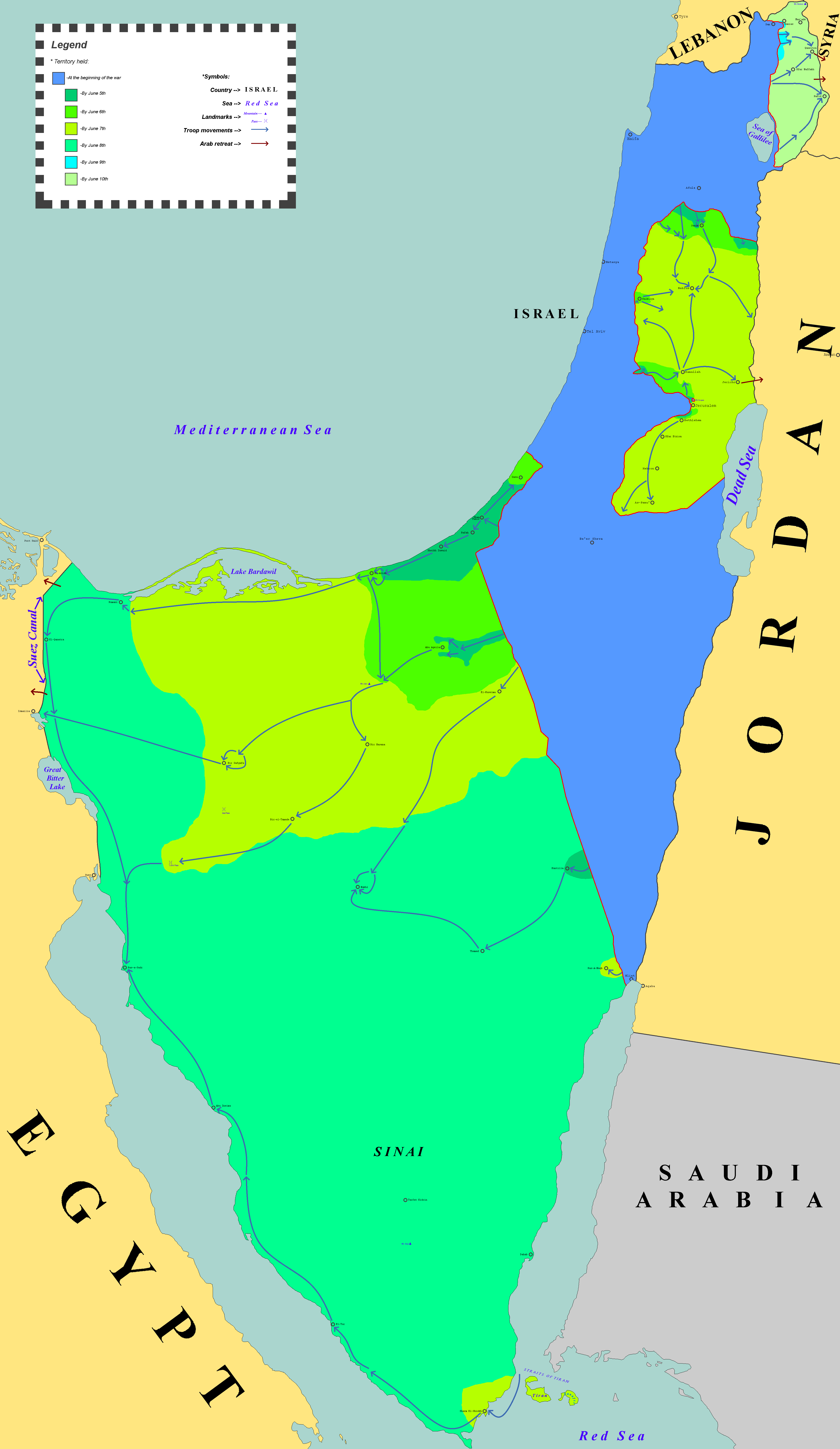
The Six-Day War (, ; ar, النكسة, , or ) or June War, also known as the 1967 Arab–Israeli War or Third Arab–Israeli War, was fought between Israel and a coalition of Arab world, Arab states (primarily United Arab Republic, Egypt, Syria, and Jordan) from 5 to 10 June 1967. Escalated hostilities broke out amid poor relations between Israel and its Arab neighbours following the 1949 Armistice Agreements, which were signed at the end of the 1948 Arab–Israeli War, First Arab–Israeli War. Earlier, in 1956, regional tensions over the Straits of Tiran escalated in what became known as the Suez Crisis, when Israel invaded Egypt over the Israeli passage through the Suez Canal and Straits of Tiran, Egyptian closure of maritime passageways to Israeli shipping, ultimately resulting in the re-opening of the Straits of Tiran to Israel as well as the deployment of the United Nations Emergency Force (UNEF) along the Borders of Israel#Border with Egypt, Egypt–Israel border. In ... [...More Info...] [...Related Items...] OR: [Wikipedia] [Google] [Baidu] |
Yarmouk River
The Yarmuk River ( ar, نهر اليرموك, translit=Nahr al-Yarmūk, ; Greek: Ἱερομύκης, ; la, Hieromyces or ''Heromicas''; sometimes spelled Yarmouk), is the largest tributary of the Jordan River. It runs in Jordan, Syria and Israel, and drains much of the Hauran plateau. Its main tributaries are the wadis of 'Allan and Ruqqad from the north, Ehreir and Zeizun from the east. Although it is narrow and shallow throughout its course, at its mouth it is nearly as wide as the Jordan, measuring thirty feet in breadth and five in depth. The once celebrated Matthew Bridge used to cross the Yarmuk at its confluence with the Jordan. History Yarmuk forms a natural border between the plains to the north - Hauran, Bashan and Golan - and the Gilead mountains to the south. Thus it has often served as boundary line between political entities. Neolithic The Yarmukian is a Pottery Neolithic culture that inhabited parts of Palestine and Jordan. Its type site is at Sha'ar HaGolan, on ... [...More Info...] [...Related Items...] OR: [Wikipedia] [Google] [Baidu] |


