|
Hale, Tanzania
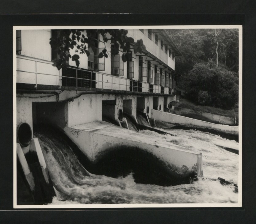
Hale is a town in eastern Tanzania. It belongs to Mnyuzi ward in Korogwe district Korogwe District also known as Korogwe District Council is one of the eleven districts of Tanga Region in Tanzania. The District covers an area of . It is bordered to the northeast by the Lushoto District and north by Bumbuli District. Korogwe D .... It is the location of the major falls of Pangani River and a hydroelectric power station. Latitude -5.2833 Longitude 38.6000 Altitude (feet) 830 Lat (DMS) 5° 16' 60S Long (DMS) 38° 36' 0E Altitude (meters) 252 Transport Hale is on the A14 highway Dar es Salaam - Chalinze - Tanga. It is served by a junction station on a cross-country line of the national railway system. See also * Railway stations in Tanzania References Populated places in Tanga Region {{Tanzania-geo-stub ... [...More Info...] [...Related Items...] OR: [Wikipedia] [Google] [Baidu] |
Tanzania
Tanzania (; ), officially the United Republic of Tanzania ( sw, Jamhuri ya Muungano wa Tanzania), is a country in East Africa within the African Great Lakes region. It borders Uganda to the north; Kenya to the northeast; Comoro Islands and the Indian Ocean to the east; Mozambique and Malawi to the south; Zambia to the southwest; and Rwanda, Burundi, and the Democratic Republic of the Congo to the west. Mount Kilimanjaro, Africa's highest mountain, is in northeastern Tanzania. According to the United Nations, Tanzania has a population of million, making it the most populous country located entirely south of the equator. Many important hominid fossils have been found in Tanzania, such as 6-million-year-old Pliocene hominid fossils. The genus Australopithecus ranged across Africa between 4 and 2 million years ago, and the oldest remains of the genus '' Homo'' are found near Lake Olduvai. Following the rise of ''Homo erectus'' 1.8 million years ago, humanity sprea ... [...More Info...] [...Related Items...] OR: [Wikipedia] [Google] [Baidu] |
Korogwe District
Korogwe District also known as Korogwe District Council is one of the eleven districts of Tanga Region in Tanzania. The District covers an area of . It is bordered to the northeast by the Lushoto District and north by Bumbuli District. Korogwe District also bordered to the east by the Mkinga District and the Muheza District, to the South by the Handeni Rural District and the Korogwe Urban District, and to the West by the Kilimanjaro Region. The highest point in Korogwe District is Mafi Peak at 1,442m. According to the 2012 Tanzania National Census, the population of Korogwe Rural District was 242,038. Administrative subdivisions As of 2012, Korogwe Rural District was administratively divided into 20 wards. Wards # Bungu # Chekelei # Dindira # Kizara # Kerenge # Kizara # Kwagunda # Kwashemshi # Lutindi # Magamba Kwalukonge # Magoma # Makuyuni Makuyuni is an administrative ward in the Monduli district of the Arusha Region of Tanzania Tanzania (; ), officially ... [...More Info...] [...Related Items...] OR: [Wikipedia] [Google] [Baidu] |
Pangani River
The Pangani River (pin-gi'nee) (also called Luffu and Jipe Ruvu, especially in older sources, and probably once called Rhaptus) is a major river of northeastern Tanzania. It has two main sources: the Ruvu, which rises as Lumi at Kilimanjaro, passes through Lake Jipe, and empties into the Nyumba ya Mungu Reservoir, and the Kikuletwa, coming from the west and mainly fed by Mount Meru in Arusha Region, which also enters into the Nyumba ya Mungu Reservoir in Kilimanjaro Region. Just after leaving the reservoir the stream becomes the main Pangani, which empties into the Indian Ocean in Tanga Region at the Tangan port town of Pangani. For much of its length the river flows along the regional borders of Kilimanjaro Region and Manyara Region, before flowing into Tanga Region, which contains the 68 MW Pangani Power Station and the Pangani Falls Dam. There are several inhabited islands within the river. The river is full of crocodiles; hippopotami are scarcer in its lower parts. ... [...More Info...] [...Related Items...] OR: [Wikipedia] [Google] [Baidu] |
Railway Stations In Tanzania
ARailway stations in Tanzania include: *Tanzania Standard Gauge Railway Maps UN Map- Tanga and Kidatu lines not shown. Railways in southern AfricaUNHCR Map* Interactive map of Tanzania railways * Look for the MSN Map at the bottom of pages of many towns, or look for the Map Button at the top and scroll down the MSN map. Towns served by rail Tanzania Railways Corporation ( all gauge) Central Line # Dar es Salaam - ocean port - former national capital - 8 km from TAZARA line # Ruvu (75m) - junction to Tanga line # Morogoro (510m) - junction to north # Kilosa (572m) - junction going south to TAZARA # Gulwe (680m) # Igandu (985m) # Dodoma (1148m) - The national capital # Manyoni (1244m) - junction going north to Singida # Itigi (1306m) # Ikungu (1289m) # Tabora (1212m) - junction going north to Mwanza # Kaliua (1112m) - junction going south to Mpanda # Kigoma (775m) - terminal and port on Lake Tanganyika Kidatu Line # (Not shown on map) # Kilosa (572 ... [...More Info...] [...Related Items...] OR: [Wikipedia] [Google] [Baidu] |
