|
Gagron Fort
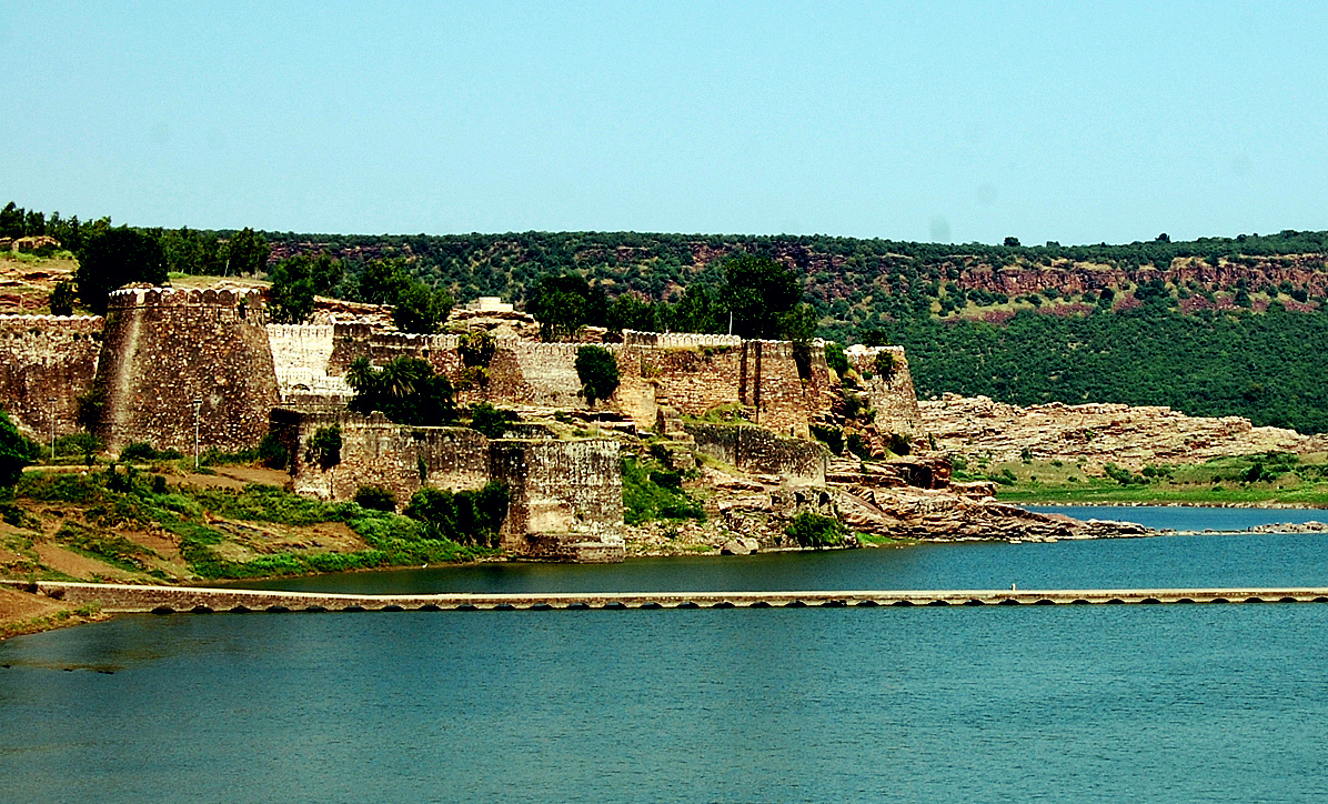
Gagron Fort (Hindi/Rajasthani: गागरोन का किला) is a hill and water fort and is situated in Jhalawar district of Rajasthan, in the Hadoti region of India. It is an example of a hill and water fort. The fort was built by Bijaldev Singh Dod (a Rajput king) in the twelfth century. Later, the fort has also been controlled by Sher Shah and Akbar. The fort is constructed on the confluence of Ahu River and Kali Sindh River. The fort is surrounded by water on three sides and a moat on the forth side and hence earned the name ''Jaladurg (Hindi/Rajasthani: जलदुर्ग, translation: Water Fort)''. It was designated a UNESCO world heritage site in 2013 as a part of Hill Forts in Rajasthan. History Gagron fort was constructed during the twelfth century by the king Bijaldev and the fort was ruled by the Khinchi kingdom for 300 years. The exact date on which the fort was constructed remains a mystery but historians estimate that the fort was constructed fro ... [...More Info...] [...Related Items...] OR: [Wikipedia] [Google] [Baidu] |
Rajasthan
Rajasthan (; lit. 'Land of Kings') is a state in northern India. It covers or 10.4 per cent of India's total geographical area. It is the largest Indian state by area and the seventh largest by population. It is on India's northwestern side, where it comprises most of the wide and inhospitable Thar Desert (also known as the Great Indian Desert) and shares a border with the Pakistani provinces of Punjab to the northwest and Sindh to the west, along the Sutlej- Indus River valley. It is bordered by five other Indian states: Punjab to the north; Haryana and Uttar Pradesh to the northeast; Madhya Pradesh to the southeast; and Gujarat to the southwest. Its geographical location is 23.3 to 30.12 North latitude and 69.30 to 78.17 East longitude, with the Tropic of Cancer passing through its southernmost tip. Its major features include the ruins of the Indus Valley civilisation at Kalibangan and Balathal, the Dilwara Temples, a Jain pilgrimage site at Rajasthan's only hill stat ... [...More Info...] [...Related Items...] OR: [Wikipedia] [Google] [Baidu] |
Hill Forts Of Rajasthan
The North Western Indian State of Rajasthan has over one hundred fortifications on hills and mountainous terrain. Six Hill Forts of Rajasthan, spread across Rajasthan state in northern India, have been clustered as a series and designated UNESCO World Heritage Site. The ‘Hill Forts of Rajasthan’ was initially submitted to the UNESCO as a serial property formed by five Rajput forts in the Aravalli Range, and were built and enhanced between the 5th and 18th centuries CE by several Rajput kings of different kingdoms. The UNESCO series has been increased to six forts. They consist of: # Chittor Fort at Chittorgarh city # Kumbhalgarh Fort at Rajsamand city # Ranthambore Fort at Sawai Madhopur # Gagron Fort at Jhalawar city # Amer Fort at Jaipur city # Jaisalmer Fort at Jaisalmer city Some of these forts have defensive fortification wall up to 20 km long, still surviving urban centers and still in use water harvesting mechanism. Selection A series was to be selected a ... [...More Info...] [...Related Items...] OR: [Wikipedia] [Google] [Baidu] |
Jaisalmer Fort
Jaisalmer Fort is situated in the city of Jaisalmer, in the Indian state of Rajasthan. It is believed to be one of the very few "living forts" in the world (such as Carcassonne, France), as nearly one fourth of the old city's population still resides within the fort. For the better part of its 860-year history, the fort was the city of Jaisalmer. The first settlements outside the fort walls, to accommodate the growing population of Jaisalmer, are said to have come up in the 17th century. Jaisalmer Fort is the second oldest fort in Rajasthan, built in 1156 AD by the Rajput Rawal (ruler) Jaisal from whom it derives its name, and stood at the crossroads of important trade routes (including the ancient Silk road). The fort's massive yellow sandstone walls are a tawny lion colour during the day, fading to honey-gold as the sun sets, thereby camouflaging the fort in the yellow desert. For this reason it is also known as the ''Sonar Quila'' or ''Golden Fort''. The name ''Sonar Qu ... [...More Info...] [...Related Items...] OR: [Wikipedia] [Google] [Baidu] |
Chittor Fort
The Chittorgarh (literally Chittor Fort), also known as Chittod Fort, is one of the largest forts in India. It is a UNESCO World Heritage Site. The fort was the capital of Mewar and is located in the present-day city of Chittorgarh. It sprawls over a hill in height spread over an area of above the plains of the valley drained by the Berach River. The fort covers 65 historic structures, which include four palaces, 19 large temples, 20 large water bodies, 4 memorials and a few victory towers. In 2013, at the 37th session of the World Heritage Committee held in Phnom Penh, Cambodia, Chittorgarh Fort, along with five other forts of Rajasthan, was declared a World Heritage Site, UNESCO World Heritage Site, as a group called the Hill Forts of Rajasthan. Geography Chittorgarh, located in the southern part of the state of Rajasthan, from Ajmer, midway between Delhi and Mumbai on the National Highway 8 (India) in the road network of Golden Quadrilateral. Chittorgarh is situated where ... [...More Info...] [...Related Items...] OR: [Wikipedia] [Google] [Baidu] |
Amer Fort
Amer Fort or Amber Fort is a fort located in Amer, Rajasthan, India. Amer is a town with an area of located from Jaipur, the capital of Rajasthan. Amber city and Amber fort were founded by ruler Alan Singh of Chanda dynasty of Meenas. Located high on a hill, it is the principal tourist attraction in Jaipur. Amer Fort is known for its artistic style elements. With its large ramparts and series of gates and cobbled paths, the fort overlooks Maota Lake, which is the main source of water for the Amer Palace. Amer Palace is great example of Rajput architecture. Some of its buildings and work have influence of Mughal architecture. Constructed of red sandstone and marble, the attractive, opulent palace is laid out on four levels, each with a courtyard. It consists of the Diwan-e-Aam, or "Hall of Public Audience", the Diwan-e-Khas, or "Hall of Private Audience", the Sheesh Mahal (mirror palace), or Jai Mandir, and the Sukh Niwas where a cool climate is artificially created by winds t ... [...More Info...] [...Related Items...] OR: [Wikipedia] [Google] [Baidu] |
Muharram
Muḥarram ( ar, ٱلْمُحَرَّم) (fully known as Muharram ul Haram) is the first month of the Islamic calendar. It is one of the four sacred months of the year when warfare is forbidden. It is held to be the second holiest month after Ramadan. The tenth day of Muharram is known as Ashura. Better known as part of the Mourning of Muharram, Shi'a Muslims mourn the tragedy of Ḥusayn ibn ʿAlī's family. Shiites mourn the martyrdom of Ḥusayn by abstaining from joyous events. Instead, Shia Muslims hold many events to offer condolences to Imam Husayn and to honor the martyrs by prayer, reading supplications, and holding charity events. Shiʿi Muslims eat as little as possible on the Ashura; however, this is not seen as fasting. Alevis fast ten or twelve days, each day for one of the Twelve Imams of Shiʿa Islam, to commemorate and mourn the Imams, as if a very close relative has died. Some (excluding children, elderly or sick) do not eat or drink, avoid entertainment unt ... [...More Info...] [...Related Items...] OR: [Wikipedia] [Google] [Baidu] |
North India
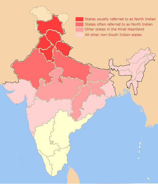
North India is a loosely defined region consisting of the northern part of India. The dominant geographical features of North India are the Indo-Gangetic Plain and the Himalayas, which demarcate the region from the Tibetan Plateau and Central Asia. The term North India has varying definitions. The Ministry of Home Affairs in its Northern Zonal Council Administrative division included the states of Haryana, Himachal Pradesh, Punjab and Rajasthan and Union Territories of Chandigarh, Delhi, Jammu and Kashmir and Ladakh. The Ministry of Culture in its ''North Culture Zone'' includes the state of Uttarakhand but excludes Delhi whereas the Geological Survey of India includes Uttar Pradesh and Delhi but excludes Rajasthan and Chandigarh. Other states sometimes included are Bihar, Gujarat, Jharkhand, Madhya Pradesh and West Bengal. North India has been the historical centre of the Mughal Empire, the Delhi Sultanate and the British Indian Empire. It has a diverse culture, and includ ... [...More Info...] [...Related Items...] OR: [Wikipedia] [Google] [Baidu] |
Vindhya Range
The Vindhya Range (also known as Vindhyachal) () is a complex, discontinuous chain of mountain ridges, hill ranges, highlands and plateau escarpments in west-central India. Technically, the Vindhyas do not form a single mountain range in the geological sense. The exact extent of the Vindhyas is loosely defined, and historically, the term covered a number of distinct hill systems in central India, including the one that is now known as the Satpura Range. Today, the term principally refers to the escarpment and its hilly extensions that runs north of and roughly parallel to the Narmada River in Madhya Pradesh. Depending on the definition, the range extends up to Gujarat in the west, Uttar Pradesh and Bihar in the north, and Chhattisgarh in the east. The Vindhyas have a great significance in Hindu mythology, Indian mythology and history. Several ancient texts mention the Vindhyas as the southern boundary of the ''Āryāvarta'', the territory of the ancient Indo-Aryan peoples. Al ... [...More Info...] [...Related Items...] OR: [Wikipedia] [Google] [Baidu] |
Mukundara Hills National Park
Mukundara Hills National Park is a national park in Rajasthan, India with an area of . It was established in 2004 and consists of three wildlife sanctuaries: Darrah Wildlife Sanctuary, National Chambal Sanctuary, and Jawahar Sagar Wildlife Sanctuary. It is located in the Khathiar-Gir dry deciduous forests. History The national park contains large tracts of forests formerly part of the Maharaja of Kota's hunting grounds. The park was embroiled in a political controversy over its nomenclature, when the Bharatiya Janata Party state government revoked the decision that it be called the Rajiv Gandhi National Park. Wildlife Mukundara Hills National Park is mountainous and has a variety of plants, trees and animals. It has grasslands in between and also many dry deciduous trees. There are four rivers that flow in this region, the rivers are Chambal river, Kali river, Ahu river, Ramzan river. Tree species in the forests of Mukundara Hills National Park include ''Acacia nilotica' ... [...More Info...] [...Related Items...] OR: [Wikipedia] [Google] [Baidu] |
Bikaner
Bikaner () is a city in the northwest of the state of Rajasthan, India. It is located northwest of the state capital, Jaipur. Bikaner city is the administrative headquarters of Bikaner District and Bikaner division. Formerly the capital of the princely state of Bikaner, the city was founded by Rao Bika in 1488 CE and from its small origins it has developed into the fourth largest city in Rajasthan. The Ganges Canal, completed in 1928, and the Indira Gandhi Canal, completed in 1987, facilitated its development. History left, Bikaner coat of arms Prior to the mid 15th century, the region that is now Bikaner was a barren wilderness called Jangladesh. Rao Bika established the city of Bikaner in 1488. He was the first son of Maharaja Rao Jodha of the Rathore clan, the founder of Jodhpur and conquered the largely arid country in the north of Rajasthan. As the first son of Jodha he wanted to have his own kingdom, not inheriting Jodhpur from his father or the title of Maharaja ... [...More Info...] [...Related Items...] OR: [Wikipedia] [Google] [Baidu] |
Jauhar
Jauhar, sometimes spelled Jowhar or Juhar, was a Hindu practice of mass self-immolation by women, in the Indian subcontinent, to avoid capture, enslavement and rape by an invading army, when facing certain defeat during a war. Some reports of ''jauhar'' mention women committing self-immolation along with their children. This practice was historically observed in northwest regions of India, with most famous jauhars in recorded history occurring during wars between Hindu Rajput kingdoms in Rajasthan and the opposing Muslim armies.Malise Ruthven (2007), Fundamentalism: A Very Short Introduction, Oxford University Press, , page 63;John Stratton Hawley (1994), Sati, the Blessing and the Curse, Oxford University Press, , page 165-166, Quote: "In this she resembles the sati who dies in jauhar. The jauhar sati dies before and while her husband fights what appears to be an unwinnable battle. By dying, she frees him from worry about her welfare and saves herself from the possible rape by ... [...More Info...] [...Related Items...] OR: [Wikipedia] [Google] [Baidu] |


%2C_1567.jpg)