|
Gyeongsan County
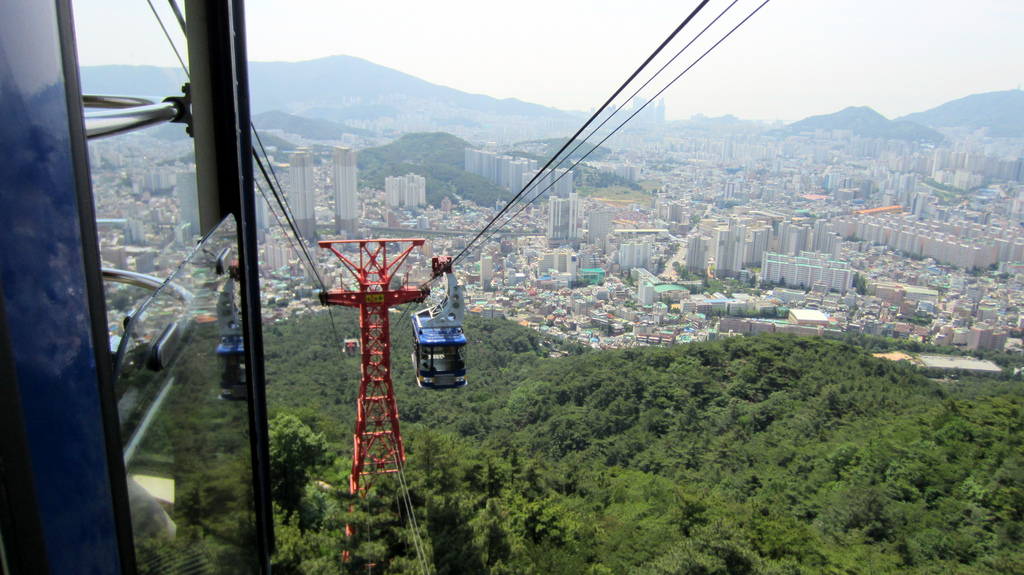
Gyeongsan () is a city in North Gyeongsang Province, South Korea. Its western border abuts the metropolitan city of Daegu, and much of Gyeongsan lies within the Daegu metropolitan area. Numerous universities are located in Gyeongsan, such as Yeungnam University, Daegu University, Daekyeung University, Catholic University of Daegu, Daegu Haany University and Gyeongil University. Symbols of City The city flower is the magnolia which grows well even in poor soil conditions. The city bird is the magpie. Its clear song reflects the bright and hopeful spirits of citizens. The city tree is the ginkgo. It symbolizes the constant prosperity, perseverance and elegant traits of Gyeongsan citizens. International Chemistry Olympiad Gyeongsan was the host for the 38th International Chemistry Olympiad (2 July 2006 - 11 July 2006). Twin towns – sister cities Gyeongsan is twinned with: * Gangdong (Seoul), South Korea * Jōyō, Japan * Sinan, South Korea * Xihai'an, China Administrat ... [...More Info...] [...Related Items...] OR: [Wikipedia] [Google] [Baidu] |
Cities Of South Korea
The largest cities of South Korea have an autonomous status equivalent to that of provinces. Seoul, the largest city and capital, is classified as a ''teukbyeolsi'' ( Special City), while the next six-largest cities are classified as ''gwangyeoksi'' (Metropolitan Cities). Smaller cities are classified as ''si'' ("cities") and are under provincial jurisdiction, at the same level as counties. City status Article 10 of the Local Autonomy Act defines the standards under which a populated area may become a city: an area which is predominantly urbanised and has a population of at least 50,000; a which has an urbanised area with a population of at least 50,000; or a which has a total population of at least 150,000 and multiple urbanised areas each with a population of at least 20,000. An English translation is available from the Korea Legislative Research Institute, but is out of date: Article 7 of the 2018 version of the law is similar in content to Article 10 of the 2021 version ... [...More Info...] [...Related Items...] OR: [Wikipedia] [Google] [Baidu] |
Busan
Busan (), officially known as is South Korea's most populous city after Seoul, with a population of over 3.4 million inhabitants. Formerly romanized as Pusan, it is the economic, cultural and educational center of southeastern South Korea, with its port being Korea's busiest and the sixth-busiest in the world. The surrounding "Southeastern Maritime Industrial Region" (including Ulsan, South Gyeongsang, Daegu, and some of North Gyeongsang and South Jeolla) is South Korea's largest industrial area. The large volumes of port traffic and urban population in excess of 1 million make Busan a Large-Port metropolis using the Southampton System of Port-City classification . Busan is divided into 15 major administrative districts and a single county, together housing a population of approximately 3.6 million. The full metropolitan area, the Southeastern Maritime Industrial Region, has a population of approximately 8 million. The most densely built-up areas of the city are situated ... [...More Info...] [...Related Items...] OR: [Wikipedia] [Google] [Baidu] |
Ulsan
Ulsan (), officially the Ulsan Metropolitan City is South Korea's seventh-largest metropolitan city and the eighth-largest city overall, with a population of over 1.1 million inhabitants. It is located in the south-east of the country, neighboring Busan to the south and facing Gyeongju to the north. Ulsan is the industrial powerhouse of South Korea, forming the heart of the Ulsan Industrial District. It has the world's largest automobile assembly plant, operated by the Hyundai Motor Company; the world's largest shipyard, operated by Hyundai Heavy Industries; and the world's third largest oil refinery, owned by SK Energy. In 2020, Ulsan had a GDP per capita of $65,352, the highest of any region in South Korea. Administrative divisions Ulsan is divided into four '' gu'' (districts) and one '' gun'' (county): *Buk District () * Dong District () * Jung District () * Nam District () * Ulju County () History Stone tools found at the Mugeo-dong Ok-hyeon archaeological site indic ... [...More Info...] [...Related Items...] OR: [Wikipedia] [Google] [Baidu] |
Gyeongsangbuk-do
North Gyeongsang Province ( ko, 경상북도, translit=Gyeongsangbuk-do, ) is a province in eastern South Korea. The province was formed in 1896 from the northern half of the former Gyeongsang province, and remained a province of Korea until the country's division in 1945, then became part of South Korea. Daegu was the capital of North Gyeongsang Province between 1896 and 1981, but has not been a part of the province since 1981. In 2016, the provincial capital moved from Daegu to Andong. The area of the province is , 19.1 percent of the total area of South Korea. Geography and climate The province is part of the Yeongnam region, on the south by Gyeongsangnam-do, on the west by Jeollabuk-do and Chungcheongbuk-do Provinces, and on the north by Gangwon-do Province. During the summer, North Gyeongsang Province is perhaps the hottest province in South Korea. This is helped by the fact that the province is largely surrounded by mountains: the Taebaek Mountains in the east and the S ... [...More Info...] [...Related Items...] OR: [Wikipedia] [Google] [Baidu] |
Xihai'an
Huangdao District () and Xihai'an New Area (), also known as Qingdao West Coast is a district and a state-level new area of Qingdao, Shandong, China, located southwest and west of the main urban area of the city on the western shore of Jiaozhou Bay. It was identical to Qingdao Economic and Technological Development Zone (QETDZ, ), which was launched in 1985 after the zone was merged with Huangdao District and set up the Free Trade Zone in 1992. In December 2012, Jiaonan, a county-level city in Qingdao was merged into Huangdao District. The pillar industries engaged in the zone include electronics, household electric appliances, building materials, petrochemicals, machinery and pharmaceutical drugs. It is connected via the Jiaozhou Bay Bridge. In mid 2018, the Ministry of Civil Affairs approved the consolidation of Huangdao District Government and Xihai'an New Area Government into a single governing body, which became the fourth administrative state-level new areas after Pudong ... [...More Info...] [...Related Items...] OR: [Wikipedia] [Google] [Baidu] |
Sinan County, South Jeolla
Sinan County (''Sinan-gun'') is a county in South Jeolla Province, South Korea. The county consists of 111 inhabited islands and 719 uninhabited islands. The number of islands in this county accounts for 25% of all islands in South Korea. Big islands among them are Anjwado (45.2 km2), Aphaedo (44.3 km2), Bigeumdo (43.1 km2), Dochodo (40.3 km2), Imjado (43.2 km2), Amtaedo (38.7 km2), Jeungdo (37.2 km2), Jangsando (24.3 km2), Haui-do (16.1 km2), and Heuksando (19.7 km2). The sea area is a continental shelf with less than 15 meter in depth. Sinan County is known for its specialities - Skate (fish) and Cheonilyeom (천일염, a Korean type of sea salt). In 2014, enslaveries on Sinan County's salt farms were discovered. Administrative Divisions Sinan County has two ''eup'' () and twelve ''myeon'' (). Islands * Anjwado (안좌도, 安佐島): 45.2 km2 * Aphaedo (압해도, 押海島): 44.3 km2 * Bigeumdo (비금도 ... [...More Info...] [...Related Items...] OR: [Wikipedia] [Google] [Baidu] |
Jōyō, Kyoto
is a city located in Kyoto Prefecture, Kansai, Japan. It is halfway between Kyoto and Nara. It contains historical sites including the Shibagahara Tomb and Mito shrine. The city was founded on May 3, 1972. As of October 2020, the city has an estimated population of 74,607 and a population density of 2,281 persons per km². The total area is 32.71 km². Demographics Per Japanese census data, the population of Jōyō has declined in recent decades. Economy Industry * Gold and silver thread Gold and silver threads weaved into Kimono and Obi are produced at Joyo. Joyo produces 60% of all the gold and silver thread in Japan. Agriculture * figs *sweet potatoes Tourist attractions *Shoudoukanga-iseki *Aodani plum forest **Currently about 10,000 ume trees are planted in this 20-hectare area, considered the largest in Kyoto Prefecture. A detailed origin of this ume grove is not known. It is known that in the beginning of the Medieval era (Kamakura period, 1185-1333 ... [...More Info...] [...Related Items...] OR: [Wikipedia] [Google] [Baidu] |
Gangdong District
Gangdong District (Gangdong-gu) is one of the 25 '' gu'' which make up the city of Seoul, South Korea. Gangdong is literally "east of the (Han) River". It is located on the east side of the city. Jungbu (literally "Central Part") Express Motorway starts in and passes through Sangil-dong, which is located in the east end of this district. In Amsa-dong, there is a Pre-historic heritage site which is about six thousand years old. At this site, there are many kinds of pottery and houses. The pottery which has been found was made of ceramic and is circular and shaped into a point similar to corn. Administrative divisions * Gangil-dong (강일동 江一洞) * Godeok-dong (고덕동 高德洞) * Gil-dong (길동 吉洞) * Dunchon-dong (둔촌동 遁村洞) * Myeongil-dong (명일동 明逸洞) * Sangil-dong (상일동 上一洞) * Seongnae-dong (성내동 城內洞) * Amsa-dong (암사동 岩寺洞) * Cheonho-dong (천호동 千戶洞) Education Gangdong District is home to 25 eleme ... [...More Info...] [...Related Items...] OR: [Wikipedia] [Google] [Baidu] |
Sister City
A sister city or a twin town relationship is a form of legal or social agreement between two geographically and politically distinct localities for the purpose of promoting cultural and commercial ties. While there are early examples of international links between municipalities akin to what are known as sister cities or twin towns today dating back to the 9th century, the modern concept was first established and adopted worldwide during World War II. Origins of the modern concept The modern concept of town twinning has its roots in the Second World War. More specifically, it was inspired by the bombing of Coventry on 14 November 1940, known as the Coventry Blitz. First conceived by the then Mayor of Coventry, Alfred Robert Grindlay, culminating in his renowned telegram to the people of Stalingrad (now Volgograd) in 1942, the idea emerged as a way of establishing solidarity links between cities in allied countries that went through similar devastating events. The comradesh ... [...More Info...] [...Related Items...] OR: [Wikipedia] [Google] [Baidu] |
International Chemistry Olympiad
The International Chemistry Olympiad (IChO) is an annual academic competition for high school students. It is one of the International Science Olympiads. The first IChO was held in Prague, Czechoslovakia, in 1968. The event has been held every year since then, with the exception of 1971. The delegations that attended the first events were mostly countries of the former Eastern bloc and it was not until 1980, the 12th annual International Chemistry Olympiad, that the event was held outside of the bloc in Austria. Up to 4 students for each national team compete around July in both a theoretical and an experimental sections, with about half of the participants being awarded medals. About The International Chemistry Olympiad (IChO) is an annual competition for the world’s most talented chemistry students at the secondary school level. Nations around the world send a team of four students who are tested on their chemistry knowledge and skills in a five-hour laboratory practical exam ... [...More Info...] [...Related Items...] OR: [Wikipedia] [Google] [Baidu] |


.jpg)
