|
Gravette, Arkansas
Gravette is a city in Benton County, Arkansas, Benton County, Arkansas, United States. The population was 3,547 as of the 2020 United States census, 2020 census. It is part of the Northwest Arkansas region. Geography Gravette is located in northwestern Benton County, Arkansas. According to the United States Census Bureau, as of 2010 the city had a total area of , all land. In 2012, the nearby Census-designated place, unincorporated community of Hiwasse, Arkansas, Hiwasse was facing annexation by the city of Bella Vista, Arkansas, Bella Vista. The majority of people within Hiwasse were opposed and chose to be annexed by Gravette instead. The annexation increased Gravette’s total area to . Gravette city limits are situated approximately 3-miles west of Bentonville, Arkansas, the Benton County, Arkansas seat, and east of Tulsa, Oklahoma, northwest of Fayetteville, Arkansas, Fayetteville, and approximately 60 miles south of Joplin, MO. Several major highways and interstates run ... [...More Info...] [...Related Items...] OR: [Wikipedia] [Google] [Baidu] |
City
A city is a human settlement of a substantial size. The term "city" has different meanings around the world and in some places the settlement can be very small. Even where the term is limited to larger settlements, there is no universally agreed definition of the lower boundary for their size. In a narrower sense, a city can be defined as a permanent and Urban density, densely populated place with administratively defined boundaries whose members work primarily on non-agricultural tasks. Cities generally have extensive systems for housing, transportation, sanitation, Public utilities, utilities, land use, Manufacturing, production of goods, and communication. Their density facilitates interaction between people, government organisations, government organizations, and businesses, sometimes benefiting different parties in the process, such as improving the efficiency of goods and service distribution. Historically, city dwellers have been a small proportion of humanity overall, bu ... [...More Info...] [...Related Items...] OR: [Wikipedia] [Google] [Baidu] |
Bella Vista, Arkansas
Bella Vista is a city in Benton County, Arkansas, United States. The population was 30,102 at the 2020 census, and was estimated to be 32,368 in 2023. The community has taken advantage of the natural setting within the Springfield Plateau of the Ozark Mountains since first established in 1917 as a summer resort destination. The oak/hickory forests, valleys, creeks, and steep rises that characterize the city's topography have slowly given way to a series of reservoirs, golf courses, and other amenities. A largely residential city, early settlement was predominantly summer cabins, later giving way to single-family housing of a retirement community developed by Cooper Communities with services and amenities provided by a strong property owners' association (POA). Located within the Northwest Arkansas region, the city has been experiencing a population and building boom in recent years, as indicated by an 82% growth in population between the 2000 and 2020 censuses, largely as a b ... [...More Info...] [...Related Items...] OR: [Wikipedia] [Google] [Baidu] |
White (U
White is the lightest color and is achromatic (having no chroma). It is the color of objects such as snow, chalk, and milk, and is the opposite of black. White objects fully (or almost fully) reflect and scatter all the visible wavelengths of light. White on television and computer screens is created by a mixture of red, blue, and green light. The color white can be given with white pigments, especially titanium dioxide. In ancient Egypt and ancient Rome, priestesses wore white as a symbol of purity, and Romans wore white togas as symbols of citizenship. In the Middle Ages and Renaissance a white unicorn symbolized chastity, and a white lamb sacrifice and purity. It was the royal color of the kings of France as well as the flag of monarchist France from 1815 to 1830, and of the monarchist movement that opposed the Bolsheviks during the Russian Civil War (1917–1922). Greek temples and Roman temples were faced with white marble, and beginning in the 18th c ... [...More Info...] [...Related Items...] OR: [Wikipedia] [Google] [Baidu] |
Arkansas And Oklahoma Railroad
The Arkansas and Oklahoma Railroad was a line running about 47 miles from Rogers, Arkansas to Grove, Oklahoma. It was formed in 1898, and sold its assets in 1901. History As background, the town of Rogers was founded as a stop on the line of a St. Louis–San Francisco Railway (Frisco) predecessor. That line, on which the first train arrived in Rogers on May 10, 1881, bypassed the county seat of Bentonville, Arkansas. So in 1883, a corporation called the Bentonville Railroad Company proceeded to link Rogers with Bentonville, about six miles. Within that framework, the Arkansas and Oklahoma Railroad Company (A&OR) was incorporated April 1, 1898, under the laws of Arkansas. On November 17, 1900, the A&OR purchased the Bentonville Railroad line between Rogers and Bentonville. The A&OR also built, between 1898 and 1900, about 41 miles of track northwesterly from Bentonville through the town of Gravette, Arkansas-- where it crossed the tracks of the Kansas City, Pittsburg ... [...More Info...] [...Related Items...] OR: [Wikipedia] [Google] [Baidu] |
Southwest City, Missouri
Southwest City is a city in McDonald County, Missouri, United States. The population was 922 at the 2020 census. It is located in the southwestern corner of the state of Missouri. History Southwest City was platted in 1870. It was named from its location in the southwest corner of the county and state. Geography Southwest City is bordered to the west by the state of Oklahoma, and the Arkansas state line is south of the city limits. Missouri Route 43 passes through the city as Main Street, leading north to Tiff City. To the south the highway becomes Arkansas Highway 43, leading to Siloam Springs. Missouri Route 90 leads east from Southwest City to Noel and to Jane. According to the U.S. Census Bureau, Southwest City has a total area of , of which are land and , or 1.55%, are water. Honey Creek runs through the city, flowing northwest to the Neosho River within the Lake o' the Cherokees in Oklahoma. Demographics 2010 census As of the census of 2010, there were 97 ... [...More Info...] [...Related Items...] OR: [Wikipedia] [Google] [Baidu] |
Kindley House In Gravette, AR
Kindley Air Force Base was a United States Air Force base in Bermuda from 1948–1970, having been operated from 1943 to 1948 by the United States Army Air Forces as ''Kindley Field''. History World War II Prior to American entry into the Second World War, the governments of the United Kingdom and the US led by Prime Minister Winston Churchill and President Roosevelt came to an agreement exchanging a number of obsolete ex-US Naval destroyers for 99-year base rights in a number of British Empire West Indian territories. Bases were also granted in Bermuda and Newfoundland, though Britain received no loans in exchange for these. This was known as the destroyers for bases deal. As the government of Bermuda had not been party to the agreement, the arrival of US engineers in 1941 came as rather a surprise to many in Bermuda. The US engineers began surveying the colony for the construction of an airfield that was envisioned as taking over most of the West End of the Island. F ... [...More Info...] [...Related Items...] OR: [Wikipedia] [Google] [Baidu] |
Humid Subtropical Climate
A humid subtropical climate is a subtropical -temperate climate type, characterized by long and hot summers, and cool to mild winters. These climates normally lie on the southeast side of all continents (except Antarctica), generally between latitudes 25° and 40° and are located poleward from adjacent tropical climates, and equatorward from either humid continental (in North America and Asia) or oceanic climates (in other continents). It is also known as warm temperate climate in some climate classifications. Under the Köppen climate classification, ''Cfa'' and ''Cwa'' climates are either described as humid subtropical climates or warm temperate climates. This climate features mean temperature in the coldest month between (or ) and and mean temperature in the warmest month or higher. However, while some climatologists have opted to describe this climate type as a "humid subtropical climate", Köppen himself never used this term. The humid subtropical climate classific ... [...More Info...] [...Related Items...] OR: [Wikipedia] [Google] [Baidu] |
Köppen Climate Classification
The Köppen climate classification divides Earth climates into five main climate groups, with each group being divided based on patterns of seasonal precipitation and temperature. The five main groups are ''A'' (tropical), ''B'' (arid), ''C'' (temperate), ''D'' (continental), and ''E'' (polar). Each group and subgroup is represented by a letter. All climates are assigned a main group (the first letter). All climates except for those in the ''E'' group are assigned a seasonal precipitation subgroup (the second letter). For example, ''Af'' indicates a tropical rainforest climate. The system assigns a temperature subgroup for all groups other than those in the ''A'' group, indicated by the third letter for climates in ''B'', ''C'', ''D'', and the second letter for climates in ''E''. Other examples include: ''Cfb'' indicating an oceanic climate with warm summers as indicated by the ending ''b.'', while ''Dwb'' indicates a semi-Monsoon continental climate, monsoonal continental climate ... [...More Info...] [...Related Items...] OR: [Wikipedia] [Google] [Baidu] |
Interstate 49 In Arkansas
Interstate 49 (I-49) is an Interstate Highway in the U.S. state of Arkansas. There are two main sections of the highway across different sides of the state. The southern section starts at the Louisiana state line, then runs to Texarkana, at the Texas state line. The northern section begins at Interstate 40 in Arkansas, I-40 and at U.S. Route 71 in Arkansas, U.S. Highway 71 (US 71) in Alma, Arkansas, Alma and runs north to the Missouri state line, where the freeway continues into Missouri. An additional small section south of Fort Smith, Arkansas, Fort Smith is currently designated as Highway 549 (AR 549) until it is extended northward to the I-40 interchange, at which point it will become part of I-49. Route description I-49 enters the state from Louisiana between Ida, Louisiana, Ida and Doddridge, Arkansas, Doddridge. The first interchange in Arkansas is with US 71 at exit 4. The Interstate passes near the town of Fouke, Arkansas, Fouke, where it has ... [...More Info...] [...Related Items...] OR: [Wikipedia] [Google] [Baidu] |
Arkansas Highway 279
Arkansas Highway 279 (AR 279 and Hwy. 279) is a north–south List of Arkansas state highways, state highway in Benton County, Arkansas. The route runs from Arkansas Highway 12 at Vaughn, Arkansas, Vaughn north to the Missouri state line through Centerton, Arkansas, Centerton. The route has a rare Arkansas Highway System#Routes and sections, officially designated exception of , overlapping Arkansas Highway 72. Route description The route begins at AR 12 near the Northwest Arkansas Regional Airport and runs north to intersect Arkansas Highway 102, AR 102 in Centerton, Arkansas, Centerton. These routes form a Concurrency (road), concurrency west until the Centerton city limits, when AR 279 turns north. AR 279 winds north through rural Benton County until intersecting Arkansas Highway 72, AR 72 in Hiwasse, Arkansas, Hiwasee near the Hiwasse Bank Building, which is listed on the National Register of Historic Places. These routes briefly overlap in what the Arkansas State Highway ... [...More Info...] [...Related Items...] OR: [Wikipedia] [Google] [Baidu] |
Arkansas Highway 59
Arkansas Highway 59 is a north–south List of Arkansas state highways, state highway in Northwest Arkansas. The route runs from Arkansas Highway 22 in Barling, Arkansas, Barling north to the Missouri state line through Van Buren, Arkansas, Van Buren, the county seat of Crawford County. Highway 59 parallels U.S. Route 59, US 59 (in Oklahoma) between Siloam Springs, Arkansas, Siloam Springs and Fort Smith, Arkansas, Fort Smith. Route description The route begins in Barling, Arkansas, Barling at Arkansas Highway 22, AR 22. The route runs north to enter Van Buren, Arkansas, Van Buren, crossing Interstate 540 (Arkansas), I-540 and briefly Concurrency (road), concurring with U.S. Route 64 in Arkansas, US 64. The concurrency begins near the Joseph Starr Dunham House and before crossing Interstate 40 in Arkansas, Interstate 40. The route exits town northbound, intersecting rural highways Arkansas Highway 162, AR 162 and Arkansas Highway 220, AR 220 in Cedarville, Arkansas, Cedarvill ... [...More Info...] [...Related Items...] OR: [Wikipedia] [Google] [Baidu] |
Arkansas Highway 72
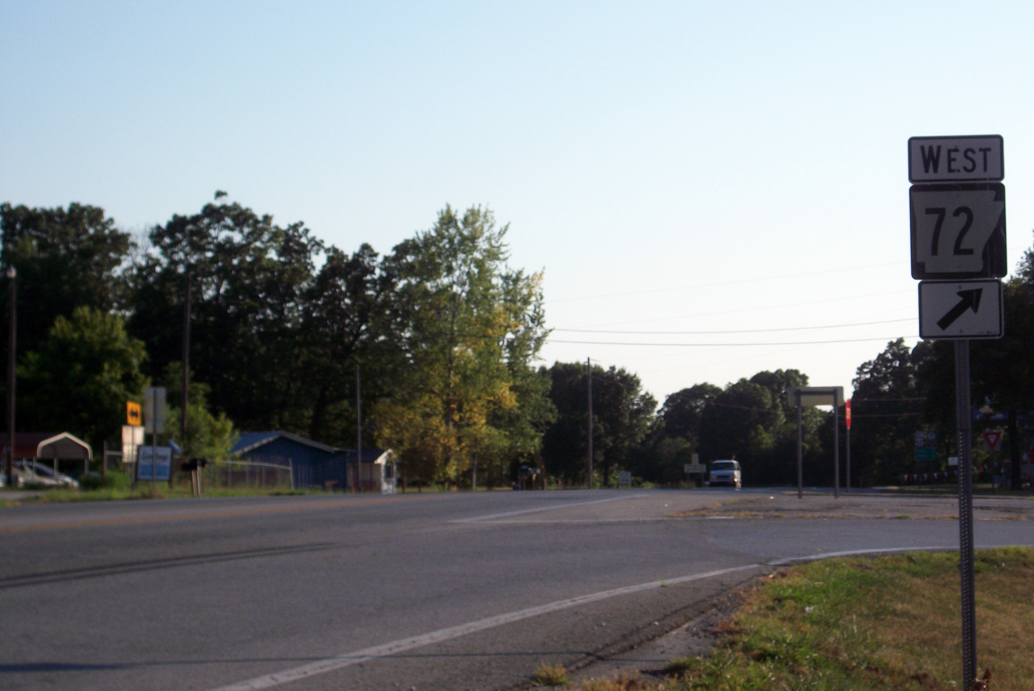
Arkansas Highway 72 (AR 72) is a designation for two east–west state highways in Benton County, Arkansas. One segment of runs from Highway 43 at Maysville east to Walton Boulevard in Bentonville. A second segment of runs from Interstate 49 (I-49) in Bentonville east to U.S. Route 62 (US 62) north of Avoca. The route is one of the original Arkansas state highways. Route description Maysville to Bentonville The route begins at Highway 43 in Maysville and runs east to Gravette. Highway 72 intersects Highway 59 in Gravette near the Kansas City Southern Railway Caboose No. 383 on the National Register of Historic Places. The highway continues east past the Banks House to the community of Hiwasse within Gravette, having an interchange with I-49 just west of the community, where the highway passes the Hiwasse Bank Building. Upon reaching Hiwasse, Highway 72 has an officially designated exception of with Highway 279. The highway runs s ... [...More Info...] [...Related Items...] OR: [Wikipedia] [Google] [Baidu] |


