|
Goodramgate
Goodramgate is a street in the city centre of York, in England. History The area now covered by Goodramgate lay within the walls of Roman Eboracum. The street runs diagonally across the line of former Roman buildings, from the Porta Decumana (now King's Square) to the Porta Principalis Sinistra (now Monk Bar). Anglo-Saxon artifacts have been found in the area, while its name dates from the Viking Jorvik era, being named after someone called "Guthrum" or "Gutherun". The street was first recorded in about 1180. In the Mediaeval period, the street lay in the parish of Holy Trinity Church, although since 1316 the church has been hidden from the street, behind Lady Row. The precinct of York Minster lay immediately north of the street, and until the early 19th-century, was entered through a gateway. Part of this may survive in the rebuilt structure at the entrance to College Street. The original site of the York Dominican Friary may have been on the street, although it moved ... [...More Info...] [...Related Items...] OR: [Wikipedia] [Google] [Baidu] |
41–45 Goodramgate
41–45 Goodramgate is a grade I listed building in the city centre of York, in England. Most of the building was constructed in 1500: a three-storey, five-bay range facing onto the east side Goodramgate, and a single-storey hall behind its northern part. It probably originated as the house of a wealthy citizen, with a shop at the front. Early in the 1600s, a further two-storey building was constructed south of the single-storey range about six feet away from it, and the gap between the two was closed up soon after. A passageway ran back-to-front through the central part of the building. By 1800, the front of the building had been plastered over, and shop windows had been installed in the ground floor, with leaded lights in the windows above. These were replaced by sash windows by the end of the century. Both 41 and 43 Goodramgate were refronted in brick during the 1800s. The property was bought by Cuthbert Morrell in the 1920s, and in 1929, Walter Brierley and Harvey Ruth ... [...More Info...] [...Related Items...] OR: [Wikipedia] [Google] [Baidu] |
Holy Trinity Church, Goodramgate, York
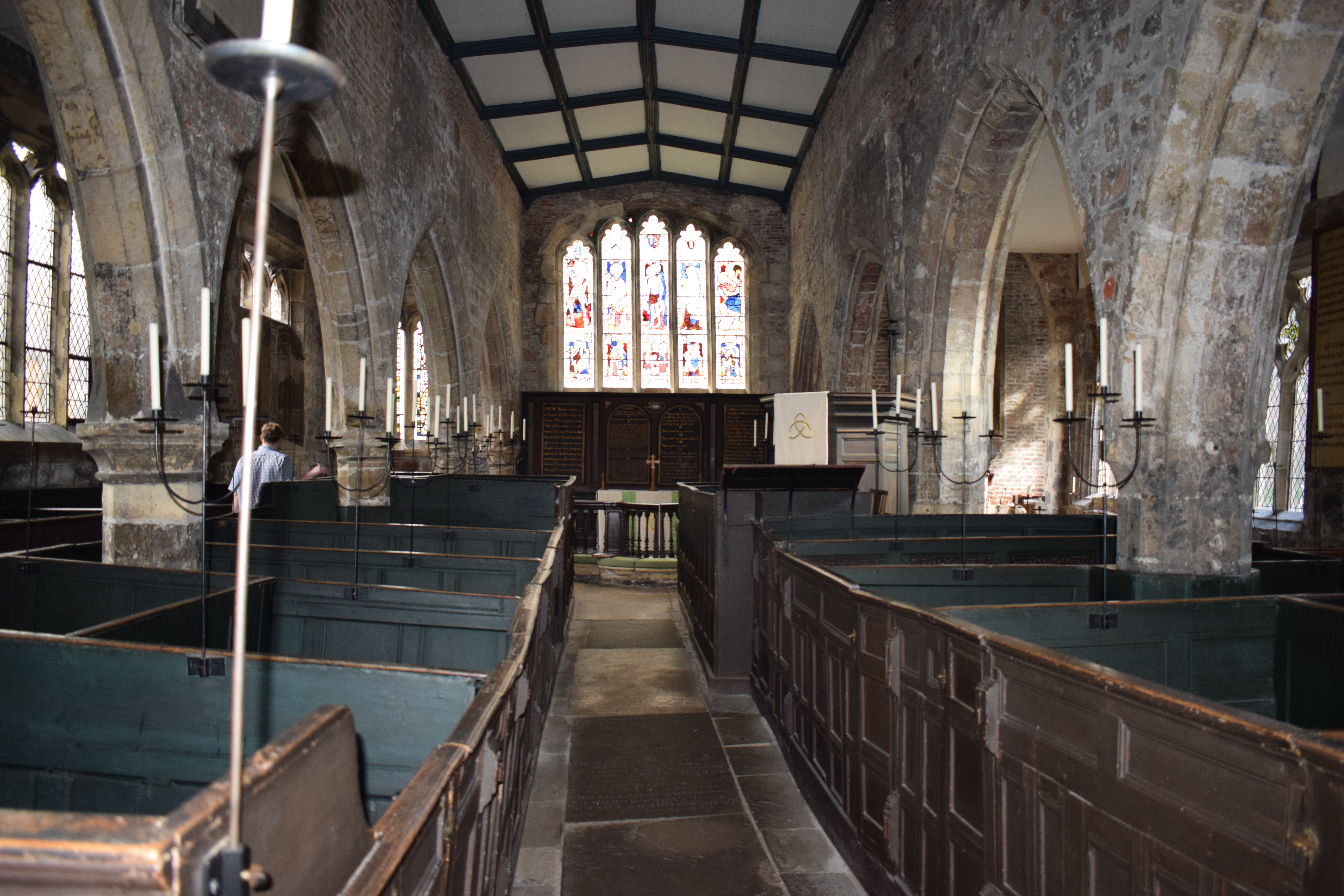
Holy Trinity Church, on Goodramgate in York, is a Grade I listed former parish church in the Church of England in York and is in the care of the Churches Conservation Trust. History The church dates from the 12th century. The south east chapel is 13th century, and the south aisle and south arcade date from the 14th century. It was enlarged in 1823 when the north side was rebuilt. The south porch was added in 1849. The condition of the building was poor by 1882 and regular worship was suspended for over 50 years until 1937 when restoration work was completed. The oak rafters were renewed and the roof was restored. The pier supporting the arches between the nave and north aisle were underpinned with concrete, and the decaying stonework on the south aisle walls was renewed. Parish status The church was declared redundant on 29 June 1971, and was vested in the care of the Churches Conservation Trust on 7 November 1972. A restoration was carried out between 1973 and 1974. Memoria ... [...More Info...] [...Related Items...] OR: [Wikipedia] [Google] [Baidu] |
Old White Swan
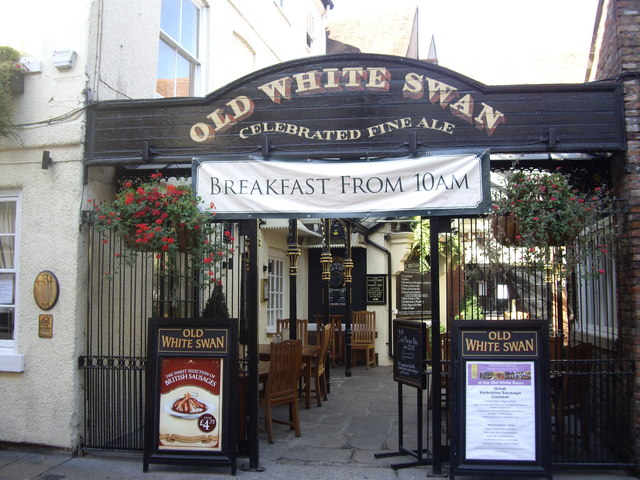
The Old White Swan is a pub in the city centre of York, in England. The core of the building is timber-framed and was constructed in the early-17th century. It lay at the back of a coaching yard on the north-western side of Goodramgate, but with another entrance on Low Petergate. Underneath a glass panel in the floor is part of a Roman column, although this is not its original location. The building was in use as an inn by 1703, making it the third-oldest pub in the city. In this period, part of the building lay in the parish of Holy Trinity King's Court, and part in the Holy Trinity Goodramgate parish. Both claimed the right to charge a rent for the pub, leading its landlord to paint a white line through the courtyard and kitchen, demarcating the boundary, and providing a justification for him to pay only partial rent to each parish. In 1723, the local constables decided to watch for possible Catholic activity in the pub, and spent £1 at the business while doing so — ... [...More Info...] [...Related Items...] OR: [Wikipedia] [Google] [Baidu] |
Wealden Hall, York
The Wealden Hall is a grade I listed building on Goodramgate in the city centre of York, in England. The building was constructed in about 1500. It is a wealden hall house, which by the date was a common design in South East England, but rare in York. The Wealden Hall and 1 Tanner Row, also in the city, are the two northernmost surviving examples of wealden halls. Using the standard wealden hall design, the building originally had a central hall, with double storey bays either side. In this case, the design was end-on to the street, and, unusually, only the front bays were jettied. In front of the hall, a three-storey range was constructed to face the street. Remain of two windows survive from the original construction, although they were originally unglazed and probably closed with shutters. The rear never had any openings, suggesting that it may have directly abutted another structure. The size of the house, and its jettying, suggests that it was built for a wealthy ow ... [...More Info...] [...Related Items...] OR: [Wikipedia] [Google] [Baidu] |
Lady Row
Lady Row, also known as Our Lady's Row, is a mediaeval Grade I listed building on Goodramgate in York, England. Historic England describe the structure as "some of the earliest urban vernacular building surviving in England". History The building was commissioned in 1316 as a terrace of tenements, to be let out to provide an income for a chantry priest at Holy Trinity, Goodramgate. The eleven-bay building was quickly constructed, and is usually dated as having been completed in 1317. Initially, it was divided into nine or ten tenements, each occupying both floors and one or more of the bays. By the 16th century, many of the tenements had been knocked together, and the building consisted of three cottages and a single tenement. Originally, an additional house was built in the churchyard of Holy Trinity, to house the chantry priest. The southernmost two bays had been demolished by the mid-18th century, when an archway to access the churchyard was built in their place. Around ... [...More Info...] [...Related Items...] OR: [Wikipedia] [Google] [Baidu] |
York
York is a cathedral city with Roman origins, sited at the confluence of the rivers Ouse and Foss in North Yorkshire, England. It is the historic county town of Yorkshire. The city has many historic buildings and other structures, such as a minster, castle, and city walls. It is the largest settlement and the administrative centre of the wider City of York district. The city was founded under the name of Eboracum in 71 AD. It then became the capital of the Roman province of Britannia Inferior, and later of the kingdoms of Deira, Northumbria, and Scandinavian York. In the Middle Ages, it became the northern England ecclesiastical province's centre, and grew as a wool-trading centre. In the 19th century, it became a major railway network hub and confectionery manufacturing centre. During the Second World War, part of the Baedeker Blitz bombed the city; it was less affected by the war than other northern cities, with several historic buildings being gutted and restore ... [...More Info...] [...Related Items...] OR: [Wikipedia] [Google] [Baidu] |
The Royal Oak, York
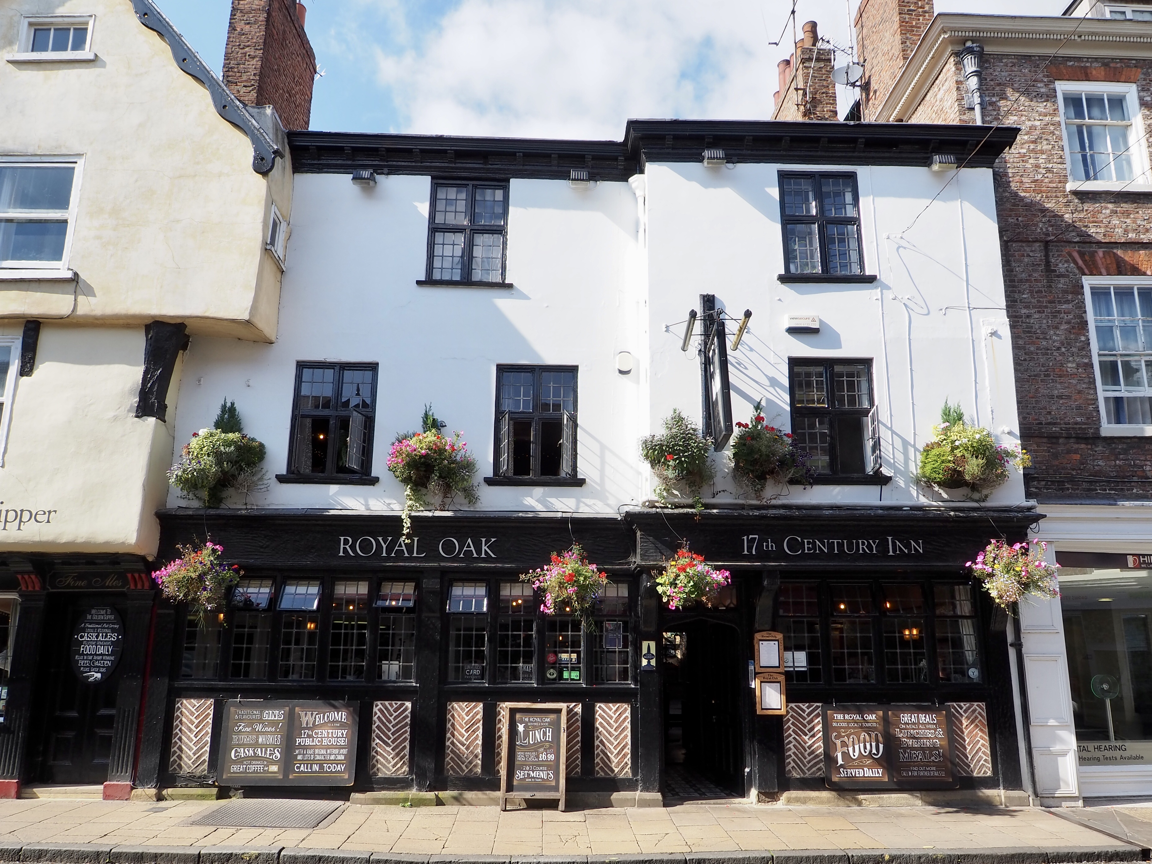
The Royal Oak is a pub in the city centre of York, in England. The pub lies on Goodramgate. The building is believed to date from the 15th-century and is largely timber-framed, although much of it has been rebuilt. The north-eastern section is of three storeys and contains one original internal wall, while the south-western section was originally a single-storey hall and contains part of one original partition wall, plus a reset Mediaeval beam. In the 18th-century, the north-eastern section was extended to the rear, in brick. Many of the features of the upper floors date from this period, including the staircase. A second storey was added to the south-western section in the 19th-century, while in 1934 the ground floor was refurbished, with a new frontage, in the Brewer's Tudor style. The building was a pub by 1772, when it was known as the Blue Pigg. It later became known as the Blue Boar, and has been the Royal Oak since 1819. From 1894, it was owned by the local John J. ... [...More Info...] [...Related Items...] OR: [Wikipedia] [Google] [Baidu] |
Deangate
Deangate is a street in the city centre of York, England, connecting College Street (York), College Street and Goodramgate with Minster Yard. It was created in 1903. The street runs east from the middle of Minster Yard to the junction of Goodramgate and College Street. It was constructed as the last part of a scheme to open up traffic flow in the former Minster Precinct. It was given the suffix "-gate" to match many of the older streets in the city. It was designated as part of the A64 road. It became increasingly busy, and by the 1980s was carrying 2,000 vehicles per hour past York Minster, causing damage to its structure and noise pollution. The York Civic Trust launched a campaign to pedestrianise the street, which succeeded in 1991. The street mostly runs around the side and back of buildings on other streets, with the main structure on the street being the stone yard of the Minster. References [...More Info...] [...Related Items...] OR: [Wikipedia] [Google] [Baidu] |
College Street (York)
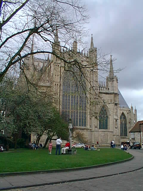
College Green is an open space in the city centre of York, England. History The green lies within the historic precinct of York Minster. As "Vicars' Lane", it was in existence by the late Mediaeval period, named as it led from York Minster towards the College of Vicars Choral on Bedern. In the 18th-century, it was known as "Little Alice Lane", after someone who lived in the area, then from about 1800 it became known as College Street, for St William's College. The church of St Mary ad Valvas lay on the south-west side of the street until 1362, when it was demolished in order to build the Lady Chapel of York Minster. In 1749, the Countess of Huntingdon's Connexion built a chapel south-east of the college. By the end of the century, it was used by the Calvinistic Baptists. South of the Minster, the south-west side was built up with houses. Two were demolished in 1862, and College Green was created. The remainder were demolished between 1905 and 1937 in order to enlarge Co ... [...More Info...] [...Related Items...] OR: [Wikipedia] [Google] [Baidu] |
College Green (York)
College Green is an open space in the city centre of York, England. History The green lies within the historic precinct of York Minster. As "Vicars' Lane", it was in existence by the late Mediaeval period, named as it led from York Minster towards the College of Vicars Choral on Bedern. In the 18th-century, it was known as "Little Alice Lane", after someone who lived in the area, then from about 1800 it became known as College Street, for St William's College. The church of St Mary ad Valvas lay on the south-west side of the street until 1362, when it was demolished in order to build the Lady Chapel of York Minster. In 1749, the Countess of Huntingdon's Connexion built a chapel south-east of the college. By the end of the century, it was used by the Calvinistic Baptists. South of the Minster, the south-west side was built up with houses. Two were demolished in 1862, and College Green was created. The remainder were demolished between 1905 and 1937 in order to enlarge Col ... [...More Info...] [...Related Items...] OR: [Wikipedia] [Google] [Baidu] |
Bedern
Bedern is a street in the city centre of York, in England, which originated as a college for the vicars choral of York Minster. History The Bedern College was founded in 1252, to house 36 vicars choral associated with York Minster. The name "Bedern" meant "house of prayer", and was in use by 1270. It was funded by three grants of land in Yorkshire, one in Hampshire, and the rents of 200 houses in York. It was built on land associated with somebody named Ulphus, which was donated by William of Laneham. The buildings consisted of small houses, a chapel, and a dining hall with kitchens, a buttery and a brewhouse, all built around a green. There was also a record room, and behind the buildings lay a garden and an orchard. In 1396, the site was improved by the construction of a latrine, and a bridge across Goodramgate, so that the vicars could enter the Minster Close without crossing the public street. In 1574, the vicars stopped dining together, and from 1640, the dining hall w ... [...More Info...] [...Related Items...] OR: [Wikipedia] [Google] [Baidu] |


