|
G1012 Jiansanjiang–Heixiazi Island Expressway
The Jiansanjiang–Heixiazi Island Expressway (), commonly referred to as the Jianhei Expressway () and designated G1012, is an expressway linking the town of Jiansanjiang with Hexiazi Island, entirely in the prefectural-level city of Jiamusi in the Chinese province of Heilongjiang. It is in length and opened on 13 August 2017. Prior to the national-level G designation, the highway was designated S14 by the province. In its western end, the expressway connects with the G1115 Jixi–Jiansanjiang Expressway, which continues some north to an interchange with the national-level G1011 Harbin–Tongjiang Expressway. This section could be considered as part of G1012, but is not signed as such. In its eastern end, the expressway ends just before a bridge to Hexiazi Island, at a junction with County Road 109 in Fuyuan. The bridge will eventually connect a new trans-national road crossing over the Amur River to the Jewish Autonomous Oblast and nearby city of Khabarovsk, in Russia ... [...More Info...] [...Related Items...] OR: [Wikipedia] [Google] [Baidu] |
Jiansanjiang
Jiansanjiang ( zh, s=建三江, p=Jiànsānjiāng, l=built on the Sanjiang Plain) is a ''Nongken'' agricultural colony, under the management of Jiansanjiang Branch. The area, consisting of 15 state farms, is situated in the eastern part of Heilongjiang province, China, across Fujin, Heilongjiang, Fujin City, Tongjiang, Heilongjiang, Tongjiang City, Fuyuan, Heilongjiang, Fuyuan City, and Raohe County.建三江15个农场有限公司全部挂牌 黑龙江日报, 2018-08-16 Population of the area is about 270,000. About 8 million tons of food are produced by the area every year. Administration Until year 2017, the government function of the area was performed by the , instead of by local governments. The government of Heilongjiang province p ...[...More Info...] [...Related Items...] OR: [Wikipedia] [Google] [Baidu] |
Heilongjiang
Heilongjiang is a province in northeast China. It is the northernmost and easternmost province of the country and contains China's northernmost point (in Mohe City along the Amur) and easternmost point (at the confluence of the Amur and Ussuri rivers). The province is bordered by Jilin to the south and Inner Mongolia to the west. It also shares a border with Russia ( Amur Oblast, Jewish Autonomous Oblast, Khabarovsk Krai, Primorsky Krai and Zabaykalsky Krai) to the north and east. The capital and the largest city of the province is Harbin. Among Chinese provincial-level administrative divisions, Heilongjiang is the sixth-largest by total area, the 20th-most populous, and the second-poorest by GDP per capita after only Gansu province. The province takes its name from the Amur river which marks the border between the People's Republic of China and Russia. Heilongjiang has significant agricultural production, and raw materials, such as timber, oil, and coal. Etymology ... [...More Info...] [...Related Items...] OR: [Wikipedia] [Google] [Baidu] |
Fuyuan, Heilongjiang
Fuyuan (; ) is a county-level city of the province of Heilongjiang, China. It is under the jurisdiction of the prefecture-level city of Jiamusi. History The area of present-day Fuyuan was inhabited by the Sushen dating back to approximately 4000 BCE. By the early 11th century BCE, local Sushen people began paying tribute to a dynasty hailing from the Central Plains. In 1909, the area was incorporated into the newly-established . In 1913, Suiyuan Prefecture was changed to a county. In 1929, Suiyuan County was renamed to Fuyuan County. The area was brought under control of the Japanese puppet state of Manchukuo in 1934, which placed the area under the administration of . The People's Liberation Army took control the area in 1945. In June 1947, they abolished Sanjiang Province, and merged it into the newly-created Hejiang Province. In April 1951, Fuyuan County was abolished, and replaced with the Fuyuan Fishing Special District, and part of its area was transferred to adjace ... [...More Info...] [...Related Items...] OR: [Wikipedia] [Google] [Baidu] |
Bolshoy Ussuriysky Island
Bolshoi Ussuriysky Island (), or Heixiazi Island ( zh, s=黑瞎子岛, t=黑瞎子島, p=Hēixiāzi Dǎo, l=black bear island), is a sedimentary island at the confluence of the Amur and Ussuri rivers. Since the Sino-Russian Border Agreement that was fully implemented in 2008, Bolshoy Ussuriysky Island was divided between China and Russia. China was given control over part of the island, and Russia retained the rest. Since then, the issue has been peacefully settled, and China no longer claims the entire island. It has an area of about 327 to 350 km2 and is bounded closely by Yinlong/Tarabarov Island, and over 90 islets. Its position at the confluence of the Amur and the Ussuri, and right next to the major Russian city of Khabarovsk, has given it great strategic importance. History The 1860 Convention of Peking stipulated that the boundary between China and Russia lay along the Amur and Ussuri rivers. As such, the island at the confluence of the two rivers was Chinese. U ... [...More Info...] [...Related Items...] OR: [Wikipedia] [Google] [Baidu] |
Russia
Russia, or the Russian Federation, is a country spanning Eastern Europe and North Asia. It is the list of countries and dependencies by area, largest country in the world, and extends across Time in Russia, eleven time zones, sharing Borders of Russia, land borders with fourteen countries. Russia is the List of European countries by population, most populous country in Europe and the List of countries and dependencies by population, ninth-most populous country in the world. It is a Urbanization by sovereign state, highly urbanised country, with sixteen of its urban areas having more than 1 million inhabitants. Moscow, the List of metropolitan areas in Europe, most populous metropolitan area in Europe, is the capital and List of cities and towns in Russia by population, largest city of Russia, while Saint Petersburg is its second-largest city and Society and culture in Saint Petersburg, cultural centre. Human settlement on the territory of modern Russia dates back to the ... [...More Info...] [...Related Items...] OR: [Wikipedia] [Google] [Baidu] |
Jiamusi
Jiamusi (Manchu: ; formerly Kiamusze) is a prefecture-level city in eastern Heilongjiang province, People's Republic of China. Located along the middle and lower reaches of the Songhua River, it faces Russia's Khabarovsk Krai across the Ussuri River and the Heilongjiang. In 2018, Jiamusi had a GDP of RMB 101.2 billion with a 4.3% growth rate. Its population was 2,156,505 at the 2020 census whom 862,555 lived in the built up area comprising 4 urban districts. History Early history In 1720, Jiamusi was first named Giyamusi (, ) during the Kangxi period by the Nani people, Nanai people. The word Giyamusi originally means "inn" in the Manchu language. Because of the harsh climate and short growing season, the region of modern day Jiamusi was largely uncultivated. Since the Qing government opened Manchuria for farming in order to prevent the conquest of the area by Russia, Jiamusi developed as a small trading post under the name Dongxing () since 1888. When Han Chinese and Manchu ... [...More Info...] [...Related Items...] OR: [Wikipedia] [Google] [Baidu] |
China
China, officially the People's Republic of China (PRC), is a country in East Asia. With population of China, a population exceeding 1.4 billion, it is the list of countries by population (United Nations), second-most populous country after India, representing 17.4% of the world population. China spans the equivalent of five time zones and Borders of China, borders fourteen countries by land across an area of nearly , making it the list of countries and dependencies by area, third-largest country by land area. The country is divided into 33 Province-level divisions of China, province-level divisions: 22 provinces of China, provinces, 5 autonomous regions of China, autonomous regions, 4 direct-administered municipalities of China, municipalities, and 2 semi-autonomous special administrative regions. Beijing is the country's capital, while Shanghai is List of cities in China by population, its most populous city by urban area and largest financial center. Considered one of six ... [...More Info...] [...Related Items...] OR: [Wikipedia] [Google] [Baidu] |
G1115 Jixi–Jiansanjiang Expressway
The G1115 Jixi–Jiansanjiang Expressway (), also referred to as the Jijian Expressway (), is an expressway in Heilongjiang, China that connects Jixi to Jiansanjiang via Mishan and Hulin Hulin () is a county-level city on the Muling River in southeastern Heilongjiang province, People's Republic of China. With a population of around 200,000, it is under the administration of Jixi. Nearby are Lake Xingkai, to the southwest, the .... It was previously designated as Heilongjiang Provincial Expressway S11 and was fully opened to traffic on 26 September 2012. References {{DEFAULTSORT:G1115 Jixi-Jiansanjiang Expressway Chinese national-level expressways Expressways in Heilongjiang ... [...More Info...] [...Related Items...] OR: [Wikipedia] [Google] [Baidu] |
G1011 Harbin–Tongjiang Expressway
The G1011 Harbin–Tongjiang Expressway (), commonly referred to as the Hatong Expressway (), is an expressway that connects the cities of Harbin, Heilongjiang, China, and Tongjiang, Heilongjiang, Tongjiang, a county-level city in Jiamusi, Heilongjiang. It is completely in Heilongjiang, Heilongjiang Province. Also, this expressway has the same route as Asian Highway Network AH33. ��UNESCAP﹣''Asian Highway Handbook'' The expressway is a spur or auxiliary line of the G10 Suifenhe–Manzhouli Expressway. The Harbin–Tongjiang Expressway meets the Suifenhe–Manzhouli Expressway at Harbin. The expressway passes through the cities of Harbin, Jiamusi, Shuangyashan, and ends at Tongjiang, Heilongjiang, Tongjiang, which is a county-level city of Jiamusi. Detailed Itinerary References {{ ...[...More Info...] [...Related Items...] OR: [Wikipedia] [Google] [Baidu] |
Amur River
The Amur River () or Heilong River ( zh, s=黑龙江) is a perennial river in Northeast Asia, forming the natural border between the Russian Far East and Northeast China (historically the Outer and Inner Manchuria). The Amur ''proper'' is long, and has a drainage basin of .Амур (река в Азии) If including its main stem , the Argun, the Am ... [...More Info...] [...Related Items...] OR: [Wikipedia] [Google] [Baidu] |
Jewish Autonomous Oblast
The Jewish Autonomous Oblast (JAO) is a federal subject of Russia in the far east of the country, bordering Khabarovsk Krai and Amur Oblast in Russia and Heilongjiang province in China. Its administrative center is the town of Birobidzhan. The JAO was designated by a Soviet official decree in 1928, and officially established in 1934. At its height, in the late 1940s, the Jewish population in the region peaked around 46,000–50,000, approximately 25% of its population. Since then the share of Jews steadily declined, and according to the 2021 Russian census, there were only 837 ethnic Jews left in the JAO (0.6%). Article 65 of the Constitution of Russia provides that the JAO is Russia's only autonomous oblast. It is one of two officially Jewish jurisdictions in the world, the other being Israel. It is one of the few places in the world where Yiddish is a recognized minority language. History Background Annexation of the Amur Region by Russia Prior to 1858, the ... [...More Info...] [...Related Items...] OR: [Wikipedia] [Google] [Baidu] |
Khabarovsk
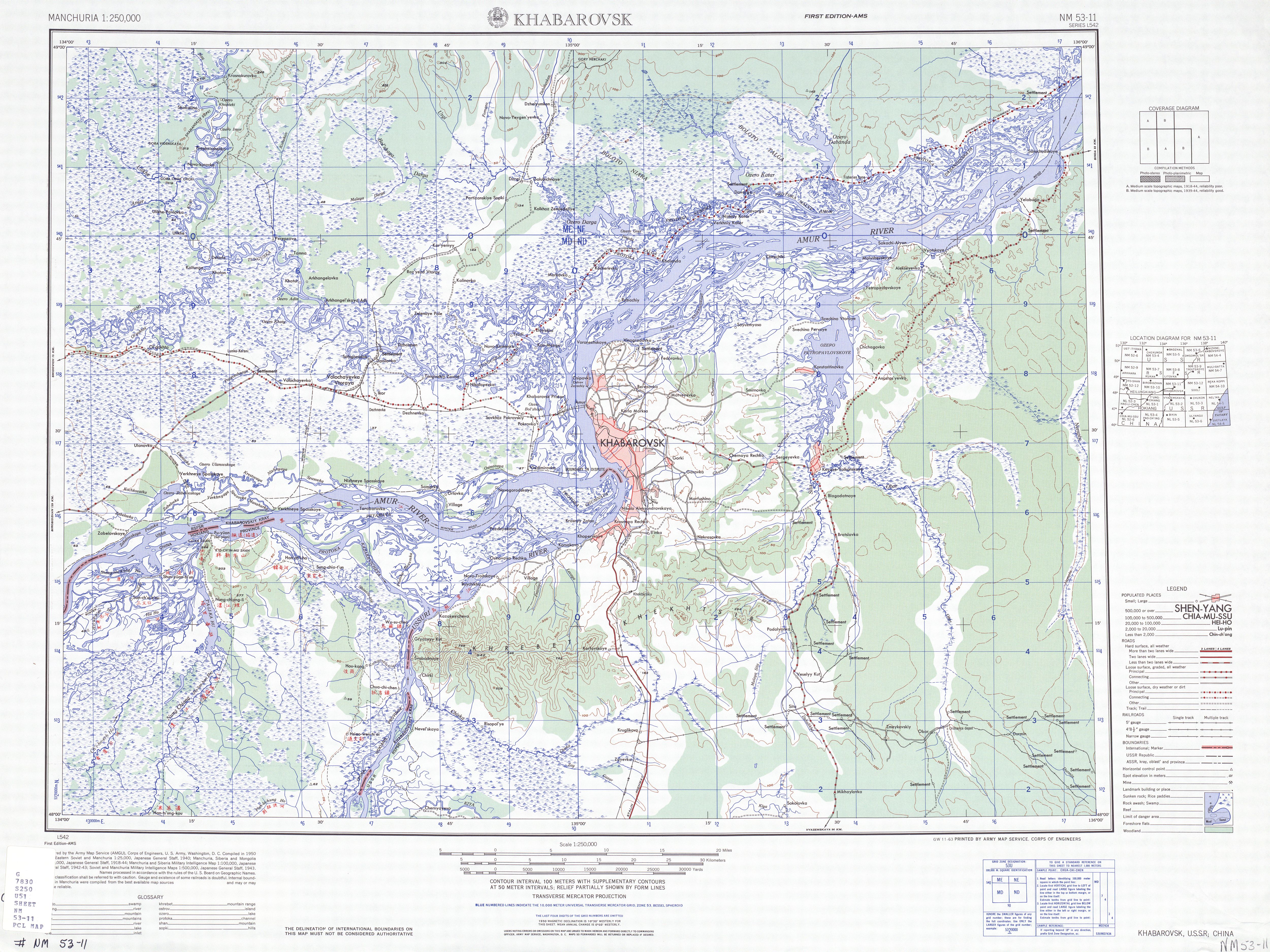
Khabarovsk ( ) is the largest city and the administrative centre of Khabarovsk Krai, Russia,Law #109 located from the China–Russia border, at the confluence of the Amur and Ussuri Rivers, about north of Vladivostok. As of the 2021 Russian census, it had a population of 617,441. It was known as ''Khabarovka'' until 1893. The city was the administrative center of the Far Eastern Federal District of Russia from 2002 until December 2018, when the status was given to Vladivostok. As is typical of the interior of the Russian Far East, Khabarovsk has an extreme climate with strong seasonal swings resulting in strong, cold winters and relatively hot and humid summers. History Earliest record Historical records indicate that a city was founded on the site in the eighth century. The Tungusic peoples are indigenous to the city's vicinity. The city was named ( zh, t= 伯力, p=Bólì, labels=no) in Chinese when it was part of the Chinese empire. During the Tang dynasty, Boli was th ... [...More Info...] [...Related Items...] OR: [Wikipedia] [Google] [Baidu] |


