|
Furnace Green
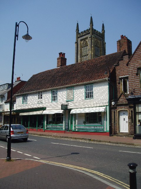
Furnace Green is one of 14 neighbourhoods in Crawley in West Sussex, England, and a local government ward. Furnace Green is located to the east of the town centre. It is bordered by Tilgate to the south west, Three Bridges to the north and Maidenbower to the east (on the other side of the London-Brighton railway line). The name Furnace Green is a reference to the iron smelting which is reputed to have taken place in Roman times - the local public house is the Charcoal Burner. Like much of Crawley, the street naming is themed i.e. different areas are linked by associated names. There are racecourses - Newmarket, Fontwell etc., forests - Arden, Savernake, Epping etc., references to the Norfolk Broads - Waveney, Oulton, Norwich, Yarmouth etc. There are also references to the iron industry - Coltash Road, Weald Drive, and the name Feroners Close also recalls the iron smelting. Crawley New Town With the creation of Crawley New Town in 1947 the Tilgate East area was reserved for housin ... [...More Info...] [...Related Items...] OR: [Wikipedia] [Google] [Baidu] |
Crawley
Crawley () is a large town and borough in West Sussex, England. It is south of London, north of Brighton and Hove, and north-east of the county town of Chichester. Crawley covers an area of and had a population of 106,597 at the time of the 2011 Census. The area has been inhabited since the Stone Age, and was a centre of ironworking in Roman times. Crawley developed slowly as a market town from the 13th century, serving the surrounding villages in the Weald. Its location on the main road from London to Brighton brought passing trade, which encouraged the development of coaching inns. A rail link to London opened in 1841. Gatwick Airport, nowadays one of Britain's busiest international airports, opened on the edge of the town in the 1940s, encouraging commercial and industrial growth. After the Second World War, the British Government planned to move large numbers of people and jobs out of London and into new towns around South East England. The New Towns Act 1946 design ... [...More Info...] [...Related Items...] OR: [Wikipedia] [Google] [Baidu] |
Tilgate Park
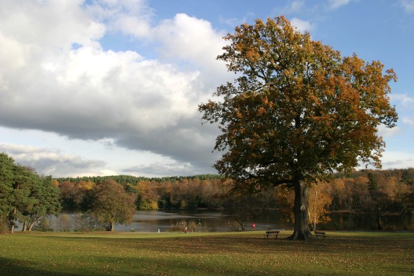
Tilgate Park is a large recreational park situated south of Tilgate, South-East Crawley. It is the largest and most popular park in the area. Originally a part of the ancient Worth Forest, the park and adjacent areas (including the modern-day Furnace Green, Three Bridges, part of Southgate and Tilgate Forest) were part of the larger Tilgate Estate. Although visitor activity is mostly focused on the area surrounding Tilgate Lake and on the adjacent gardens of a former country mansion, a large area of the park is former silvicultural forest. This is now being managed as a Local Nature Reserve called Tilgate Forest. The park also contains the Tilgate Nature Centre featuring captive breeding of some vulnerable and endangered animal species and varieties. History Prehistory Worked flint tools of the Mesolithic "Horsham Culture" have been found in numbers in the park, including so-called "Horsham Point" arrowheads of the 8th millennium BCE. The major find-spot is now on the Gol ... [...More Info...] [...Related Items...] OR: [Wikipedia] [Google] [Baidu] |
The Hawth
The Hawth Theatre is an arts and entertainment complex located in of woodland about from the town centre of the English town of Crawley. It is wholly owned by Crawley Borough Council and is currently operated by Parkwood Theatres. History The new town of Crawley had been without a theatre since its inception in 1947, leading, in part, a local newspaper editor to describe the town as soulless. In 1986, plans were approved by the borough council for a new theatre in an area of woodland known locally as The Hawth. Development began quickly, and the theatre opened for the first time in April 1988. In 1992, the theatre hosted a performance of London City Ballet's ''Romeo and Juliet'', which was attended by the then Her Royal Highness Diana, Princess of Wales. Facilities Main auditorium The main auditorium seats up to 855 for performances, and can be converted to an exhibition or conference venue. The stage is around wide, with a depth of , and is equipped to a high standard with so ... [...More Info...] [...Related Items...] OR: [Wikipedia] [Google] [Baidu] |
NCR 21
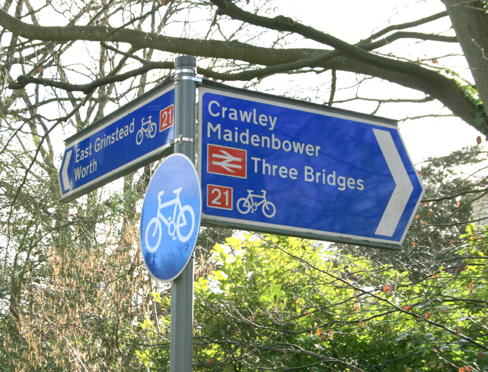
National Cycle Route 21 (or NCR 21) is part of the United Kingdom's National Cycle Network. It runs from Greenwich in South-East London south to Crawley, then east to Groombridge and south to Eastbourne, with a short final loop northwards again to its end at Pevensey. The route is approximately 150 km (93 miles) long. Several sections are not suitable for road bikes. Links to: *National Cycle Route 4 at Greenwich which is the route's start. *National Cycle Route 1 at Greenwich is a few hundred metres from the route's start. *National Cycle Route 2 at Polegate and at Pevensey at the route's finish. *National Cycle Route 20 at Redhill and at Crawley. The route forms much of the English section of the Avenue Verte, a planned long-distance cycle route linking London and Paris. Route Greenwich to Crawley Greenwich , Lewisham , South Norwood , New Addington , Redhill , Horley , Gatwick Airport , Crawley This section starts by leaving NCR 4 beside the River Thame ... [...More Info...] [...Related Items...] OR: [Wikipedia] [Google] [Baidu] |
Worth Way
The Worth Way is a footpath and bridleway linking the West Sussex towns of Crawley and East Grinstead via the village of Crawley Down. Mostly following the trackbed of a disused railway the path is an important wildlife corridor. It is part of the National Cycle Network. History The Worth Way follows for much of its route part of the course of a dismantled railway - the Three Bridges to Tunbridge Wells Central Line - which opened in 1855 and closed in 1967 as a result of the programme of closures put forward by East Grinstead resident and British Transport Commission Chairman, Richard Beeching. By 1977 West Sussex County Council had purchased almost of the line, mostly in the parish of Worth. On 10 July 1979 much of the route was officially reopened as footpath and bridleway. The reopening came, however, too late for two sections of the route which had already been lost to development by 1979. Firstly, a small commercial and residential development was built over the site o ... [...More Info...] [...Related Items...] OR: [Wikipedia] [Google] [Baidu] |
East Grinstead
East Grinstead is a town in West Sussex, England, near the East Sussex, Surrey, and Kent borders, south of London, northeast of Brighton, and northeast of the county town of Chichester. Situated in the extreme northeast of the county, the civil parish has an area of . The population at the 2011 Census was 26,383. Nearby towns include Crawley and Horley to the west, Tunbridge Wells to the east and Redhill and Reigate to the northwest. The town is contiguous with the village of Felbridge to the northwest. Until 1974 East Grinstead was in East Sussex, before joining together with Haywards Heath and Burgess Hill as the Mid-Sussex district of West Sussex. The town is on the Greenwich Meridian. It has many historic buildings, and the Weald and Ashdown Forest lie to the south-east. Places of interest The High Street contains one of the longest continuous runs of 14th-century timber-framed buildings in England. Other notable buildings in the town include Sackville College, the san ... [...More Info...] [...Related Items...] OR: [Wikipedia] [Google] [Baidu] |
Avenue Verte
The Avenue Verte/Greenway is a joint Anglo-French initiative assisted by Europe, to develop a largely traffic-free route between Paris and London (via the Dieppe – Newhaven ferry) for cyclists, walkers and horse riders. A route was put in place in time for the 2012 London Olympic Games. The route is not yet finalised and several sections are noted on the Avenue Verte website as being temporary. England In England, the route would follow the National Cycle Network (NCN) Route 21 between London and the South Coast. In East Sussex, the Avenue Verte incorporates existing paths including the Cuckoo Trail and Forest Way, offering more than 30 km of traffic-free cycling, walking and horse riding along former railway lines. The route would continue to Newhaven as NCN Route 2, along the South Coast, into West Sussex to the West and Kent to the East. North of East Sussex, the route would follow NCN 21 through West Sussex, Surrey and into London. Here, the route would pass t ... [...More Info...] [...Related Items...] OR: [Wikipedia] [Google] [Baidu] |
Brighton
Brighton () is a seaside resort and one of the two main areas of the City of Brighton and Hove in the county of East Sussex, England. It is located south of London. Archaeological evidence of settlement in the area dates back to the Bronze Age, Roman and Anglo-Saxon periods. The ancient settlement of "Brighthelmstone" was documented in the ''Domesday Book'' (1086). The town's importance grew in the Middle Ages as the Old Town developed, but it languished in the early modern period, affected by foreign attacks, storms, a suffering economy and a declining population. Brighton began to attract more visitors following improved road transport to London and becoming a boarding point for boats travelling to France. The town also developed in popularity as a health resort for sea bathing as a purported cure for illnesses. In the Georgian era, Brighton developed as a highly fashionable seaside resort, encouraged by the patronage of the Prince Regent, later King George IV, who spent ... [...More Info...] [...Related Items...] OR: [Wikipedia] [Google] [Baidu] |
National Cycle Route 20
National Cycle Route 20 is part of the United Kingdom's National Cycle Network and follows the Wandle Trail in London. It is the London - Brighton cycle route which starts alongside the river Thames at Wandsworth heading south along a mixture of roads and cycle paths to the southern side of the M25, here it combines with National Cycle Route 21 as far as Crawley. In July 2020, the route between Crawley and Pyecombe was removed from that national cycle network due to being of insufficient quality, as a result a small section remains in Crawley after Route 21 heads off East. The old route here still exists physically and is mostly made up of a dedicated cycle path beside the A23 dual carriageway, however parts use the B2118 and B2114 which can have fast moving traffic. At Pyecombe the official route returns using a cycle path beside the A23, once south of the A27 Brighton bypass the route mostly uses on road cycle lanes on the A23 all the way to the seafront where it meets Nat ... [...More Info...] [...Related Items...] OR: [Wikipedia] [Google] [Baidu] |
Public House
A pub (short for public house) is a kind of drinking establishment which is licensed to serve alcoholic drinks for consumption on the premises. The term ''public house'' first appeared in the United Kingdom in late 17th century, and was used to differentiate private houses from those which were, quite literally, open to the public as "alehouses", "taverns" and "inns". By Georgian times, the term had become common parlance, although taverns, as a distinct establishment, had largely ceased to exist by the beginning of the 19th century. Today, there is no strict definition, but CAMRA states a pub has four characteristics:GLA Economics, Closing time: London's public houses, 2017 # is open to the public without membership or residency # serves draught beer or cider without requiring food be consumed # has at least one indoor area not laid out for meals # allows drinks to be bought at a bar (i.e., not only table service) The history of pubs can be traced to Roman taverns in B ... [...More Info...] [...Related Items...] OR: [Wikipedia] [Google] [Baidu] |
West Sussex
West Sussex is a county in South East England on the English Channel coast. The ceremonial county comprises the shire districts of Adur, Arun, Chichester, Horsham, and Mid Sussex, and the boroughs of Crawley and Worthing. Covering an area of 1,991 square kilometres (769 sq mi), West Sussex borders Hampshire to the west, Surrey to the north, and East Sussex to the east. The county town and only city in West Sussex is Chichester, located in the south-west of the county. This was legally formalised with the establishment of West Sussex County Council in 1889 but within the ceremonial County of Sussex. After the reorganisation of local government in 1974, the ceremonial function of the historic county of Sussex was divided into two separate counties, West Sussex and East Sussex. The existing East and West Sussex councils took control respectively, with Mid Sussex and parts of Crawley being transferred to the West Sussex administration from East Sussex. In the 2011 censu ... [...More Info...] [...Related Items...] OR: [Wikipedia] [Google] [Baidu] |
Roman Britain
Roman Britain was the period in classical antiquity when large parts of the island of Great Britain were under occupation by the Roman Empire. The occupation lasted from AD 43 to AD 410. During that time, the territory conquered was raised to the status of a Roman province. Julius Caesar invaded Britain in 55 and 54 BC as part of his Gallic Wars. According to Caesar, the Britons had been overrun or culturally assimilated by other Celtic tribes during the British Iron Age and had been aiding Caesar's enemies. He received tribute, installed the friendly king Mandubracius over the Trinovantes, and returned to Gaul. Planned invasions under Augustus were called off in 34, 27, and 25 BC. In 40 AD, Caligula assembled 200,000 men at the Channel on the continent, only to have them gather seashells ('' musculi'') according to Suetonius, perhaps as a symbolic gesture to proclaim Caligula's victory over the sea. Three years later, Claudius directed four legi ... [...More Info...] [...Related Items...] OR: [Wikipedia] [Google] [Baidu] |


.png)
