|
Tilgate Park
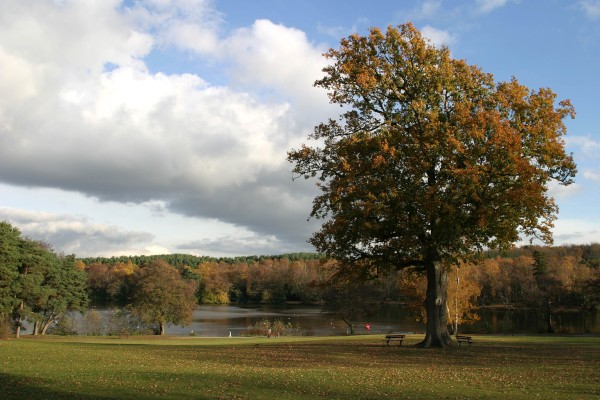
Tilgate Park is a large recreational park situated south of Tilgate, South-East Crawley. It is the largest and most popular park in the area. Originally a part of the ancient Worth Forest, the park and adjacent areas (including the modern-day Furnace Green, Three Bridges, part of Southgate and Tilgate Forest) were part of the larger Tilgate Estate. Although visitor activity is mostly focused on the area surrounding Tilgate Lake and on the adjacent gardens of a former country mansion, a large area of the park is former silvicultural forest. This is now being managed as a Local Nature Reserve called Tilgate Forest. The park also contains the Tilgate Nature Centre featuring captive breeding of some vulnerable and endangered animal species and varieties. History Prehistory Worked flint tools of the Mesolithic "Horsham Culture" have been found in numbers in the park, including so-called "Horsham Point" arrowheads of the 8th millennium BCE. The major find-spot is now on the Gol ... [...More Info...] [...Related Items...] OR: [Wikipedia] [Google] [Baidu] |
Tilgate Nature Centre
Tilgate Nature Centre is a small BIAZA-accredited zoo located within Tilgate Park in Tilgate Forest, South-East Crawley, West Sussex, England. The nature centre holds 144 different animal species (in 2021), and are actively involved in breeding programmes to preserve many threatened wild species from extinction. History Tilgate Nature Centre was formed in 1966 by Crawley Borough Council to breed ducklings for introduction into the three lakes at Tilgate, namely Campbells, Silt and Titmus. The zoo's focus changed over the years, and it now houses an impressive animal collection including reindeer, owls, raccoon dogs, parrots, mongooses, otters, snakes, tarantulas, lizards and various invertebrates. Tilgate Nature Centre is actively involved in breeding programmes for threatened species such as the Northern bald ibis, and has also been involved in re-introduction programmes; most notably the fen raft spider (Dolomedes plantarius) from the UK. Attractions There are 144 diff ... [...More Info...] [...Related Items...] OR: [Wikipedia] [Google] [Baidu] |
Tilgate, Crawley
Tilgate is one of 14 neighbourhoods within the town of Crawley in West Sussex, England. The area contains a mixture of privately developed housing, self-build groups and ex- council housing. It is bordered by the districts of Furnace Green to the north east, Southgate to the north west and Broadfield to the south west. History Tilgate was first mentioned in 13th- and 14th-century tax returns with the inclusion of land owned by William Yllegate (or de illegate). Within the Tilgate forest in the 17th century was a furnace (''Tilgate Furnace''). In the 1860s a large house (''Tilgate Mansion'') and estate was created of 2,185 acres (which included of woodland). The entrance and Tilgate Forest Lodge is near Three Bridges railway station. The supply ponds for the furnace survived and became ''Tilgate Lake'' within the estate. The estate was associated with the Joliffe family (and later the Nix family of bankers). The estate was sold by auction on 7 September 1939; this included ... [...More Info...] [...Related Items...] OR: [Wikipedia] [Google] [Baidu] |
Hunter-gatherer
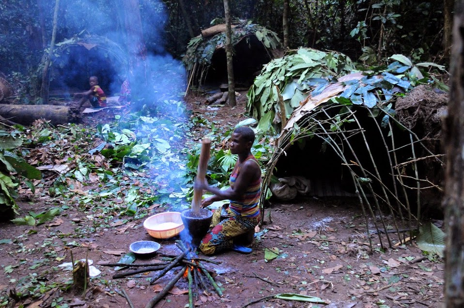
A traditional hunter-gatherer or forager is a human living an ancestrally derived lifestyle in which most or all food is obtained by foraging, that is, by gathering food from local sources, especially edible wild plants but also insects, fungi, honey, or anything safe to eat, and/or by hunting game (pursuing and/or trapping and killing wild animals, including catching fish), roughly as most animal omnivores do. Hunter-gatherer societies stand in contrast to the more sedentary agricultural societies, which rely mainly on cultivating crops and raising domesticated animals for food production, although the boundaries between the two ways of living are not completely distinct. Hunting and gathering was humanity's original and most enduring successful competitive adaptation in the natural world, occupying at least 90 percent of human history. Following the invention of agriculture, hunter-gatherers who did not change were displaced or conquered by farming or pastoralist groups in ... [...More Info...] [...Related Items...] OR: [Wikipedia] [Google] [Baidu] |
Smelting
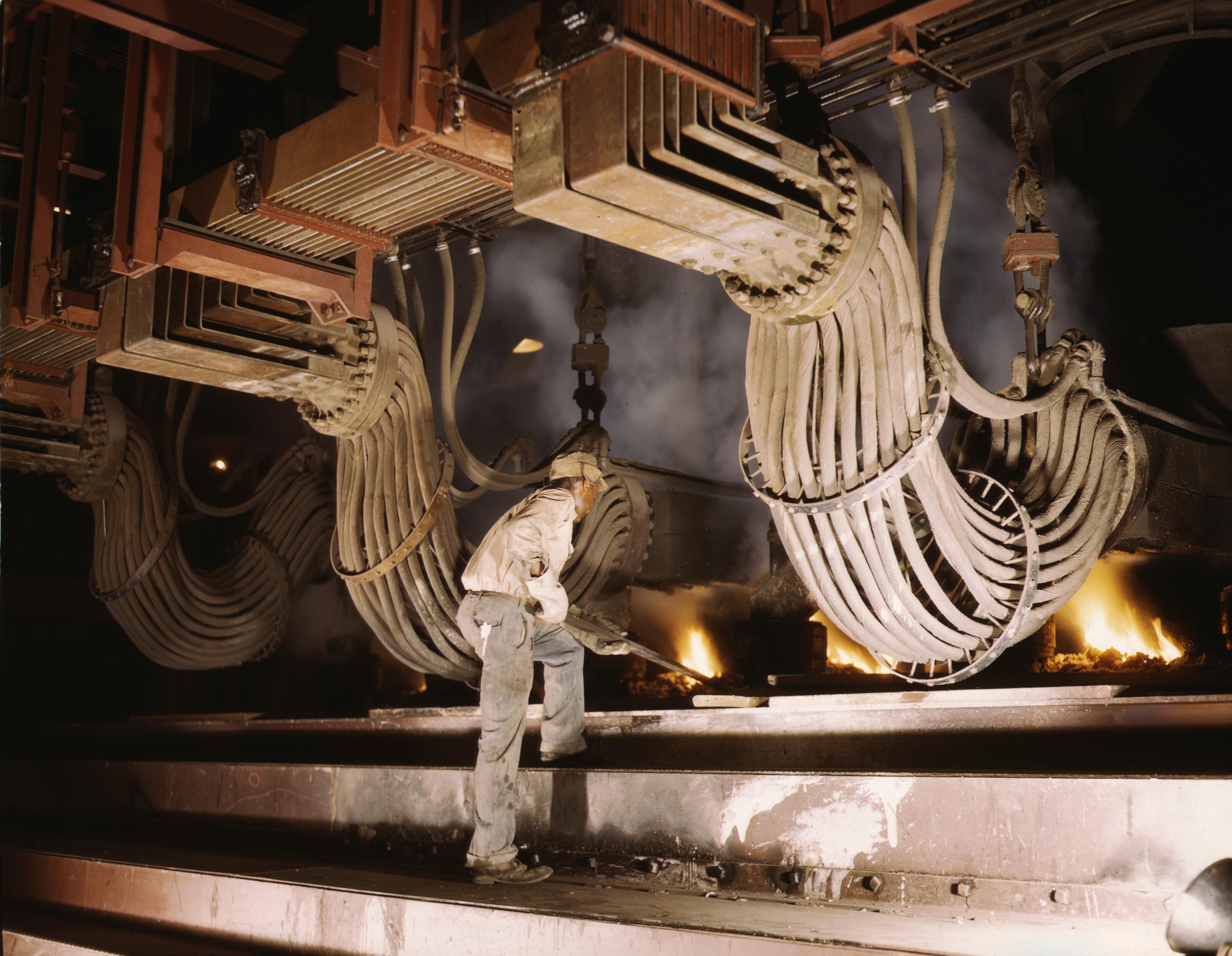
Smelting is a process of applying heat to ore, to extract a base metal. It is a form of extractive metallurgy. It is used to extract many metals from their ores, including silver, iron, copper, and other base metals. Smelting uses heat and a chemical reducing agent to decompose the ore, driving off other elements as gases or slag and leaving the metal base behind. The reducing agent is commonly a fossil fuel source of carbon, such as coke—or, in earlier times, charcoal. The oxygen in the ore binds to carbon at high temperatures due to the lower potential energy of the bonds in carbon dioxide (). Smelting most prominently takes place in a blast furnace to produce pig iron, which is converted into steel. The carbon source acts as a chemical reactant to remove oxygen from the ore, yielding the purified metal element as a product. The carbon source is oxidized in two stages. First, the carbon (C) combusts with oxygen (O2) in the air to produce carbon monoxide (CO). Second, the ... [...More Info...] [...Related Items...] OR: [Wikipedia] [Google] [Baidu] |
Pannage
Pannage (also referred to as ''Eichelmast'' or ''Eckerich'' in Germany, Switzerland, Liechtenstein, Luxembourg, Austria, Slovenia and Croatia) is the practice of releasing livestock-domestic pig, pigs in a forest, so that they can feed on fallen acorns, beechmast, Sweet Chestnut, chestnuts or other Nut (fruit), nuts. Historically, it was a right or privilege granted to local people on common land or in royal forests.H. R. Loyn, ''Anglo-Saxon England and the Norman Conquest'', 2nd ed. 1991:369. Pannage had two very useful purposes in Middle Ages, Medieval times: in Domestic pig#Rooting, rooting around looking for nuts, they also turned the soil and broke it. Pig-rooting prevented soil compaction and released nutrients for plant growth. It was also fattened pigs for slaughter. Especially in the eastern shires of England, pannage was so prominent a value in the economic importance of woodland that it was often employed, as in ''Domesday Book'' (1086), as a measurement. Customarily ... [...More Info...] [...Related Items...] OR: [Wikipedia] [Google] [Baidu] |
Classis Britannica
The ''Classis Britannica'' (literally, ''British fleet'', in the sense of 'the fleet in British waters' or 'the fleet of the province of Britannia', rather than 'the fleet of the state of Britain') was a provincial naval fleet of the navy of ancient Rome. Its purpose was to control the English Channel and the waters around the Roman province of Britannia. Unlike modern (and some contemporary Roman) "fighting navies", its job was largely the logistical movement of personnel and support, and keeping open communication routes across the Channel. There is no literary reference in the classical historians to the ''Classis Britannica'' by that name, and archaeological evidence is also tantalizingly scant (although tiles stamped CLBR are common along the east Kent coast and in London, suggesting either government buildings or an early instance of army surplus), meaning that details of its history and form are unfortunately based on a large degree of interpretation. History Invasion A f ... [...More Info...] [...Related Items...] OR: [Wikipedia] [Google] [Baidu] |
Bell Pit
A bell pit is a primitive method of mining coal, iron ore, or other minerals lying near the surface. Operation A shaft is sunk to reach the mineral which is excavated by miners, transported to the surface by a winch, and removed by means of a bucket, much like a well. The bottom of the shaft is enlarged and a sloping roof is created as the desired mineral and surrounding rock is removed – giving its name because the pit in cross section resembles a bell. Typically, no supports were used, and mining continued outwards until the cavity became too dangerous or collapsed at which point another mine was started, often in close proximity. Example and illustrated description This type of mine was in use in prehistoric times, the Middle Ages, and a few continued in use until the early 20th century in the region around Ford, Northumberland. Such pits are common at prehistoric flint working sites such as Grime's Graves in Norfolk and also in the coal mining areas of Yorkshire, the Fores ... [...More Info...] [...Related Items...] OR: [Wikipedia] [Google] [Baidu] |
Broadfield, West Sussex
Broadfield is one of 14 neighbourhoods within the town of Crawley in West Sussex, England. Broadfield is located in the south west of the town. It is bordered by Bewbush to the north, Southgate to the north east and Tilgate to the east. Broadfield is split across three local government wards, Broadfield, Bewbush & North Broadfield and Gossops Green & North East Broadfield. Broadfield was built in several stages and is relatively densely populated. There is a mixture of property types, including private estates, housing association, council houses and self-build. Broadfield has one central shopping parade, the Barton, which is one of the largest neighbourhood parade in the town. Unlike many of the parades in the town, which are council run, the Barton is owned and managed by the shop-owners. There is a wide variety of shops, a library, a church (shared by Anglicans, Catholics and Broadfield Christian Fellowship), a nearby mosque and a large medical centre. There is also a comm ... [...More Info...] [...Related Items...] OR: [Wikipedia] [Google] [Baidu] |
Iron Age
The Iron Age is the final epoch of the three-age division of the prehistory and protohistory of humanity. It was preceded by the Stone Age (Paleolithic, Mesolithic, Neolithic) and the Bronze Age (Chalcolithic). The concept has been mostly applied to Iron Age Europe and the Ancient Near East, but also, by analogy, to other parts of the Old World. The duration of the Iron Age varies depending on the region under consideration. It is defined by archaeological convention. The "Iron Age" begins locally when the production of iron or steel has advanced to the point where iron tools and weapons replace their bronze equivalents in common use. In the Ancient Near East, this transition took place in the wake of the Bronze Age collapse, in the 12th century BC. The technology soon spread throughout the Mediterranean Basin region and to South Asia (Iron Age in India) between the 12th and 11th century BC. Its further spread to Central Asia, Eastern Europe, and Central Europe is somewhat dela ... [...More Info...] [...Related Items...] OR: [Wikipedia] [Google] [Baidu] |
Turners Hill
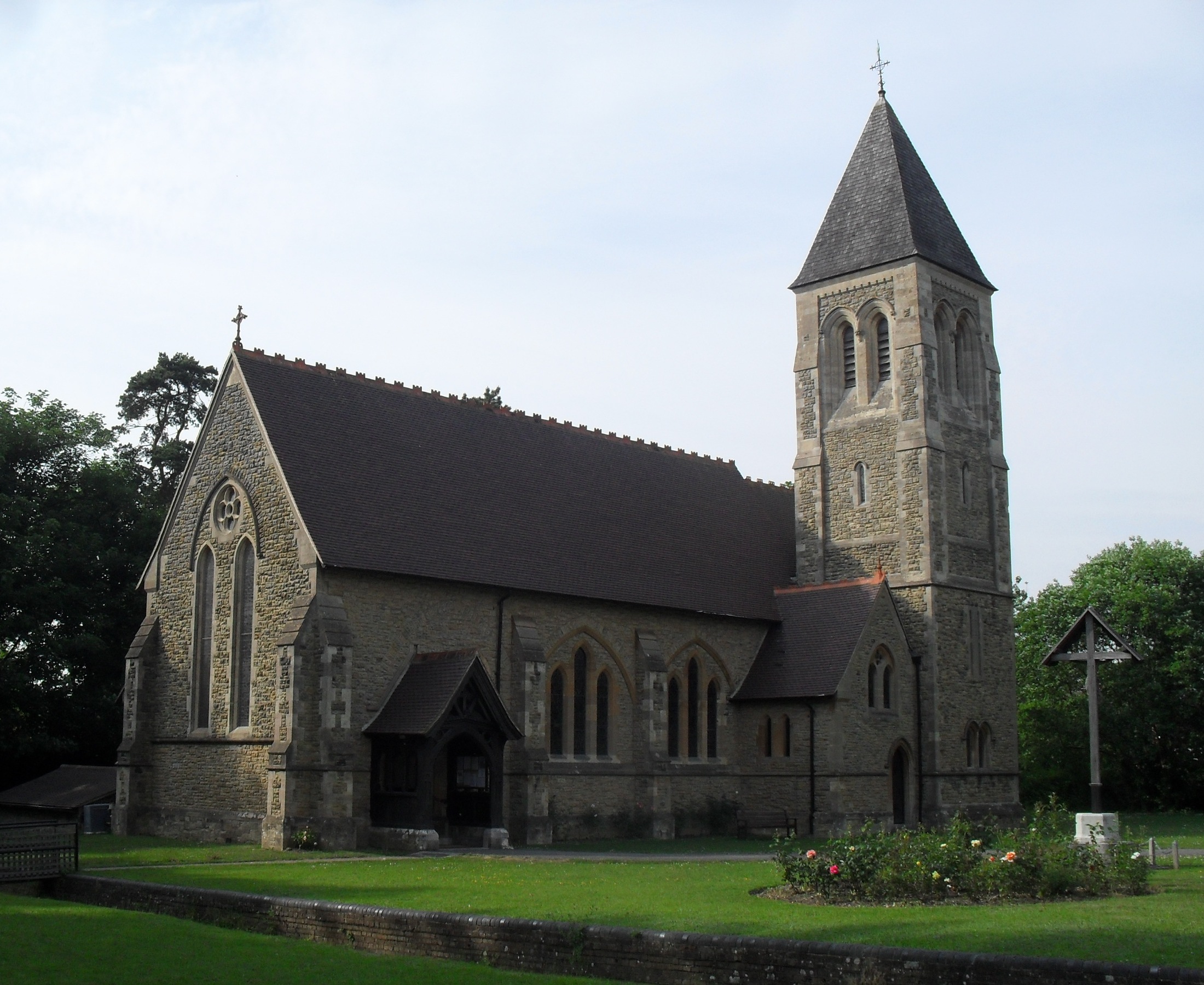
Turners Hill is a village and civil parish in the Mid Sussex District of West Sussex, England. The civil parish covers an area of , and has a population of 1,849 (2001 census) increasing to 1,919 at the 2011 Census. The village is located three miles (5 km) south-west of East Grinstead, four miles (6 km) to the south-east of Crawley and stands on a steep ridge line at one of the highest points (580 feet above sea level) of the High Weald, where two historically important routes, the B2110 and B2028, cross. The village In the centre is the village green which, together with the shops, the ''Crown'' pub and the Free Church, form the focal point. St Leonard's Anglican church is on a ridge of the hill. St Leonard's was built in 1895–7 by Lacy Ridge, with porches and the rock-faced tower added by Sir Aston Webb in 1923. The stained glass windows are all by Charles Eamer Kempe. The reredos seems to be a composite of salvaged pieces from different sources. The Free Church bu ... [...More Info...] [...Related Items...] OR: [Wikipedia] [Google] [Baidu] |
Handcross
Handcross is a village in the Mid Sussex District, Mid Sussex District of West Sussex, England. It lies on the A23 road south of Crawley. At the 2011 Census the population fell within the civil parish of Slaugham. Nymans Garden, of parklands run by the National Trust, is located adjacent to the High Street, as are of woodland and water gardens at High Beeches Garden. Handcross has one public house, The Red Lion (High Street), which was refurbished in 2010 in contemporary style. It formerly had three, the other two being The Fountain (demolished in 2012 and replaced by housing) and The Royal Oak (closed in 2020). Handcross also has a Social club. Handcross Primary School, situated at the northern end of the village recently underwent extensive building works to increase capacity. Opposite the primary school is Handcross Park School, an independent prep school. Handcross Hill Handcross Hill is a stretch of the A23 road which runs past the village. This part of dual carriageway ... [...More Info...] [...Related Items...] OR: [Wikipedia] [Google] [Baidu] |
Horsham
Horsham is a market town on the upper reaches of the River Arun on the fringe of the Weald in West Sussex, England. The town is south south-west of London, north-west of Brighton and north-east of the county town of Chichester. Nearby towns include Crawley to the north-east and Haywards Heath and Burgess Hill to the south-east. It is the administrative centre of the Horsham district. History Governance Horsham is the largest town in the Horsham District Council area. The second, higher, tier of local government is West Sussex County Council, based in Chichester. It lies within the ancient Norman administrative division of the Rape of Bramber and the Hundred of Singlecross in Sussex. The town is the centre of the parliamentary constituency of Horsham, recreated in 1983. Jeremy Quin has served as Conservative Member of Parliament for Horsham since 2015, succeeding Francis Maude, who held the seat from 1997 but retired at the 2015 general election. Geography Weat ... [...More Info...] [...Related Items...] OR: [Wikipedia] [Google] [Baidu] |

.jpg)


_-_geograph.org.uk_-_69937.jpg)
