|
Frensham
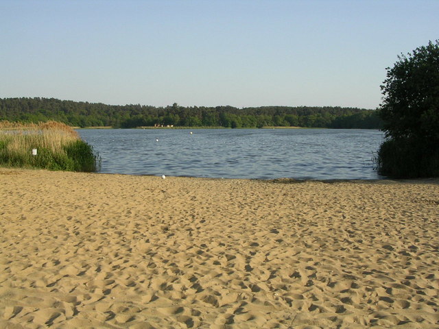
Frensham is a village in Surrey, England, next to the A287 road, WSW of Guildford, the county town. Frensham lies on the right bank of the River Wey (south branch), only navigable to canoes, shortly before its convergence with the north branch. Farnham is the nearest town, to the north. The majority of Frensham parish is within the Metropolitan Green Belt and the substantial green buffer in the parish is Frensham Common which is owned by the National Trust and is a Site of Special Scientific Interest (SSSI). The non-agricultural land surrounding the village is mainly open heathland and birch woodland. The Common covers about and comprises heathland, together with some coniferous and mixed woodland. There are two large ponds, known as Frensham Great and Little Ponds, which were built in the Middle Ages to provide fish for the Bishop of Winchester's estate and today are the backdrop for a hotel and are used for fishing and sailing. History Before the English Reformation M ... [...More Info...] [...Related Items...] OR: [Wikipedia] [Google] [Baidu] |
Frensham Great Pond
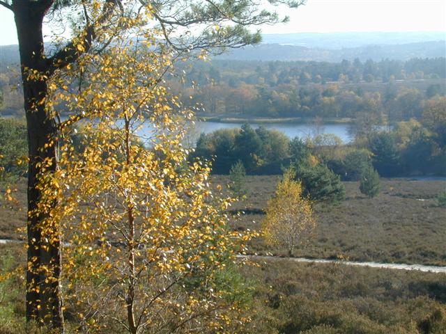
Frensham Common is a large Site of Special Scientific Interest (SSSI) heathland of which includes two lakes; it is owned by the National Trust. Terrain, plants and animals Frensham Common is an English SSSI heathland of which includes two large lakes; it is owned by the National Trust and managed by Waverley Borough Council. It lies almost wholly within Frensham, Surrey, a nucleated village on alluvial soil narrowly buffered to the north-west, connected by a path. The local road network surrounds the site; the nearest trunk roads are away. The terrain is elevated and undulating — it has few streams due to the permeability of the soil and high points in ridges to the south-east.Easy walks around Surrey > Frensham Commonfrom Surrey County Council Surrey County Council is the county council administering certain services in the non-metropolitan county of Surrey in England. The council is composed of 81 elected councillors, and in all but one election since 1965 ... [...More Info...] [...Related Items...] OR: [Wikipedia] [Google] [Baidu] |
Frensham Common
Frensham Common is a large Site of Special Scientific Interest (SSSI) heathland of which includes two lakes; it is owned by the National Trust. Terrain, plants and animals Frensham Common is an English SSSI heathland of which includes two large lakes; it is owned by the National Trust and managed by Waverley Borough Council. It lies almost wholly within Frensham, Surrey, a nucleated village on alluvial soil narrowly buffered to the north-west, connected by a path. The local road network surrounds the site; the nearest trunk roads are away. The terrain is elevated and undulating — it has few streams due to the permeability of the soil and high points in ridges to the south-east.Easy walks around Surrey > Frensham Commonfrom Surrey County Council Surrey County Council is the county council administering certain services in the non-metropolitan county of Surrey in England. The council is composed of 81 elected councillors, and in all but one election since 1965 th ... [...More Info...] [...Related Items...] OR: [Wikipedia] [Google] [Baidu] |
Churt
Churt is a village and civil parish in the borough of Waverley, Surrey, Waverley in Surrey, England, about south of the town of Farnham on the A287 road towards Hindhead. A nucleated village, clustered settlement is set in areas acting as its buffer zone, green buffers, which include the Devil's Jumps, Churt, Devil's Jumps. The west of the village slopes down to the steep edge of Whitmore Vale, which is mostly in Headley, East Hampshire, Headley, Hampshire; at the foot of this bank is a steeply cut brook which defines the Hampshire border. There are forests and heathland by and atop the Greensand Ridge, and the hamlet of Crosswater is in the north of the parish. History Churt's origins are Anglo Saxon England, Saxon. The village as Churt and Cherte is recorded in the 14th century as part of the "Great Sacks", and a tything of Farnham of the Bishop of Winchester; a subsidy roll assessed it at £3 9s farthing (British coin), ¼d (very roughly ), presumably annually. Frensham Great ... [...More Info...] [...Related Items...] OR: [Wikipedia] [Google] [Baidu] |
Farnham
Farnham ( /ˈfɑːnəm/) is a market town and civil parish in Surrey, England, around southwest of London. It is in the Borough of Waverley, close to the county border with Hampshire. The town is on the north branch of the River Wey, a tributary of the Thames, and is at the western end of the North Downs. The civil parish, which includes the villages of Badshot Lea, Hale and Wrecclesham, covers and had a population of 39,488 in 2011. Among the prehistoric artefacts from the area is a woolly mammoth tusk, excavated in Badshot Lea at the start of the 21st century. The earliest evidence of human activity is from the Neolithic and, during the Roman period, tile making took place close to the town centre. The name "Farnham" is of Saxon origin and is generally agreed to mean "meadow where ferns grow". From at least 803, the settlement was under the control of the Bishops of Winchester and the castle was built as a residence for Bishop Henry de Blois in 1138. Henry VIII is thou ... [...More Info...] [...Related Items...] OR: [Wikipedia] [Google] [Baidu] |
South West Surrey (UK Parliament Constituency)
South West Surrey is a constituency represented in the House of Commons of the UK Parliament. Since 2005, the seat has been represented by Conservative MP Jeremy Hunt, the current chancellor of the Exchequer and the former Culture Secretary, Health Secretary and Foreign Secretary. Boundaries 1983–2010: The District of Waverley wards of Alford and Dunsfold, Busbridge, Hambledon and Hascombe, Chiddingfold, Elstead, Peper Harow and Thursley, Farnham Bourne, Farnham Castle, Farnham Hale and Heath End, Farnham Rowledge and Wrecclesham, Farnham Upper Hale, Farnham Waverley, Farnham Weybourne and Badshot Lea, Frensham, Dockenfield and Tilford, Godalming North, Godalming North East and South West, Godalming North West, Godalming South East, Haslemere North and Grayswood, Haslemere South, Hindhead, Milford, Shottermill, and Witley. 2010–present: The Borough of Waverley wards of Bramley, Busbridge and Hascombe, Chiddingfold and Dunsfold, Elstead and Thursley, Farnham Bourne, Farnh ... [...More Info...] [...Related Items...] OR: [Wikipedia] [Google] [Baidu] |
River Wey
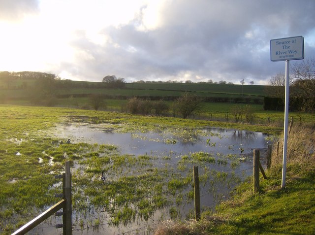
The River Wey is a main tributary of the River Thames in south east England. Its two branches, one of which rises near Alton in Hampshire and the other in West Sussex to the south of Haslemere, join at Tilford in Surrey. Once combined the flow is eastwards then northwards via Godalming and Guildford to meet the Thames at Weybridge. Downstream the river forms the backdrop to Newark Priory and Brooklands. The Wey and Godalming Navigations were built in the 17th and 18th centuries, to create a navigable route from Godalming to the Thames. The Wey drains much of south west Surrey (as well as parts of east Hampshire and the north of West Sussex) and has a total catchment area of . Although it is the longest tributary of the Thames (if the Medway is excluded), its total average discharge is lower than that of the Kennet and Cherwell. The river morphology and biodiversity of the Wey are well studied, with many places to take samples and record data. The main tributary is the Ti ... [...More Info...] [...Related Items...] OR: [Wikipedia] [Google] [Baidu] |
Surrey
Surrey () is a ceremonial and non-metropolitan county in South East England, bordering Greater London to the south west. Surrey has a large rural area, and several significant urban areas which form part of the Greater London Built-up Area. With a population of approximately 1.2 million people, Surrey is the 12th-most populous county in England. The most populated town in Surrey is Woking, followed by Guildford. The county is divided into eleven districts with borough status. Between 1893 and 2020, Surrey County Council was headquartered at County Hall, Kingston-upon-Thames (now part of Greater London) but is now based at Woodhatch Place, Reigate. In the 20th century several alterations were made to Surrey's borders, with territory ceded to Greater London upon its creation and some gained from the abolition of Middlesex. Surrey is bordered by Greater London to the north east, Kent to the east, Berkshire to the north west, West Sussex to the south, East Sussex to ... [...More Info...] [...Related Items...] OR: [Wikipedia] [Google] [Baidu] |
Waverley, Surrey
The Borough of Waverley is a local government district with borough status in Surrey, England. The borough's headquarters are in the town of Godalming; other notable settlements are the towns of Farnham and Haslemere and the large village of Cranleigh. At the 2021 Census, the population of the borough was 128,200. Waverley borders the borough of Guildford to the north, the Mole Valley district to the east, the Horsham and Chichester districts of West Sussex to the south, and the East Hampshire and Hart districts and the borough of Rushmoor in Hampshire to the west and northwest. The borough is named after Waverley Abbey, near Farnham, the earliest Cistercian monastery in Britain. Blackheath Common, in the north of the borough, is a Site of Special Scientific Interest. Waverley is a Wealden borough, bounded to the north by the Hog's Back section of the North Downs and by the Greensand Ridge. It has the most green space in absolute terms in Surrey at 293.1 km² (113 sq. mi.) a ... [...More Info...] [...Related Items...] OR: [Wikipedia] [Google] [Baidu] |
Battle Of Ashdown
The Battle of Ashdown, was a West Saxon victory over a Danish Viking army on about 8 January 871. The location of Ashdown is not known, but may be Kingstanding Hill in Berkshire. Other writers place the battle near Starveall, a short distance north of the village of Aldworth and south east of Lowbury Hill. The West Saxons were led by King Æthelred and his younger brother, the future King Alfred the Great, while the Viking commanders were Bagsecg and Halfdan. The battle is described in the ''Anglo-Saxon Chronicle'' and Asser's ''Life of King Alfred''. Prelude By 870, the Vikings had conquered two of the four Anglo-Saxon kingdoms, Northumbria and East Anglia. At the end of 870 they launched an attempt to conquer Wessex and marched from East Anglia to Reading, arriving on about 28 December. Three days after their arrival they sent out a large foraging party, which was defeated by an army of local levies under the command of Æthelwulf, Ealdorman of Berkshire, at the Battle of En ... [...More Info...] [...Related Items...] OR: [Wikipedia] [Google] [Baidu] |
Earl
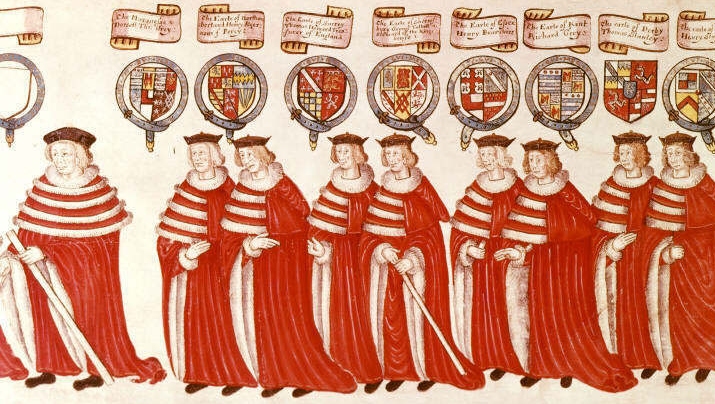
Earl () is a rank of the nobility in the United Kingdom. The title originates in the Old English word ''eorl'', meaning "a man of noble birth or rank". The word is cognate with the Scandinavian form ''jarl'', and meant "chieftain", particularly a chieftain set to rule a territory in a king's stead. After the Norman Conquest, it became the equivalent of the continental count (in England in the earlier period, it was more akin to a duke; in Scotland, it assimilated the concept of mormaer). Alternative names for the rank equivalent to "earl" or "count" in the nobility structure are used in other countries, such as the '' hakushaku'' (伯爵) of the post-restoration Japanese Imperial era. In modern Britain, an earl is a member of the peerage, ranking below a marquess and above a viscount. A feminine form of ''earl'' never developed; instead, ''countess'' is used. Etymology The term ''earl'' has been compared to the name of the Heruli, and to runic '' erilaz''. Proto-Norse ' ... [...More Info...] [...Related Items...] OR: [Wikipedia] [Google] [Baidu] |
Denmark
) , song = ( en, "King Christian stood by the lofty mast") , song_type = National and royal anthem , image_map = EU-Denmark.svg , map_caption = , subdivision_type = Sovereign state , subdivision_name = Danish Realm, Kingdom of Denmark , established_title = History of Denmark#Middle ages, Consolidation , established_date = 8th century , established_title2 = Christianization , established_date2 = 965 , established_title3 = , established_date3 = 5 June 1849 , established_title4 = Faroese home rule , established_date4 = 24 March 1948 , established_title5 = European Economic Community, EEC 1973 enlargement of the European Communities, accession , established_date5 = 1 January 1973 , established_title6 = Greenlandic home rule , established_date6 = 1 May 1979 , official_languages = Danish language, Danish , languages_type = Regional languages , languages_sub = yes , languages = German language, GermanGerman is recognised as a protected minority language in t ... [...More Info...] [...Related Items...] OR: [Wikipedia] [Google] [Baidu] |
Mesolithic
The Mesolithic (Greek: μέσος, ''mesos'' 'middle' + λίθος, ''lithos'' 'stone') or Middle Stone Age is the Old World archaeological period between the Upper Paleolithic and the Neolithic. The term Epipaleolithic is often used synonymously, especially for outside northern Europe, and for the corresponding period in the Levant and Caucasus. The Mesolithic has different time spans in different parts of Eurasia. It refers to the final period of hunter-gatherer cultures in Europe and Western Asia, between the end of the Last Glacial Maximum and the Neolithic Revolution. In Europe it spans roughly 15,000 to 5,000 BP; in Southwest Asia (the Epipalaeolithic Near East) roughly 20,000 to 10,000 BP. The term is less used of areas farther east, and not at all beyond Eurasia and North Africa. The type of culture associated with the Mesolithic varies between areas, but it is associated with a decline in the group hunting of large animals in favour of a broader hunter-g ... [...More Info...] [...Related Items...] OR: [Wikipedia] [Google] [Baidu] |


