|
Environmental Issues In Afghanistan
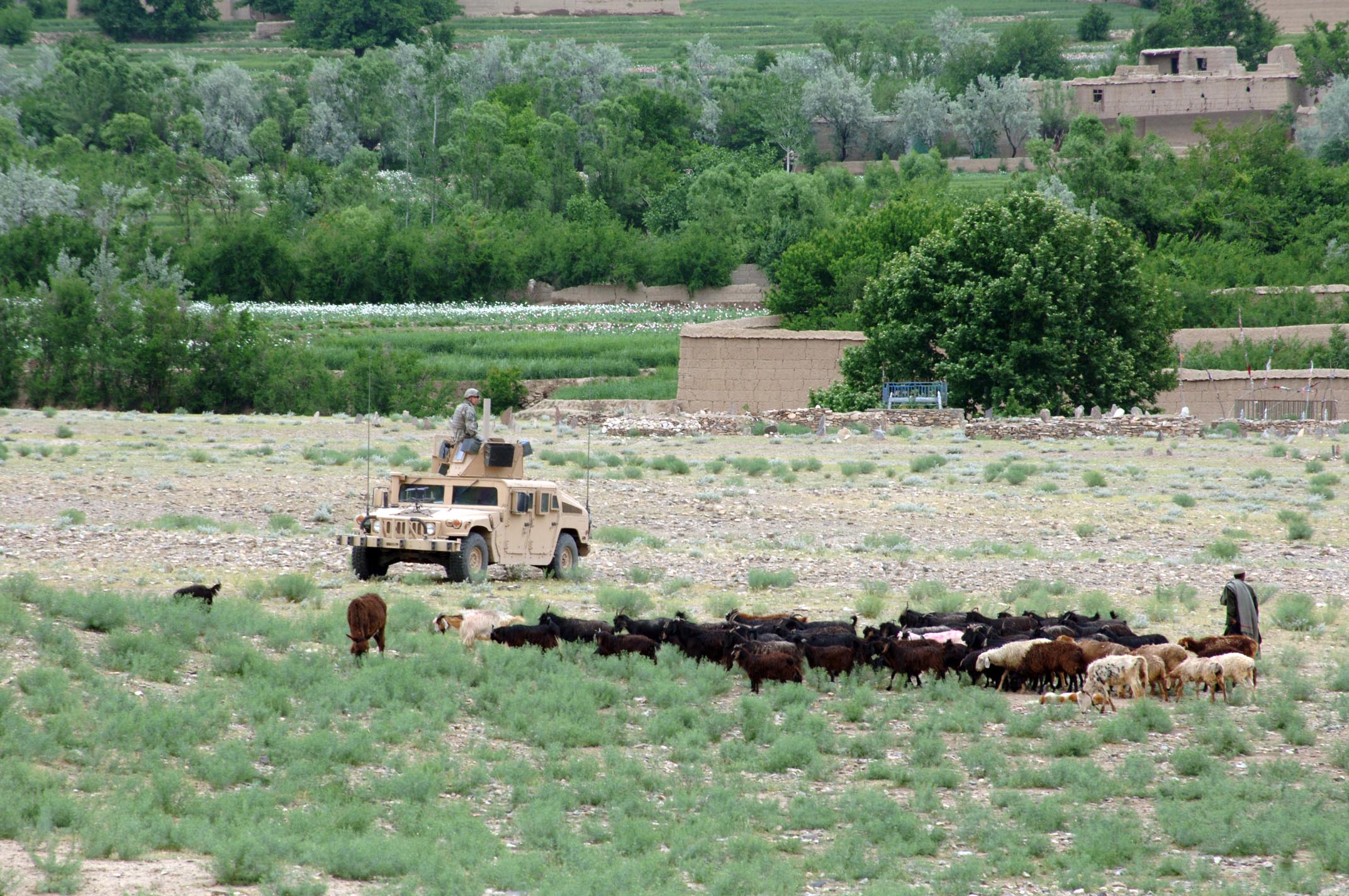
Environmental issues in Afghanistan predate the political turmoil of the past few decades. Forests have been depleted by centuries of grazing and farming, practices which have only increased with modern population growth. In Afghanistan, environmental conservation and economic concerns are not at odds; with over 44% of the population dependent on herding or farming, the welfare of the environment is critical to the economic welfare of the people. In 2007, the World Health Organization released a report ranking Afghanistan as the lowest among non-African nations in deaths from environmental hazards. Deforestation Felling is illegal all over the country. According to a 2010 report, only about 2.1% (or 1,350,000 ha) of Afghanistan is forested. Some steps have been taken in recent years in planting trees in the urban areas across Afghanistan. Even the Taliban spiritual leader has recently called for planting more trees. Afghanistan had a Forest Landscape Integrity Index mean score ... [...More Info...] [...Related Items...] OR: [Wikipedia] [Google] [Baidu] |
Kapisa Province Of Afghanistan (or Kapisa), located near modern Bagram
{{geodis ...
Kapisa, Kapiśa, Kapiśi, Kapesa or Kapissa may refer to: * modern Kapisa Province of Afghanistan * the 1st millennium Kingdom of Kapisa * the city of Kapisi Kapisi (, ) or Kapisa was the capital city of the former Kingdom of Kapisa (now part of modern Afghanistan). While the name of the kingdom has been used for the modern Kapisa Province, the ancient city of Kapisa was located in Parwan Province, ... [...More Info...] [...Related Items...] OR: [Wikipedia] [Google] [Baidu] |
Takhar Province
Takhar (Dari , Farsi/Pashto: ) is one of the thirty-four provinces of Afghanistan, located in the northeast of the country next to Tajikistan. It is surrounded by Badakhshan in the east, Panjshir in the south, and Baghlan and Kunduz in the west. The city of Taloqan serves as its capital. The province contains 17 districts, over 1,000 villages, and approximately 1,113,173 people, which is multi-ethnic and mostly a rural society. The city was attacked during the 2021 Taliban offensive (which coincided with the withdrawal of United States troops). On May 2, 2021, PiramQul Ziayi, the most influential anti-Taliban figure in Takhar, was assassinated in Rustaq district. Following the fall of several districts of Takhar to the Taliban on June 20, 2021, a group of Takhar elders led by Mohibullah Noori, a Resistance leader, announced at a press conference in Kabul that will mobilize people resistance in support of security forces in Takhar. Mohibullah Noori led the group entered t ... [...More Info...] [...Related Items...] OR: [Wikipedia] [Google] [Baidu] |
Agriculture
Agriculture or farming is the practice of cultivating plants and livestock. Agriculture was the key development in the rise of sedentary human civilization, whereby farming of domesticated species created food surpluses that enabled people to live in cities. The history of agriculture began thousands of years ago. After gathering wild grains beginning at least 105,000 years ago, nascent farmers began to plant them around 11,500 years ago. Sheep, goats, pigs and cattle were domesticated over 10,000 years ago. Plants were independently cultivated in at least 11 regions of the world. Industrial agriculture based on large-scale monoculture in the twentieth century came to dominate agricultural output, though about 2 billion people still depended on subsistence agriculture. The major agricultural products can be broadly grouped into foods, fibers, fuels, and raw materials (such as rubber). Food classes include cereals (grains), vegetables, fruits, cooking oils, meat, milk, ... [...More Info...] [...Related Items...] OR: [Wikipedia] [Google] [Baidu] |
Soil Erosion
Soil erosion is the denudation or wearing away of the upper layer of soil. It is a form of soil degradation. This natural process is caused by the dynamic activity of erosive agents, that is, water, ice (glaciers), snow, air (wind), plants, and animals (including humans). In accordance with these agents, erosion is sometimes divided into water erosion, glacial erosion, snow erosion, wind (aeolean) erosion, zoogenic erosion and anthropogenic erosion such as tillage erosion. Soil erosion may be a slow process that continues relatively unnoticed, or it may occur at an alarming rate causing a serious loss of topsoil. The loss of soil from farmland may be reflected in reduced crop production potential, lower surface water quality and damaged drainage networks. Soil erosion could also cause sinkholes. Human activities have increased by 10–50 times the rate at which erosion is occurring world-wide. Excessive (or accelerated) erosion causes both "on-site" and "off-site" problems. On- ... [...More Info...] [...Related Items...] OR: [Wikipedia] [Google] [Baidu] |
Lahore
Lahore ( ; pnb, ; ur, ) is the second most populous city in Pakistan after Karachi and 26th most populous city in the world, with a population of over 13 million. It is the capital of the province of Punjab where it is the largest city. Lahore is one of Pakistan's major industrial and economic hubs, with an estimated GDP ( PPP) of $84 billion as of 2019. It is the largest city as well as the historic capital and cultural centre of the wider Punjab region,Lahore Cantonment globalsecurity.org and is one of Pakistan's most , progressiv ... [...More Info...] [...Related Items...] OR: [Wikipedia] [Google] [Baidu] |
Rawalpindi
Rawalpindi ( or ; Urdu, ) is a city in the Punjab province of Pakistan. It is the fourth largest city in Pakistan after Karachi, Lahore and Faisalabad, and third largest in Punjab after Lahore and Faisalabad. Rawalpindi is next to Pakistan's capital Islamabad, and the two are jointly known as the "twin cities" because of the social and economic links between them. Rawalpindi is on the Pothohar Plateau, known for its ancient Hindu and Buddhist heritage, especially in the neighbouring town of Taxila, a UNESCO World Heritage Site. In 1765, the ruling Gakhars were defeated and the city came under Sikh rule, becoming an important city within the Sikh Empire based at Lahore. The city's ''Babu Mohallah'' neighbourhood was once home to a community of Jewish traders that had fled Mashhad, Persia, in the 1830s. The city was conquered by the British Raj in 1849, and in the late 19th century became the largest garrison town of the British Indian Army's Northern command as its climate ... [...More Info...] [...Related Items...] OR: [Wikipedia] [Google] [Baidu] |
Islamabad
Islamabad (; ur, , ) is the capital city of Pakistan. It is the country's ninth-most populous city, with a population of over 1.2 million people, and is federally administered by the Pakistani government as part of the Islamabad Capital Territory. Built as a planned city in the 1960s, it replaced Rawalpindi as Pakistan's national capital. The city is notable for its high standards of living, safety, cleanliness, and abundant greenery. Greek architect Constantinos Apostolou Doxiadis developed Islamabad's master plan, in which he divided it into eight zones; administrative, diplomatic enclave, residential areas, educational and industrial sectors, commercial areas, as well as rural and green areas administered by the Islamabad Metropolitan Corporation with support from the Capital Development Authority. Islamabad is known for the presence of several parks and forests, including the Margalla Hills National Park and the Shakarparian. It is home to several landmarks, includin ... [...More Info...] [...Related Items...] OR: [Wikipedia] [Google] [Baidu] |
Peshawar
Peshawar (; ps, پېښور ; hnd, ; ; ur, ) is the sixth most populous city in Pakistan, with a population of over 2.3 million. It is situated in the north-west of the country, close to the International border with Afghanistan. It is the capital of the province of Khyber Pakhtunkhwa, where it is the largest city. Peshawar is primarily populated by Pashtuns, who comprise the second-largest ethnic group in the country. Situated in the Valley of Peshawar, a broad area situated east of the historic Khyber Pass, Peshawar's recorded history dates back to at least 539 BCE, making it one of the oldest cities in South Asia. Peshawer is among the oldest continuously inhabited cities of the country. The area encompassing modern-day Peshawar is mentioned in Vedic scriptures; it served as the capital of the Kushan Empire during the rule of Kanishka and was home to the Kanishka Stupa, which was among the tallest buildings in the ancient world. Peshawar was then ruled by the Hephtha ... [...More Info...] [...Related Items...] OR: [Wikipedia] [Google] [Baidu] |
Logging
Logging is the process of cutting, processing, and moving trees to a location for transport. It may include skidding, on-site processing, and loading of trees or logs onto trucks or skeleton cars. Logging is the beginning of a supply chain that provides raw material for many products societies worldwide use for housing, construction, energy, and consumer paper products. Logging systems are also used to manage forests, reduce the risk of wildfires, and restore ecosystem functions, though their efficiency for these purposes has been challenged. In forestry, the term logging is sometimes used narrowly to describe the logistics of moving wood from the stump to somewhere outside the forest, usually a sawmill or a lumber yard. In common usage, however, the term may cover a range of forestry or silviculture activities. Illegal logging refers to the harvesting, transportation, purchase, or sale of timber in violation of laws. The harvesting procedure itself may be illegal, includin ... [...More Info...] [...Related Items...] OR: [Wikipedia] [Google] [Baidu] |
Timber
Lumber is wood that has been processed into dimensional lumber, including beams and planks or boards, a stage in the process of wood production. Lumber is mainly used for construction framing, as well as finishing (floors, wall panels, window frames). Lumber has many uses beyond home building. Lumber is sometimes referred to as timber as an archaic term and still in England, while in most parts of the world (especially the United States and Canada) the term timber refers specifically to unprocessed wood fiber, such as cut logs or standing trees that have yet to be cut. Lumber may be supplied either rough- sawn, or surfaced on one or more of its faces. Beside pulpwood, ''rough lumber'' is the raw material for furniture-making, and manufacture of other items requiring cutting and shaping. It is available in many species, including hardwoods and softwoods, such as white pine and red pine, because of their low cost. ''Finished lumber'' is supplied in standard sizes, mostly ... [...More Info...] [...Related Items...] OR: [Wikipedia] [Google] [Baidu] |
Nuristan Province
Nuristan, also spelled as Nurestan or Nooristan (Dari: ; Kamkata-vari: ), is one of the 34 provinces of Afghanistan, located in the eastern part of the country. It is divided into seven districts and is Afghanistan's least populous province, with a population of around 167,000. Parun serves as the provincial capital. Nuristan is bordered on the south by Laghman and Kunar provinces, on the north by Badakhshan province, on the west by Panjshir province. The origins of the Nuristani people traces back to the 4th century BC. Some Nuristanis claim being descendants of the Greek occupying forces of Alexander the Great. It was formerly called Kafiristan ( ps, ) ("Land of the Infidels") until the inhabitants were forcibly converted from an animist religion; a form of ancient Hinduism infused with local variations, to Islam in 1895, and thence the region has become known as Nuristan ("land of illumination", or "land of light"). The region was located in an area surrounded by Buddhist ... [...More Info...] [...Related Items...] OR: [Wikipedia] [Google] [Baidu] |
Kunar Province
Kunar (Pashto: ; Dari: ) is one of the 34 provinces of Afghanistan, located in the northeastern part of the country. Its capital is Asadabad. Its population is estimated to be 508,224. Kunar's major political groups include Wahhabis or Ahl-e- Hadith, ''Nazhat-e Hambastagi Milli, Hezb-e Afghanistan Naween, Hezb-e Islami Gulbuddin''. It is one of the four " N2KL" provinces ( Nangarhar Province, Nuristan Province, Kunar Province and Laghman Province). N2KL was the designation used by the US and Coalition Forces in Afghanistan for the rugged region along the Afghanistan–Pakistan border opposite Pakistan's Federally Administered Tribal Areas (merged in 2018 with Khyber Pakhtunkhwa). Kunar is the center of the N2KL region. Kunar was the birthplace of Sayyed Jamaluddin Afghani (al-Afghani), who was an influential Muslim scholar and philosopher. Geography Kunar province is located in the northeast of Afghanistan. It borders with Nangarhar Province to the south, Nuristan Province ... [...More Info...] [...Related Items...] OR: [Wikipedia] [Google] [Baidu] |


