|
Entre Ríos, Cochabamba
Entre Ríos is a small town in the Cochabamba Department of the South American Republic of Bolivia. Location Entre Ríos is the capital of the Entre Ríos Municipality, which was newly established in 2004, the sixth municipal section of Carrasco Province. The town is located at an elevation of in the central regions of Bolivia on the left bank of the ''Ichoa River'', which downstream discharges into the Ichilo River. Geography Entre Ríos is situated in the Bolivian lowlands on the north-eastern foothills of the Cordillera Oriental. The region has an average temperature of 24 °C, the monthly averages range from 26 °C (October to December) to 20 °C (June and July). The average yearly precipitation is higher than , with a wet season from November to February and a drier season with less than per month in July and August. Regional traffic Entre Ríos is located 265 km east of Cochabamba, the department's capital. The small town is passed by th ... [...More Info...] [...Related Items...] OR: [Wikipedia] [Google] [Baidu] |
Flag Of Bolivia
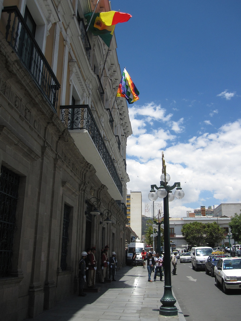
The flag of Bolivia is the national flag of the Plurinational State of Bolivia. It was originally adopted in 1851. The state and war flag is a horizontal tricolor of red, yellow and green with the Bolivian coat of arms in the center. According to one source, the red stands for Bolivia's brave soldiers, while the green symbolizes fertility and yellow the nation's mineral deposits. Since 2009 the Wiphala also holds the status of ''dual flag'' in the country. According to the revised Constitution of Bolivia of 2009, the Wiphala is considered a national symbol of Bolivia (along with the flag, national anthem, coat of arms, the cockade; kantuta flower and patujú flower). Despite its landlocked status, Bolivia has a naval ensign used by navy vessels on rivers and lakes. It consists of a blue field with the state flag in the canton bordered by nine small yellow five-pointed stars, with a larger yellow five-pointed star in the fly. The nine small stars represent the nine depa ... [...More Info...] [...Related Items...] OR: [Wikipedia] [Google] [Baidu] |
Tambo Quemado
Tambo may refer to: People * Adelaide Tambo (1929–2007), South African anti-apartheid activist * Dali Tambo (born 1959), South African anti-apartheid activist, TV presenter and also son of Oliver Tambo and Adelaide Tambo * Oliver Tambo (1917–1993), South African anti-apartheid activist * Thembi Tambo, British-South African diplomat, politician and also daughter of Oliver Tambo and Adelaide Tambo Places Australia Queensland * Tambo, Queensland, a locality in Blackall-Tambo Region *Shire of Tambo (Queensland), a former local government area Victoria *Tambo River (Victoria) * County of Tambo, Victoria * Mount Tambo, Victoria * Shire of Tambo (Victoria) Peru * Tambo River (Peru) * Tambo District, Huaytará * Tambo District, La Mar Elsewhere * Pizzo Tambò, a mountain in the Swiss Alps near the Splügen Pass * Tambo Island, in Pontevedra, Spain * Tambo, Parañaque, in the Philippines Art, entertainment, and media Fictional characters * Tambo, a character in minst ... [...More Info...] [...Related Items...] OR: [Wikipedia] [Google] [Baidu] |
Quechuas
Quechua people (, ; ) or Quichua people, may refer to any of the aboriginal people of South America who speak the Quechua languages, which originated among the Indigenous people of Peru. Although most Quechua speakers are native to Peru, there are some significant populations in Ecuador, Bolivia, Chile, Colombia, and Argentina. The most common Quechua dialect is Southern Quechua. The Kichwa people of Ecuador speak the Kichwa dialect; in Colombia, the Inga people speak Inga Kichwa. The Quechua word for a Quechua speaker is ''runa'' or ''nuna'' ("person"); the plural is ''runakuna'' or ''nunakuna'' ("people"). "Quechua speakers call themselves Runa -- simply translated, 'the people.'" Some historical Quechua people are: * The Chanka people, who lived in the Huancavelica, Ayacucho, and Apurímac regions of Peru. * The Huanca people of the Junín Region of Peru, who spoke Quechua before the Incas did. * The Inca, who established the largest empire of the pre-Columbian e ... [...More Info...] [...Related Items...] OR: [Wikipedia] [Google] [Baidu] |
Census
A census is the procedure of systematically acquiring, recording and calculating information about the members of a given population. This term is used mostly in connection with national population and housing censuses; other common censuses include censuses of agriculture, traditional culture, business, supplies, and traffic censuses. The United Nations (UN) defines the essential features of population and housing censuses as "individual enumeration, universality within a defined territory, simultaneity and defined periodicity", and recommends that population censuses be taken at least every ten years. UN recommendations also cover census topics to be collected, official definitions, classifications and other useful information to co-ordinate international practices. The UN's Food and Agriculture Organization (FAO), in turn, defines the census of agriculture as "a statistical operation for collecting, processing and disseminating data on the structure of agriculture, covering ... [...More Info...] [...Related Items...] OR: [Wikipedia] [Google] [Baidu] |
Santa Cruz De La Sierra
Santa Cruz de la Sierra (; "Holy Cross of the Mountain Range"), commonly known as Santa Cruz, is the largest city in Bolivia and the capital of the Santa Cruz department. Situated on the Pirai River in the eastern Tropical Lowlands of Bolivia, the Santa Cruz de la Sierra Metropolitan Region is the most populous urban agglomeration in Bolivia with an estimated of 2.4 million population in 2020, it is formed by a conurbation of seven Santa Cruz municipalities: Santa Cruz de la Sierra, La Guardia, Warnes, Cotoca, El Torno, Porongo, and Montero. The city was first founded in 1561 by Spanish explorer Ñuflo de Chavez about east of its current location, and was moved several times until it was finally established on the Pirai River in the late 16th century. For much of its history, Santa Cruz was mostly a small outpost town, and even after Bolivia gained its independence in 1825 there was little attention from the authorities or the population in general to settle the region. ... [...More Info...] [...Related Items...] OR: [Wikipedia] [Google] [Baidu] |
Warnes (Santa Cruz)
Warnes is a town in Bolivia, named after Colonel Ignacio Warnes, a military leader in the South American war of independence. It is located 24 kilometers north of Santa Cruz de la Sierra Santa Cruz de la Sierra (; "Holy Cross of the Mountain Range"), commonly known as Santa Cruz, is the largest city in Bolivia and the capital of the Santa Cruz department. Situated on the Pirai River in the eastern Tropical Lowlands of Bolivia .... References *Instituto Nacional de Estadística External links Populated places in Santa Cruz Department (Bolivia) {{SantaCruzBO-geo-stub ... [...More Info...] [...Related Items...] OR: [Wikipedia] [Google] [Baidu] |
Ivirgarzama
Ivirgarzama is a small town in Bolivia. See also * Inkallaqta Inkallaqta (Quechua ''inka'' Inca, ''llaqta'' place (village, town, city, country, nation), "Inca place", Hispanicized spellings ''Incallacta, Incallajta, Incallakta, Inkallajta, Inkallakta'') is a monumental Inca site in central Bolivia. It is lo ... * Carrasco National Park External links Map of the Carrasco Province References *Instituto Nacional de Estadistica de Bolivia (INE) Populated places in Cochabamba Department {{CochabambaBO-geo-stub ... [...More Info...] [...Related Items...] OR: [Wikipedia] [Google] [Baidu] |
Chimoré, Cochabamba
Chimoré is a location in the Carrasco Province, Cochabamba Department, Bolivia. It is the seat of the Chimoré Municipality. Geography Chimoré is located in the wettest region of the Bolivia, situated in the Amazon rainforests of the Chapare region. While Chimoré experiences a short dry season, rain is plentiful year round, and temperatures are generally warm to hot. The area has a tropical rainforest climate A tropical rainforest climate, humid tropical climate or equatorial climate is a tropical climate sub-type usually found within 10 to 15 degrees latitude of the equator. There are some other areas at higher latitudes, such as the coast of southea ... according to the Köppen Classification System. Transports The city is served by the Chimore Airport . References * Populated places in Cochabamba Department {{CochabambaBO-geo-stub ... [...More Info...] [...Related Items...] OR: [Wikipedia] [Google] [Baidu] |
Villa Tunari
Villa Tunari or Tunari is a location in the department of Cochabamba, Bolivia. It is the seat of the Villa Tunari Municipality, the third municipal section of the Chapare Province. According to the census 2012 the population was 3,213 in the town which is an increment from 2,510 registered during the 2001 census. Villa Tunari has several parks located nearby including Parque Machía and Carrasco National Park. Parque Machía is home to one of three wildlife centers maintained by |
Brazil
Brazil ( pt, Brasil; ), officially the Federative Republic of Brazil (Portuguese: ), is the largest country in both South America and Latin America. At and with over 217 million people, Brazil is the world's fifth-largest country by area and the List of countries and dependencies by population, seventh most populous. Its capital is Brasília, and List of cities in Brazil by population, its most populous city is São Paulo. The federation is composed of the union of the 26 States of Brazil, states and the Federal District (Brazil), Federal District. It is the largest country to have Portuguese language, Portuguese as an List of territorial entities where Portuguese is an official language, official language and the only one in the Americas; one of the most Multiculturalism, multicultural and ethnically diverse nations, due to over a century of mass Immigration to Brazil, immigration from around the world; and the most populous Catholic Church by country, Roman Catholic-major ... [...More Info...] [...Related Items...] OR: [Wikipedia] [Google] [Baidu] |
Puerto Suárez
Puerto Suárez is an inland river port and municipality in Santa Cruz Department, Bolivia. It is located 10 km west of the border with Brazil. Location ''Puerto Suárez'' is located in the province of Germán Busch, Santa Cruz Department and situated by Laguna Cáceres which is connected to the important Río Paraguay and Río Paraná waterway by the Tamengo Canal. It is also home to Bolivian Navy flotilla. Transport The municipality is connected to the city of Santa Cruz in the west and Brazil in the east by major roads and rail-links as well as by an airport. In 2013, a railway connection to the Peruvian port of Ilo was proposed. Puerto Suarez International Airport has some commercial airline service. Population The town was founded on November 10, 1875 by Miguel Suárez Arana. The population was 11,564 (2001 census) and has increased to 12,546 (2007 estimate), some sources even say 20–22,000. Climate See also * Railway stations in Bolivia F ... [...More Info...] [...Related Items...] OR: [Wikipedia] [Google] [Baidu] |
Chile
Chile, officially the Republic of Chile, is a country in the western part of South America. It is the southernmost country in the world, and the closest to Antarctica, occupying a long and narrow strip of land between the Andes to the east and the Pacific Ocean to the west. Chile covers an area of , with a population of 17.5 million as of 2017. It shares land borders with Peru to the north, Bolivia to the north-east, Argentina to the east, and the Drake Passage in the far south. Chile also controls the Pacific islands of Juan Fernández, Isla Salas y Gómez, Desventuradas, and Easter Island in Oceania. It also claims about of Antarctica under the Chilean Antarctic Territory. The country's capital and largest city is Santiago, and its national language is Spanish. Spain conquered and colonized the region in the mid-16th century, replacing Inca rule, but failing to conquer the independent Mapuche who inhabited what is now south-central Chile. In 1818, after declaring ... [...More Info...] [...Related Items...] OR: [Wikipedia] [Google] [Baidu] |


