|
Ester Mountains
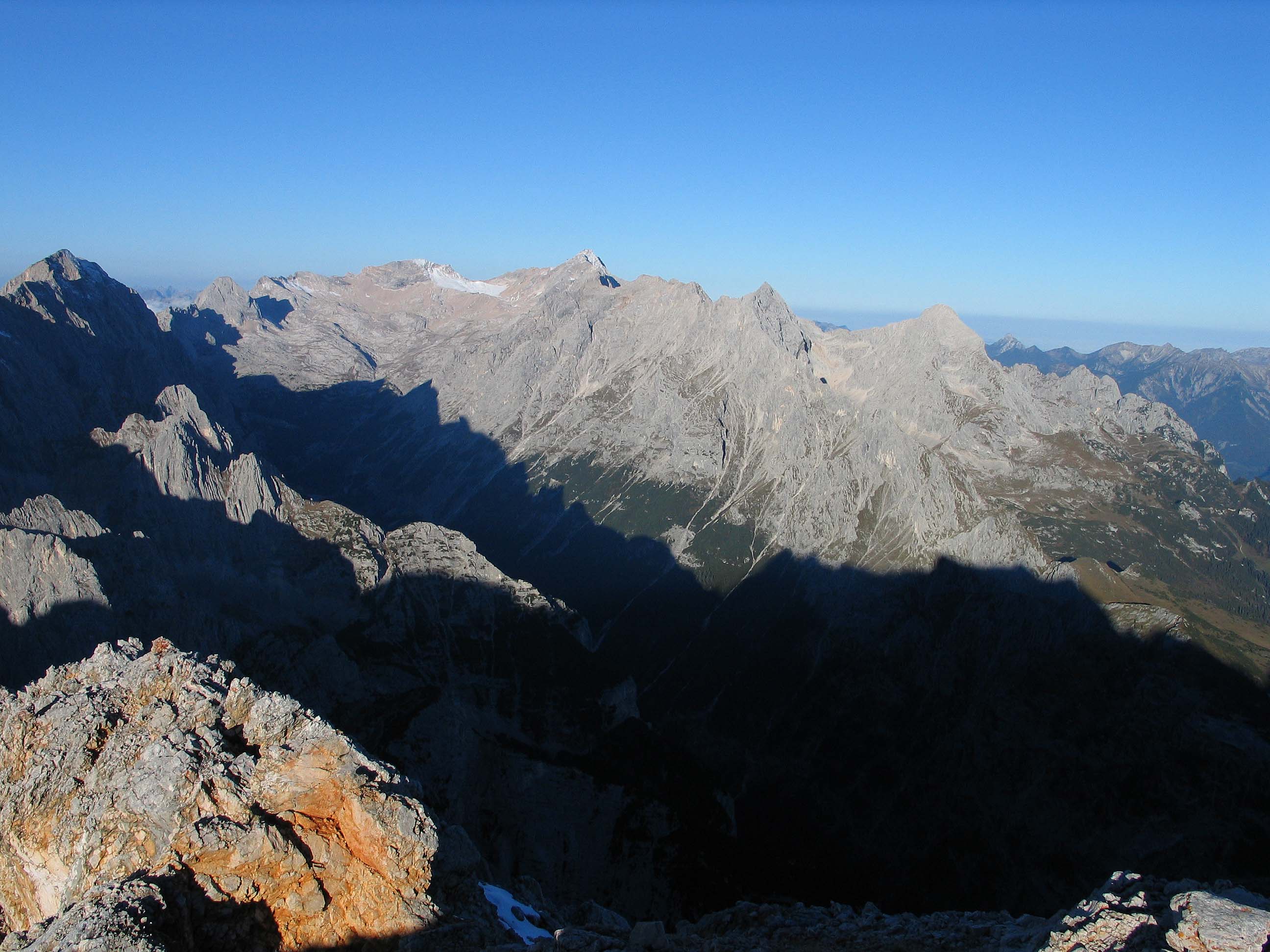
The Ester MountainsBourne, Grant and Körner-Bourne, Sabine (2007). ''Walking in the Bavarian Alps'', 2nd ed., Cicerone, Milnthorpe, p.8 and 115-168. . (german: Estergebirge) are a small mountain range in Bavaria. They are classified either as part of Bavarian Prealps or the larger chain of Northern Limestone Alps. The range stretches for about 15 kilometres. From the west it is bordered by the valley of the river Loisach and from the east by Walchensee lake and the valley of the river Isar. With its highest peak being Krottenkopf (2,086 m), the highest part of the range just exceeds 2,000 m. The range is of composed of limestone. The treeline is around 1,700 m. Etymology Probably from preceltic ''ester'' (cf. basque ''Ezterenzubi'', occitan ''Esterel''). Peaks Most important summits The most important summits in the Ester range are the Krottenkopf (2,086 m), the Bischof (2,033 m), the Hohe Kisten (1,922 m), the Hoher Fricken (1,940 m) and the Simetsberg (1,836 m). The ... [...More Info...] [...Related Items...] OR: [Wikipedia] [Google] [Baidu] |
Bavaria
Bavaria ( ; ), officially the Free State of Bavaria (german: Freistaat Bayern, link=no ), is a state in the south-east of Germany. With an area of , Bavaria is the largest German state by land area, comprising roughly a fifth of the total land area of Germany. With over 13 million inhabitants, it is second in population only to North Rhine-Westphalia, but due to its large size its population density is below the German average. Bavaria's main cities are Munich (its capital and largest city and also the third largest city in Germany), Nuremberg, and Augsburg. The history of Bavaria includes its earliest settlement by Iron Age Celtic tribes, followed by the conquests of the Roman Empire in the 1st century BC, when the territory was incorporated into the provinces of Raetia and Noricum. It became the Duchy of Bavaria (a stem duchy) in the 6th century AD following the collapse of the Western Roman Empire. It was later incorporated into the Holy Roman Empire, became an ind ... [...More Info...] [...Related Items...] OR: [Wikipedia] [Google] [Baidu] |
Simetsberg (Ester Mountains)
Simetsberg (elevation ) is a mountain in the Bavarian Prealps of southern Germany. An isolated peak, it forms the eastern end of the Ester Mountains The Ester MountainsBourne, Grant and Körner-Bourne, Sabine (2007). ''Walking in the Bavarian Alps'', 2nd ed., Cicerone, Milnthorpe, p.8 and 115-168. . (german: Estergebirge) are a small mountain range in Bavaria. They are classified either as par .... References Mountains of Bavaria Bavarian Prealps Mountains of the Alps {{Bavaria-geo-stub ... [...More Info...] [...Related Items...] OR: [Wikipedia] [Google] [Baidu] |
Mountain Ranges Of The Alps
A mountain is an elevated portion of the Earth's crust, generally with steep sides that show significant exposed bedrock. Although definitions vary, a mountain may differ from a plateau in having a limited summit area, and is usually higher than a hill, typically rising at least 300 metres (1,000 feet) above the surrounding land. A few mountains are isolated summits, but most occur in mountain ranges. Mountains are formed through tectonic forces, erosion, or volcanism, which act on time scales of up to tens of millions of years. Once mountain building ceases, mountains are slowly leveled through the action of weathering, through slumping and other forms of mass wasting, as well as through erosion by rivers and glaciers. High elevations on mountains produce colder climates than at sea level at similar latitude. These colder climates strongly affect the ecosystems of mountains: different elevations have different plants and animals. Because of the less hospitable terrain and ... [...More Info...] [...Related Items...] OR: [Wikipedia] [Google] [Baidu] |
Zugspitze
The Zugspitze (), at above Normalhöhennull, sea level, is the highest peak of the Wetterstein Mountains as well as the highest mountain in Germany. It lies south of the town of Garmisch-Partenkirchen, and the Austria–Germany border runs over its western summit. South of the mountain is the ''Zugspitzplatt'', a high karst plateau with numerous caves. On the flanks of the Zugspitze are three glaciers, including the two largest in Germany: the Schneeferner#Northern Schneeferner, Northern Schneeferner with an area of 30.7 hectares and the Höllentalferner with an area of 24.7 hectares. The third is the Schneeferner#Southern Schneeferner, Southern Schneeferner which covers 8.4 hectares. The Zugspitze was first climbed on 27 August 1820 by Josef Naus, his survey assistant, Maier, and mountain guide, Johann Georg Tauschl. Today there are three normal routes to the summit: one from the Höllental (Wetterstein), Höllental valley to the northeast; another out of the Reintal (Wetterste ... [...More Info...] [...Related Items...] OR: [Wikipedia] [Google] [Baidu] |
Karwendel
The Karwendel is the largest mountain range of the Northern Limestone Alps. The major part belongs to the Austrian federal state of Tyrol (state), Tyrol, while the adjacent area in the north is part of Bavaria, Germany. Four mountain chain, chains stretch from west to east; in addition, there are a number of fringe ranges and an extensive promontory (''Vorkarwendel'') in the north. Geography The term Karwendel describes the part of the Alps between the Isar river and the Seefeld Saddle mountain pass in the west and Achen Lake in the east. In the north it stretches to the Bavarian Prealps. In the south the Lower Inn Valley with the city of Innsbruck separates the Karwendel from the Central Eastern Alps. Other major settlements include Seefeld in Tirol and Mittenwald in the west, as well as Eben am Achensee in the east. Neighbouring ranges are the Wetterstein and Mieming Range, Mieming Mountains in the west and the Brandenberg Alps in the east. The mountaineer Hermann von Barth cre ... [...More Info...] [...Related Items...] OR: [Wikipedia] [Google] [Baidu] |
Wetterstein
The Wetterstein mountains (german: Wettersteingebirge), colloquially called Wetterstein, is a mountain group in the Northern Limestone Alps within the Eastern Alps. It is a comparatively compact range located between Garmisch-Partenkirchen, Mittenwald, Seefeld in Tirol and Ehrwald along the border between Germany (Bavaria) and Austria (Tyrol). Zugspitze, the highest peak is at the same time the highest mountain in Germany. The Wetterstein mountains are an ideal region for mountaineers and climbers. Mountain walkers sometimes need to allow for significant differences in elevation. The proximity of the range to the south German centres of population, the scenic landscape and its good network of cable cars and lifts mean that the mountains are heavily frequented by tourists for most of the year. There are, however, places in the Wetterstein that are rarely or never visited by people. Neighbouring ranges The Wetterstein borders on the following other mountain ranges of t ... [...More Info...] [...Related Items...] OR: [Wikipedia] [Google] [Baidu] |
Wankbahn
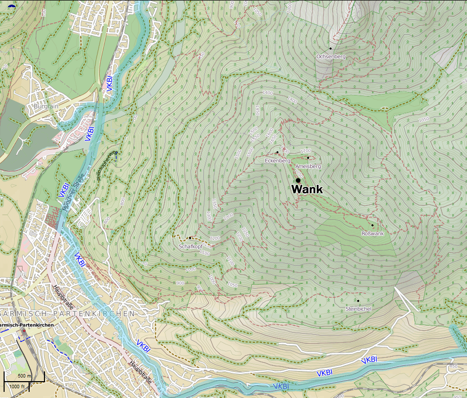
The Wank () is a mountain in southern Germany, situated in the Loisach valley close to the Austrian border in the southwestern Ester Mountains range near Garmisch-Partenkirchen. It rises from about above mean sea level up to at the summit.Rennenberg, H.; Polle, A.; Reuther, M.: "Role of Ozone in Forest Decline on Wank Mountain (Alps)", in Sandermann, H.; Wellburn, A.; Heath, Robert L.: ''Forest decline and ozone: a comparison of controlled chamber and field experiments'', pp. 136-7. Springer, 1997. The mountain is crowned by a grassy summit which has views over Garmisch-Partenkirchen and the surrounding region. The summit can be reached via the eponymous Wankbahn, a cable car system that runs during the summer months, or by a network of footpaths that criss-cross the area. A mountain hut on the summit, the Wank-Haus, provides food and accommodation, and a nearby scientific observatory plays a role in monitoring atmospheric and climatic conditions. The Wank is a destination for h ... [...More Info...] [...Related Items...] OR: [Wikipedia] [Google] [Baidu] |
Wank (mountain)
The Wank () is a mountain in southern Germany, situated in the Loisach valley close to the Austrian border in the southwestern Ester Mountains range near Garmisch-Partenkirchen. It rises from about above mean sea level up to at the summit.Rennenberg, H.; Polle, A.; Reuther, M.: "Role of Ozone in Forest Decline on Wank Mountain (Alps)", in Sandermann, H.; Wellburn, A.; Heath, Robert L.: ''Forest decline and ozone: a comparison of controlled chamber and field experiments'', pp. 136-7. Springer, 1997. The mountain is crowned by a grassy summit which has views over Garmisch-Partenkirchen and the surrounding region. The summit can be reached via the eponymous Wankbahn, a cable car system that runs during the summer months, or by a network of footpaths that criss-cross the area. A mountain hut on the summit, the Wank-Haus, provides food and accommodation, and a nearby scientific observatory plays a role in monitoring atmospheric and climatic conditions. The Wank is a destination for hi ... [...More Info...] [...Related Items...] OR: [Wikipedia] [Google] [Baidu] |
Wallgau
Wallgau is a municipality in the district of Garmisch-Partenkirchen, in Bavaria, Germany. Population Growth :''*Statistics according to the Bavarian government, as of 2007.'' Demographics :''*Statistics according to the Bavarian government, as of 2007.''Bayerisches Landesamt für Statistik und Datenverarbeitung – GENESIS-Online Bayern bayern.de. Accessed 11 February 2010. Notable people * , (born 1987), twelve-time world champion, Olympic champion, |
Krün
Krün is a municipality in the Upper Bavarian district of Garmisch-Partenkirchen. It belongs with Garmisch-Partenkirchen as district capital and cultural center as well as other municipalities to the region Werdenfelser Land. A few kilometers south runs the German-Austrian border. The village, together with Mittenwald and Wallgau, builds the tourism network ''Alpenwelt Karwendel'' who markets the holiday region throughout the year as a starting point for sports and recreational activities such as hiking and cross-country skiing. In 2015, Krün was the host-community of the 41st G7 summit. It took place on 7 June and 8 June 2015 in Schloss Elmau, which belongs as a separate district to the municipality of Krün. On the occasion of the G7 summit US-President Barack Obama visited the village together with Chancellor Angela Merkel and her husband. From June 26 to 28, 2022, Krün once again hosted the G7 Summit. Geography Krün is located in the Upper Isar Valley, about 100 kilo ... [...More Info...] [...Related Items...] OR: [Wikipedia] [Google] [Baidu] |
Hoher Fricken
The Hoher Fricken ("High Fricken") is a mountain high, in the Ester Mountains in the Bavarian Prealps and lies between the Wank and the over 2000 m high Bischof. Below and to the north is the Niederer Fricken ("Low Fricken", ) and the Fricken Cirque (''Frickenkar''). The summit may be reached as a mountain hike from Oberau or from the swimming pool in Farchant (via the path to the Esterbergalm) or rather more steeply from Farchant on a route going past the Kuhflucht Waterfalls. at hikr.org. Retrieved 30 August 2022. Halfway up the climb via the Kuhflucht Falls lies the Fricken Cave. Hiking time in each case is about 4 hours. Since the re-opening of the Farchant railway halt in December 2010 the ... [...More Info...] [...Related Items...] OR: [Wikipedia] [Google] [Baidu] |
Bavarian Prealps
The Bavarian Prealps (german: Bayerische Voralpen) are a mountain range within the Northern Limestone Alps in south Germany. They include the Bavarian Prealp region between the river Loisach to the west and the river Inn to the east; the range is about long and wide. The term is not defined politically, but alpine-geographically because small areas of the Bavarian Prealps lie in Tyrol (e.g. the Hinteres Sonnwendjoch south of the Rotwand). The term is not to be confused with the Bavarian Alps or the Bavarian Alpine Foreland. These terms include the whole of the alpine region (together with parts of the Wetterstein, the Karwendel, etc.) and the whole Alpine Foreland on Bavarian state territory. Except in the Ester Mountains in the extreme west, the summits of the Bavarian Prealps are all below 2000 metres in height and only a few have prominent limestone cliffs. Extent According to the 1984 classification of the Eastern Alps by the German Alpine Club the Bavarian Prealps a ... [...More Info...] [...Related Items...] OR: [Wikipedia] [Google] [Baidu] |


