|
Elton Plateau
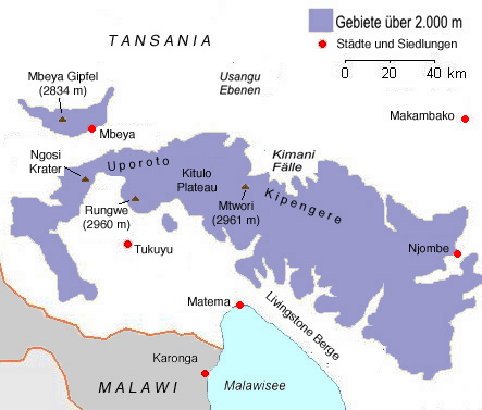
The Kitulo Plateau, formerly known as the Elton Plateau, ( sw, Bustani ya Mungu; meaning 'The Garden of God'), is a plateau in Tanzania's Kipengere Range known for its floral diversity. The plateau is in Kitulo National Park. This montane grassland area was the first area in East Africa to become a national park because of its unique flora. Botanists have referred to it as the ''Serengeti of Flowers''.Kitulo National Park, Official Website, Tanzania National Parks, accessed 20 November 2014 See also *Wildlife of Tanzania
Tanzania contains some 20 percent of the species of Africa's ...
[...More Info...] [...Related Items...] OR: [Wikipedia] [Google] [Baidu] |
Tanzania
Tanzania (; ), officially the United Republic of Tanzania ( sw, Jamhuri ya Muungano wa Tanzania), is a country in East Africa within the African Great Lakes region. It borders Uganda to the north; Kenya to the northeast; Comoro Islands and the Indian Ocean to the east; Mozambique and Malawi to the south; Zambia to the southwest; and Rwanda, Burundi, and the Democratic Republic of the Congo to the west. Mount Kilimanjaro, Africa's highest mountain, is in northeastern Tanzania. According to the United Nations, Tanzania has a population of million, making it the most populous country located entirely south of the equator. Many important hominid fossils have been found in Tanzania, such as 6-million-year-old Pliocene hominid fossils. The genus Australopithecus ranged across Africa between 4 and 2 million years ago, and the oldest remains of the genus ''Homo'' are found near Lake Olduvai. Following the rise of '' Homo erectus'' 1.8 million years ago, humanity spread ... [...More Info...] [...Related Items...] OR: [Wikipedia] [Google] [Baidu] |
Kipengere Range
The Kipengere Range, also known as the Livingstone Mountains, lies entirely in Njombe Region in southwest Tanzania at the northern end of Lake Nyasa. Near Lake Nyasa they are known as the Kinga Mountains. It is a plateau-like ridge of mountains running southeastwards from the basin of the Great Ruaha River in the north to that of the Ruhuhu River in the south, and forms part of the eastern escarpment of the East African Rift. The range is mostly clad in montane grasslands, renowned for their botanical diversity and displays of flowers, with montane evergreen forests mostly in stream valleys. Some sources use the names Kipengere Range or Livingstone Mountains to describe the entire range, while others distinguish the Livingstone Mountains as the southwest-facing escarpment which runs along the shore of Lake Malawi, and the Kipengere Range as the high ridge that defines the northeastern edge of the Kitulo Plateau. Geography From the town of Mbeya the range runs south-east and for ... [...More Info...] [...Related Items...] OR: [Wikipedia] [Google] [Baidu] |
Kitulo National Park
Kitulo National Park is a protected area of montane grassland and montane forest on the Kitulo Plateau in the southern highlands of Tanzania. The park is at an elevation of between the peaks of the Kipengere and Poroto mountains and covers an area of , The Ndumbi forest is also home to a 100-meter waterfall. References External links Kitulo National Park, Tanzania National Parks website {{authority control Geography of Njombe Region Geography of Mbeya Region National parks of Tanzania Protected areas established in 2005 Southern Highlands, Tanzania Southern Rift montane forest–grassland mosaic Tourist attractions in the Njombe Region Tourist attractions in the Mbeya Region 2005 establishments in Tanzania ... [...More Info...] [...Related Items...] OR: [Wikipedia] [Google] [Baidu] |
East Africa
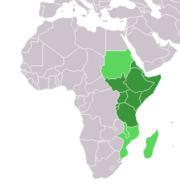
East Africa, Eastern Africa, or East of Africa, is the eastern subregion of the African continent. In the United Nations Statistics Division scheme of geographic regions, 10-11-(16*) territories make up Eastern Africa: Due to the historical Omani Empire and colonial territories of the British East Africa Protectorate and German East Africa, the term ''East Africa'' is often (especially in the English language) used to specifically refer to the area now comprising the three countries of Kenya, Tanzania, and Uganda. However, this has never been the convention in many other languages, where the term generally had a wider, strictly geographic context and therefore typically included Djibouti, Eritrea, Ethiopia, and Somalia.Somaliland is not included in the United Nations geoscheme, as it is internationally recognized as a part of Somalia. *Tanzania, Kenya, Uganda, Rwanda, Burundi, Democratic Republic of Congo and South Sudan are members of the East African Community. The firs ... [...More Info...] [...Related Items...] OR: [Wikipedia] [Google] [Baidu] |
National Park
A national park is a nature park, natural park in use for conservation (ethic), conservation purposes, created and protected by national governments. Often it is a reserve of natural, semi-natural, or developed land that a sovereign state declares or owns. Although individual nations designate their own national parks differently, there is a common idea: the conservation of 'wild nature' for posterity and as a symbol of national pride. The United States established the first "public park or pleasuring-ground for the benefit and enjoyment of the people", Yellowstone National Park, in 1872. Although Yellowstone was not officially termed a "national park" in its establishing law, it was always termed such in practice and is widely held to be the first and oldest national park in the world. However, the Tobago Main Ridge Forest Reserve (in what is now Trinidad and Tobago; established in 1776), and the area surrounding Bogd Khan Mountain, Bogd Khan Uul Mountain (Mongolia, 1778), wh ... [...More Info...] [...Related Items...] OR: [Wikipedia] [Google] [Baidu] |
Botany
Botany, also called , plant biology or phytology, is the science of plant life and a branch of biology. A botanist, plant scientist or phytologist is a scientist who specialises in this field. The term "botany" comes from the Ancient Greek word (''botanē'') meaning " pasture", " herbs" "grass", or " fodder"; is in turn derived from (), "to feed" or "to graze". Traditionally, botany has also included the study of fungi and algae by mycologists and phycologists respectively, with the study of these three groups of organisms remaining within the sphere of interest of the International Botanical Congress. Nowadays, botanists (in the strict sense) study approximately 410,000 species of land plants of which some 391,000 species are vascular plants (including approximately 369,000 species of flowering plants), and approximately 20,000 are bryophytes. Botany originated in prehistory as herbalism with the efforts of early humans to identify – and later cultivate – ed ... [...More Info...] [...Related Items...] OR: [Wikipedia] [Google] [Baidu] |
Wildlife Of Tanzania
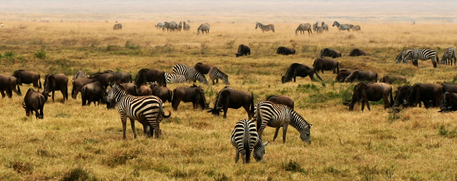
Tanzania contains some 20 percent of the species of Africa's large mammal population, found across its reserves, conservation areas, marine parks, and 17 national parks, spread over an area of more than and forming approximately 38 percent of the country's territory.Briggs, pp. 1–31 Wildlife resources of Tanzania are described as "without parallel in Africa" and "the prime game viewing country". Serengeti National Park, the country's second largest national park area at , is located in northern Tanzania and is famous for its extensive migratory herds of wildebeests and zebra while also having the reputation as one of the great natural wonders of the world. The Ngorongoro Conservation Area, established in 1959, is a UNESCO World Heritage Site and inhabited by the Maasai people. Its Ngorongoro Crater is the largest intact caldera in the world. The national parks are also part of the wetlands of Tanzania. The wild animals tend to be closer to the wetlands, particularly the wate ... [...More Info...] [...Related Items...] OR: [Wikipedia] [Google] [Baidu] |
Landforms Of Tanzania
A landform is a natural or anthropogenic land feature on the solid surface of the Earth or other planetary body. Landforms together make up a given terrain, and their arrangement in the landscape is known as topography. Landforms include hills, mountains, canyons, and valleys, as well as shoreline features such as bays, peninsulas, and seas, including submerged features such as mid-ocean ridges, volcanoes, and the great ocean basins. Physical characteristics Landforms are categorized by characteristic physical attributes such as elevation, slope, orientation, stratification, rock exposure and soil type. Gross physical features or landforms include intuitive elements such as berms, mounds, hills, ridges, cliffs, valleys, rivers, peninsulas, volcanoes, and numerous other structural and size-scaled (e.g. ponds vs. lakes, hills vs. mountains) elements including various kinds of inland and oceanic waterbodies and sub-surface features. Mountains, hills, plateaux, and plains are the fou ... [...More Info...] [...Related Items...] OR: [Wikipedia] [Google] [Baidu] |
Southern Highlands, Tanzania
The Southern Highlands is a highland region in southwestern Tanzania, at the northern end of Lake Malawi. The highlands include portions of Mbeya, Njombe, Rukwa, Ruvuma, and Songwe regions, bordering Malawi, Mozambique, and Zambia. Mbeya is the largest city in the highlands. Geography The highlands comprise a group of plateaus and volcanic mountains, including the Mbeya Mountains, Poroto Mountains, Kipengere Range, Mount Rungwe, Kitulo Plateau, Umalila Mountains, and Matengo Highlands. The Ufipa Plateau extends northwest, between Lake Tanganyika and Lake Rukwa. The eastern and western branches of the East African Rift converge in the highlands, and the Western Rift continues south as the valley of Lake Malawi. To the northeast, the Makambako Gap separates the Southern Highlands from the Eastern Arc Mountains. Mt. Rungwe (2,960 metres), and Mtorwe (2961 m) in the Kipengere Range, are the highest peaks in the highlands. Other peaks include Chaluhangi (2933 m) and Ishinga (2688 ... [...More Info...] [...Related Items...] OR: [Wikipedia] [Google] [Baidu] |
Southern Rift Montane Forest–grassland Mosaic
The South Malawi montane forest-grassland mosaic is a montane grasslands and shrublands ecoregion of Tanzania, Malawi, Mozambique, and Zambia. The ecoregion encompasses several high mountains and plateaus north and east of Lake Malawi. Climate The ecoregion has a tropical highlands climate, generally cooler and more humid than the surrounding lowlands. Most rainfall occurs during the November to April wet season. Most rain comes from convectional thunderstorms originating over Lake Malawi. Flora The predominant plant communities include montane grasslands, shrublands, and evergreen forests. Fauna Near-endemic mammals include the Black and red bush squirrel ''(Paraxerus lucifer)'', Swynnerton's bush squirrel ''(Paraxerus vexillarius)'', Greater hamster-rat ''(Beamys major)'', Grant's bushbaby ''(Galagoides granti)'', Desperate shrew ''(Crocidura desperata)'', and Tanzanian vlei rat ''(Otomys lacustris)'' The Rungwe dwarf galago, a newly-identified species in genus ''Galagoides' ... [...More Info...] [...Related Items...] OR: [Wikipedia] [Google] [Baidu] |

.jpg)

.jpg)


.jpg)