|
Egerland
The Egerland (; ; Egerland German dialect: ''Eghalånd'') is a historical region in the far north west of Bohemia in what is today the Czech Republic, at the border with Germany. It is named after the German name ''Eger'' for the town of Cheb and the main river Ohře. The north-western panhandle around the town of Aš (Asch) was historically part of Vogtland before being incorporated into the Lands of the Bohemian Crown in the 16th century; it is thus known as Bohemian Vogtland (German: '; Czech: '). The rest of historic Vogtland is divided between the German states of Saxony, Thuringia and Bavaria. Geography The Egerland forms the northwestern edge of the Czech Republic. Originally, it was a small region of less than around the historic town of Eger, now named Cheb, roughly corresponding with the present-day Cheb District of the Karlovy Vary Region, originally with the exception of Aš, but including the headwaters of the Ohře river and the area of Marktredwitz in today' ... [...More Info...] [...Related Items...] OR: [Wikipedia] [Google] [Baidu] |
March Of The Nordgau
The Margraviate of the Nordgau (Modern , ) or Bavarian Nordgau () was a medieval administrative unit ('' Gau'') on the frontier of the German Duchy of Bavaria. It comprised the region north of the Danube and Regensburg (Ratisbon), roughly covered by the modern Upper Palatinate stretching up to the river Main and, especially after 1061, into the Egerland on the border with Bohemia. History The area east of Franconia proper up to the Bohemian Forest had been settled by Germanic Varisci and Armalausi tribes in ancient times; after the Migration Period, the forces of the proto-Merovingian king Chlodio (died ) occupied the district. From the mid-6th century onwards, the region was Christianised by several wandering bishops, among them Saints Boniface (lived 675 to 754) and Emmeram of Regensburg. In 739, the Diocese of Regensburg was founded. At the insistence of Saint Boniface, Charles Martel (lived 688 to 741) built the great fortress of Wogastisburg.Thompson, 619. When ... [...More Info...] [...Related Items...] OR: [Wikipedia] [Google] [Baidu] |
Lands Of The Bohemian Crown
The Lands of the Bohemian Crown were the states in Central Europe during the Middle Ages, medieval and early modern periods with feudalism, feudal obligations to the List of Bohemian monarchs, Bohemian kings. The crown lands primarily consisted of the Kingdom of Bohemia, an Prince-elector, electorate of the Holy Roman Empire according to the Golden Bull of 1356, the Margraviate of Moravia, the duchies of Silesia, and the two Lusatias, known as the Margraviate of Upper Lusatia and the Margraviate of Lower Lusatia, as well as other territories throughout its history. This agglomeration of states nominally under the rule of the Bohemian kings was referred to simply as Bohemia. They are now sometimes referred to in scholarship as the Czech lands, a direct translation of the Czech abbreviated name. The joint rule of ''Corona regni Bohemiae'' was legally established by decree of King Charles IV, Holy Roman Emperor, Charles IV issued on 7 April 1348, on the foundation of the original Cze ... [...More Info...] [...Related Items...] OR: [Wikipedia] [Google] [Baidu] |
Sudetenland
The Sudetenland ( , ; Czech and ) is a German name for the northern, southern, and western areas of former Czechoslovakia which were inhabited primarily by Sudeten Germans. These German speakers had predominated in the border districts of Bohemia, Moravia, and Czech Silesia since the Middle Ages. The word "Sudetenland" did not come into being until the early part of the 20th century and did not come to prominence until almost two decades into the century, after World War I, when Austria-Hungary disintegrated and the Sudeten Germans found themselves living in the new country of Czechoslovakia. The ''Sudeten crisis'' of 1938 was provoked by the Pan-Germanist demands of Nazi Germany that the Sudetenland be annexed to Germany, which happened after the later Munich Agreement. Part of the borderland was invaded and annexed by Poland. Afterwards, the formerly unrecognized Sudetenland became an administrative division of Germany. When Czechoslovakia was reconstituted after World Wa ... [...More Info...] [...Related Items...] OR: [Wikipedia] [Google] [Baidu] |
Cheb Hrad 4
Cheb (; ) is a town in the Karlovy Vary Region of the Czech Republic. It has about 33,000 inhabitants. It lies on the Ohře River. Before the expulsion of Germans in 1945, the town was the centre of the German-speaking region known as Egerland. The historic town centre is well preserved and is protected as an urban monument reservation. Administrative division Cheb consists of 19 municipal parts (in brackets population according to the 2021 census): *Cheb (26,768) *Bříza (47) *Cetnov (104) *Chvoječná (28) *Dolní Dvory (49) *Dřenice (50) *Háje (1,082) *Horní Dvory (57) *Hradiště (206) *Hrozňatov (209) *Jindřichov (86) *Klest (41) *Loužek (23) *Pelhřimov (95) *Podhoří (142) *Podhrad (665) *Skalka (228) *Střížov (172) *Tršnice (109) Etymology The first name of the town, documented in 1061, was ''Egire''. It was a Latin name, which was derived from the Celtic name of the Ohře River ''Agara''. The German name ''Eger'' was then derived from the Latin name. ... [...More Info...] [...Related Items...] OR: [Wikipedia] [Google] [Baidu] |
Cheb
Cheb (; ) is a town in the Karlovy Vary Region of the Czech Republic. It has about 33,000 inhabitants. It lies on the Ohře River. Before the Expulsion of Germans from Czechoslovakia, expulsion of Germans in 1945, the town was the centre of the German-speaking region known as Egerland. The historic town centre is well preserved and is protected as an Cultural monument (Czech Republic)#Monument reservations, urban monument reservation. Administrative division Cheb consists of 19 municipal parts (in brackets population according to the 2021 census): *Cheb (26,768) *Bříza (47) *Cetnov (104) *Chvoječná (28) *Dolní Dvory (49) *Dřenice (50) *Háje (1,082) *Horní Dvory (57) *Hradiště (206) *Hrozňatov (209) *Jindřichov (86) *Klest (41) *Loužek (23) *Pelhřimov (95) *Podhoří (142) *Podhrad (665) *Skalka (228) *Střížov (172) *Tršnice (109) Etymology The first name of the town, documented in 1061, was ''Egire''. It was a Latin name, which was derived from the Celtic nam ... [...More Info...] [...Related Items...] OR: [Wikipedia] [Google] [Baidu] |
Ostsiedlung
(, ) is the term for the Early Middle Ages, early medieval and High Middle Ages, high medieval migration of Germanic peoples and Germanisation of the areas populated by Slavs, Slavic, Balts, Baltic and Uralic languages, Uralic peoples; the most settled area was known as . Germanisation efforts included eastern parts of Francia, East Francia, and the Holy Roman Empire and beyond; and the consequences for settlement development and social structures in the areas of settlement. Other regions were also settled, though not as heavily. The ''Ostsiedlung'' encompassed multiple modern and historical regions, primarily Germany east of the Saale and Elbe rivers, the states of Lower Austria and Styria in Austria, Poland and the Czech Republic, but also in other parts of Central and Eastern Europe. The majority of settlers moved individually, in independent efforts, in multiple stages and on different routes. Many settlers were encouraged and invited by the local princes and regional l ... [...More Info...] [...Related Items...] OR: [Wikipedia] [Google] [Baidu] |
Ohře
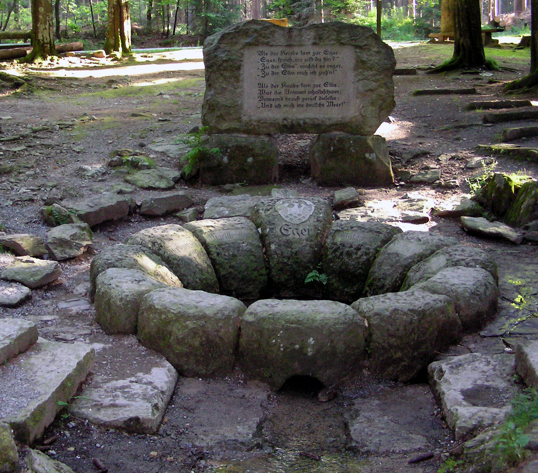
The Ohře (), also known in English and German as Eger (), is a river in Germany and the Czech Republic, a left tributary of the Elbe River. It flows through the Bavarian district of Upper Franconia in Germany, and through the Karlovy Vary Region, Karlovy Vary and Ústí nad Labem Region, Ústí nad Labem regions in the Czech Republic. It is long, of which is in the Czech Republic, making it the List of rivers of the Czech Republic, fourth longest river in the country. Etymology The name is of Celtic language, Celtic or pre-Celtic origin. In the 9th century, it appeared as ''Agara''. According to one theory, its meaning was 'salmon river' (composed of the words ''ag'', ''eg'' – 'salmon', and ''are'', ''ara'' – 'flowing water'). Another theory suggests that the name was derived from ''agriā'' and meant a fast-moving, fast-flowing river. In the 12th century, Ohře was written as ''Egre'', ''Oegre'' and ''Ogre''. Course The Ohře originates in the territory of Weißenstadt i ... [...More Info...] [...Related Items...] OR: [Wikipedia] [Google] [Baidu] |
Saxony
Saxony, officially the Free State of Saxony, is a landlocked state of Germany, bordering the states of Brandenburg, Saxony-Anhalt, Thuringia, and Bavaria, as well as the countries of Poland and the Czech Republic. Its capital is Dresden, and its largest city is Leipzig. Saxony is the List of German states by area, tenth largest of Germany's sixteen states, with an area of , and the List of German states by population, sixth most populous, with more than 4 million inhabitants. The term Saxony (other), Saxony has been in use for more than a millennium. It was used for the medieval Duchy of Saxony, the Electorate of Saxony of the Holy Roman Empire, the Kingdom of Saxony, and twice for a republic. The first Free State of Saxony was established in 1918 as a constituent state of the Weimar Republic. After World War II, it was under Soviet occupation before it became part of communist East Germany and was abolished by the government in 1952. Following German reunificat ... [...More Info...] [...Related Items...] OR: [Wikipedia] [Google] [Baidu] |
Bavaria Slavica
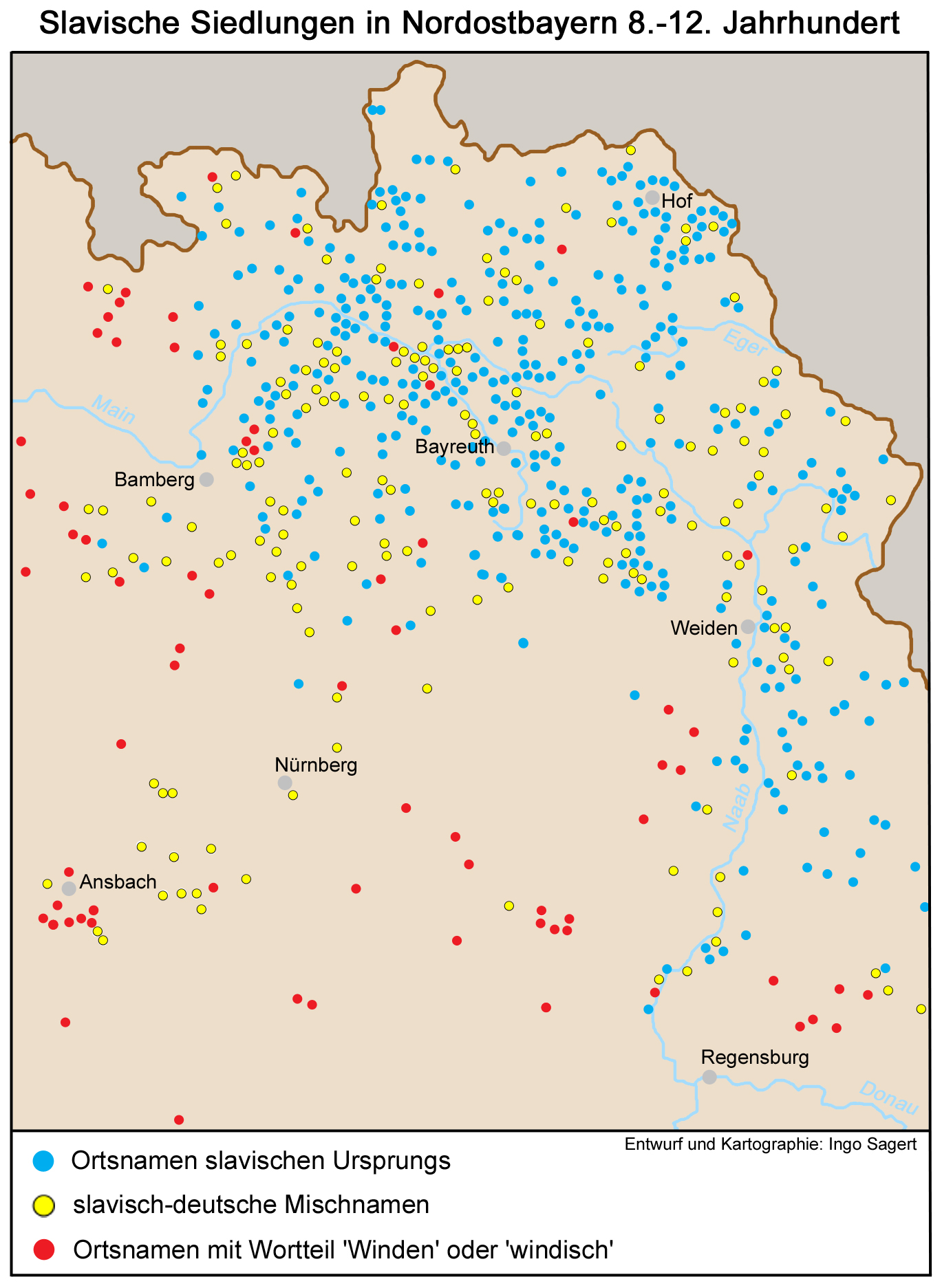
Bavaria Slavica is a historiographic term used to denote the areas populated by West Slavic people (Wends) between the 6th and the 12th centuries in northeastern Bavaria. The Wends settled in Bavaria in several waves between the 6th and the 9th centuries and then in the 10th and the 11th centuries. The settlement of loyal West Slavic Wends and other minor tribes was favoured under Frankish Emperor Charlemagne. Later, the East Frankish Empire also settled largely-Christianized Wends in regions that were rural or unpopulated or threatened by uprisings. After the migration had ended, they were quickly assimilated by the local Franks, who had always continued to constitute the majority, and by the Baiuvarii. See also * Germania Slavica ''Germania Slavica'' is a historiographic term used since the 1950s to denote the landscape of the medieval language border (roughly east of the Elbe-Saale line) zone between Germanic people and Slavs in Central Europe on the one hand and a 20 ... [...More Info...] [...Related Items...] OR: [Wikipedia] [Google] [Baidu] |
Euroregion
In European politics, the term Euroregion usually refers to a transnational co-operation structure between two (or more) contiguous territories located in different European countries. Euroregions represent a specific type of cross-border region. Scope Euroregions usually do not correspond to any legislative or governmental institution and do not have direct political power. Their work is limited to the competencies of the local and regional authorities which constitute them. They are usually arranged to promote common interests across the border and to cooperate for the common good of the border populations. Criteria The Association of European Border Regions sets the following criteria for the identification of Euroregions:Council of Europe (date unknown). Local and Regional Democracy and Good Governance Website of the Council of Europe. Retrieved from http://www.coe.int/t/dgap/localdemocracy/Areas_of_Work/Transfrontier_Cooperation/Euroregions/What_is_en.asp. * an associat ... [...More Info...] [...Related Items...] OR: [Wikipedia] [Google] [Baidu] |
Tachov
Tachov (; ) is a town in the Plzeň Region of the Czech Republic. It has about 14,000 inhabitants. It lies on the Mže River. The historic town centre is well preserved and is protected as an urban monument zone. Administrative division Tachov consists of nine municipal parts (in brackets population according to the 2021 census): *Tachov (11,888) *Bíletín (19) *Malý Rapotín (76) *Mýto (48) *Oldřichov (171) *Světce (58) *Velký Rapotín (73) *Vilémov (16) *Vítkov (161) Geography Tachov is located about west of Plzeň. The eastern and central parts of the municipal territory with the town proper lie in the Upper Palatine Forest Foothills. The western part lies in the Upper Palatinate Forest and includes the highest point of Tachov, the hill Světecký vrch at above sea level. The Mže River flows through the town. History The area was inhabited by humans around 8,000–6,000 BCE. The first written mention of Tachov is from 1126. King Ottokar II of Bohemia (1233� ... [...More Info...] [...Related Items...] OR: [Wikipedia] [Google] [Baidu] |
Mariánské Lázně
Mariánské Lázně (; ) is a spa town in Cheb District in the Karlovy Vary Region of the Czech Republic. It has about 14,000 inhabitants. Most of the town's buildings come from its Golden Era in the second half of the 19th century, when many celebrities and top European rulers came to enjoy the curative carbon dioxide springs. The town centre with the spa cultural landscape is well preserved and is protected as an urban monument reservation. In 2021, the town became part of the transnational UNESCO World Heritage Site under the name " Great Spa Towns of Europe" because of its springs and architectural testimony to the popularity of spa towns in Europe during the 18th through 20th centuries. Administrative division Mariánské Lázně consists of six municipal parts (in brackets population according to the 2021 census): *Mariánské Lázně (5,037) *Chotěnov-Skláře (109) *Hamrníky (661) *Kladská (32) *Stanoviště (71) *Úšovice (6,069) Etymology Both the initial Germ ... [...More Info...] [...Related Items...] OR: [Wikipedia] [Google] [Baidu] |


