|
Edgeley, Ontario
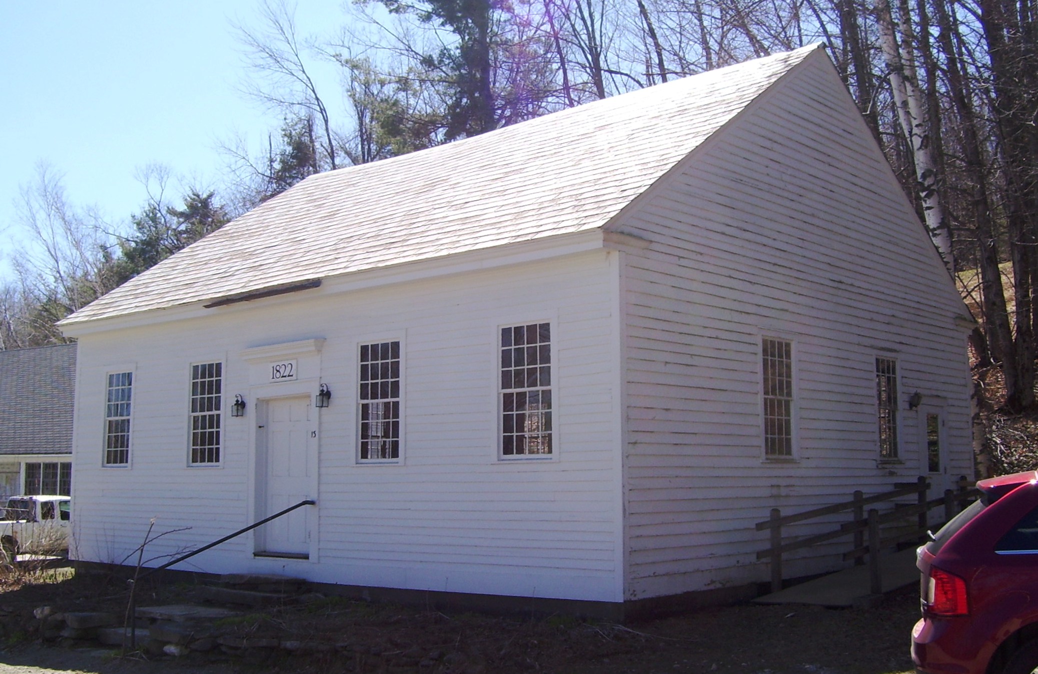
Edgeley was a small rural community located in the city of Vaughan in York Region, Ontario, Canada, which today is the site of Vaughan's planned downtown core; Vaughan Metropolitan Centre. The first inhabitants of the Edgeley area immigrated from Somerset County, Pennsylvania, circa 1800. Early family names were ''Smith, Stong, Shunk, Hoover, Burkholder, Muskrat, Snider, Brown,'' and ''Dalziel''. A Mennonite church, built of logs in 1824 on the northern portion of Lot #7, Concession #4, was one of the first churches built in Vaughan Township. A steam-powered shingle mill stood on the northwest corner of Highway 7 and Jane Street. A hotel was located on the northeast corner, with a general store on the southeast corner. The store contained the Edgeley post office from 1872 until 1960. Just south of the store, Samuel Snider operated a horse-powered cider mill. His son-in-law, Abraham Winger, and Abraham's brother Henry, later assumed the business, putting up a new steam-powered mi ... [...More Info...] [...Related Items...] OR: [Wikipedia] [Google] [Baidu] |
Country
A country is a distinct part of the world, such as a state, nation, or other political entity. It may be a sovereign state or make up one part of a larger state. For example, the country of Japan is an independent, sovereign state, while the country of Wales is a component of a multi-part sovereign state, the United Kingdom. A country may be a historically sovereign area (such as Korea), a currently sovereign territory with a unified government (such as Senegal), or a non-sovereign geographic region associated with certain distinct political, ethnic, or cultural characteristics (such as the Basque Country). The definition and usage of the word "country" is flexible and has changed over time. ''The Economist'' wrote in 2010 that "any attempt to find a clear definition of a country soon runs into a thicket of exceptions and anomalies." Most sovereign states, but not all countries, are members of the United Nations. The largest country by area is Russia, while the smallest is ... [...More Info...] [...Related Items...] OR: [Wikipedia] [Google] [Baidu] |
Geographical Names Board Of Canada
The Geographical Names Board of Canada (GNBC) is a national committee with a secretariat in Natural Resources Canada, part of the Government of Canada, which authorizes the names used and name changes on official federal government maps of Canada created since 1897. The board consists of 27 members, one from each of the provinces and territories, and others from departments of the Government of Canada. The board also is involved with names of areas in the Antarctic through the Antarctic Treaty. Structure The secretariat is provided by Natural Resources Canada. In addition to the provincial and territorial members are members from the following federal government departments: Aboriginal Affairs and Northern Development Canada, Canada Post Corporation, Fisheries and Oceans Canada, Elections Canada, Library and Archives Canada, Department of National Defence, Natural Resources Canada (including Geological Survey of Canada and Canada Centre for Mapping and Earth Observation), Pa ... [...More Info...] [...Related Items...] OR: [Wikipedia] [Google] [Baidu] |
Meeting House
A meeting house (meetinghouse, meeting-house) is a building where religious and sometimes public meetings take place. Terminology Nonconformist Protestant denominations distinguish between a * church, which is a body of people who believe in Christ, and; * meeting house or chapel, which is a building where the church meets. In early Methodism, meeting houses were typically called preaching houses (to distinguish it from a church house), which hosted itinerant preachers. Meeting houses in America The colonial meeting house in America was typically the first public building built as new villages sprang up. A meeting-house had a dual purpose as a place of worship and for public discourse, but sometimes only for "...the service of God." As the towns grew and the separation of church and state in the United States matured the buildings which were used as the seat of local government were called a town-house or town-hall. The nonconformist meeting houses generally do not have s ... [...More Info...] [...Related Items...] OR: [Wikipedia] [Google] [Baidu] |
Jane Street
Jane may refer to: * Jane (given name), a feminine given name * Jane (surname), related to the given name Film and television * ''Jane'' (1915 film), a silent comedy film directed by Frank Lloyd * ''Jane'' (2016 film), a South Korean drama film starring Lee Min-ji * ''Jane'' (2017 film), an American documentary film about Jane Goodall * ''Jane'' (2022 film), an American psychological thriller directed by Sabrina Jaglom * Jane (TV series), an 1980s British television series Music * ''Jane'' (album), an album by Jane McDonald * Jane (American band) * Jane (German band) * Jane, unaccompanied and original singer of "It's a Fine Day" in 1983 Songs * "Jane" (Barenaked Ladies song), 1994 * "Jane", a song by Ben Folds Five from their 1999 album ''The Unauthorized Biography of Reinhold Messner'' * "Jane" (Century song) * "Jane", a song by Elf Power * "Jane", a song by EPMD from '' Strictly Business'' * "Jane" (Jefferson Starship song), 1979 * "Jane", a song by the Loved Ones fro ... [...More Info...] [...Related Items...] OR: [Wikipedia] [Google] [Baidu] |
List Of Numbered Roads In York Region
York Region, located in southcentral Ontario, Canada, assigned approximately 50 regional roads, each with a number ranging from 1 to 99. All expenses of York Regional Roads (for example, snow shovelling, road repairs, traffic lights) are funded by the York Region government. Several new roads were assumed by the region include King–Vaughan Town Line and Kirby Sideroad. Most north-south roads originating in Toronto retains the proper names from south of Steeles Avenue. Roads on Georgina Island are maintained by Chippewas of Georgina Island First Nation despite the island being within York Region. Roads are generally paved with some gravel roads in less populated areas. Before the 20th Century most cleared roads were dirt roads. Types of roads King's Highways There are of provincially maintained highways, termed "provincial highways" or "King's Highways" As in the rest of Ontario, the provincially maintained highways in York Region are designated with a shield-shaped sig ... [...More Info...] [...Related Items...] OR: [Wikipedia] [Google] [Baidu] |
Mennonite
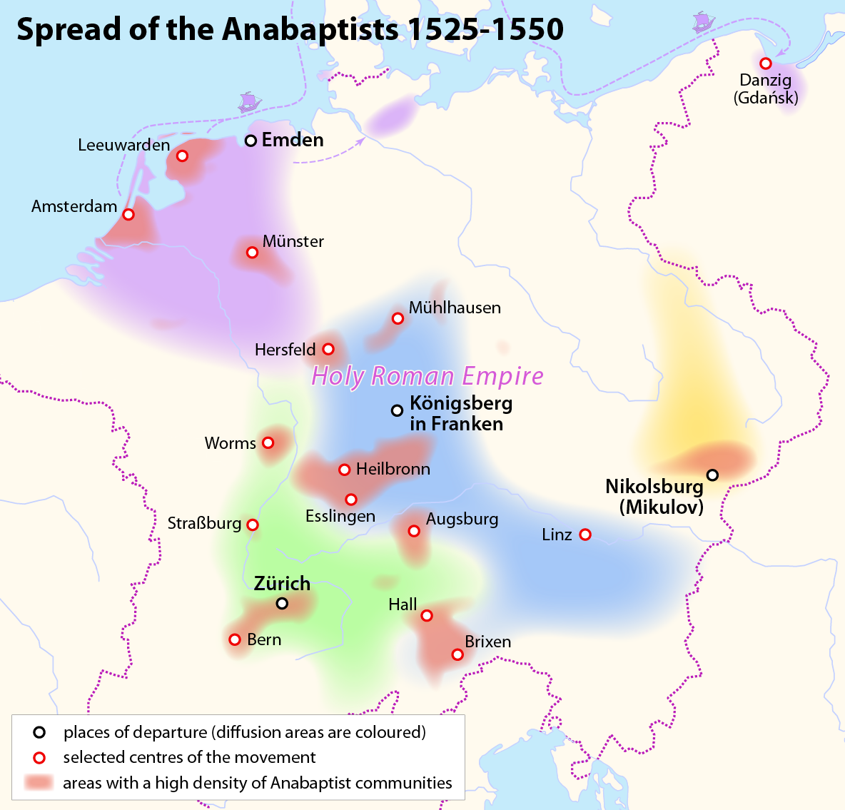
Mennonites are groups of Anabaptist Christian church communities of denominations. The name is derived from the founder of the movement, Menno Simons (1496–1561) of Friesland. Through his writings about Reformed Christianity during the Radical Reformation, Simons articulated and formalized the teachings of earlier Swiss founders, with the early teachings of the Mennonites founded on the belief in both the mission and ministry of Jesus, which the original Anabaptist followers held with great conviction, despite persecution by various Roman Catholic and Mainline Protestant states. Formal Mennonite beliefs were codified in the Dordrecht Confession of Faith in 1632, which affirmed "the baptism of believers only, the washing of the feet as a symbol of servanthood, church discipline, the shunning of the excommunicated, the non-swearing of oaths, marriage within the same church, strict pacifistic physical nonresistance, anti-Catholicism and in general, more emphasis on "true Chris ... [...More Info...] [...Related Items...] OR: [Wikipedia] [Google] [Baidu] |
Pennsylvania
Pennsylvania (; ( Pennsylvania Dutch: )), officially the Commonwealth of Pennsylvania, is a state spanning the Mid-Atlantic, Northeastern, Appalachian, and Great Lakes regions of the United States. It borders Delaware to its southeast, Maryland to its south, West Virginia to its southwest, Ohio to its west, Lake Erie and the Canadian province of Ontario to its northwest, New York to its north, and the Delaware River and New Jersey to its east. Pennsylvania is the fifth-most populous state in the nation with over 13 million residents as of 2020. It is the 33rd-largest state by area and ranks ninth among all states in population density. The southeastern Delaware Valley metropolitan area comprises and surrounds Philadelphia, the state's largest and nation's sixth most populous city. Another 2.37 million reside in Greater Pittsburgh in the southwest, centered around Pittsburgh, the state's second-largest and Western Pennsylvania's largest city. The state's su ... [...More Info...] [...Related Items...] OR: [Wikipedia] [Google] [Baidu] |
Somerset County, Pennsylvania
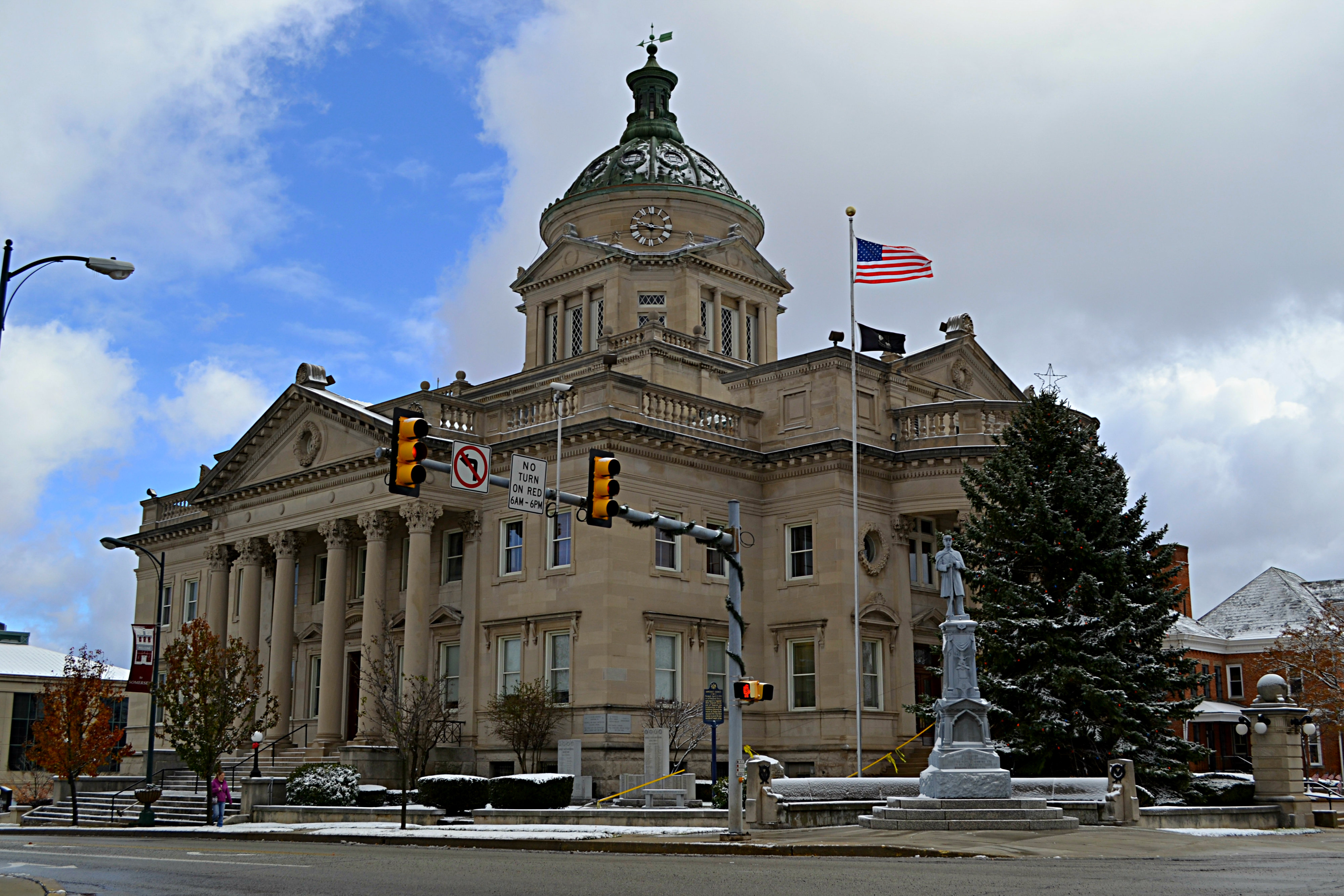
Somerset County (Pennsylvania Dutch language, Pennsylvania German: ''Somerset Kaundi'') is a County (United States), county in the Commonwealth (U.S. state), Commonwealth of Pennsylvania. As of the 2020 United States census, 2020 census, the population was 74,129. Its county seat is Somerset, Pennsylvania, Somerset. The county was created from part of Bedford County, Pennsylvania, Bedford County on April 17, 1795, and named after the county of Somerset in England. Somerset County comprises the Somerset, PA micropolitan statistical area, which is included in the Johnstown, Pennsylvania, Johnstown–Somerset, PA combined statistical area. The county is famous for being the crash site of United Airlines Flight 93, one of the four flights involved in the September 11 attacks, which crashed near the village of Shanksville, Pennsylvania, Shanksville after the flight's passengers struggled with Al-Qaeda hijackers for control of the plane, which terrorists intended to fly into either t ... [...More Info...] [...Related Items...] OR: [Wikipedia] [Google] [Baidu] |
Vaughan Metropolitan Centre
Vaughan Metropolitan Centre is a central business district in Vaughan, Ontario, Canada. Measuring , the district is located at the intersection of Highway 7 and Jane Street, northeast of the Ontario Highway 400, Highway 400 and Ontario Highway 407, Highway 407 interchange, at the site of the historic farming community of Edgeley, Ontario, Edgeley within the larger district of Concord, Vaughan, Concord. The district is served by the Vaughan Metropolitan Centre station, TTC subway station of the same name, which is the northwestern terminus of Line 1 Yonge–University of the Toronto subway system. It is also a major transit hub for York Region Transit (YRT), as well as Viva Rapid Transit, Viva and Züm bus rapid transit services. Name In the summer of 2009, Vaughan's city council announced that they wanted public submissions to suggest a new name for Vaughan's new downtown core. At the time, it was known as "Vaughan Corporate Centre", but the name change was suggested so that the n ... [...More Info...] [...Related Items...] OR: [Wikipedia] [Google] [Baidu] |
Regional Municipality Of York
The Regional Municipality of York, also called York Region, is a regional municipality in Southern Ontario, Canada, between Lake Simcoe and Toronto. The region was established after the passing of then Bill 102, An Act to Establish The Regional Municipality of York, in 1970. It replaced the former York County in 1971, and is part of the Greater Toronto Area and the inner ring of the Golden Horseshoe. The regional government is headquartered in Newmarket. The 2021 census population was 1,173,334, with a growth rate of 5.7% from 2016. The Government of Ontario expects its population to surpass 1.5 million residents by 2031. The largest cities in York Region are Markham, Vaughan and Richmond Hill. History At a meeting in Richmond Hill on May 6, 1970, officials representing the municipalities of York County approved plans for the creation of a regional government entity to replace York County. The plan had been presented in 1969 by Darcy McKeough, the Ontario Minister of Muni ... [...More Info...] [...Related Items...] OR: [Wikipedia] [Google] [Baidu] |
Vaughan
Vaughan () (2021 population 323,103) is a city in Ontario, Canada. It is located in the Regional Municipality of York, just north of Toronto. Vaughan was the fastest-growing municipality in Canada between 1996 and 2006 with its population increasing by 80.2% during this time period and having nearly doubled in population since 1991. It is the fifth-largest city in the Greater Toronto Area, and the 17th-largest city in Canada. Toponymy The township was named after Benjamin Vaughan, a British commissioner who signed a peace treaty with the United States in 1783. History In the late pre-contact period, the Huron-Wendat people populated what is today Vaughan. The Skandatut ancestral Wendat village overlooked the east branch of the Humber River (Pine Valley Drive) and was once home to approximately 2,000 Huron in the sixteenth century. The site is close to a Huron ossuary (mass grave) uncovered in Kleinburg in 1970, and one kilometre north of the Seed-Barker Huron site. The first ... [...More Info...] [...Related Items...] OR: [Wikipedia] [Google] [Baidu] |
National Topographic System
The National Topographic System or NTS is the system used by Natural Resources Canada for providing general purpose topographic maps of the country. NTS maps are available in a variety of scales, the standard being 1:50,000 and 1:250,000 scales. The maps provide details on landforms and terrain, lakes and rivers, forested areas, administrative zones, populated areas, roads and railways, as well as other man-made features. These maps are currently used by all levels of government and industry for forest fire and flood control (as well as other environmental issues), depiction of crop areas, right-of-way, real estate planning, development of natural resources and highway planning. To add context, land area outside Canada is depicted on the 1:250,000 maps, but not on the 1:50,000 maps. History Topographic mapping in Canada was originally undertaken by many different agencies, with the Canadian Army’s Intelligence Branch forming a survey division to create a more standardized mappi ... [...More Info...] [...Related Items...] OR: [Wikipedia] [Google] [Baidu] |


