|
E12 European Long Distance Path
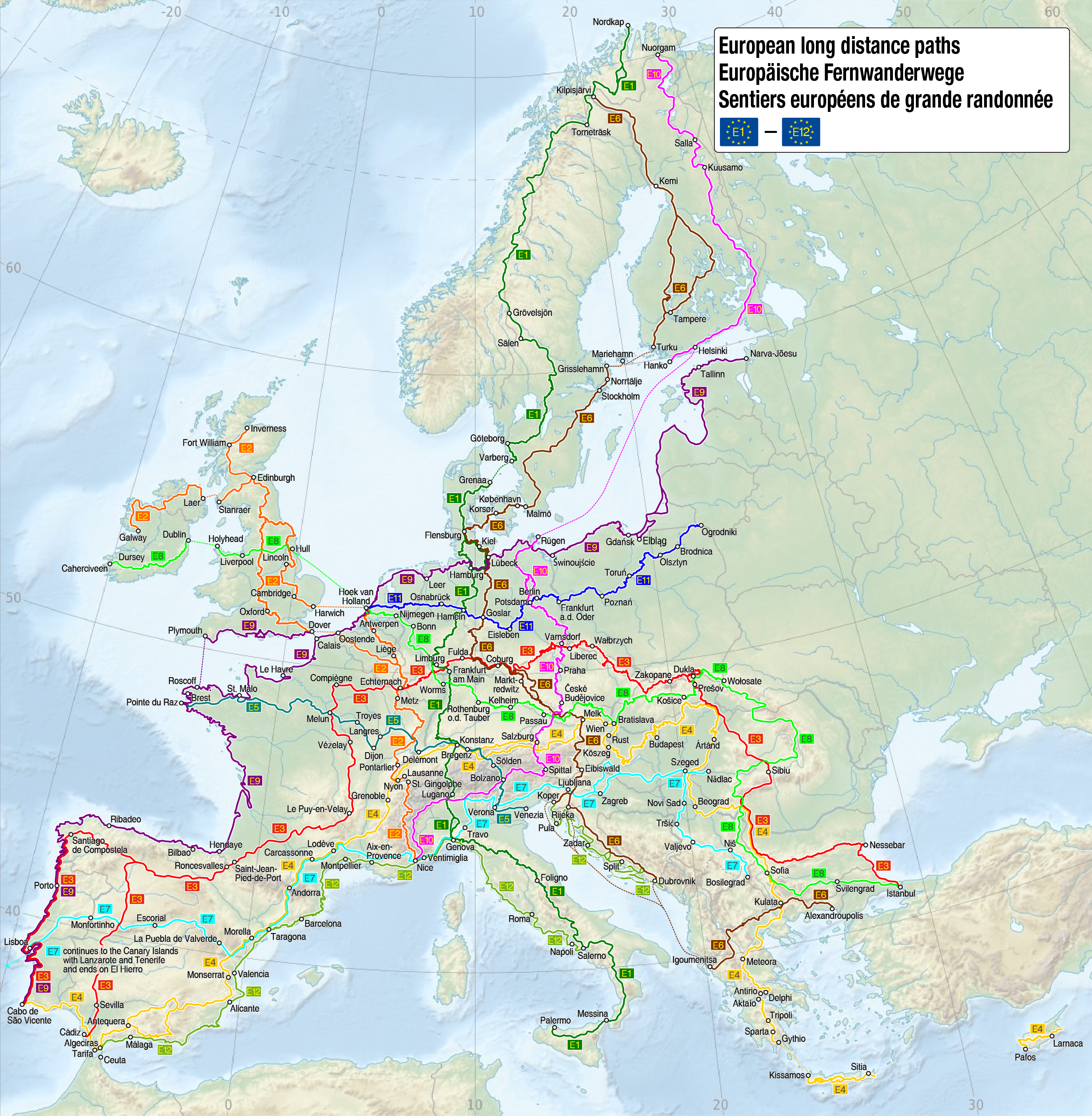
The E12 European long distance path or E12 path is one of the twelve European long-distance paths. It passes through Spain, France, Italy, Slovenia and Croatia. The E12 path is currently under construction and is planned to be 1,800km in length. A section has been completed in Marina di Camerota, South of Napoli, allowing hikers to experience the E12 path before it is fully completed. The path will connect the Mediterranean coast, as well as islands such as Majorca, Corsica, Crete, Cyprus, Malta and Sardinia. Spain The E12 path in Spain begins in Portbou and finishes in Tarifa. It passes through the major cities of Barcelona and Malaga. The path is 772km in length and joins the E7 path in Tarifa. The organisations responsible for the E12 in Spain are theFederación de Entitats Excursionistes de Cataluña Croatia The E12 path in Croatia begins in Plovanija (on the Croatia-Slovenia border) and finishes in Poreč. The path in 59.4km in length and passes through the city ... [...More Info...] [...Related Items...] OR: [Wikipedia] [Google] [Baidu] |
European Long-distance Paths
The European long-distance paths (alternatively, abbreviated as E-paths) are a network of long-distance footpaths that traverse Europe. While most long-distance footpaths in Europe are located in just one country or region, each of these numbered European long-distance paths passes through many different countries. The first long-distance hiking trail in Europe was the National Blue Trail of Hungary, established in 1938. The formation of the European Union made transnational hiking trails possible. Today the network consists of 12 paths and covers more than , crisscrossing Europe. In general the routes connect and make use of existing national and local trails such as the GR footpaths. The paths are officially designated by the European Ramblers' Association. List See also * Geography of Europe *GR footpath * EuroVelo, the European cycle route network * Long-distance trails in the United States References External links {{commons category, European long-distance pathsOvervi ... [...More Info...] [...Related Items...] OR: [Wikipedia] [Google] [Baidu] |
Tarifa
Tarifa (, Arabic: طريفة) is a Spanish municipality in the province of Cádiz, Andalusia. Located at the southernmost end of the Iberian Peninsula, it is primarily known as one of the world's most popular destinations for windsports. Tarifa lies on the Costa de la Luz ("coast of light") and across the Strait of Gibraltar facing Morocco. Besides the city proper, the municipality also comprises several villages, including Tahivilla, Facinas, and Bolonia. History It was thought that Tarifa was once the site of the Roman settlement of Julia Transducta (also known as Julia Joza, or just Transducta). However, that settlement is now thought to have been where Algeciras now stands, while there is strong evidence that Casas de Porro, Valdevaqueros (Tarifa) was the site of the settlement of Mellaria. Tarifa was given its present name after the attack of Tarif ibn Malik in 710, a Berber military commander of Musa bin Nusayr. The village of Bolonia near Tarifa was also popul ... [...More Info...] [...Related Items...] OR: [Wikipedia] [Google] [Baidu] |
Poreč
Poreč (; it, Parenzo; la, Parens or ; grc, Πάρενθος, Párenthos) is a town and municipality on the western coast of the Istrian peninsula, in Istria County, west Croatia. Its major landmark is the 6th-century Euphrasian Basilica, which was designated a UNESCO World Heritage Site in 1997. The town is almost 2,000 years old, and is set around a harbour protected from the sea by the small island of Sveti Nikola/San Nicola (Saint Nicholas). Its population of approximately 12,000 resides mostly on the outskirts, while the wider Poreč area has a population of approximately 16,600 inhabitants. The municipal area covers , with the long shoreline stretching from the Mirna River near Novigrad (Cittanova) to Funtana (Fontane) and Vrsar (Orsera) in the south. Ever since the 1970s, the coast of Poreč and neighboring Rovinj (Rovigno) has been the most visited tourist destination in Croatia. History Prehistory This area has been inhabited since prehistoric times. Rom ... [...More Info...] [...Related Items...] OR: [Wikipedia] [Google] [Baidu] |
Plovanija
Plovanija is a village in Croatia, near the border with Slovenia Slovenia ( ; sl, Slovenija ), officially the Republic of Slovenia (Slovene: , abbr.: ''RS''), is a country in Central Europe. It is bordered by Italy to the west, Austria to the north, Hungary to the northeast, Croatia to the southeast, and .... It is connected by the D200 highway. Populated places in Istria County {{Istria-geo-stub ... [...More Info...] [...Related Items...] OR: [Wikipedia] [Google] [Baidu] |
E6 European Long Distance Path
The E6 European long distance path or E6 path is one of the European long-distance paths from the northwest tip of Finland through Sweden, Denmark, Germany and Austria to the Adriatic coast in Slovenia. A second section starts again in Greece to finish in Turkey. Finland Responsible organisation: None European Ramblers' Association doesn’t take the responsibility for E6 in Finland, because of no ERA Member Organisation in this country. Some of the places passed on the north-to-south route include: * Kilpisjärvi, Finland * Kemi, Finland * Tampere, Finland * Turku, Finland * Mariehamn, Finland Sweden Responsible organisation: Svenska Turistforeningen Some of the places passed on the north-to-south route include: * Grisslehamn, Sweden (reached by ferry) * Stockholm, Sweden * the lake country of S Sweden * Malmö, Sweden Denmark Responsible organisationDansk Vandrelaug Route The E-path starts in Kastrup Airport in Copenhagen and follows the southern side of Copenha ... [...More Info...] [...Related Items...] OR: [Wikipedia] [Google] [Baidu] |
Ankaran
Ankaran (; it, Ancarano ) is a town in the Municipality of Ankaran, located near the border with Italy, in the Littoral region of Slovenia. It is less than 5 km from the Italian town of Muggia near Trieste, about 2.5 km from the Italian-Slovenian border, 6.5 km from Koper, and 33 km from the nearest Croatian town, Buje. In the entire municipality both Slovenian and Italian are official languages. Geography The town of Ankaran is located at the south end of the Muggia Peninsula (sometimes also called the Ankaran Peninsula) at the northwest end of Istria, and extends across the territory of former village of Ankaran, Valdoltra, and Debeli Rtič ( it, Punta Grossa). It is the northernmost of all the coastal settlements of the Slovenian Riviera and one of the last settlements in Istria before the Karst region. In ancient times it was one of the most important routes along the Adriatic coast. The Mediterranean climate allows grape and olive cultivation. ... [...More Info...] [...Related Items...] OR: [Wikipedia] [Google] [Baidu] |
Hrvatini
Hrvatini (; it, Crevatini) is a village in southwestern Slovenia in the City Municipality of Koper. Name Hrvatini was mentioned in historical sources as ''Cruatine'' in 1763–87. The name is a plural form of what was originally a nickname and has now become a surname, borrowed from old Croatian ''Hrvatin'' 'Croat'. For similar names, compare '' Hrovača'' and '' Hrobači'' (a hamlet of Dobravlje). The name originally referred to medieval Croatian resettlement from the south connected with Ottoman occupation of the central Balkans. History For centuries Hrvatini belonged to the municipality of Muggia (now in Italy). After the dissolution of the Free Territory of Trieste in 1954, it was annexed to the Socialist Federal Republic of Yugoslavia. Since then, it has been gravitating towards Koper. During Slovenia's war of independence in 1991, a maritime landing near Hrvatini by special forces of the Yugoslav Army was repulsed by Slovenian troops. Slovene, Italian, and Croatian Cro ... [...More Info...] [...Related Items...] OR: [Wikipedia] [Google] [Baidu] |
Sečovlje
Sečovlje (; it, Sicciole) is a settlement in the Municipality of Piran in the Littoral region of Slovenia. Name The modern Slovene name ''Sečovlje'' is an artificial creation dating from after 1945. It was coined from the Italian name of the settlement, ''Sicciole'', influenced by the name of the neighbouring village of Seča. The origin of the Italian name of the village, ''Sicciole'', is uncertain. Overview Sečovlje is the last Slovenian settlement before the Slovenia–Croatia border on the highway south from Portorož. Its main source of income is tourism at Sečovlje Saltpans Natural Park. The section of the Parenzana railway path that runs through Sečovlje is now a recreational path for tourists. Nearby is the Portorož Airport, which offers panoramic flights over Slovenian Istria. The Sečovlje international border crossing is one of the main crossings from Slovenia into Croatian Istria. History Archaeological finds and text sources point to a settlement in ... [...More Info...] [...Related Items...] OR: [Wikipedia] [Google] [Baidu] |
Škoflje, Divača
Škoflje (; it, Scoffe) is a village on the Reka River in the Municipality of Divača in the Littoral region of Slovenia Slovenia ( ; sl, Slovenija ), officially the Republic of Slovenia (Slovene: , abbr.: ''RS''), is a country in Central Europe. It is bordered by Italy to the west, Austria to the north, Hungary to the northeast, Croatia to the southeast, and .... References External links *Škoflje at Geopedia Populated places in the Municipality of Divača {{Divača-geo-stub ... [...More Info...] [...Related Items...] OR: [Wikipedia] [Google] [Baidu] |
Mount Etna
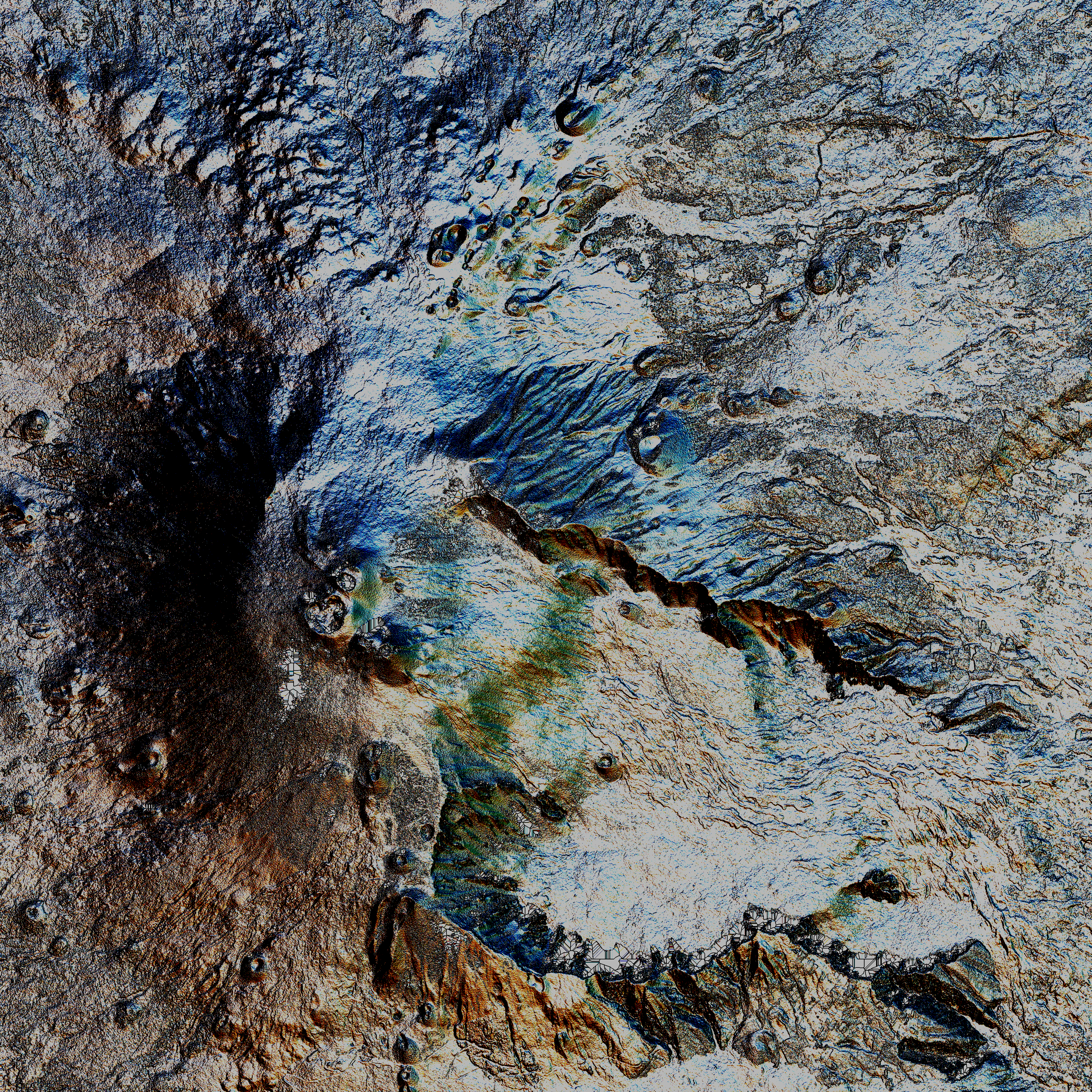
Mount Etna, or simply Etna ( it, Etna or ; scn, Muncibbeḍḍu or ; la, Aetna; grc, Αἴτνα and ), is an active stratovolcano on the east coast of Sicily, Italy, in the Metropolitan City of Catania, between the cities of Messina and Catania. It lies above the convergent plate margin between the African Plate and the Eurasian Plate. It is one of the tallest active volcanoes in Europe, and the tallest peak in Italy south of the Alps with a current height (July 2021) of , though this varies with summit eruptions. Over a six-month period in 2021, Etna erupted so much volcanic material that its height increased by approximately , and the southeastern crater is now the tallest part of the volcano. Etna covers an area of with a basal circumference of . This makes it by far the largest of the three active volcanoes in Italy, being about two and a half times the height of the next largest, Mount Vesuvius. Only Mount Teide on Tenerife in the Canary Islands surpasses it i ... [...More Info...] [...Related Items...] OR: [Wikipedia] [Google] [Baidu] |
Nice
Nice ( , ; Niçard: , classical norm, or , nonstandard, ; it, Nizza ; lij, Nissa; grc, Νίκαια; la, Nicaea) is the prefecture of the Alpes-Maritimes department in France. The Nice agglomeration extends far beyond the administrative city limits, with a population of nearly 1 millionDemographia: World Urban Areas , Demographia.com, April 2016 on an area of . Located on the , the southeastern coast of France on the Mediterranean Sea, at the foot of the [...More Info...] [...Related Items...] OR: [Wikipedia] [Google] [Baidu] |
Montpellier
Montpellier (, , ; oc, Montpelhièr ) is a city in southern France near the Mediterranean Sea. One of the largest urban centres in the region of Occitania (administrative region), Occitania, Montpellier is the prefecture of the Departments of France, department of Hérault. In 2018, 290,053 people lived in the city, while its Functional area (France), metropolitan area had a population of 787,705.Comparateur de territoire INSEE, retrieved 20 June 2022. The inhabitants are called Montpelliérains. In the Middle Ages, Montpellier was an important city of the Crown of Aragon (and was the birthplace of James I of Aragon, James I), and then of Kingdom of Majorca, Majorca, before its sale to France in 1349. Established in 1220, the University of Montpellier is one of the List of oldest univ ... [...More Info...] [...Related Items...] OR: [Wikipedia] [Google] [Baidu] |

.jpg)


