|
Durkar
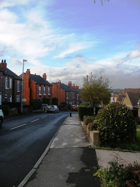
Durkar is a small village in the southwestern suburbs of the City of Wakefield, West Yorkshire, England. The name 'Durkar' derives from the Norse ''drit kjarr'' meaning 'dirt marsh'. Durkar is bordered by the parishes of Crigglestone to the south-west and Kettlethorpe to the east. It is under the local administration of Crigglestone Parish Council with authoritative powers exercised by Wakefield Metropolitan District Council. The village lies on the main arterial road into Wakefield, the A636, and adjacent to Junction 39 of the M1 motorway. The city of Leeds is to the north; Sheffield to the south; and Manchester to the south-west. Nearest schools are Kettlethorpe High School and St James CE Junior. Local landmarks include Sandal Castle, a 10th-century stronghold, Kenton Drive, West Bretton Sculpture Park and Pugneys Country Park. The local public house A pub (short for public house) is a kind of drinking establishment which is licensed to serve alcoho ... [...More Info...] [...Related Items...] OR: [Wikipedia] [Google] [Baidu] |
City Of Wakefield
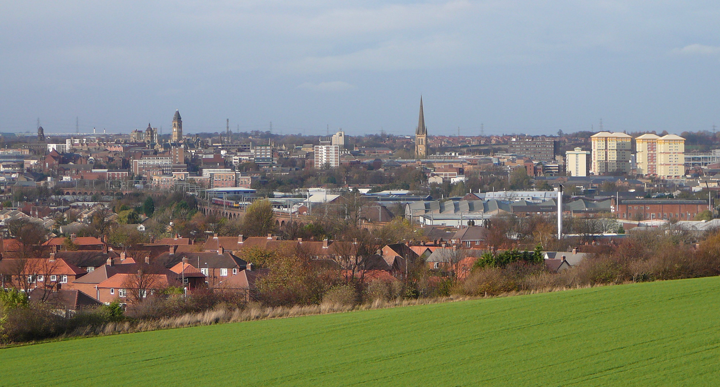
The City of Wakefield is a local government district with the status of a city and metropolitan borough in West Yorkshire, England. Wakefield, the largest settlement, is the administrative centre of the district. The population of the City of Wakefield at the 2011 Census was 325,837. The district includes the ''Five Towns'' of Normanton, Pontefract, Featherstone, Castleford and Knottingley. Other towns include Ossett, Horbury, Hemsworth, South Kirkby and Moorthorpe and South Elmsall. The city and district are governed by Wakefield Metropolitan District Council from headquarters in County Hall. In 2010, Wakefield was named as the UK's third most musical city by PRS for Music. Economy The economic and physical condition of several of the former mining towns and villages in Wakefield District have started to improve due to the booming economy of Leeds – and an increase in numbers of commuters to the city from the sub-region – and a recognition of undeveloped assets. For i ... [...More Info...] [...Related Items...] OR: [Wikipedia] [Google] [Baidu] |
West Yorkshire
West Yorkshire is a metropolitan and ceremonial county in the Yorkshire and Humber Region of England. It is an inland and upland county having eastward-draining valleys while taking in the moors of the Pennines. West Yorkshire came into existence as a metropolitan county in 1974 after the reorganisation of the Local Government Act 1972 which saw it formed from a large part of the West Riding of Yorkshire. The county had a recorded population of 2.3 million in the 2011 Census making it the fourth-largest by population in England. The largest towns are Huddersfield, Castleford, Batley, Bingley, Pontefract, Halifax, Brighouse, Keighley, Pudsey, Morley and Dewsbury. The three cities of West Yorkshire are Bradford, Leeds and Wakefield. West Yorkshire consists of five metropolitan boroughs (City of Bradford, Calderdale, Kirklees, City of Leeds and City of Wakefield); it is bordered by the counties of Derbyshire to the south, Greater Manchester to the south-west, Lancash ... [...More Info...] [...Related Items...] OR: [Wikipedia] [Google] [Baidu] |
A636 Road
The A636 is a main road in West Yorkshire, England, starting at Wakefield and connecting with the M1 motorway at junction 39 and with the A637 at Flockton roundabout. It ends at the A635 at Denby Dale Denby Dale is a village and civil parish in the metropolitan borough of Kirklees in West Yorkshire, England. It is 10 miles (17 km) to the south-east of Huddersfield and 9 miles (14 km) north-west of Barnsley. The village is the main village ... Roads in Yorkshire Transport in West Yorkshire Wakefield {{England-road-stub ... [...More Info...] [...Related Items...] OR: [Wikipedia] [Google] [Baidu] |
Hollin Lane, Durkar - Geograph
The geography of Middle-earth encompasses the physical, political, and moral geography of J. R. R. Tolkien's fictional world of Middle-earth, strictly a continent on the planet of Arda but widely taken to mean the physical world, and ''Eä'', all of creation, as well as all of his writings about it. Arda was created as a flat world, incorporating a Western continent, Aman, which became the home of the godlike Valar, as well as Middle-earth. At the end of the First Age, the Western part of Middle-earth, Beleriand, was drowned in the War of Wrath. In the Second Age, a large island, Númenor, was created in the Great Sea, Belegaer, between Aman and Middle-earth; it was destroyed in a cataclysm near the end of the Second Age, in which Arda was remade as a spherical world, and Aman was removed so that Men could not reach it. In ''The Lord of the Rings'', Middle-earth at the end of the Third Age is described as having free peoples, namely Men, Hobbits, Elves, and Dwarves in the West, op ... [...More Info...] [...Related Items...] OR: [Wikipedia] [Google] [Baidu] |
Kettlethorpe High School
Kettlethorpe High School (KHS) is a mixed secondary school with specialist status for maths and computing in Wakefield, West Yorkshire, England. It provides for children ages 11–16, with a comprehensive admissions policy, and in January 2022 had an enrolment of 1,619 pupils. Qur'an controversy In February 2023, the school suspended four Year 10 pupils for causing minor damage to the pages of a personal copy of the Qur'an by dropping it accidentally. While there were rumours of deliberate damage, a school investigation finding there was no "malicious intent". The Free Speech Union wrote a letter demanding that West Yorkshire Police expunge the hate incident record against the four boys. The mother of one autistic boy said that he had stopped eating due to death threats, and Home Secretary Suella Braverman expressed concern at the police involvement in the matter. Humanists UK alleged that the school took severe disciplinary action because of religious pressure. Notable peo ... [...More Info...] [...Related Items...] OR: [Wikipedia] [Google] [Baidu] |
Pugneys Country Park
Pugneys Country Park is a park located on the A636 between Wakefield, West Yorkshire, England and Junction 39 of the M1 motorway. It is a Local Nature Reserve. The area was developed from a former opencast mine and a sand and gravel quarry A quarry is a type of open-pit mine in which dimension stone, rock, construction aggregate, riprap, sand, gravel, or slate is excavated from the ground. The operation of quarries is regulated in some jurisdictions to reduce their envi ... and was opened to the public in 1985. It is overlooked by Sandal Castle. The park comprises two lakes, the larger of which is dedicated to non-powered watersports and the smaller lake is designated as a nature reserve. A gauge miniature railway, running round part of the larger lake, operates on weekends and bank holidays, and cafeteria facilities are available. The nature reserve is home to a large flock of non-breeding swans, with up to 100 in residence at any time. The lakes serve as a ... [...More Info...] [...Related Items...] OR: [Wikipedia] [Google] [Baidu] |
Yorkshire Sculpture Park
The Yorkshire Sculpture Park (YSP) is an art gallery, with both open-air and indoor exhibition spaces, in West Bretton, Wakefield, in West Yorkshire, England. It shows work by British and international artists, including Henry Moore and Barbara Hepworth. The sculpture park occupies the parkland of Bretton Hall. History The Yorkshire Sculpture Park, opened in 1977, was the UK's first sculpture park based on the temporary open air exhibitions organised in London parks from the 1940s to 1970s by the Arts Council and London County Council (and later Greater London Council). The 'gallery without walls' has a changing exhibition programme, rather than permanent display as seen in other UK sculpture parks such as Grizedale Forest. Exhibition spaces YSP has a number of areas where its collection is displayed. Parkland The park is situated in the grounds of Bretton Hall, an 18th-century estate which was a family home until the mid-20th century when it became Bretton Hall College ... [...More Info...] [...Related Items...] OR: [Wikipedia] [Google] [Baidu] |
Sandal Castle
Sandal Castle is a ruined Middle Ages, medieval castle in Sandal Magna, a suburb of the city of Wakefield in West Yorkshire, England, overlooking the River Calder, West Yorkshire, River Calder. It was the site of royal intrigue and the setting for a scene in one of William Shakespeare's plays. History The Warennes William de Warenne, 2nd Earl of Surrey (1081–1138) was granted the Sandal estates in 1107. The 2nd earl built the first Sandal Castle of timber. He supported Robert Curthose against Henry I and was banished from the kingdom for two years. Later he was given the Wakefield manor. William de Warenne, 3rd Earl of Surrey (1119–1148) spent little time at Sandal, having taken crusading vows and joined the Second Crusade. He had one daughter, Isabel de Warenne, 4th Countess of Surrey, Isabel de Warenne (1137–1199), who married William I, Count of Boulogne, William of Blois, son of King Stephen, who became the 4th earl. He died in 1159, leaving no children. Isabel, his w ... [...More Info...] [...Related Items...] OR: [Wikipedia] [Google] [Baidu] |
Christian School
A Christian school is a school run on Christian principles or by a Christian organization. The nature of Christian schools varies enormously from country to country, according to the religious, educational, and political cultures. In some countries, there is a strict separation of church and state, so all religious schools are private; in others, there is an established church whose teachings form an integral part of the state-operated educational system; in yet others, the state subsidizes religious schools of various denominations. Background Traditionally, many Christian denominations have seen providing catechesis as a necessary part of the educational formation of children; the Emmanuel Association of Churches, a Methodist denomination in the conservative holiness movement teaches, for example: To this end, Christian Churches have established schools around the world. North America United States In the United States, religion is generally not taught by state-fun ... [...More Info...] [...Related Items...] OR: [Wikipedia] [Google] [Baidu] |
Leeds
Leeds () is a city and the administrative centre of the City of Leeds district in West Yorkshire, England. It is built around the River Aire and is in the eastern foothills of the Pennines. It is also the third-largest settlement (by population) in England, after London and Birmingham. The city was a small manorial borough in the 13th century and a market town in the 16th century. It expanded by becoming a major production centre, including of carbonated water where it was invented in the 1760s, and trading centre (mainly with wool) for the 17th and 18th centuries. It was a major mill town during the Industrial Revolution. It was also known for its flax industry, iron foundries, engineering and printing, as well as shopping, with several surviving Victorian era arcades, such as Kirkgate Market. City status was awarded in 1893, a populous urban centre formed in the following century which absorbed surrounding villages and overtook the nearby York population. It is locate ... [...More Info...] [...Related Items...] OR: [Wikipedia] [Google] [Baidu] |
Manchester
Manchester () is a city in Greater Manchester, England. It had a population of 552,000 in 2021. It is bordered by the Cheshire Plain to the south, the Pennines to the north and east, and the neighbouring city of Salford to the west. The two cities and the surrounding towns form one of the United Kingdom's most populous conurbations, the Greater Manchester Built-up Area, which has a population of 2.87 million. The history of Manchester began with the civilian settlement associated with the Roman fort ('' castra'') of ''Mamucium'' or ''Mancunium'', established in about AD 79 on a sandstone bluff near the confluence of the rivers Medlock and Irwell. Historically part of Lancashire, areas of Cheshire south of the River Mersey were incorporated into Manchester in the 20th century, including Wythenshawe in 1931. Throughout the Middle Ages Manchester remained a manorial township, but began to expand "at an astonishing rate" around the turn of the 19th century. Manchest ... [...More Info...] [...Related Items...] OR: [Wikipedia] [Google] [Baidu] |
Sheffield
Sheffield is a city status in the United Kingdom, city in South Yorkshire, England, whose name derives from the River Sheaf which runs through it. The city serves as the administrative centre of the City of Sheffield. It is Historic counties of England, historically part of the West Riding of Yorkshire and some of its southern suburbs were transferred from Derbyshire to the city council. It is the largest settlement in South Yorkshire. The city is in the eastern foothills of the Pennines and the valleys of the River Don, Yorkshire, River Don with its four tributaries: the River Loxley, Loxley, the Porter Brook, the River Rivelin, Rivelin and the River Sheaf, Sheaf. Sixty-one per cent of Sheffield's entire area is green space and a third of the city lies within the Peak District national park. There are more than 250 parks, woodlands and gardens in the city, which is estimated to contain around 4.5 million trees. The city is south of Leeds, east of Manchester, and north ... [...More Info...] [...Related Items...] OR: [Wikipedia] [Google] [Baidu] |


.jpg)

